Mikana, Wisconsin | |
---|---|
Coordinates: 45°35′31″N91°36′05″W / 45.59194°N 91.60139°W | |
Country | United States |
State | Wisconsin |
County | Barron |
Town | Cedar Lake |
Elevation | 364 m (1,194 ft) |
Time zone | UTC-6 (Central (CST)) |
• Summer (DST) | UTC-5 (CDT) |
ZIP code | 54857 [1] |
Area code(s) | 715 & 534 |
GNIS feature ID | 1569456 [2] |
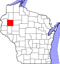
Mikana is an unincorporated community in Barron County, Wisconsin, United States. Mikana is situated on the western shore of Red Cedar Lake and is southwest of Birchwood, in the town of Cedar Lake.
Mikana was platted in 1902, soon after the railroad was extended to that point. [3] Mikana is an Ojibwe word meaning "road" (or "trail"). [4] Mikana had a post office, which opened on June 3, 1902, and closed on October 21, 1995. [5]
Mikana is known in the region for its Fourth of July celebration, in particular its parade which is colloquially referred to as "The Biggest Littlest Fourth of July Parade." [6]
A ZIP Code is a system of postal codes used by the United States Postal Service (USPS). Introduced on July 1, 1963, the basic format consisted of five digits. In 1983, an extended ZIP+4 code was introduced; it included the five digits of the ZIP Code, followed by a hyphen and four digits that designated a more specific location.
Barron County is a county located in the U.S. state of Wisconsin. As of the 2020 census, the population was 46,711. Its county seat is Barron. The county was created in 1859 and later organized in 1874.
Cedar Lake is a town in Barron County in the U.S. state of Wisconsin. The population was 1,076 at the 2020 census. The unincorporated communities of Angus and Mikana are located in the town.
Colgate is an unincorporated community in Washington County, Wisconsin, United States, straddling the county line with Waukesha County. Colgate is located partially in the village of Richfield, and the village of Lisbon. Its ZIP Code is 53017. The population is around 300, up from about 50 in 1983.
Ray is an unincorporated community in both Steuben County, Indiana and Branch County, Michigan in the United States. Located along the local "State Line Road," the small community straddles the border between the two states. The Indiana Northeastern Railroad travels southwest-northeast through Ray. Its elevation is 1,079 feet (329 m), making it the highest populated place in northern Indiana.
Heafford Junction is an unincorporated community located in Lincoln County, Wisconsin, United States. Heafford Junction is located along U.S. Route 8 north of Tomahawk, in the town of Bradley, and is surrounded by several lakes. Heafford Junction was named for George Heafford, an employee of the Chicago, Milwaukee & St. Paul Railroad. The community had a post office, which was opened by its first postmaster, Warren Slater, in March 1898. It closed on November 30, 1984.
Star Lake is an unincorporated community located in Vilas County, Wisconsin, United States. Star Lake is located on the northeast shore of Star Lake northwest of Eagle River. It is one of two unincorporated communities in the town of Plum Lake, the other being Sayner, Wisconsin. Star Lake has a post office, which was downgraded to a Community Post Office on February 8, 1997.
Holcombe is a census-designated place located in Chippewa County, Wisconsin, United States.
Brill is an unincorporated community located in Barron County, Wisconsin, United States. Brill is east of Haugen, in the town of Oak Grove.
Comstock is an unincorporated community located in Barron County, Wisconsin, United States. Comstock is located on U.S. Route 63 southwest of Cumberland, in the town of Crystal Lake. Comstock has a post office with ZIP code 54826.
Hertel is an unincorporated community in the town of La Follette, Burnett County, Wisconsin, United States. It is along Wisconsin Highway 70. Hertel is 14 miles west of Spooner, and 12 miles east of Siren.
Red Cedar Lake is a lake in Barron and Washburn counties, Wisconsin, United States. The lake covers an area of 1,841 acres (7.45 km2) and reaches a maximum depth of 53 ft (16 m). The community of Mikana, Wisconsin is located on the lake's western shore. Fish species enzootic to Red Cedar Lake include bluegill, largemouth bass, northern pike, smallmouth bass, and walleye.
Lake George is an unincorporated community and census-designated place (CDP) in Lake George Township, Hubbard County, Minnesota, United States. As of the 2010 census, its population was 230.
Poskin is an unincorporated community in the town of Clinton, Barron County, Wisconsin, United States. Poskin is located on U.S. Route 8 5.5 miles (8.9 km) west of Barron.
Lakewood is an unincorporated census-designated place located in the town of Lakewood, Oconto County, Wisconsin, United States. Lakewood is located on Wisconsin Highway 32 22 miles (35 km) north-northwest of Suring. Lakewood has a post office with ZIP code 54138. As of the 2010 census, its population was 323.
Edgewater is an unincorporated community located in the town of Edgewater, Sawyer County, Wisconsin, United States. Edgewater is located along County Highway F on the northern shore of Lake Chetac, 9 miles (14 km) west-southwest of Couderay. Edgewater had a post office, which closed on October 21, 1995.
Barronett is an unincorporated census-designated place located in the town of Lakeland, Barron County, Wisconsin, United States. Barronett is located on U.S. Route 63 7.5 miles (12.1 km) north-northeast of Cumberland. Barronett has a post office with ZIP code 54813. As of the 2010 census, its population is 111.
Killarney is an unincorporated community in Orange County, Florida, United States. Its ZIP code is 34740. The community is located west of Oakland, south of Lake Apopka, north of John's Lake, and east of the Lake-Orange County Line.
Abernant is an unincorporated community in Tuscaloosa County, Alabama, United States. Abernant is located along Alabama State Route 216, 3.6 miles (5.8 km) west of Lake View. Abernant has a post office with ZIP code 35440.
Cedar Falls is an unincorporated community in Randolph County, North Carolina, United States. The community is located along the Deep River, 5.5 miles (8.9 km) northeast of Asheboro. Cedar Falls has a post office with ZIP code 27230, which opened on March 4, 1878.