Cameron, Wisconsin | |
---|---|
Country | United States |
State | Wisconsin |
County | Barron |
Area | |
• Total | 2.66 sq mi (6.90 km2) |
• Land | 2.62 sq mi (6.79 km2) |
• Water | 0.04 sq mi (0.11 km2) |
Population | |
• Total | 1,872 |
• Density | 714.50/sq mi (275.70/km2) |
Time zone | UTC-6 (Central (CST)) |
• Summer (DST) | UTC-5 (CDT) |
Zip Code | 54822 |
FIPS code | 55-12250 |
GNIS feature ID | 1582910 |
Website | Official website |
Cameron is a village in Barron County in the U.S. state of Wisconsin. The population was 1,872 at the 2020 census, [3] and 1,783 at the 2010 census.
A post office called Cameron has been in operation since 1882. [4]
The village was named for Angus Cameron, a United States Senator from Wisconsin. [5]
Cameron is located at 45°24′32″N91°44′33″W / 45.408807°N 91.742489°W . [6]
According to the United States Census Bureau, the village has a total area of 2.51 square miles (6.50 km2), of which, 2.47 square miles (6.40 km2) is land and 0.04 square miles (0.10 km2) is water. [7]
Cameron is located along U.S. Highways 8 and 53; and also County Road SS (1st Street), and County Road W (Main Street).
Census | Pop. | Note | %± |
---|---|---|---|
1900 | 394 | — | |
1910 | 562 | 42.6% | |
1920 | 572 | 1.8% | |
1930 | 760 | 32.9% | |
1940 | 807 | 6.2% | |
1950 | 963 | 19.3% | |
1960 | 982 | 2.0% | |
1970 | 893 | −9.1% | |
1980 | 1,115 | 24.9% | |
1990 | 1,273 | 14.2% | |
2000 | 1,546 | 21.4% | |
2010 | 1,783 | 15.3% | |
2020 | 1,872 | 5.0% | |
U.S. Decennial Census [8] |
As of the census [2] of 2010, there were 1,783 people, 744 households, and 488 families living in the village. The population density was 721.9 inhabitants per square mile (278.7/km2). There were 797 housing units at an average density of 322.7 per square mile (124.6/km2). The racial makeup of the village was 97.0% White, 0.4% African American, 0.2% Native American, 0.5% Asian, 0.2% from other races, and 1.7% from two or more races. Hispanic or Latino people of any race were 2.0% of the population.
There were 744 households, of which 35.5% had children under the age of 18 living with them, 46.8% were married couples living together, 13.6% had a female householder with no husband present, 5.2% had a male householder with no wife present, and 34.4% were non-families. 27.0% of all households were made up of individuals, and 9.6% had someone living alone who was 65 years of age or older. The average household size was 2.40 and the average family size was 2.89.
The median age in the village was 34.5 years. 26.9% of residents were under the age of 18; 7.8% were between the ages of 18 and 24; 28.6% were from 25 to 44; 23.7% were from 45 to 64; and 13.1% were 65 years of age or older. The gender makeup of the village was 48.9% male and 51.1% female.
As of the census [9] of 2000, there were 1,546 people, 640 households, and 414 families living in the village. The population density was 641.3 people per square mile (247.7/km2). There were 661 housing units at an average density of 274.2/sq mi (105.9/km2). The racial makeup of the village was 97.74% White, 0.84% Native American, 0.19% Asian, 0.32% from other races, and 0.91% from two or more races. Hispanic or Latino people of any race were 1.81% of the population.
There were 640 households, out of which 33.9% had children under the age of 18 living with them, 50.6% were married couples living together, 9.1% had a female householder with no husband present, and 35.2% were non-families. 28.3% of all households were made up of individuals, and 13.3% had someone living alone who was 65 years of age or older. The average household size was 2.41 and the average family size was 2.94.
In the village, the population was spread out, with 25.9% under the age of 18, 9.5% from 18 to 24, 29.4% from 25 to 44, 20.8% from 45 to 64, and 14.3% who were 65 years of age or older. The median age was 36 years. For every 100 females, there were 96.4 males. For every 100 females age 18 and over, there were 92.1 males.
The median income for a household in the village was $34,167, and the median income for a family was $40,625. Males had a median income of $30,069 versus $20,885 for females. The per capita income for the village was $16,470. About 8.4% of families and 10.3% of the population were below the poverty line, including 10.1% of those under age 18 and 16.3% of those age 65 or over.
Winston is a village in southwestern Daviess County, Missouri, United States. The population was 229 at the 2020 census.
Grantwood Village is a town in St. Louis County, Missouri, United States. The population was 863 at the 2010 census.
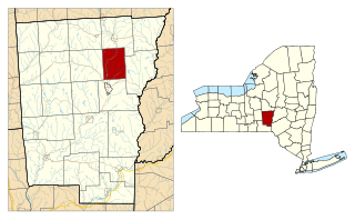
North Norwich is a town in Chenango County, New York, United States. The population was 1,783 at the 2010 census. The town is directly north of the City of Norwich in the eastern half of the county.
Rathbone is a town in Steuben County, New York, United States. The population was 1,095 as of the 2020 census. The name comes from early settler, General Ransom Rathbone.
Pleasant Garden is a town in Guilford County, North Carolina, United States.
Polk is a village in Ashland County, Ohio, United States. The population was 310 at the 2020 census.
Powhatan Point is a village in southeastern Belmont County, Ohio, United States, along the Ohio River. The population was 1,461 at the 2020 census. It is part of the Wheeling metropolitan area.
Sugar Grove is a village in Fairfield County, Ohio, United States. The population was 429 at the 2020 census.
Lockland is a village in Hamilton County, Ohio, United States. The population was 3,514 at the 2020 United States Census. Lockland is located in southwest Ohio, north of Cincinnati.
Tarlton is a village in Fairfield and Pickaway counties in the U.S. state of Ohio. The population was 254 at the 2020 census.
Attica is a village in Seneca County, Ohio, United States. The population was 873 at the 2020 census.
Limaville is a census-designated place (CDP) and former village in Stark County, Ohio, United States. The population was 151 at the 2020 census. It is part of the Canton–Massillon Metropolitan Statistical Area.
McArthur is a village in and the county seat of Vinton County, Ohio, United States. It is located 27 miles (43 km) southeast of Chillicothe. The population was 1,783 at the 2020 census.
Wickerham Manor-Fisher is a census-designated place (CDP) in Washington County, Pennsylvania, United States. The population was 1,728 at the 2010 census.
Cameron is a city in Marshall County, West Virginia, United States. It is part of the Wheeling metropolitan area. The population was 849 at the 2020 census.
Stanley is a town in Barron County in the U.S. state of Wisconsin. The population was 2,570 at the 2020 census, up from 2,546 at the 2010 census. The town surrounds the village of Cameron but is separate from it.
Oliver is a village in Douglas County, Wisconsin, United States. The population was 423 at the 2020 census.
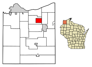
Poplar is a village in Douglas County, Wisconsin, United States. The population was 603 at the 2010 census.
Clifton is a village in Clark and Greene counties in the U.S. state of Ohio and is home to the Clifton Mill, one of the largest water-powered grist mills still in existence. The population was 131 at the 2020 census.
Dallas is a village in Barron County in the U.S. state of Wisconsin. The population was 359 at the 2020 census. The village is located within the Town of Dallas.