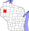
New Auburn, Wisconsin

Last updated

New Auburn, Wisconsin
Chippewa County Wisconsin Incorporated and Unincorporated areas New Auburn Highlighted.svg
Location of New Auburn in Chippewa County
and Barron County, Wisconsin
Coordinates: 45°12′14″N91°33′42″W / 45.20389°N 91.56167°W / 45.20389; -91.56167
Country Flag of the United States.svg  United States
State Flag of Wisconsin.svg  Wisconsin
Counties Chippewa, Barron
Area
[1]
  Total3.40 sq mi (8.81 km2)
  Land3.40 sq mi (8.81 km2)
  Water0.00 sq mi (0.00 km2)
Elevation
[2]
1,102 ft (336 m)
Population
 (2020) [3]
  Total562
  Density170/sq mi (64/km2)
Time zone UTC-6 (Central (CST))
  Summer (DST) UTC-5 (CDT)
Area code(s) 715 & 534
FIPS code 55-56350 [4]
GNIS feature ID1570199 [2]
Website www.newauburn-wi.com

New Auburn is a village in Barron and Chippewa counties in the U.S. state of Wisconsin. The population was 562 at the 2020 census. Of these, 537 were in Chippewa County, and 25 were in Barron County. [5] [6] The village is located mostly within the Town of Auburn in Chippewa County. Small portions extend east into the adjacent Town of Bloomer, Chippewa County and north into the Town of Dovre in Barron County.

Contents

Geography

New Auburn is located at 45°12′14″N91°33′42″W / 45.20389°N 91.56167°W / 45.20389; -91.56167 (45.203766, -91.561570). [7]

According to the United States Census Bureau, the village has a total area of 3.39 square miles (8.78 km2), containing no bodies of water inside. [8]

New Auburn is located along U.S. Highway 53; and also County Roads AA, M, Q, and SS.

Demographics

2000 Census age pyramid for Eau Claire County USA Eau Claire County, Wisconsin age pyramid.svg
2000 Census age pyramid for Eau Claire County
Historical population
CensusPop.Note
1910 364
1920 3866.0%
1930 376−2.6%
1940 3985.9%
1950 371−6.8%
1960 3833.2%
1970 368−3.9%
1980 46626.6%
1990 4854.1%
2000 56215.9%
2010 548−2.5%
2020 5622.6%
U.S. Decennial Census [9]

2010 census

As of the census [10] of 2010, there were 548 people, 217 households, and 139 families living in the village. The population density was 161.7 inhabitants per square mile (62.4/km2). There were 235 housing units at an average density of 69.3 per square mile (26.8/km2). The racial makeup of the village was 97.3% White, 0.2% African American, 0.2% Native American, 0.4% Asian, and 2.0% from two or more races.

There were 217 households, of which 36.9% had children under the age of 18 living with them, 47.9% were married couples living together, 9.7% had a female householder with no husband present, 6.5% had a male householder with no wife present, and 35.9% were non-families. 30.4% of all households were made up of individuals, and 12.4% had someone living alone who was 65 years of age or older. The average household size was 2.53 and the average family size was 3.13.

The median age in the village was 34.6 years. 29% of residents were under the age of 18; 7.7% were between the ages of 18 and 24; 27.6% were from 25 to 44; 22.4% were from 45 to 64; and 13.3% were 65 years of age or older. The gender makeup of the village was 52.0% male and 48.0% female.

2000 census

As of the census [4] of 2000, there were 562 people, 216 households, and 147 families living in the village. The population density was 165.8 people per square mile (64.0/km2). There were 222 housing units at an average density of 65.5 per square mile (25.3/km2). The racial makeup of the village was 99.11% White, 0.18% Native American, and 0.71% from two or more races. Hispanic or Latino people of any race were 0.36% of the population.

There were 216 households, out of which 34.3% had children under the age of 18 living with them, 50.9% were married couples living together, 11.6% had a female householder with no husband present, and 31.9% were non-families. 26.9% of all households were made up of individuals, and 9.3% had someone living alone who was 65 years of age or older. The average household size was 2.60 and the average family size was 3.17.

In the village, the population was spread out, with 30.8% under the age of 18, 5.7% from 18 to 24, 28.1% from 25 to 44, 23.1% from 45 to 64, and 12.3% who were 65 years of age or older. The median age was 35 years. For every 100 females, there were 100.7 males. For every 100 females age 18 and over, there were 100.5 males.

The median income for a household in the village was $30,341, and the median income for a family was $36,250. Males had a median income of $26,683 versus $20,375 for females. The per capita income for the village was $13,444. 9.9% of the population and 9.6% of families were below the poverty line. Out of the total population, 9.9% of those under the age of 18 and 6.7% of those 65 and older were living below the poverty line.

Population: 485

New Auburn is the setting of Michael Perry's memoir, Population: 485: Meeting your Neighbors One Siren at a Time, in which he describes his experiences as a volunteer firefighter and EMT for the New Auburn Area Fire Department. [11]

Notable people

Related Research Articles

<span class="mw-page-title-main">Chippewa County, Wisconsin</span> County in Wisconsin, United States

Chippewa County is a county located in the U.S. state of Wisconsin. It is named for the historic Chippewa people, also known as the Ojibwe, who long controlled this territory. As of the 2020 census, the population was 66,297. Its county seat is Chippewa Falls. The county was founded in 1845 from Crawford County, then in the Wisconsin Territory, and organized in 1853.

<span class="mw-page-title-main">Barron County, Wisconsin</span> County in Wisconsin, United States

Barron County is a county located in the U.S. state of Wisconsin. As of the 2020 census, the population was 46,711. Its county seat is Barron. The county was created in 1859 and organized in 1874.

<span class="mw-page-title-main">Wayne, Maine</span> Town in the state of Maine, United States

Wayne is a town in Kennebec County, Maine, United States. Wayne is included in the Lewiston-Auburn, Maine metropolitan New England city and town area. The population was 1,129 at the 2020 census. The town was named after Revolutionary War General Anthony Wayne. During the summer, Wayne is home to Camp Androscoggin. A popular recreation spot in central Maine, Wayne is part of the Winthrop Lakes Region. The town is included in the Augusta, Maine micropolitan New England City and Town Area. and included in the Lewiston-Auburn, Maine metropolitan New England city and town area.

<span class="mw-page-title-main">Barryton, Michigan</span> Village in Michigan, United States

Barryton is a village in Mecosta County in the U.S. state of Michigan. The population was 405 at the 2020 census, up from 355 in 2010. The village is located in Fork Township on M-66.

<span class="mw-page-title-main">Auburn, Nebraska</span> City in Nebraska, United States

Auburn is a city in Nemaha County, Nebraska, United States, and its county seat. The population was 3,470 at the 2020 census.

<span class="mw-page-title-main">Unionville, Orange County, New York</span> Village in New York, United States

Unionville is a village in Orange County, New York, United States. The population was 592 at the 2020 census, making it by far the smallest village in Orange County and one of the smallest in New York State.

<span class="mw-page-title-main">Chippewa Lake, Ohio</span> Village in Ohio, United States

Chippewa Lake is a village in Medina County, Ohio, United States. It is located on Chippewa Lake, a natural inland lake in Ohio. The village was incorporated in 1920. The population was 654 at the 2020 census.

<span class="mw-page-title-main">New Franklin, Ohio</span> City in Ohio, United States

New Franklin is a city in southwestern Summit County, Ohio, United States, in the northeastern part of the state. The population was 13,877 according to the 2020 census. It is part of the Akron metropolitan area.

<span class="mw-page-title-main">Geneva, Pennsylvania</span> Census-designated place in Pennsylvania, United States

Geneva is a census-designated place in Crawford County, Pennsylvania, United States. The population was 109 at the 2010 census.

<span class="mw-page-title-main">Cameron, Barron County, Wisconsin</span> Village in Wisconsin, United States

Cameron is a village in Barron County in the U.S. state of Wisconsin. The population was 1,872 at the 2020 census, and 1,783 at the 2010 census.

<span class="mw-page-title-main">Cedar Lake, Wisconsin</span> Town in Wisconsin, United States

Cedar Lake is a town in Barron County in the U.S. state of Wisconsin. The population was 1,076 at the 2020 census, up from 948 at the 2010 census. The unincorporated communities of Angus and Mikana are located in the town.

<span class="mw-page-title-main">Dovre, Wisconsin</span> Town in Wisconsin, United States

Dovre is a town in Barron County in the U.S. state of Wisconsin. The population was 825 at the 2020 census, down from 849 at the 2010 census.

<span class="mw-page-title-main">Haugen, Wisconsin</span> Village in Wisconsin, United States

Haugen is a village in Barron County in the U.S. state of Wisconsin. The population was 266 at the 2020 census.

Sioux Creek is a town in Barron County in the U.S. state of Wisconsin. The population was 667 at the 2020 census, up from 655 at the 2010 census.

Stanley is a town in Barron County in the U.S. state of Wisconsin. The population was 2,570 at the 2020 census, up from 2,546 at the 2010 census. The town surrounds the village of Cameron but is separate from it.

<span class="mw-page-title-main">Webster, Burnett County, Wisconsin</span> Village in Wisconsin, United States

Webster is a village in Burnett County in the U.S. state of Wisconsin. The population was 653 at the 2010 census. It is along Wisconsin Highway 35.

<span class="mw-page-title-main">Auburn, Chippewa County, Wisconsin</span> Town in Wisconsin, United States

Auburn is a town in Chippewa County in the U.S. state of Wisconsin. The population was 697 at the 2010 census, up from 580 at the 2000 census.

<span class="mw-page-title-main">Almena, Wisconsin</span> Village in Wisconsin, United States

Almena is a village in Barron County in the U.S. state of Wisconsin. The population was 705 at the 2020 census.

<span class="mw-page-title-main">Dallas (town), Wisconsin</span> Town in Barron County, Wisconsin, US

Dallas is a town in Barron County in the U.S. state of Wisconsin. As of the 2020 census, the population was 570, up from the 2010 census, in which the town had a population of 565. The Village of Dallas is within the town.

<span class="mw-page-title-main">Turtle Lake, Wisconsin</span> Village in Wisconsin, United States

Turtle Lake is a village in Barron and Polk counties in the U.S. state of Wisconsin. Its population was 1,037 at the 2020 census. Of these, 959 were in Barron County, and 78 were in Polk County. The village is located between the towns of Almena, in Barron County, and Beaver, in Polk County.

References

  1. "2019 U.S. Gazetteer Files". United States Census Bureau. Retrieved August 7, 2020.
  2. 1 2 "US Board on Geographic Names". United States Geological Survey. October 25, 2007. Retrieved January 31, 2008.
  3. "Census Bureau profile: New Auburn village, Wisconsin". United States Census Bureau. May 2023. Retrieved October 29, 2024.
  4. 1 2 "U.S. Census website". United States Census Bureau . Retrieved January 31, 2008.
  5. "Census Bureau profile: New Auburn village, Chippewa County, Wisconsin". United States Census Bureau. May 2023. Retrieved October 29, 2024.
  6. "Census Bureau profile: New Auburn village, Barron County, Wisconsin". United States Census Bureau. May 2023. Retrieved October 29, 2024.
  7. "US Gazetteer files: 2010, 2000, and 1990". United States Census Bureau. February 12, 2011. Retrieved April 23, 2011.
  8. "US Gazetteer files 2010". United States Census Bureau. Archived from the original on January 25, 2012. Retrieved November 18, 2012.
  9. "Census of Population and Housing". Census.gov. Retrieved June 4, 2015.
  10. "U.S. Census website". United States Census Bureau . Retrieved November 18, 2012.
  11. "Michael Perry - Population 485 Reviews". Archived from the original on August 12, 2008. Retrieved October 5, 2008.