Edson, Wisconsin

Last updated
Town of Edson
WIMap-doton-Edson.png
Location of the Town of Edson
Coordinates: 44°55′27″N91°0′23″W / 44.92417°N 91.00639°W / 44.92417; -91.00639 Coordinates: 44°55′27″N91°0′23″W / 44.92417°N 91.00639°W / 44.92417; -91.00639
Country Flag of the United States.svg  United States
State Flag of Wisconsin.svg  Wisconsin
County Chippewa
Area
  Total54.0 sq mi (139.8 km2)
  Land53.9 sq mi (139.7 km2)
  Water0.04 sq mi (0.1 km2)
Elevation
[1]
1,056 ft (322 m)
Population
 (2010)
  Total1,089
  Density20/sq mi (7.8/km2)
Time zone UTC-6 (Central (CST))
  Summer (DST) UTC-5 (CDT)
Area code(s) 715 & 534
FIPS code 55-22750 [2]
GNIS feature ID1583135 [1]
PLSS townshipT28N R5W and east half of T28N R6W

The Town [3] of Edson is located in Chippewa County in the U.S. state of Wisconsin. The population was 1,089 at the 2010 census, [4] up from 966 at the 2000 census.

Contents

History

The 6-by-6-mile (10 by 10 km) squares that became Edson were first surveyed in the fall of 1848 by crews working for the U.S. government. In September 1853 another crew marked all the section corners of the eastern six by six square, walking the woods and swamps on foot, measuring with chain and compass. [5] [6] When done, the deputy surveyor filed this general description:

This Township contains but few Swamps has a Surface but slightly rolling with a good Soil & excellent timber throughout the whole Township. The Streams are Small except one in the NW of the Township which has(?) Marshy banks & sluggish current, & also a stream passing through the Eastern portions of Sections 1, 12, 25 & 36. There are no improvements in the Township except a lumberman's Cabin near the Center of Section 36. [7]

Geography

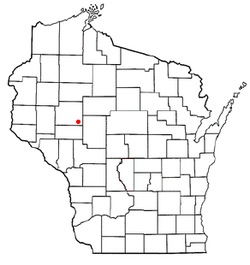
The Town of Edson is located in the southeast corner of Chippewa County and is bordered by Clark County to the east, Eau Claire County to the south, and the Town of Sigel to the west. The town has the shape of a rectangle, 9 miles (14 km) east to west and 6 miles (10 km) north to south. According to the United States Census Bureau, the town has a total area of 54.0 square miles (139.8 km2), of which 53.9 square miles (139.7 km2) is land and 0.04 square miles (0.1 km2), or 0.09%, is water. [4]

Demographics

Historical population
CensusPop.Note
1990 913
2000 9665.8%
2010 1,08912.7%
2020 (est.)1,1344.1%

As of the census [2] of 2000, there were 966 people, 309 households, and 259 families residing in the town. The population density was 17.9 people per square mile (6.9/km2). There were 322 housing units at an average density of 6.0 per square mile (2.3/km2). The racial makeup of the town was 98.14% White, 0.10% Asian, and 1.76% from two or more races. Hispanic or Latino of any race were 0.72% of the population.

There were 309 households, out of which 46.3% had children under the age of 18 living with them, 66.3% were married couples living together, 11.3% had a female householder with no husband present, and 15.9% were non-families. 13.9% of all households were made up of individuals, and 5.2% had someone living alone who was 65 years of age or older. The average household size was 3.13 and the average family size was 3.38.

The population distribution was 33.6% under the age of 18, 8.1% from 18 to 24, 26.7% from 25 to 44, 21.9% from 45 to 64, and 9.6% who were 65 years of age or older. The median age was 33 years. For every 100 females, there were 103 males. For every 100 females age 18 and over, there were 98 males.

The median income for a household in the town was $34,722, and the median income for a family was $36,563. Males had a median income of $22,014 versus $20,885 for females. The per capita income for the town was $12,154. About 20.1% of families and 24.1% of the population were below the poverty line, including 33.5% of those under age 18 and 12.5% of those age 65 or over.

Education

The town is served by the School District of Cadott Community and the Stanley-Boyd Area School District.

Related Research Articles

<span class="mw-page-title-main">Arthur, Wisconsin</span> Town in Wisconsin, United States

Arthur is a town in Chippewa County in the U.S. state of Wisconsin. The population was 759 at the 2010 census. The unincorporated communities of Cobban, Crescent, and Drywood are located in the town.

<span class="mw-page-title-main">Birch Creek, Wisconsin</span> Town in Wisconsin, United States

Birch Creek is a town in Chippewa County in the U.S. state of Wisconsin. The population was 517 at the 2010 census.

<span class="mw-page-title-main">Cleveland, Chippewa County, Wisconsin</span> Town in Wisconsin, United States

Cleveland is a town in Chippewa County, Wisconsin, United States. The population was 864 at the 2010 census.

<span class="mw-page-title-main">Colburn, Chippewa County, Wisconsin</span> Town in Wisconsin, United States

Colburn is a town in Chippewa County in the U.S. state of Wisconsin. The population was 856 at the 2010 census, up from 727 at the 2000 census. The unincorporated communities of Colburn and Huron are located in the town. The unincorporated community of Brownville is located partially in the town.

<span class="mw-page-title-main">Delmar, Wisconsin</span> Town in Wisconsin, United States

The Town of Delmar is located in Chippewa County in the U.S. state of Wisconsin. The population was 936 at the 2010 census.

<span class="mw-page-title-main">Estella, Wisconsin</span> Town in Wisconsin, United States

The Town of Estella is located in Chippewa County in the U.S. state of Wisconsin. The population was 433 at the 2010 census.

<span class="mw-page-title-main">Goetz, Wisconsin</span> Town in Wisconsin, United States

Goetz is a town in Chippewa County in the U.S. state of Wisconsin. The population was 762 at the 2010 census.

<span class="mw-page-title-main">Hallie, Wisconsin</span> Town in Wisconsin, United States

Hallie is a town in Chippewa County in the U.S. state of Wisconsin. As of the 2010 census its population was 161. In 2000, the town population was 4,703 according to the federal census. On February 18, 2003, however, most of the town incorporated as the village of Lake Hallie, taking with it nearly all of the town's population and reducing the town's remaining land area to 7.5 square miles (19.3 km2).

<span class="mw-page-title-main">Lafayette, Chippewa County, Wisconsin</span> Town in Wisconsin, United States

Lafayette is a town in Chippewa County in the U.S. state of Wisconsin. The population was 5,765 at the 2010 census. The census-designated place of Lake Wissota is located within the town. The unincorporated community of Bateman is also located in the town.

<span class="mw-page-title-main">Lake Holcombe, Wisconsin</span> Town in Wisconsin, United States

Lake Holcombe is a town in Chippewa County in the U.S. state of Wisconsin. Its population was 1,031 at the 2010 census. The census-designated place of Holcombe is located in the town.

<span class="mw-page-title-main">Ruby, Wisconsin</span> Town in Wisconsin, United States

The Town of Ruby is located in northeast Chippewa County in the U.S. state of Wisconsin. The population was 494 at the 2010 census. The unincorporated communities of Arnold and Ruby are located in the town.

<span class="mw-page-title-main">Sampson, Wisconsin</span> Town in Wisconsin, United States

Sampson is a town in Chippewa County in the U.S. state of Wisconsin. The population was 892 at the 2010 census.

<span class="mw-page-title-main">Sigel, Chippewa County, Wisconsin</span> Town in Wisconsin, United States

Sigel is a town in Chippewa County in the U.S. state of Wisconsin. The population was 1,044 at the 2010 census, up from 825 at the 2000 census.

<span class="mw-page-title-main">Tilden, Wisconsin</span> Town in Wisconsin, United States

The Town of Tilden is located in Chippewa County in the U.S. state of Wisconsin. The population was 1,485 at the 2010 census, up from 1,185 at the 2000 census.

<span class="mw-page-title-main">Wheaton, Wisconsin</span> Town in Wisconsin, United States

The Town of Wheaton is located in Chippewa County in the U.S. state of Wisconsin. The population was 2,701 at the 2010 census, up from 2,366 at the 2000 census. The unincorporated communities of Old Albertville and Pine Grove are located in the town.

<span class="mw-page-title-main">Woodmohr, Wisconsin</span> Town in Wisconsin, United States

Woodmohr is a town in Chippewa County in the U.S. state of Wisconsin. The population was 932 at the 2010 census. The name comes from a blend of the names of Woodard, a state representative and Lawrence Mohr, an old settler.

<span class="mw-page-title-main">Little Black, Wisconsin</span> Town in Wisconsin, United States

Little Black is a town located in Taylor County, Wisconsin. As of the 2000 census, the town had a total population of 1,148.

<span class="mw-page-title-main">Westboro, Wisconsin</span> Town in the United States

Westboro is a town in Taylor County, Wisconsin, United States. The population was 660 at the 2000 census. The census-designated place of Westboro is located in the town. The unincorporated community of Queenstown is also located in the town.

Bloomer is a town in Chippewa County in the U.S. state of Wisconsin. The population was 1,050 at the 2010 census, up from 926 at the 2000 census. The city of Bloomer is also located in Chippewa County, but to the south of the town within the adjacent town of Woodmohr.

<span class="mw-page-title-main">Medford (town), Wisconsin</span> Town in Wisconsin, United States

Medford is a town in Taylor County, Wisconsin, United States. The population was 2,216 at the 2000 census. The City of Medford lies mostly within the town boundaries.

References

  1. 1 2 "US Board on Geographic Names". United States Geological Survey. 2007-10-25. Retrieved 2008-01-31.
  2. 1 2 "U.S. Census website". United States Census Bureau . Retrieved 2008-01-31.
  3. "Towns" in Wisconsin perform most of the same functions as townships in many other states. see 'Wisconsin Blue Book 2022,' Town, pp 354-355
  4. 1 2 "Geographic Identifiers: 2010 Demographic Profile Data (G001): Edson town, Chippewa County, Wisconsin". U.S. Census Bureau, American Factfinder. Retrieved September 16, 2015.[ dead link ]
  5. "Land Survey Information". Board of Commissioners of Public Lands. Retrieved 26 March 2011.
  6. "Field Notes for T28N R5W". Original Field Notes and Plat Maps, 1833-1866. Board of Commissioners of Public Lands. Retrieved 12 March 2013.
  7. Clark, J. G. "Interior Field Notes (Sept. 1853)". Land Survey Notes. Board of Commissioners of Public Lands. Retrieved 2013-03-12.