Sigel, Chippewa County, Wisconsin

Last updated
Sigel, Wisconsin
WIMap-doton-Sigel.png
Location of Sigel, Wisconsin
Coordinates: 44°54′9″N91°10′21″W / 44.90250°N 91.17250°W / 44.90250; -91.17250 Coordinates: 44°54′9″N91°10′21″W / 44.90250°N 91.17250°W / 44.90250; -91.17250
Country Flag of the United States.svg  United States
State Flag of Wisconsin.svg  Wisconsin
County Chippewa
Area
  Total35.8 sq mi (92.8 km2)
  Land35.7 sq mi (92.5 km2)
  Water0.2 sq mi (0.4 km2)
Elevation
[1]
961 ft (293 m)
Population
 (2010)
  Total1,044
  Density29/sq mi (11.3/km2)
Time zone UTC-6 (Central (CST))
  Summer (DST) UTC-5 (CDT)
Area code(s) 715 & 534
FIPS code 55-73875 [2]
GNIS feature ID1584159 [1]
PLSS townshipEast half of T28N R6W and west half of T28N R7W

Sigel is a town in Chippewa County in the U.S. state of Wisconsin. The population was 1,044 at the 2010 census, [3] up from 825 at the 2000 census.

Contents

History

The area that became Sigel was first surveyed in the fall of 1848 by crews working for the U.S. government. In September 1849 another crew marked all the section corners of the eastern half of Sigel, walking the woods and swamps on foot, measuring with chain and compass. [4] [5] When done, the deputy surveyor filed this general description:

The Surface in this Township is generally level and a fair proportion good fertile soil. It is well watered by numerous small Streams, none of which, however, afford any water power. A large part of the township is well timbered with Birch, Ash, Elm, Lind, Sugar, Oak, Ironwood and Some Pine. [6]

For a surveyor's description of the six mile square that includes the west half of Sigel, see Lafayette.

The town was founded on January 3, 1863, presumably named after Franz Sigel, a colonel in the Union Army during the American Civil War.

Geography

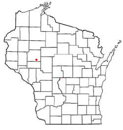
The town of Sigel is located in southern Chippewa County, bordered to the east by the Town of Edson, and to the south by Eau Claire County. It is bordered to the north by the Yellow River and the village of Cadott. The Yellow River is a west-flowing tributary of the Chippewa River. According to the United States Census Bureau, Sigel has a total area of 35.8 square miles (92.8 km2), of which 35.7 square miles (92.5 km2) is land and 0.2 square miles (0.4 km2), or 0.38%, is water. [3]

Demographics

Historical population
CensusPop.Note
1990 736
2000 82512.1%
2010 1,04426.5%
2020 (est.)1,0954.9%

As of the census [2] of 2000, there were 825 people, 294 households, and 239 families residing in the town. The population density was 23.1 people per square mile (8.9/km2). There were 307 housing units at an average density of 8.6 per square mile (3.3/km2). The racial makeup of the town was 98.18% White, 0.12% African American, 0.48% Native American, 0.24% Asian, 0.24% from other races, and 0.73% from two or more races. Hispanic or Latino of any race were 0.24% of the population.

There were 294 households, out of which 40.1% had children under the age of 18 living with them, 68.0% were married couples living together, 6.8% had a female householder with no husband present, and 18.4% were non-families. 14.6% of all households were made up of individuals, and 4.1% had someone living alone who was 65 years of age or older. The average household size was 2.81 and the average family size was 3.07.

In the town, the population was spread out, with 28.4% under the age of 18, 7.2% from 18 to 24, 26.7% from 25 to 44, 27.6% from 45 to 64, and 10.2% who were 65 years of age or older. The median age was 37 years. For every 100 females, there were 115.4 males. For every 100 females age 18 and over, there were 114.1 males.

The median income for a household in the town was $37,639, and the median income for a family was $40,833. Males had a median income of $28,750 versus $21,071 for females. The per capita income for the town was $15,635. About 5.0% of families and 7.1% of the population were below the poverty line, including 8.3% of those under age 18 and 10.6% of those age 65 or over.

Education

Sigel is served by the School District of Cadott Community.

Related Research Articles

<span class="mw-page-title-main">Anson, Wisconsin</span> Town in Wisconsin, United States

Anson is a town in Chippewa County in the U.S. state of Wisconsin. The population was 2,076 at the 2010 census. The unincorporated communities of Anson and Jim Falls are located in the town. The town was named after Anson Burlingame, a Massachusetts politician, diplomat and lawyer.

<span class="mw-page-title-main">Arthur, Wisconsin</span> Town in Wisconsin, United States

Arthur is a town in Chippewa County in the U.S. state of Wisconsin. The population was 759 at the 2010 census. The unincorporated communities of Cobban, Crescent, and Drywood are located in the town.

<span class="mw-page-title-main">Birch Creek, Wisconsin</span> Town in Wisconsin, United States

Birch Creek is a town in Chippewa County in the U.S. state of Wisconsin. The population was 517 at the 2010 census.

<span class="mw-page-title-main">Cleveland, Chippewa County, Wisconsin</span> Town in Wisconsin, United States

Cleveland is a town in Chippewa County, Wisconsin, United States. The population was 864 at the 2010 census.

<span class="mw-page-title-main">Colburn, Chippewa County, Wisconsin</span> Town in Wisconsin, United States

Colburn is a town in Chippewa County in the U.S. state of Wisconsin. The population was 856 at the 2010 census, up from 727 at the 2000 census. The unincorporated communities of Colburn and Huron are located in the town. The unincorporated community of Brownville is located partially in the town.

<span class="mw-page-title-main">Delmar, Wisconsin</span> Town in Wisconsin, United States

The Town of Delmar is located in Chippewa County in the U.S. state of Wisconsin. The population was 936 at the 2010 census.

<span class="mw-page-title-main">Edson, Wisconsin</span> Town in Wisconsin, United States

The Town of Edson is located in Chippewa County in the U.S. state of Wisconsin. The population was 1,089 at the 2010 census, up from 966 at the 2000 census.

<span class="mw-page-title-main">Estella, Wisconsin</span> Town in Wisconsin, United States

The Town of Estella is located in Chippewa County in the U.S. state of Wisconsin. The population was 433 at the 2010 census.

<span class="mw-page-title-main">Goetz, Wisconsin</span> Town in Wisconsin, United States

Goetz is a town in Chippewa County in the U.S. state of Wisconsin. The population was 762 at the 2010 census.

<span class="mw-page-title-main">Hallie, Wisconsin</span> Town in Wisconsin, United States

Hallie is a town in Chippewa County in the U.S. state of Wisconsin. As of the 2010 census its population was 161. In 2000, the town population was 4,703 according to the federal census. On February 18, 2003, however, most of the town incorporated as the village of Lake Hallie, taking with it nearly all of the town's population and reducing the town's remaining land area to 7.5 square miles (19.3 km2).

<span class="mw-page-title-main">Lafayette, Chippewa County, Wisconsin</span> Town in Wisconsin, United States

Lafayette is a town in Chippewa County in the U.S. state of Wisconsin. The population was 5,765 at the 2010 census. The census-designated place of Lake Wissota is located within the town. The unincorporated community of Bateman is also located in the town.

<span class="mw-page-title-main">Ruby, Wisconsin</span> Town in Wisconsin, United States

The Town of Ruby is located in northeast Chippewa County in the U.S. state of Wisconsin. The population was 494 at the 2010 census. The unincorporated communities of Arnold and Ruby are located in the town.

<span class="mw-page-title-main">Sampson, Wisconsin</span> Town in Wisconsin, United States

Sampson is a town in Chippewa County in the U.S. state of Wisconsin. The population was 892 at the 2010 census.

<span class="mw-page-title-main">Tilden, Wisconsin</span> Town in Wisconsin, United States

The Town of Tilden is located in Chippewa County in the U.S. state of Wisconsin. The population was 1,485 at the 2010 census, up from 1,185 at the 2000 census.

<span class="mw-page-title-main">Wheaton, Wisconsin</span> Town in Wisconsin, United States

The Town of Wheaton is located in Chippewa County in the U.S. state of Wisconsin. The population was 2,701 at the 2010 census, up from 2,366 at the 2000 census. The unincorporated communities of Old Albertville and Pine Grove are located in the town.

<span class="mw-page-title-main">Woodmohr, Wisconsin</span> Town in Wisconsin, United States

Woodmohr is a town in Chippewa County in the U.S. state of Wisconsin. The population was 932 at the 2010 census. The name comes from a blend of the names of Woodard, a state representative and Lawrence Mohr, an old settler.

<span class="mw-page-title-main">Westboro, Wisconsin</span> Town in the United States

Westboro is a town in Taylor County, Wisconsin, United States. The population was 660 at the 2000 census. The census-designated place of Westboro is located in the town. The unincorporated community of Queenstown is also located in the town.

<span class="mw-page-title-main">Sigel, Wood County, Wisconsin</span> Town in Wisconsin, United States

Th Town of Sigel is located in Wood County, Wisconsin, United States. The population was 1,130 at the 2000 census. The unincorporated community of Eight Corners is located in the town.

Bloomer is a town in Chippewa County in the U.S. state of Wisconsin. The population was 1,050 at the 2010 census, up from 926 at the 2000 census. The city of Bloomer is also located in Chippewa County, but to the south of the town within the adjacent town of Woodmohr.

<span class="mw-page-title-main">Medford (town), Wisconsin</span> Town in Wisconsin, United States

Medford is a town in Taylor County, Wisconsin, United States. The population was 2,216 at the 2000 census. The City of Medford lies mostly within the town boundaries.

References

  1. 1 2 "US Board on Geographic Names". United States Geological Survey. 2007-10-25. Retrieved 2008-01-31.
  2. 1 2 "U.S. Census website". United States Census Bureau . Retrieved 2008-01-31.
  3. 1 2 "Geographic Identifiers: 2010 Demographic Profile Data (G001): Sigel town, Chippewa County, Wisconsin". U.S. Census Bureau, American Factfinder. Retrieved September 18, 2015.[ dead link ]
  4. "Land Survey Information". Board of Commissioners of Public Lands. Retrieved 26 March 2011.
  5. "Field Notes for T28N R6W". Original Field Notes and Plat Maps, 1833-1866. Board of Commissioners of Public Lands. Retrieved 23 March 2013.
  6. Welsh, H. B. "Interior Field Notes (Sept. 1849)". Land Survey Notes. Board of Commissioners of Public Lands. Retrieved 2013-03-23.