Woodmohr, Wisconsin

Last updated

Woodmohr, Wisconsin
WIMap-doton-Woodmohr.png
Location of Woodmohr, Wisconsin
Coordinates: 45°4′38″N91°28′27″W / 45.07722°N 91.47417°W / 45.07722; -91.47417
Country Flag of the United States.svg  United States
State Flag of Wisconsin.svg  Wisconsin
County Chippewa
Area
  Total35.1 sq mi (90.8 km2)
  Land35.0 sq mi (90.7 km2)
  Water0.04 sq mi (0.1 km2)
Elevation
[1]
984 ft (300 m)
Population
 (2010)
  Total932
  Density27/sq mi (10.3/km2)
Time zone UTC-6 (Central (CST))
  Summer (DST) UTC-5 (CDT)
Area code(s) 715 & 534
FIPS code 55-88875 [2]
GNIS feature ID1584477 [1]
PLSS townshipT30N R9W and a bit of T30N R8W

Woodmohr is a town in Chippewa County in the U.S. state of Wisconsin. The population was 932 at the 2010 census. [3] The name comes from a blend of the names of Woodard, a state representative and Lawrence Mohr, an old settler. [4]

Contents

Geography

The Town of Woodmohr is roughly a 6-mile (10 km) square, with a few notches added and removed. The town is in the west-central part of Chippewa County, and it surrounds the city of Bloomer, a separate municipality. According to the United States Census Bureau, Woodmohr has a total area of 35.1 square miles (90.8 km2), of which 35.0 square miles (90.7 km2) is land and 0.04 square miles (0.1 km2), or 0.15%, is water. [3]

History

The six mile square that would become most of Woodmohr was first surveyed in the summer of 1847 by a crew working for the U.S. government. In September 1849, another crew marked all the section corners of the six mile squares, walking through the woods and wading the swamps, measuring with chain and compass. [5] [6] When done, the deputy surveyor filed this general description:

The East side of this Township including Sections 1, 12, 13, 24, 25 & 36; and parts of Sections 3, 11, 14, 23, 26 & 35 are well Timbered and have a productive sand & loam soil. Sections 17, 18, 19, 20, 29 and 30, and parts of sections 7, 8, 16, 21 & 28 are covered with Aspen thickets and Oak Brush with a soil similar to the East side of the Township The remainder of the lands lying along the Streams in the center and South West part are mostly Bur Oak & Pitch(?) Pine Openings having a more sandy soil than(?) the more thickly timbered portions. [7]

Demographics

Historical population
CensusPop.Note
1990 1,086
2000 883−18.7%
2010 9325.5%
2020 (est.)9653.5%

As of the census [2] of 2000, there were 883 people, 319 households, and 262 families residing in the town. The population density was 25.0 people per square mile (9.7/km2). There were 331 housing units at an average density of 9.4 per square mile (3.6/km2). The racial makeup of the town was 99.32% White, 0.45% Asian, and 0.23% from two or more races. Hispanic or Latino of any race were 0.11% of the population.

There were 319 households, out of which 39.5% had children under the age of 18 living with them, 73.7% were married couples living together, 4.7% had a female householder with no husband present, and 17.6% were non-families. 15.4% of all households were made up of individuals, and 6.3% had someone living alone who was 65 years of age or older. The average household size was 2.77 and the average family size was 3.08.

In the town, the population was spread out, with 27.2% under the age of 18, 6.30% from 18 to 24, 28.5% from 25 to 44, 25.7% from 45 to 64, and 12.2% who were 65 years of age or older. The median age was 39 years. For every 100 females, there were 105.8 males. For every 100 females age 18 and over, there were 104.1 males.

The median income for a household in the town was $47,500, and the median income for a family was $55,347. Males had a median income of $30,769 versus $21,688 for females. The per capita income for the town was $21,045. About 2.80% of families and 5.60% of the population were below the poverty line, including 3.50% of those under age 18 and 7.10% of those age 65 or over.

Related Research Articles

<span class="mw-page-title-main">Anson, Wisconsin</span> Town in Wisconsin, United States

Anson is a town in Chippewa County in the U.S. state of Wisconsin. The population was 2,076 at the 2010 census. The unincorporated communities of Anson and Jim Falls are located in the town. The town was named after Anson Burlingame, a Massachusetts politician, diplomat and lawyer.

<span class="mw-page-title-main">Arthur, Wisconsin</span> Town in Wisconsin, United States

Arthur is a town in Chippewa County in the U.S. state of Wisconsin. The population was 759 at the 2010 census. The unincorporated communities of Cobban, Crescent, and Drywood are located in the town.

<span class="mw-page-title-main">Birch Creek, Wisconsin</span> Town in Wisconsin, United States

Birch Creek is a town in Chippewa County in the U.S. state of Wisconsin. The population was 517 at the 2010 census.

<span class="mw-page-title-main">Cleveland, Chippewa County, Wisconsin</span> Town in Wisconsin, United States

Cleveland is a town in Chippewa County, Wisconsin, United States. The population was 864 at the 2010 census.

<span class="mw-page-title-main">Delmar, Wisconsin</span> Town in Wisconsin, United States

The Town of Delmar is located in Chippewa County in the U.S. state of Wisconsin. The population was 936 at the 2010 census.

<span class="mw-page-title-main">Eagle Point, Wisconsin</span> Town in Wisconsin, United States

Eagle Point is a town in Chippewa County in the U.S. state of Wisconsin. The population was 3,053 at the 2010 census. The unincorporated communities of Eagle Point and Eagleton are located in the town.

<span class="mw-page-title-main">Edson, Wisconsin</span> Town in Wisconsin, United States

The Town of Edson is located in Chippewa County in the U.S. state of Wisconsin. The population was 1,089 at the 2010 census, up from 966 at the 2000 census.

<span class="mw-page-title-main">Estella, Wisconsin</span> Town in Wisconsin, United States

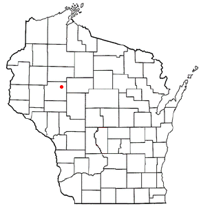
The Town of Estella is located in Chippewa County in the U.S. state of Wisconsin. The population was 433 at the 2010 census.
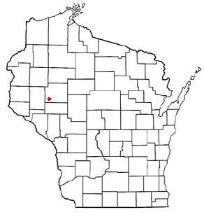
<span class="mw-page-title-main">Hallie, Wisconsin</span> Town in Wisconsin, United States

Hallie is a town in Chippewa County in the U.S. state of Wisconsin. As of the 2010 census its population was 161. In 2000, the town population was 4,703 according to the federal census. On February 18, 2003, however, most of the town incorporated as the village of Lake Hallie, taking with it nearly all of the town's population and reducing the town's remaining land area to 7.5 square miles (19.3 km2).

<span class="mw-page-title-main">Lafayette, Chippewa County, Wisconsin</span> Town in Wisconsin, United States

Lafayette is a town in Chippewa County in the U.S. state of Wisconsin. The population was 5,765 at the 2010 census. The census-designated place of Lake Wissota is located within the town. The unincorporated community of Bateman is also located in the town.

<span class="mw-page-title-main">Lake Holcombe, Wisconsin</span> Town in Wisconsin, United States

Lake Holcombe is a town in Chippewa County in the U.S. state of Wisconsin. Its population was 1,031 at the 2010 census. The census-designated place of Holcombe is located in the town.

<span class="mw-page-title-main">Ruby, Wisconsin</span> Town in Wisconsin, United States

The Town of Ruby is located in northeast Chippewa County in the U.S. state of Wisconsin. The population was 494 at the 2010 census. The unincorporated communities of Arnold and Ruby are located in the town.

<span class="mw-page-title-main">Sampson, Wisconsin</span> Town in Wisconsin, United States

Sampson is a town in Chippewa County in the U.S. state of Wisconsin. The population was 892 at the 2010 census.

<span class="mw-page-title-main">Sigel, Chippewa County, Wisconsin</span> Town in Wisconsin, United States

Sigel is a town in Chippewa County in the U.S. state of Wisconsin. The population was 1,044 at the 2010 census, up from 825 at the 2000 census.

<span class="mw-page-title-main">Tilden, Wisconsin</span> Town in Wisconsin, United States

The Town of Tilden is located in Chippewa County in the U.S. state of Wisconsin. The population was 1,485 at the 2010 census, up from 1,185 at the 2000 census.

<span class="mw-page-title-main">Wheaton, Wisconsin</span> Town in Wisconsin, United States

The Town of Wheaton is located in Chippewa County in the U.S. state of Wisconsin. The population was 2,701 at the 2010 census, up from 2,366 at the 2000 census. The unincorporated communities of Old Albertville and Pine Grove are located in the town.

<span class="mw-page-title-main">Pershing, Wisconsin</span> Town in Wisconsin, United States

Pershing is a town in Taylor County, Wisconsin, United States. The population was 180 at the 2000 census. The unincorporated community of Donald is located in the town.

Milladore is a town in Wood County, Wisconsin, United States. The population was 706 at the 2000 census. The Village of Milladore is located mostly within the town. The unincorporated community of Blenker is also located in the town.

Bloomer is a town in Chippewa County in the U.S. state of Wisconsin. The population was 1,050 at the 2010 census, up from 926 at the 2000 census. The city of Bloomer is also located in Chippewa County, but to the south of the town within the adjacent town of Woodmohr.

<span class="mw-page-title-main">Medford (town), Wisconsin</span> Town in Wisconsin, United States

Medford is a town in Taylor County, Wisconsin, United States. The population was 2,216 at the 2000 census. The City of Medford lies mostly within the town boundaries.

References

  1. 1 2 "US Board on Geographic Names". United States Geological Survey. October 25, 2007. Retrieved January 31, 2008.
  2. 1 2 "U.S. Census website". United States Census Bureau . Retrieved January 31, 2008.
  3. 1 2 "Geographic Identifiers: 2010 Demographic Profile Data (G001): Woodmohr town, Chippewa County, Wisconsin". U.S. Census Bureau, American Factfinder. Retrieved September 18, 2015.[ dead link ]
  4. Gard, Robert E. (2015). The Romance of Wisconsin Place Names. Wisconsin Historical Society. p. 362. ISBN   9780870207082.
  5. "Land Survey Information". Board of Commissioners of Public Lands. Retrieved March 26, 2011.
  6. "Field Notes for T30N R9W". Original Field Notes and Plat Maps, 1833-1866. Board of Commissioners of Public Lands. Retrieved April 23, 2013.
  7. Stuntz, G. R. "Interior Field Notes (Sept. 1849)". Board of Commissioners of Public Lands. Retrieved April 23, 2013.