Chetek, Wisconsin | |
---|---|
Coordinates: 45°19′7″N91°39′16″W / 45.31861°N 91.65444°W | |
Country | United States |
State | Wisconsin |
County | Barron |
Area | |
• Total | 3.11 sq mi (8.05 km2) |
• Land | 2.40 sq mi (6.21 km2) |
• Water | 0.71 sq mi (1.85 km2) |
Elevation | 1,050 ft (320 m) |
Population | |
• Total | 2,221 |
• Estimate (2019) [4] | 2,095 |
• Density | 874.01/sq mi (337.46/km2) |
Time zone | UTC-6 (Central (CST)) |
• Summer (DST) | UTC-5 (CDT) |
Zip Code | 54728 |
Area code(s) | 715 & 534 |
FIPS code | 55-14325 [5] |
GNIS feature ID | 1562995 [2] |
Website | cityofchetek-wi |
Chetek is a city in Barron County, Wisconsin, United States. The population was 2,172 at the 2020 census, [6] down from 2,221 at the 2010 census. The city is located partially within the Town of Chetek.
The original inhabitants of the area were the Ojibwa Indians, who referred to the area as zhedeg, meaning "pelicans". This was translated into various spellings, such as "Sheetak", "Shetak", "Shetuk", and "Chetack", until the first post office was opened in 1872. The spelling was then standardized to "Chetek."
In 1872, the Omaha Railroad began service to Chetek, the Knapp-Stout logging camp was established, and the first log schoolhouse was built.
Other important dates:
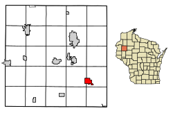
Chetek is located at 45°19′7″N91°39′16″W / 45.31861°N 91.65444°W (45.318656, -91.65447). [9]
According to the United States Census Bureau, the city has a total area of 3.13 square miles (8.11 km2), of which 2.42 square miles (6.27 km2) is land and 0.71 square miles (1.84 km2) is water. [10]
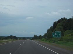
Chetek is located along U.S. Highway 53, as well as County Roads I and SS.
Census | Pop. | Note | %± |
---|---|---|---|
1890 | 406 | — | |
1900 | 531 | 30.8% | |
1910 | 829 | 56.1% | |
1920 | 1,154 | 39.2% | |
1930 | 1,076 | −6.8% | |
1940 | 1,227 | 14.0% | |
1950 | 1,585 | 29.2% | |
1960 | 1,729 | 9.1% | |
1970 | 1,630 | −5.7% | |
1980 | 1,931 | 18.5% | |
1990 | 1,953 | 1.1% | |
2000 | 2,180 | 11.6% | |
2010 | 2,221 | 1.9% | |
2019 (est.) | 2,095 | [4] | −5.7% |
U.S. Decennial Census [11] |
As of the census [3] of 2010, there were 2,221 people, 951 households, and 564 families living in the city. The population density was 917.8 inhabitants per square mile (354.4/km2). There were 1,104 housing units at an average density of 456.2 per square mile (176.1/km2). The racial makeup of the city was 97.4% White, 0.2% African American, 0.4% Native American, 0.3% Asian, 0.7% from other races, and 0.9% from two or more races. Hispanic or Latino people of any race were 1.8% of the population.
There were 951 households, of which 26.9% had children under the age of 18 living with them, 43.2% were married couples living together, 11.3% had a female householder with no husband present, 4.8% had a male householder with no wife present, and 40.7% were non-families. 34.8% of all households were made up of individuals, and 18.4% had someone living alone who was 65 years of age or older. The average household size was 2.22 and the average family size was 2.82.
The median age in the city was 44.7 years. 21.1% of residents were under the age of 18; 6.8% were between the ages of 18 and 24; 22.6% were from 25 to 44; 24.7% were from 45 to 64; and 25% were 65 years of age or older. The gender makeup of the city was 45.9% male and 54.1% female.
As of the census [5] of 2000, there were 2,180 people, 939 households, and 568 families living in the city. The population density was 925.7 people per square mile (358.2/km2). There were 1,052 housing units at an average density of 446.7 per square mile (172.8/km2). The racial makeup of the city was 98.62% White, 0.09% Black or African American, 0.32% Native American, 0.23% Asian, 0.05% Pacific Islander, 0.09% from other races, and 0.60% from two or more races. Hispanic or Latino people of any race were 0.96% of the population.
There were 939 households, out of which 25.0% had children under the age of 18 living with them, 47.9% were married couples living together, 8.7% had a female householder with no husband present, and 39.5% were non-families. 34.9% of all households were made up of individuals, and 20.4% had someone living alone who was 65 years of age or older. The average household size was 2.21 and the average family size was 2.81.
In the city, the population was spread out, with 22.2% under the age of 18, 7.2% from 18 to 24, 24.3% from 25 to 44, 20.8% from 45 to 64, and 25.6% who were 65 years of age or older. The median age was 43 years. For every 100 females, there were 92.9 males. For every 100 females age 18 and over, there were 88.6 males.
The median income for a household in the city was $31,270, and the median income for a family was $40,114. Males had a median income of $28,375 versus $18,906 for females. The per capita income for the city was $17,922. About 9.0% of families and 12.4% of the population were below the poverty line, including 15.0% of those under age 18 and 8.3% of those age 65 or over.
Chetek Municipal–Southworth Airport (Y23) serves the city and surrounding communities.
Friendship is a village in Adams County in the U.S. state of Wisconsin. It is the county seat of Adams County. The population was 648 at the 2020 census.
Dovre is a town in Barron County in the U.S. state of Wisconsin. The population was 849 at the 2010 census.
Prairie Lake is a town in Barron County in the U.S. state of Wisconsin. The population was 1,532 at the 2010 census. The unincorporated community of Wickware is located partially in the town.
Sherwood is a village in Calumet County, Wisconsin, United States. The population was 2,713 at the 2010 census. The former historical unincorporated community of High Cliff is located within present-day Sherwood.
Ferryville is a village in Crawford County, Wisconsin, United States. The population was 176 at the 2010 census. It is located on Wisconsin Highway 35 along the Great River Road.
Monona is a city in Dane County, Wisconsin, United States. A suburb of the state capital, Madison, the city lies on the southeastern shore of Lake Monona, from which the city gets its name. The population was 8,624 at the 2020 census.
New Lisbon is a city in Juneau County, Wisconsin, United States. The population was 1,748 at the 2020 census.
Cleveland is a village in Manitowoc County, Wisconsin, United States. The population was 1,579 at the 2020 census.
Hewitt is a town in Marathon County, Wisconsin, United States. It is part of the Wausau, Wisconsin Metropolitan Statistical Area. The population was 606 at the 2010 census. The unincorporated community of Glandon is located in the town.
Schofield is a city in Marathon County, Wisconsin, United States. It is part of the Wausau, Wisconsin Metropolitan Statistical Area. The population was 2,157 at the 2020 census. The city was named for William Scholfield, who came to the area in the 1851 to open a sawmill. The city has since dropped the "L" from its name.
Cudahy is a city in Milwaukee County, Wisconsin, United States. The population was 18,204 at the 2020 census.
Amery is a city in Polk County, Wisconsin, United States, along the Apple River. It is a part of Wisconsin's 7th congressional district. The population was 2,902 at the 2010 census. The city was named in honor of William Amery, a carpenter who held several local offices in the 1870s.
Phillips is a city and the county seat of Price County, Wisconsin, United States. The population was 1,478 at the 2010 census.
Ingram is a village in Rusk County, Wisconsin, United States. The population was 78 at the 2010 census.
Galesville is a city in Trempealeau County, Wisconsin, United States. The population was 1,662 at the 2020 census. A dam on Beaver Creek is located at Galesville, forming Lake Marinuka north of the city. The mayor is Vince Howe.
Pigeon Falls is a village in Trempealeau County, Wisconsin, United States. The population was 411 at the 2010 census.
Pittsville is a city in Wood County, Wisconsin, United States. Located in a rural part of the county, Pittsville is surrounded by parks and public land, including; North Wood County Park and Campground, Powers Bluff, Dexter County Park and Campground, Sherwood County Park and Campground, Wood County Forest, Sandhill State Wildlife Area, and Black River State Forest. The population was 874 at the 2010 census and was 813 at the 2020 census.
Lake Wisconsin is a census-designated place (CDP) in Columbia and Sauk counties, in the towns of Lodi and Merrimac, in Wisconsin, United States. The population was 4,189 at the 2010 census.
Chetek is a town in Barron County in the U.S. state of Wisconsin. The population was 1,644 at the 2010 census. The City of Chetek is located partially within the town.
Rib Lake is a village in Taylor County, Wisconsin, United States located at the junction of Wisconsin Highway 102 and Taylor County Highway D. The population was 910 at the 2010 census. The village is completely surrounded by the Town of Rib Lake.