Almena, Wisconsin

Last updated

Almena, Wisconsin
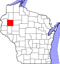
Barron County Wisconsin Incorporated and Unincorporated areas Almena Highlighted.svg
Location of Almena in Barron County, Wisconsin.
Coordinates: 45°25′27″N92°5′31″W / 45.42417°N 92.09194°W / 45.42417; -92.09194 [1]
Country Flag of the United States.svg  United States
State Flag of Wisconsin.svg  Wisconsin
County Barron
Government
  MayorBrad Rundhaug
Area
[2]
  Total1.13 sq mi (2.93 km2)
  Land1.13 sq mi (2.93 km2)
  Water0.00 sq mi (0.00 km2)
Elevation
[3]
1,211 ft (369 m)
Population
 (2010) [4]
  Total677
  Estimate 
(2019) [5]
641
  Density567.76/sq mi (219.13/km2)
Time zone UTC-6 (Central (CST))
  Summer (DST) UTC-5 (CDT)
Area codes 715 & 534
FIPS code 55-01350 [6]
GNIS feature ID1582680 [3]
Website https://villageofalmenawi.com

Almena is a village in Barron County in the U.S. state of Wisconsin. The population was 677 at the 2010 census.

Contents

History

A post office called Almena has been in operation since 1888. [7] The village's name is an amalgamation of Albert and Wilhelmina, the names of a first settler and his wife. [8] Almena was platted in 1891. [8] The name Almena came about after the federal government rejected the name "Lightning City" for a post office, which was derived from the nearby Lightning Creek. [9]

Geography

Almena is located on the boundary between the Town of Almena and the Town of Clinton, about 82 miles (132 km) northeast of Minneapolis.

According to the United States Census Bureau, the village has a total area of 1.14 square miles (2.95 km2), all of it land. [10]

Almena is along U.S. Highway 8 and County Road P.

Demographics

Historical population
CensusPop.Note
1950 406
1960 398−2.0%
1970 4236.3%
1980 52624.3%
1990 62518.8%
2000 72015.2%
2010 677−6.0%
2019 (est.)641 [5] −5.3%
U.S. Decennial Census [11]

2010 census

As of the census [4] of 2010, there were 677 people, 297 households, and 178 families living in the village. The population density was 593.9 inhabitants per square mile (229.3/km2). There were 337 housing units at an average density of 295.6 per square mile (114.1/km2). The racial makeup of the village was 96.2% White, 0.1% African American, 0.9% Native American, 0.3% Asian, 0.3% from other races, and 2.2% from two or more races. Hispanic or Latino of any race were 0.7% of the population.

There were 297 households, of which 30.3% had children under the age of 18 living with them, 42.8% were married couples living together, 9.1% had a female householder with no husband present, 8.1% had a male householder with no wife present, and 40.1% were non-families. 30.6% of all households were made up of individuals, and 15.5% had someone living alone who was 65 years of age or older. The average household size was 2.28 and the average family size was 2.79.

The median age in the village was 39.3 years. 23.5% of residents were under the age of 18; 8% were between the ages of 18 and 24; 25.9% were from 25 to 44; 26.4% were from 45 to 64; and 16.2% were 65 years of age or older. The gender makeup of the village was 50.2% male and 49.8% female.

2000 census

As of the census [6] of 2000, there were 720 people, 295 households, and 182 families living in the village. The population density was 720.0 people per square mile (278.0/km2). There were 308 housing units at an average density of 308.0 per square mile (118.9/km2). The racial makeup of the village was 97.08% White, 0.14% Black or African American, 1.25% Native American, 0.83% from other races, and 0.69% from two or more races. Hispanic or Latino of any race were 1.53% of the population.

There were 295 households, out of which 33.9% had children under the age of 18 living with them, 41.7% were married couples living together, 13.2% had a female householder with no husband present, and 38.3% were non-families. 29.5% of all households were made up of individuals, and 13.9% had someone living alone who was 65 years of age or older. The average household size was 2.44 and the average family size was 2.99.

In the village, the population was spread out, with 29.9% under the age of 18, 8.6% from 18 to 24, 31.8% from 25 to 44, 15.8% from 45 to 64, and 13.9% who were 65 years of age or older. The median age was 32 years. For every 100 females, there were 100.0 males. For every 100 females age 18 and over, there were 93.5 males.

The median income for a household in the village was $27,917, and the median income for a family was $34,028. Males had a median income of $25,833 versus $20,278 for females. The per capita income for the village was $13,928. About 10.8% of families and 14.9% of the population were below the poverty line, including 18.0% of those under age 18 and 15.6% of those age 65 or over.

Related Research Articles

<span class="mw-page-title-main">Almena, Kansas</span> City in Norton County, Kansas, United States

Almena is a city in Norton County, Kansas, United States. As of the 2020 census, the population of the city was 363.

<span class="mw-page-title-main">Long Island, Kansas</span> City in Phillips County, Kansas

Long Island is a city in Phillips County, Kansas, United States. As of the 2020 census, the population of the city was 137.

<span class="mw-page-title-main">Almena Township, Michigan</span> Township in Michigan, United States

Almena Township is a civil township of Van Buren County in the U.S. state of Michigan. As of the 2020 census, the township population was 5,308.

<span class="mw-page-title-main">Wilbur Park, Missouri</span> Village in Missouri, United States

Wilbur Park is a village in St. Louis County, Missouri, United States. The population was 439 at the 2020 census.

<span class="mw-page-title-main">Beech Bottom, West Virginia</span> Village in West Virginia, United States

Beech Bottom is a village in Brooke County, West Virginia, United States, situated along the Ohio River. The population was 523 at the 2010 census. It is part of the Weirton–Steubenville metropolitan area.

<span class="mw-page-title-main">Cameron, Barron County, Wisconsin</span> Village in Wisconsin, United States

Cameron is a village in Barron County in the U.S. state of Wisconsin. The population was 1,783 at the 2010 census.

Stanley is a town in Barron County in the U.S. state of Wisconsin. The population was 2,546 at the 2010 census. The town surrounds the village of Cameron but is separate from it.

<span class="mw-page-title-main">Sumner, Barron County, Wisconsin</span> Town in Wisconsin, United States

The Town of Sumner is located in Barron County in the U.S. state of Wisconsin. The population was 798 at the 2010 census. The unincorporated communities of Canton, Lehigh and Sumner are located in the town.

<span class="mw-page-title-main">Readstown, Wisconsin</span> Village in Wisconsin, United States

Readstown is a village in Vernon County, Wisconsin, United States. The population was 376 at the 2020 census.

<span class="mw-page-title-main">New Auburn, Wisconsin</span> Village in Wisconsin, United States

New Auburn is a village in Barron and Chippewa counties in the U.S. state of Wisconsin. The population was 548 at the 2010 census. Of this, 528 were in Chippewa County, and 20 were in Barron County. The village is located mostly within the Town of Auburn in Chippewa County. Small portions extend east into the adjacent Town of Bloomer, Chippewa County and north into the Town of Dovre in Barron County.

<span class="mw-page-title-main">Almena (town), Wisconsin</span>

The Town of Almena is in Barron County in the U.S. state of Wisconsin. The population was 858 at the 2010 census. The Village of Almena is partially located within the town.

Barron is a town in Barron County in the U.S. state of Wisconsin. The population was 873 at the 2010 census. The town surrounds the City of Barron.

<span class="mw-page-title-main">Barron, Wisconsin</span> City in Wisconsin, United States

Barron is a city in Barron County, in the U.S. state of Wisconsin. The population was 3,733 at the 2020 census. The city is surrounded by the Town of Barron.

<span class="mw-page-title-main">Dallas, Wisconsin</span> Village in Wisconsin, United States

Dallas is a village in Barron County in the U.S. state of Wisconsin. The population was 409 at the 2010 census. The village is located within the Town of Dallas.

Dallas is a town in Barron County in the U.S. state of Wisconsin. As of the 2010 census, the town had a population of 565. The Village of Dallas is within the town.

<span class="mw-page-title-main">Prairie Farm, Wisconsin</span> Village in Wisconsin, United States

Prairie Farm is a village in Barron County in the U.S. state of Wisconsin. The population was 473 at the 2010 census. The village is located within the Town of Prairie Farm, on eastern shore of the Prairie Farm Flowage, a reservoir on the Hay River.

Prairie Farm is a town in Barron County in the U.S. state of Wisconsin. The population was 573 at the 2010 census. The village of Prairie Farm is surrounded by the town.

Turtle Lake is a town in Barron County, Wisconsin, United States. The population was 624 at the 2010 census. The Village of Turtle Lake is located just north of the town. The unincorporated community of Twin Town is located partially in the town.

<span class="mw-page-title-main">Turtle Lake, Wisconsin</span> Village in Wisconsin, United States

Turtle Lake is a village in Barron and Polk counties in the U.S. state of Wisconsin. Its population was 1,064 at the 2010 census. Of these, 972 were in Barron County and 93 were in Polk County. The village is located between the towns of Almena, in Barron County, and Beaver, in Polk County.

<span class="mw-page-title-main">Lowell, Wisconsin</span> Village in Wisconsin, United States

Lowell is a village in Dodge County, Wisconsin, United States, along the Beaver Dam River. The population was 340 at the 2010 census. The village is located within the Town of Lowell.

References

  1. "US Gazetteer files: 2010, 2000, and 1990". United States Census Bureau. February 12, 2011. Retrieved April 23, 2011.
  2. "2019 U.S. Gazetteer Files". United States Census Bureau. Retrieved August 7, 2020.
  3. 1 2 "US Board on Geographic Names". United States Geological Survey. October 25, 2007. Retrieved January 31, 2008.
  4. 1 2 "U.S. Census website". United States Census Bureau . Retrieved November 18, 2012.
  5. 1 2 "Population and Housing Unit Estimates". United States Census Bureau. May 24, 2020. Retrieved May 27, 2020.
  6. 1 2 "U.S. Census website". United States Census Bureau . Retrieved January 31, 2008.
  7. "Barron County". Jim Forte Postal History. Retrieved June 24, 2017.
  8. 1 2 Gordon, Newton S. (1922). History of Barron County, Wisconsin. H.C. Cooper, Jr., & Company. p. 1133.
  9. Gard, Robert (2015). The Romance of Wisconsin Place Names (2nd ed.). Madison, WI: Wisconsin Historical Society Press. p. 8. ISBN   978-0-87020-707-5.
  10. "US Gazetteer files 2010". United States Census Bureau. Archived from the original on January 25, 2012. Retrieved November 18, 2012.
  11. "Census of Population and Housing". Census.gov. Retrieved June 4, 2015.