
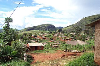
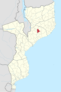
Milange District is a district of Zambezia Province in Mozambique. The town of Milange is the district center.
Milange District is a district of Zambezia Province in Mozambique. The town of Milange is the district center.
Milange District was one of the areas where the Revolutionary Party of Mozambique (PRM) operated during the Mozambican Civil War's early stages. The PRM attacked the village of Mongue in the district in May 1981, and again raided the area in the following month. [1]
Zambezia is the second most-populous province of Mozambique, located in the central coastal region south-west of Nampula Province and north-east of Sofala Province. It has a population of 5,11 million. The provincial capital is Quelimane on the Bons Sinais River.
Nampula is a province of northern Mozambique. It has an area of 79,010 km² and a population of 5,758,920, making it the most populous province in Mozambique. Nampula is the capital of the province.
The Mozambican National Resistance is a militant organization and political movement in Mozambique. Originally sponsored by the Rhodesian Central Intelligence Organisation (CIO), it was founded in 1975 as part of an anti-communist backlash against the country's ruling FRELIMO party.

Chinde District is a district of Zambezia Province in Mozambique. The principal town is Chinde.
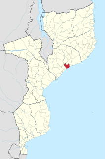
Mocuba District is a district of Zambezia Province in Mozambique. The main town is Mocuba.
Marromeu District is a district of Sofala Province in Mozambique. The principal town is Marromeu. The district is located in the northeast of the province, and borders with Chinde and Mopeia Districts of Zambezia Province in the north, Cheringoma District in the south and in the west, and with Caia District in the northwest. In the southeast, the district is limited by the Indian Ocean. The area of the district is 5,871 square kilometres (2,267 sq mi). It has a population of 119,718 as of 2007.

Alto Molocue District is a district of Zambezia Province in Mozambique. It covers, 6,368 km² and has a population of, 278,064.
Gilé District is a district of Zambezia Province in Mozambique.
Ile District is a district of Zambezia Province in Mozambique. Ile is bordered by Gurué and Alta Molócue to the north, Mulevala to the east, Mocuba to the south, and Lugela and Namarroi to the west. While Portuguese is the official language of Mozambique, the most commonly spoken language in Ile is the Bantu language, eLomwe. Subsistence agriculture sustains a large portion of the Ile population with crops such as cassava, rice and corn. These cereal crops are supplemented with small-scale farms of legumes, sweet potato, peanut, greens, tomato, onion, garlic, and more. Commercial agricultural crops include tea and eucalyptus. Available fruits include orange, banana, mango, papaya, coconut, lemon and lime. Ile is home to many granite domes and other bornhardts.
Inhassunge District is a district of the province of Zambezia Province in Mozambique, with its headquarters in the town of Mucupia. It has a borders, to the north with the municipality of Quelimane and with the district of Nicoadala, to the west with the district of Mopeia, to the south with the district of Chinde and to the east with the Indian Ocean.
Maganja da Costa District is a district of Zambezia Province in Mozambique.
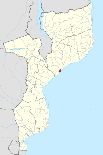
Mopeia District is a district of Zambezia Province in Mozambique.
Morrumbala District is a district of Zambezia Province in Mozambique. The town of Morrumbala is the district headquarters.

According to the most recent census conducted by the National Institute of Statistics in 2007, 56.1% of the population of Mozambique were Christian, 17.9% were Muslim, 18.7% had no religion, and 7.3% adhered to other beliefs. These figures need to be used with caution, especially those for the population that is categorised as having no religion, a significant section of whom is likely to practice traditional animist beliefs.

Water supply and sanitation in Mozambique is characterized by low levels of access to an at least basic water source, low levels of access to at least basic sanitation and mostly poor service quality. In 2007 the government has defined a strategy for water supply and sanitation in rural areas, where 62% of the population lives. In urban areas, water is supplied by informal small-scale providers and by formal providers.
The RENAMO insurgency was a guerrilla campaign by militants of the RENAMO party in Mozambique. The insurgency is widely considered to be an aftershock of the Mozambican Civil War; it resulted in renewed tensions between RENAMO and Mozambique's ruling FRELIMO coalition over charges of state corruption and the disputed results of 2014 general elections.

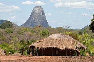
Mount Chiperone is a mountain in northern Mozambique.
Milange is a town in Zambezia Province of Mozambique. It is the district center of Milange District.
The Revolutionary Party of Mozambique was an armed rebel group in northern Mozambique during the Mozambican Civil War. Founded by Amos Sumane in 1974 or 1976, the PRM was strongly opposed to Mozambique's FRELIMO government and its communist ideology. The party waged a low-level insurgency in the provinces of Zambezia, Tete and Niassa from 1977. Sumane was captured in 1980 and executed by the Mozambican government in 1981. The PRM's leadership passed to Gimo Phiri under whom the party merged with another rebel group, RENAMO, in 1982.
Paulina Mateus Nkunda was a Mozambican women's activist, veteran of the war of independence and politician who served in positions at the highest levels of FRELIMO.
Coordinates: 16°06′04″S35°46′12″E / 16.101°S 35.770°E
| | This Mozambique location article is a stub. You can help Wikipedia by expanding it. |