Nhamatanda District

Last updated
Nhamatanda
Nhamatanda District map.svg
Nhamatanda District on the map of Mozambique
Country Mozambique
Province Sofala
Capital Nhamatanda
Area
  Total3,987 km2 (1,539 sq mi)
Population
 (2007 census)
  Total210,757
  Density53/km2 (140/sq mi)

Nhamatanda District is a district of Sofala Province in Mozambique. The principal town is Nhamatanda. The district is located in the center of the province, and borders with Gorongosa District in the north, Muanza District in the northeast, Dondo District in the east, Buzi District in the south, and with Gondola District of Manica Province in the west. The area of the district is 3,987 square kilometres (1,539 sq mi). [1] It has a population of 210,757 as of 2007. [2]

Contents

Geography

The principal rivers in the district are the Muda River, the Mecuzi River, the Nhamatanda River, the Tsengudza River, the Nhamissenguere Metuchira River, the Mecuzi Manguena River, the Mítua River, the Mussicavo River, the Mutarara River, and the Pungwe River. [1]

According to the Köppen climate classification, in the east the district has tropical wet and dry climate (Aw), and in the east tropical humid climate (Cw). The annual rainfall is 846 millimetres (33.3 in). [1]

History

Until colonial times, the area was scarcely populated, but for the railway construction people from the whole country were settled here. The district was established in 1980. [1]

Demographics

As of 2005, 43% of the population of the district was younger than 15 years. 36% did speak Portuguese. The most common mothertongue is Cindau. 71% were analphabetic, mostly women. [1]

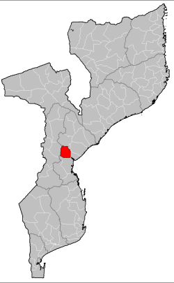
Administrative divisions

The district is divided into two postos, Nhamatanda (two localities) and Tica (two localities). [1]

Economy

1% of the households in the district have access to electricity. [1]

Agriculture

In the district, there are 33,000 farms which have on average 1.5 hectares (0.0058 sq mi) of land. The main agricultural products are corn, cassava, cowpea, peanut, sorghum, sweet potato, and rice. [1]

Transportation

There is a road network in the district 520 kilometres (320 mi) long. It includes a stretch of the national road EN6 which connects Beira with Chimoio and the border with Zimbabwe. The railway from Beira to Zimbabwe crosses the district. [1]

Related Research Articles

Sofala Province Province of Mozambique

Sofala is a province of Mozambique. It has a population of 2,259,248. Beira is the capital of the province, named for the ruined port of Sofala which is 35 kilometres (22 mi) to the south.

Dondo District District in Sofala, Mozambique

Dondo District is a district of Sofala Province in Mozambique. The principal town is Dondo. The district is located in the center of the province, and borders with Muanza District in the north, the city of Beira and Buzi District in the south, and with Nhamatanda District in the west. In the east, the district is limited by the Indian Ocean. The area of the district is 2,306 square kilometres (890 sq mi). It has a population of 142,387 as of 2007.

Gorongosa District District in Sofala, Mozambique

Gorongosa District is a district of Sofala Province in Mozambique. The principal town is Gorongosa. The district is located in the northwest of the province, and borders with Maringué District in the north, Cheringoma District in the east, Muanza District in the southeast, Nhamatanda District in the south, and with Macossa and Gondola Districts of Manica Province in the west. The area of the district is 6,722 square kilometres (2,595 sq mi). It has a population of 116,912 as of 2007.

Govuro District District in Inhambane, Mozambique

Govuro District is a district of Inhambane Province in south-east Mozambique. Its principal town is Nova Mambone. The district is located at the northeast of the province, and borders with Machanga District of Sofala Province in the north, Inhassoro District in the south, and Mabote District in the west. In the east, the district is bounded by the Indian Ocean. The area of the district is 3,961 square kilometres (1,529 sq mi). It has a population of 34,809 as of 2007.

Báruè District District in Manica, Mozambique

Báruè District is a district of Manica Province in western Mozambique. Its principal town is Catandica. The district is located in the west of the province, and borders with Guro District in the north, Macossa District in the east, Gondola District in the southeast, Manica District in the south, and with Zimbabwe in the west. The area of the district is 5,743 square kilometres (2,217 sq mi). It has a population of 137,582 as of 2007.

Gondola District District in Manica, Mozambique

Gondola District is a district of Manica Province in western Mozambique. The principal town is Gondola. The area of the district is 5,739 square kilometres (2,216 sq mi). It has a population of 262,412 as of 2007.

Machaze District District in Manica, Mozambique

Machaze District is a district of Manica Province in western Mozambique. The principal town is Machaze. The district is located in the south of the province, and borders with Mossurize District in the north, Chibabava District of Sofala Province in the northeast, Machanga District of Sofala Province in the east, Mabote District of Inhambane Province in the south, Massangena District of Gaza Province in the southwest, and with Zimbabwe in the west. The area of the district is 13,189 square kilometres (5,092 sq mi). It has a population of 104,608 as of 2007.

Macossa District District in Manica, Mozambique

Macossa District is a district of Manica Province in western Mozambique. The principal town is Macossa. The district is located in the east of the province, and borders with Tambara District in the north, Maringué District of Sofala Province in the northeast, Gorongosa District of Sofala Province in the east, Gondola District in the south, Báruè District in the west, and with Guro District in the northwest. The area of the district is 9,554 square kilometres (3,689 sq mi). It has a population of 27,245 as of 2007.

Manica District District in Manica, Mozambique

Manica District is a district of Manica Province in western Mozambique. The principal town is Manica. The district is located in the west of the province, and borders with Báruè District in the north, Vanduzi District in the east, Sussundenga District in the south, and with Zimbabwe in the west. The area of the district is 4,594 square kilometres (1,774 sq mi). It has a population of 213,206 as of 2007.

Mossurize District District in Manica, Mozambique

Mossurize District is a district of Manica Province in western Mozambique. The principal town is Espungabera. The district is located in the south of the province, and borders with Sussundenga District in the north, Chibabava District of Sofala Province in the east, Machaze District in the south, and with Zimbabwe in the west. The area of the district is 5,038 square kilometres (1,945 sq mi). It has a population of 195,182 as of 2007.

Sussundenga District District in Manica, Mozambique

Sussundenga District is a district of Manica Province in western Mozambique. The principal town is Sussundenga. The district is located in the center of the province, and borders with Manica District in the north, Gondola District in the northeast, Buzi District of Sofala Province in the east, Chibabava District of Sofala Province in the southeast, Mossurize District in the south, and with Zimbabwe in the west. The area of the district is 7,057 square kilometres (2,725 sq mi). It has a population of 129,851 as of 2007.

Tambara District District in Manica, Mozambique

Tambara District is a district of Manica Province in western Mozambique. The principal town is Nhacolo. The district is located in the north of the province, and borders with Tete Province in the north, Chemba District of Sofala Province in the east, Maringué District of Sofala Province in the southeast, Macossa District in the south, and with Guro District in the west. The area of the district is 3,892 square kilometres (1,503 sq mi). It has a population of 41,339 as of 2007.

Buzi District District in Sofala, Mozambique

Buzi District is a district of Sofala Province in Mozambique. The principal town is Búzi. The district is located in the southeast of the province, and borders with Nhamatanda District in the north, Dondo District in the northeast, Machanga District in the south, Chibabava District in the southwest, Sussundenga District of Manica Province in the west, and with Gondola District of Manica Province in the northwest. The area of the district is 7,329 square kilometres (2,830 sq mi). It has a population of 159,614 as of 2007.

Caia District District in Sofala, Mozambique

Caia District is a district of Sofala Province in Mozambique. The principal town is Caia. The district is located in the north of the province, and borders with Chemba District in the north, Marromeu District in the southeast, Cheringoma District in the south, and with Maringué District in the west. In the east, the district is bounded by the Indian Ocean. The area of the district is 3,542 square kilometres (1,368 sq mi). It has a population of 115,455 as of 2007.

Chemba District District in Sofala, Mozambique

Chemba District is a district of Sofala Province in Mozambique. The principal town is Chemba. The district is located in the north of the province, and borders with Tete Province in the northeast, Caia District in the southeast, Maringué District in the southwest, and with Tambara District of Manica Province in the northwest. The area of the district is 3,998 square kilometres (1,544 sq mi). It has a population of 65,107 as of 2007.

Cheringoma District District in Sofala, Mozambique

Cheringoma District is a district of Sofala Province in Mozambique. The principal town is Inhaminga. The district is located in the northeast of the province, and borders with Caia District in the north, Marromeu District in the northeast, Muanza District in the south, Gorongosa District in the west, and with Maringué District in the northwest. In the south, it is bounded by the Indian Ocean. The area of the district is 6,954 square kilometres (2,685 sq mi). It has a population of 34,133 as of 2007.

Chibabava District District in Sofala, Mozambique

Chibabava District is a district of Sofala Province in Mozambique. The principal town is Chibabava. The district is located in the south of the province, and borders with Buzi District in the north, Machanga District in the southeast, with Machaze and Mossurize Districts of Manica Province in the west, and with Sussundenga District of Manica Province in the northwest. The area of the district is 6,977 square kilometres (2,694 sq mi). It has a population of 101,667 as of 2007.

Marromeu District District in Sofala, Mozambique

Marromeu District is a district of Sofala Province in Mozambique. The principal town is Marromeu. The district is located in the northeast of the province, and borders with Chinde and Mopeia Districts of Zambezia Province in the north, Cheringoma District in the south and in the west, and with Caia District in the northwest. In the southeast, the district is limited by the Indian Ocean. The area of the district is 5,871 square kilometres (2,267 sq mi). It has a population of 119,718 as of 2007.

Machanga District District in Sofala, Mozambique

Machanga District is a district of Sofala Province in Mozambique. The principal town is Machanga. The district is located in the south of the province, and borders with Buzi District in the north, Mabote and Govuro Districts of Inhambane Province in the south, Machaze District of Manica Province in the west, and with Chibabava District in the northwest. In the east, the district is limited by the Indian Ocean. The area of the district is 5,940 square kilometres (2,290 sq mi). It has a population of 51,855 as of 2007.

Muanza District District in Sofala, Mozambique

Muanza District is a district of Sofala Province in Mozambique. The principal town is Muanza. The district is located in the center of the province, and borders with Cheringoma District in the north, Dondo District in the south, Nhamatanda District in the southwest, and with Gorongosa District in the northwest. In the east, the district is bordered by the Indian Ocean. The area of the district is 7,500 square kilometres (2,900 sq mi). It has a population of 25,229 as of 2007.

References

  1. 1 2 3 4 5 6 7 8 9 "Perfil do Distrito do Nhamatanda" (PDF) (in Portuguese). Ministry of State Administration. 2005. Retrieved 9 November 2016.
  2. "População da Provincia de Sofala". Censo 2007 (in Portuguese). Instituto Nacional de Estatística. Archived from the original on 19 December 2007. Retrieved 20 March 2008.

Coordinates: 19°16′S34°13′E / 19.267°S 34.217°E / -19.267; 34.217