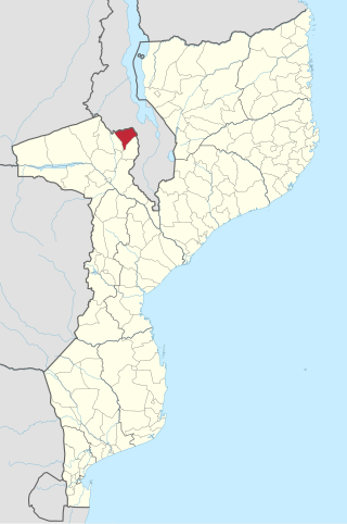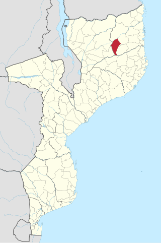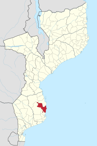
Angónia District is a district in the northern part of Tete Province in the central region of Mozambique. Its administrative center is the town of Ulongué. The district is located in the northwest of the province, and borders with Dedza District of Malawi in the north, Ntcheu District of Malawi in the east, Tsangano District in the south, and with Macanga District in the west. The area of the district is 3,277 square kilometres (1,265 sq mi). It has a population of 335,808 as of 2007.

Chókwè District is a district of Gaza Province in south-western Mozambique. Its principal town is Chokwe. The district is located in the south of the province, and borders with Mabalane District in the north, Guijá District in the east, Chibuto, Xai-Xai, and Bilene Macia Districts in the southeast, Magude District of Maputo Province in the south, and with Massingir District in the west. The area of the district is 2,466 square kilometres (952 sq mi). It has a population of 187,422 (2007).

Xai-Xai District is a district of Gaza Province in south-western Mozambique. The administrative center of the district is Chongoene. The district is located in the south of the province, and borders with Chibuto District in the north, Manjacaze District in the east, Bilene Macia District in the southeast, and with Chókwè District in the west. In the south, it is bounded by the Indian Ocean. The area of the district is 1,908 square kilometres (737 sq mi). It has a population of 188,720 as of 2007.

Chigubo District is a district of Gaza Province in south-western Mozambique. The administrative center of the district is Dindiza. The district is located in the east of the province, and borders with Massangena District in the north, Mabote and Funhalouro Districts of Inhambane Province in the east, Chibuto District in the south, Guijá District in the southwest, Mabalane District in the west, and with Chicualacuala District in the northwest. The area of the district is 14,864 square kilometres (5,739 sq mi). It has a population of 20,685 (2007).

Guijá District is a district of Gaza Province in south-western Mozambique. The administrative center of the district is Caniçado. The district is located at the south of the province, and borders with Chigubo District in the north, Chibuto District in the east, Chókwè District in the south, and with Mabalane District in the west. The area of the district is 4,207 square kilometres (1,624 sq mi). It has a population of 75,303 as of 2007.

Mabalane District is a district of Gaza Province in south-western Mozambique. The administrative center of the district is Mabalane. The district is located at the center of the province, and borders with Chicualacuala District in the north, Chigubo District in the east, Guijá District in the southeast, Chókwè District in the south, and with Massingir District in the west. The area of the district is 9,107 square kilometres (3,516 sq mi). It has a population of 32,040 (2007).

Balama District is a district of Cabo Delgado Province in northern Mozambique. It covers 5,540 km² with 142,968 inhabitants.

Chiúre District is a district of Cabo Delgado Province in northern Mozambique. It covers 5,439 km² with 248,381 inhabitants.

Funhalouro District is a district of Inhambane Province in south-east Mozambique. Its principal town is Funhalouro. The district is located at the west of the province, and borders with Mabote District in the north, Inhassoro District in the northeast, Massinga and Morrumbene Districts in the east, Homoine District in the southeast, Inharrime District in the south, and with Chigubo District of Gaza Province in the west. The area of the district is 13,653 square kilometres (5,271 sq mi). It has a population of 37.925 as of 2007.

Govuro District is a district of Inhambane Province in south-east Mozambique. Its principal town is Nova Mambone. The district is located at the northeast of the province, and borders with Machanga District of Sofala Province in the north, Inhassoro District in the south, and Mabote District in the west. In the east, the district is bounded by the Indian Ocean. The area of the district is 3,961 square kilometres (1,529 sq mi). It has a population of 34,809 as of 2007.

Homoine District is a district of Inhambane Province in south-east Mozambique. Its principal town is Vila de Homoine. The district is located at the east of the province, and borders with Morrumbene District in the north, Jangamo District in the southeast, Inharrime District in the south, Panda District in the west, and Funhalouro District in the northwest. In the east, the district is bounded by the Indian Ocean. The area of the district is 1,891 square kilometres (730 sq mi). It has a population of 107.475 as of 2007.

Massinga District is a district of Inhambane Province in south-east Mozambique. Its principal town is Massinga. The district is located at the east of the province and borders with Inhassoro District in the north, Vilanculos District in the northeast, Morrumbene District in the south, and with Funhalouro District in the west. In the east, the district is bounded by the Indian Ocean. The area of the district is 7,458 square kilometres (2,880 sq mi). In terms of the area, this is the biggest district of Inhambane Province. It has a population of 184,531 as of 2007.

Matutuíne District is a district of Maputo Province in southern Mozambique. The principal town is Bela Vista. The district is located in the south of the province, and borders with the city of Maputo in the north, the province of KwaZulu-Natal of South Africa in the south, Eswatini in the west, and with Namaacha and Boane Districts in the northwest. In the east, the district is limited by the Indian Ocean. The area of the district is 5,387 square kilometres (2,080 sq mi). This is the southernmost district of Mozambique. It has a population of 37,165 as of 2007.
Nacala-a-Velha District is a district of Nampula Province in north-eastern Mozambique.

Buzi District is a district of Sofala Province in Mozambique. The principal town is Búzi. The district is located in the southeast of the province, and borders with Nhamatanda District in the north, Dondo District in the northeast, Machanga District in the south, Chibabava District in the southwest, Sussundenga District of Manica Province in the west, and with Gondola District of Manica Province in the northwest. The area of the district is 7,329 square kilometres (2,830 sq mi). It has a population of 159,614 as of 2007.

Magoé District is a district of Tete Province in western Mozambique. Its administrative center is the town of Mpheende. The district is located in the north of the province, and borders with Zumbo District in the north, Marávia District in the northeast, Cahora-Bassa District in the east, and with Zimbabwe in the south and in the west. The area of the district is 8,792 square kilometres (3,395 sq mi). It had a population of 89,273 as of 2017.

Marávia District is a district of Tete Province in western Mozambique. Its administrative center is the town of Fingoé. The district is located in the northwest of the province, and borders with Zambia in the north, Chifunde District in the east, Chiuta District in the southeast, Cahora-Bassa District in the south, Magoé District in the southwest, and with Zumbo District in the west. The area of the district is 17,108 square kilometres (6,605 sq mi). It has a population of 82,789 as of 2007.

Mozambique is divided into ten provinces (provincias) and one capital city with provincial status. The provinces are subdivided into 129 districts (distritos). The districts are further divided in 405 "Postos Administrativos" and then into Localidades (Localities), the lowest geographical level of the central state administration. Since 1998, 65 "Municípios" (Municipalities) have been created in Mozambique.

Vanduzi District is a district in Manica Province of Mozambique.

Macate District is a district in Manica Province of Mozambique.


