Related Research Articles
Nampula is a province of northern Mozambique. It has an area of 79,010 km2 (30,510 sq mi) and a population of 5,758,920, making it the most populous province in Mozambique. Nampula is the capital of the province.
Nacala, also known as Cidade de Nacala or Nacala-Porto is a city on the northern coast of Mozambique. Located in the southwestern indentation of inner Fernao Veloso Bay, it is the deepest natural port on the east coast of Africa. Nacala serves as the terminal for the Nacala railway, a rail line to the landlocked Malawi. South of Nacala is Mozambique Island, at one time the capital of Mozambique and now a World Heritage site.

The Catholic Church in Mozambique is part of the worldwide Catholic Church, under the spiritual leadership of the Pope in Rome.

Macanga is a district situated in the north part of Tete Province in the central region of Mozambique. Its administrative center is the town of Furancungo. The district is located in the north of the province, and borders with Dedza District and Lilongwe District of Malawi in the north, Angónia District in the east, Tsangano District in the southeast, Chiuta District in the south, and with Chifunde District in the west. The area of the district is 6,999 square kilometres (2,702 sq mi). It has a population of 112,551 as of 2007.

Namaacha District is a district of Maputo Province in southern Mozambique. The principal town is Namaacha. The district is located in the southwest of the province, and borders with Moamba District in the north, Boane District in the east, Matutuíne District in the south, and with Eswatini and South Africa in the west. The area of the district is 2,196 square kilometres (848 sq mi). It has a population of 41,914 as of 2007.

Massingir District is a district of Gaza Province in southwestern Mozambique. The administrative center of the district is in Massingir. The district is located in the west of the province, and borders with Chicualacuala District in the north, Mabalane District in the east, Chókwè District in the southeast, Magude District of Maputo Province in the south, and with South Africa in the west. The area of the district is 5,893 square kilometres (2,275 sq mi). It has a population of 28,470 (2007).

Zavala District is a district of Inhambane Province in south-east Mozambique. Its principal town is Zavala. The district is located at the east of the province, and borders with Inharrime District in the north and with Manjacaze District of Gaza Province in the west. In the east and in the south, the district is bounded by the Indian Ocean. The area of the district is 1,997 square kilometres (771 sq mi). It has a population of 139.616 as of 2007.

Macossa District is a district of Manica Province in western Mozambique. The principal town is Macossa. The district is located in the east of the province, and borders with Tambara District in the north, Maringué District of Sofala Province in the northeast, Gorongosa District of Sofala Province in the east, Gondola District in the south, Báruè District in the west, and with Guro District in the northwest. The area of the district is 9,554 square kilometres (3,689 sq mi). It has a population of 27,245 as of 2007.

Manica District is a district of Manica Province in western Mozambique. The principal town is Manica. The district is located in the west of the province, and borders with Báruè District in the north, Vanduzi District in the east, Sussundenga District in the south, and with Zimbabwe in the west. The area of the district is 4,594 square kilometres (1,774 sq mi). It has a population of 213,206 as of 2007.

Moamba District is a district of Maputo Province in southern Mozambique. Its main town is Moamba. The district is located in the western part of the province, and borders with Magude District in the north, Manhiça and Marracuene Districts in the east, the city of Matola in the southeast, Boane District and Namaacha District in the south, and with Mpumalanga Province of South Africa, in the west. The area of the district is 4,628 square kilometres (1,787 sq mi). It has a population of 56,335 as of 2007.

Mwenezi River is a major tributary of the Limpopo River. The Mwenezi River starts up in south central Zimbabwe and flows south-east along what is known as the Mwenezi River Valley that bisects the district into two sectors. The river is found in both Zimbabwe and Mozambique. In Zimbabwe it has been known as the Nuanetsi or Nuanetzi River in the past, a name it retains in Mozambique.
Cubal is a town and municipality in Benguela Province in Angola. The municipality had a population of 305,632 in 2014.
Chiure or Chiure Novo is a town in Chiure District in Cabo Delgado Province in northeastern Mozambique.
The Port of Nacala, also called the Nacala port complex, is a Mozambican port located in the cities of Nacala and Nacala-a-Velha. Is the deepest port in Southern Africa. The natural deep harbour serves landlocked Malawi with a 931-kilometre (578 mi) railway.

Lumbo is a port on the northeast Indian Ocean coast of Mozambique. It is part of the Island of Mozambique District in Nampula Province.
Nacala-a-Velha, is a town on the northern coast of Mozambique. It is located on the western shore of inner Fernao Veloso Bay, opposite the city of Nacala.
Fernao Veloso Bay is a bay in Mozambique. It is located in Nampula Province, south of Memba Bay on the northern coast of Mozambique.

Nacala railway, also known as Northern Corridor railway and Nacala Corridor railway, is a railway line that operates in northern Mozambique on a 912 kilometres (567 mi) line that runs west from the port city of Nacala, crossing the central region of Malawi, connecting with the coal belt of Moatize, in northwest Mozambique. It is connected to the Dona Ana-Moatize railway branch and the Sena railway (Chipata-Lilongwe-Blantyre-Nhamayabue-Dondo). It also has a 262 kilometres (163 mi) branch line from Cuamba to Lichinga.
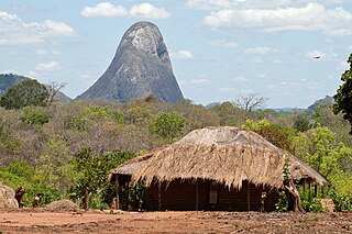
Mount Morrumbala, also known as Mount Tembe, is a mountain in Morrumbala District of Zambezia Province in central Mozambique.
The Cheringoma Plateau is a low plateau in Sofala Province of Mozambique. It lies mostly within Cheringoma, Muanza, and Marromeu districts.