Millport, Alabama

Last updated

Millport, Alabama
Lamar County Alabama Incorporated and Unincorporated areas Millport Highlighted 0148808.svg
Location of Millport in Lamar County, Alabama.
Coordinates: 33°33′37″N88°4′49″W / 33.56028°N 88.08028°W / 33.56028; -88.08028
Country United States
State Alabama
County Lamar
Area
[1]
  Total5.51 sq mi (14.26 km2)
  Land5.49 sq mi (14.23 km2)
  Water0.01 sq mi (0.04 km2)
Elevation
276 ft (84 m)
Population
 (2020)
  Total1,010
  Density183.87/sq mi (71.00/km2)
Time zone UTC-6 (Central (CST))
  Summer (DST) UTC-5 (CDT)
ZIP code
35576
Area code(s) 205, 659
FIPS code 01-48808
GNIS feature ID0122845

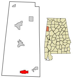
Millport is a town in Lamar County, Alabama, United States. It incorporated in 1887. [2] At the 2010 census the population was 1,049, down from 1,160 in 2000. After its incorporation from 1890 to 1900, it was the largest town in Lamar County, losing the distinction to Sulligent. Since 1940, it has been the 3rd largest town. [3]

Contents

Geography

According to the U.S. Census Bureau, the town has a total area of 5.4 square miles (14 km2), of which 5.4 square miles (14 km2) is land and 0.18% is water. [4]

Demographics

Historical population
CensusPop.Note
1890 244
1900 35746.3%
1910 52948.2%
1920 60414.2%
1930 71418.2%
1940 700−2.0%
1950 682−2.6%
1960 94338.3%
1970 1,07013.5%
1980 1,28720.3%
1990 1,203−6.5%
2000 1,160−3.6%
2010 1,049−9.6%
2020 1,010−3.7%
U.S. Decennial Census [5]
2013 Estimate [6]

2000 census

At the 2000 census there were 1,160 people, 495 households, and 328 families living in the town. The population density was 213.7 inhabitants per square mile (82.5/km2). There were 561 housing units at an average density of 103.3 per square mile (39.9/km2). The racial makeup of the town was 65.52% White, 33.97% Black, 0.09% Native American, and 0.43% from two or more races. [7] Of the 495 households 28.5% had children under the age of 18 living with them, 46.1% were married couples living together, 16.4% had a female householder with no husband present, and 33.7% were non-families. 32.5% of households were one person and 15.8% were one person aged 65 or older. The average household size was 2.34 and the average family size was 2.96.

The age distribution was 24.0% under the age of 18, 8.8% from 18 to 24, 26.6% from 25 to 44, 24.1% from 45 to 64, and 16.6% 65 or older. The median age was 38 years. For every 100 females, there were 85.9 males. For every 100 females age 18 and over, there were 84.1 males.

The median household income was $26,458 and the median family income was $33,869. Males had a median income of $30,521 versus $17,396 for females. The per capita income for the town was $12,822. About 18.2% of families and 21.0% of the population were below the poverty line, including 25.4% of those under age 18 and 28.7% of those age 65 or over.

2010 census

At the 2010 census there were 1,049 people, 453 households, and 304 families living in the town. The population density was 194.3 inhabitants per square mile (75.0/km2). There were 536 housing units at an average density of 99.3 per square mile (38.3/km2). The racial makeup of the town was 64.7% White, 33.7% Black, 0.1% Native American, and 1.3% from two or more races. [8] Of the 453 households 27.6% had children under the age of 18 living with them, 43.7% were married couples living together, 19.4% had a female householder with no husband present, and 32.9% were non-families. 30.9% of households were one person and 15.0% were one person aged 65 or older. The average household size was 2.32 and the average family size was 2.88.

The age distribution was 23.1% under the age of 18, 9.9% from 18 to 24, 24.0% from 25 to 44, 25.0% from 45 to 64, and 18.0% 65 or older. The median age was 39.4 years. For every 100 females, there were 83.1 males. For every 100 females age 18 and over, there were 83.9 males.

The median household income was $23,722 and the median family income was $24,597. Males had a median income of $34,125 versus $22,153 for females. The per capita income for the town was $15,309. About 18.5% of families and 21.8% of the population were below the poverty line, including 31.7% of those under age 18 and 7.5% of those age 65 or over.

2020 census

Millport racial composition [9]
RaceNum.Perc.
White (non-Hispanic)66165.45%
Black or African American (non-Hispanic)29729.41%
Native American 50.5%
Other/Mixed 363.56%
Hispanic or Latino 111.09%

As of the 2020 United States census, there were 1,010 people, 451 households, and 274 families residing in the town.

Government

A Steel Dust Recycling plant in Millport, August 2019 Steel Dust Recycling.jpg
A Steel Dust Recycling plant in Millport, August 2019

2005 bankruptcy

Millport filed for chapter 9 bankruptcy in 2005 after mayor Waymon Fields, who was a former banker and was elected in 2004, discovered that the town was almost $3.5 million behind in payments and was facing its water and sewer system being taken over by the federal government because of missed payments. [10]

Education

South Lamar School is in Millport.

Notable people

See also

Related Research Articles

<span class="mw-page-title-main">Lamar County, Alabama</span> County in Alabama, United States

Lamar County is a county in the U.S. state of Alabama. As of the 2020 census, the population was 13,972. Its county seat is Vernon and it is a dry county. It is named in honor of Lucius Quintus Cincinnatus Lamar, a former Confederate officer and former member of both houses of the United States Congress from Mississippi.

<span class="mw-page-title-main">Marion County, Alabama</span> County in Alabama, United States

Marion County is a county of the U.S. state of Alabama. As of the 2020 census the population was 29,341. The county seat is Hamilton. The county was created by an act of the Alabama Territorial General Assembly on February 13, 1818. The county seat was originally established in Pikeville in 1820, and moved to Hamilton in 1881. The county was named by planter and US Indian agent John Dabney Terrell, Sr., in recognition of General Francis Marion of South Carolina.

<span class="mw-page-title-main">Sylvania, Alabama</span> Town in Alabama, United States

Sylvania is a town in DeKalb County, Alabama, United States. It incorporated in October 1967. At the 2010 census the population was 1,837, up from 1,186 in 2000. Sylvania is located atop Sand Mountain. Sylvania was incorporated in 1967. The post office /town hall was built in 1977.

<span class="mw-page-title-main">Deatsville, Alabama</span> Town in Alabama, United States

Deatsville is a town in Elmore County, Alabama, United States. Although Deatsville initially incorporated in 1903, it lapsed at some point after the 1910 U.S. Census and did not appear again as incorporated until 2000. As of the 2020 census, the population was 1,679.

<span class="mw-page-title-main">Eclectic, Alabama</span> Village in Alabama, United States

Eclectic is a town in Elmore County, Alabama, United States. It incorporated in 1907. At the 2020 census, the population was 1,193. It is part of the Montgomery Metropolitan Statistical Area.

<span class="mw-page-title-main">Elmore, Alabama</span> Town in Alabama, United States

Elmore is a town in Elmore County, Alabama, United States. Although initially incorporated in 1906, it lapsed and was not reincorporated again until 1997. At the 2010 census the population was 1,262, up from 199 in 2000. It is part of the Montgomery Metropolitan Statistical Area.

<span class="mw-page-title-main">Belk, Alabama</span> Town in Alabama, United States

Belk is a town in Fayette County, Alabama, United States. Its citizens voted to incorporate in January 1969. At the 2020 census, the population was 186.

<span class="mw-page-title-main">Cottonwood, Alabama</span> Town in Alabama, United States

Cottonwood is a town in Houston County, Alabama, United States. One source said the town incorporated in 1901, although the 1910 U.S. Census stated 1903. It is part of the Dothan, Alabama Metropolitan Statistical Area. At the 2010 census the population was 1,289, up from 1,170 in 2000.

<span class="mw-page-title-main">Cowarts, Alabama</span> Town in Alabama, United States

Cowarts is a town in Houston County, Alabama, United States. The town incorporated in August 1961. It is part of the Dothan, Alabama Metropolitan Statistical Area. At the 2010 census the population was 1,871, up from 1,546 in 2000.

<span class="mw-page-title-main">Webb, Alabama</span> Town in Alabama, United States

Webb is a town in Houston County, Alabama, United States. It is named for plantation owner B. F. Webb, who settled in the area around 1890. The town was incorporated in 1903. It is part of the Dothan, Alabama Metropolitan Statistical Area. As of the 2010 census, the population was 1,430, up from 1,298 in 2000.

<span class="mw-page-title-main">Argo, Alabama</span> Town in Alabama, United States

Argo is a town in Jefferson and St. Clair counties, Alabama, United States. It incorporated in 1987. At the 2020 census, the population was 4,368.

<span class="mw-page-title-main">Midfield, Alabama</span> Town in Alabama, United States

Midfield is a town in Jefferson County, Alabama, United States, located two miles south of the Birmingham suburb of Fairfield. It incorporated in 1953. As of the 2020 census, it had a population of 5,211.

<span class="mw-page-title-main">Sulligent, Alabama</span> City in Alabama, United States

Sulligent is a city in Lamar County, Alabama, United States. As of the 2010 census, the population of the city was 1,927, down from its record high of 2,151 in 2000. From 1910-1950 and again in 2000, it was the largest community in Lamar County before losing the distinction both times to the county seat of Vernon. The name is derived from railroad personnel.

<span class="mw-page-title-main">Vernon, Alabama</span> City in Alabama, United States

Vernon is a city in Lamar County, Alabama, United States. The city is the county seat of Lamar County, and previously served as the seat of its two predecessors, Jones County, which briefly existed in 1867, and for Sanford County from 1868 until it was renamed Lamar in 1877. It incorporated in 1870. At the 2010 census the population was 2,000, down from 2,143 in 2000. It is the largest city in Lamar County as of 2010, and previously held the distinction in 1880 and from 1960 to 1990, falling to 2nd place in 2000 behind Sulligent, but since reclaiming the title.

<span class="mw-page-title-main">Town Creek, Alabama</span> Town in Alabama, United States

Town Creek is a town in Lawrence County, Alabama, United States, and is included in the Decatur Metropolitan Area, as well as the Huntsville-Decatur Combined Statistical Area. It incorporated in March 1875. As of the 2010 census, the population of the town is 1100, down from 1216 in 2000. Since 1920, it has been the second largest town in Lawrence County after Moulton.

<span class="mw-page-title-main">New Hope, Alabama</span> City in Alabama, United States

New Hope is a city in Madison County, Alabama, United States, and is included in the Huntsville-Decatur Combined Statistical Area. The population was 2,889 at the 2020 census.

<span class="mw-page-title-main">Trinity, Alabama</span> Town in Alabama, United States

Trinity is a town in Morgan County, Alabama, United States. It is included in the Decatur Metropolitan Area and the Huntsville-Decatur Combined Statistical Area. As of the 2020 census, the population of the town was 2,526, up from 2,095 in 2010. It was incorporated in 1901.

<span class="mw-page-title-main">Margaret, Alabama</span> City in Alabama, United States

Margaret is a city in St. Clair County, Alabama, United States. At the 2020 census, the population was 5,106. As of the 2010 census, the population is 4,428, an increase of 278.8%. Margaret incorporated in 1960 and became a city in October 2011.

<span class="mw-page-title-main">Lake View, Alabama</span> City in Alabama, United States

Lake View is a city in Alabama, United States, with the majority in Tuscaloosa County and with a small portion in Jefferson County. At the 2010 census the population was 1,943, up from 1,357 in 2000. It is part of the Tuscaloosa Metropolitan Statistical Area and the Birmingham metropolitan area. It is located approximately halfway between Tuscaloosa and Birmingham via Interstates 20 and 59.

<span class="mw-page-title-main">Chatom, Alabama</span> City in and county seat of Washington County, Alabama

Chatom is a town in Washington County, Alabama, United States. It incorporated in 1949. Chatom is the county seat of Washington County, holding the distinction since 1907. The town's population was 1,288 At the 2010 census, up from 1,193 in 2000.

References

  1. "2020 U.S. Gazetteer Files". United States Census Bureau. Retrieved October 29, 2021.
  2. "Millport Encyclopedia of Alabama". Encyclopedia of Alabama.
  3. U.S. Census records for Millport, Sulligent and Vernon, 1890-2010 (See historic population data boxes)
  4. "US Gazetteer files: 2010, 2000, and 1990". United States Census Bureau. February 12, 2011. Retrieved April 23, 2011.
  5. "U.S. Decennial Census". Census.gov. Retrieved June 6, 2013.
  6. "Annual Estimates of the Resident Population: April 1, 2010 to July 1, 2013" . Retrieved June 3, 2014.
  7. "U.S. Census website". United States Census Bureau . Retrieved January 31, 2008.
  8. "U.S. Census website". United States Census Bureau . Retrieved July 30, 2015.
  9. "Explore Census Data". data.census.gov. Retrieved December 18, 2021.
  10. Writer, Jason Morton Staff. "Millport making a comeback". Tuscaloosa News.

Commons-logo.svg Media related to Millport, Alabama at Wikimedia Commons