Mining in the Northern Territory

Last updated

Mining in the Northern Territory
Northern Territory in Australia.svg
Position of Northern Territory within Australia
Location
State Flag of the Northern Territory.svg Northern Territory
CountryFlag of Australia (converted).svg  Australia
Regulatory authority
Authority Department of Mines and Energy
Website Official website
Production
ValueDecrease2.svg A$3,436 million
EmployeesDecrease2.svg 5,732
Year2015 [1]

Mining in the Northern Territory accounts for 16.4% of the gross domestic product, inclusive of both the minerals and petroleum industries. In 2015, it was valued at A$3,436 million. It accounts for 4.3% of the Northern Territory workforce. 63 businesses are currently engaged in the sector. [1]

Contents

History

The Ochre Pits Ochre pits.JPG
The Ochre Pits

Prior to European Settlement Indigenous groups mined ochre and other materials for ceremonial activities. [2] With the arrival of the Overland Telegraph Line in the 1860s-70's gold was discovered in small quantities at a number of locations when the Northern Territory was being administered by South Australia. [3]

The first large find of gold in the region was made at Pine Creek, about 250kms south of Darwin in 1872. Its discovery led to an influx of prospectors to the region, including a large number of Chinese migrants. Soon Chinese migrants outnumbered 'white' miners, those of European backgrounds, and tensions arose with many white miners being angered that Chinese workers were 'undercutting the existing labour force. [4] This tension ultimately led to the creation of South Australia's Chinese Restriction Act 1868 which brought in tonnage restrictions and a poll tax on each Chinese arrival and dramatically reduced the number of arrivals to the region. [5]

The next major gold discovery was made at Arltunga, 110kms east of Alice Springs, in 1897 where a battery and cyanide plant were established to process the ore. [3]

Other mineral discoveries, besides gold, were also made during this period including copper at Pine Creek in 1872 and the Daly River region in 1882. Mica was discovered at Hart Range from 1892 and wolfram at Hatches Creek (between Alice Springs and Tennant Creek). [3]

Despite these discoveries there were few early mining successes during this early era, in large part, because conditions on the goldfields and mines were harsh and often the mines were located long distances from the larger settlements, harsh weather conditions, high prices for goods and services and fluctuating metal prices. [3]

Major commodities

Manganese

Manganese mining in the Northern Territory in the financial year 2013-14, was worth A$1,024 million. [1]

Petroleum

Petroleum, like mining, falls under the jurisdiction of the Department of Mines and Energy. It was worth $214 million in 2014. [1] The NT onshore area is over 1.35 million km2. There were 54 active exploration permits, three retention and five productions licences. Hydrocarbons have been produced since the 1980s. [6]

Onshore gas was produced at the Mereenie and Palm Valley gas fields in the Amadeus Basin, west of Alice Springs. The Dingo Field began producing gas in November 2015. [6]

Gold

Gold mining in the Northern Territory was worth A$770 million in 2014. [1]

Uranium

Uranium mining in the Northern Territory in the financial year 2013-14, was worth A$136 million. [1]

Geothermal

There are no granted geothermal permits in the NT at the time of producing this report. The last permit was surrendered in 2014. [6]

Table of Mines in the Northern Territory

Mines in Northern Territory [7]
NameAlternate NamesCoordinatesStatusCommoditiesGeological ProvinceGeological AgeDeposit Model [8]
Millars/Big Tree/PingQueUnion Reefs Project 13°43′28″S131°47′46″E / 13.7244°S 131.796°E / -13.7244; 131.796 Historic Mine Gold Pine Creek Orogen Paleoproterozoic
MLS167Carbine, Central Tanami Project, Dogbolter, Harleys, Phoenix, Redback SE 20°24′21″S129°40′01″E / 20.4058°S 129.667°E / -20.4058; 129.667 Historic Mine Gold Tanami Orogen Proterozoic
MLS168Camel Bore, Central Tanami Project, Jims Main 20°09′29″S129°37′15″E / 20.1581°S 129.6207°E / -20.1581; 129.6207 Historic Mine Gold Tanami Orogen Proterozoic
MLS180Banjo, Beaver, Bonsai, Central Tanami Project 19°58′13″S129°24′28″E / 19.9703°S 129.4079°E / -19.9703; 129.4079 Historic Mine Gold Tanami Orogen Proterozoic Environment: unknown, Group: unknown, Type: unknown
ML 22934 - GroundrushCentral Tanami Project 19°42′37″S129°59′34″E / 19.7103°S 129.9928°E / -19.7103; 129.9928 Historic Mine Gold Tanami Orogen Proterozoic
Tanami - NewmontCallie, Dead Bullock Soak, Tanami Project, The Granites 20°31′32″S129°56′01″E / 20.5256°S 129.9336°E / -20.5256; 129.9336 Operating Mine Gold Tanami Orogen Paleoproterozoic Environment: Metamorphic hydrothermal, Group: Orogenic, Type: Mesozonal orogenic Au
Ammaroo PhosphateBarrow Creek 1 21°47′32″S135°50′05″E / 21.7921°S 135.8348°E / -21.7921; 135.8348 Under Development Phosphate, (Uranium, Phosphorus oxide, Uranium oxide) Georgina Basin
Davies 13°33′46″S131°33′55″E / 13.5629°S 131.5653°E / -13.5629; 131.5653 Historic Mine Gold Pine Creek Orogen
Coronation Hill 13°35′10″S132°36′27″E / 13.5862°S 132.6074°E / -13.5862; 132.6074 Historic Mine Gold, (Uranium, Platinum, Palladium, Platinum group elements, Uranium oxide)Pine Creek Orogen Paleoproterozoic Environment: Basin hydrothermal, Group: Unconformity-related, Type: Unconformity-related U
Nabarlek Uranium Mine Nabarlek 12°18′30″S133°19′12″E / 12.3082°S 133.32°E / -12.3082; 133.32 Historic Mine Uranium oxide, Uranium Pine Creek Orogen Proterozoic Environment: Basin hydrothermal, Group: Unconformity-related, Type: Unconformity-related U
EldoradoTennant Creek 19°41′50″S134°13′59″E / 19.6971°S 134.233°E / -19.6971; 134.233 Historic Mine Gold Tennant Creek Block, Warramunga Province, Warrego Metallogenic Province Paleoproterozoic Environment: Regional metasomatic, Group: Metasomatic iron, Type: Iron oxide Au
Woodcutters 12°58′05″S131°06′45″E / 12.9681°S 131.1124°E / -12.9681; 131.1124 Historic Mine Lead, Copper, Antimony, Silver, Cadmium, Zinc Pine Creek Orogen Proterozoic Environment: Metamorphic hydrothermal, Group: Orogenic, Type: Orogenic Ag-Pb-Zn-Cu-Sb
Woolwonga 13°24′16″S131°33′02″E / 13.4045°S 131.5505°E / -13.4045; 131.5505 Historic Mine Gold Pine Creek Orogen, Mount Todd Gold Metallogenic Province Proterozoic Environment: Metamorphic hydrothermal, Group: Orogenic, Type: Mesozonal orogenic Au
Nobles Nob 19°42′41″S134°17′24″E / 19.7115°S 134.2901°E / -19.7115; 134.2901 Historic Mine Gold, (Silver, Copper, Bismuth)Tennant Creek Block, Warramunga Province, Warrego Metallogenic Province Paleoproterozoic Environment: Regional metasomatic, Group: Metasomatic iron, Type: Iron oxide Au
Hatches Creek 20°53′10″S135°11′17″E / 20.8861°S 135.188°E / -20.8861; 135.188 Historic Mine Tungsten trioxide (wolframite), Copper, Bismuth, Tungsten Davenport Province Proterozoic
Roper River Iron 14°25′31″S134°11′02″E / 14.4253°S 134.1839°E / -14.4253; 134.1839 Care And Maintenance Iron ore, (Iron) McArthur Basin
MolineNorthern Hercules 13°40′02″S132°09′00″E / 13.6672°S 132.15°E / -13.6672; 132.15 Historic Mine Gold Pine Creek Orogen, Mount Todd Gold Metallogenic Province Proterozoic Environment: Metamorphic hydrothermal, Group: Orogenic, Type: Mesozonal orogenic Au
Mount Wells 13°29′59″S131°42′47″E / 13.4996°S 131.713°E / -13.4996; 131.713 Historic Mine Tin, Copper Pine Creek Orogen Proterozoic Environment: unknown, Group: unknown, Type: unknown
CallieTanami Project 20°31′36″S129°55′30″E / 20.5266°S 129.9249°E / -20.5266; 129.9249 Operating Mine Gold Tanami Orogen Paleoproterozoic Environment: Metamorphic hydrothermal, Group: Orogenic, Type: Mesozonal orogenic Au
Tiwi 11°22′S130°50′E / 11.36°S 130.83°E / -11.36; 130.83 Historic Mine Zircon, Rutile, Ilmenite, Leucoxene
Quest 29Mount Bundy Project 12°57′25″S131°35′15″E / 12.9569°S 131.5876°E / -12.9569; 131.5876 Historic Mine Gold Pine Creek Orogen Proterozoic
Toms GullyMount Bundy Project 12°49′52″S131°33′39″E / 12.831°S 131.5608°E / -12.831; 131.5608 Historic Mine Gold Pine Creek Orogen, Mount Todd Gold Metallogenic Province Proterozoic
Bootu CreekChugga, Gogo, Shekuma, Tourag, Xhosa 18°41′59″S134°07′33″E / 18.6998°S 134.1258°E / -18.6998; 134.1258 Care And Maintenance Manganese ore, (Manganese)Tomkinson Province
Mls119-133Central Tanami Project, Tanami Mine JV 19°58′21″S129°42′32″E / 19.9725°S 129.7088°E / -19.9725; 129.7088 Historic Mine Gold Paleoproterozoic
Zapopan 13°28′32″S131°26′15″E / 13.4756°S 131.4376°E / -13.4756; 131.4376 Historic Mine Silver, Gold, Lead Pine Creek Orogen, Mount Todd Gold Metallogenic Province Proterozoic
Dead Bullock SoakColliwobble Ridge, Dead Bullock Ridge, Fumarole, Tanami Project, Villa 20°31′32″S129°56′01″E / 20.5256°S 129.9336°E / -20.5256; 129.9336 Historic Mine Gold Callie, The Granites-Tanami Block Paleoproterozoic Environment: Metamorphic hydrothermal, Group: Orogenic, Type: Mesozonal orogenic Au
Rustlers RoostMt Bundy Project 12°55′01″S131°29′54″E / 12.917°S 131.4984°E / -12.917; 131.4984 Historic Mine Gold Pine Creek Orogen, Mount Todd Gold Metallogenic Province Proterozoic
Gove 12°15′40″S136°50′13″E / 12.2611°S 136.837°E / -12.2611; 136.837 Operating Mine Bauxite, (Alumina)Carpentaria Basin Cenozoic
OrlandoTennant Creek 19°26′19″S134°01′41″E / 19.4387°S 134.0281°E / -19.4387; 134.0281 Historic Mine Copper, Gold, Silver, (Bismuth)Tennant Creek Block, Warramunga Province, Warrego Metallogenic Province Paleoproterozoic Environment: Regional metasomatic, Group: Metasomatic iron, Type: Iron oxide Au
GlencoeBurnside project 13°26′23″S131°30′14″E / 13.4397°S 131.504°E / -13.4397; 131.504 Historic Mine Gold Pine Creek Orogen, Mount Todd Gold Metallogenic Province Proterozoic
Mount Bonnie 13°32′30″S131°32′56″E / 13.5417°S 131.549°E / -13.5417; 131.549 Historic Mine Zinc, Silver, Gold, Lead, (Copper)Pine Creek Orogen, Mount Todd Gold Metallogenic Province Proterozoic
Molyhil 22°45′26″S135°44′57″E / 22.7571°S 135.7493°E / -22.7571; 135.7493 Under Development Molybdenum, (Copper, Molybdenite, Tungsten, Tungsten trioxide (wolframite), Iron)Arunta Orogen, Aileron Province Proterozoic
Juno 19°42′12″S134°14′27″E / 19.7033°S 134.2407°E / -19.7033; 134.2407 Historic Mine Gold, Silver, (Copper, Bismuth)Tennant Creek Block, Warramunga Province, Warrego Metallogenic Province Paleoproterozoic Environment: Regional metasomatic, Group: Metasomatic iron, Type: Iron oxide Au
Frances Creek2, 3, 4, 5, 6/7, 9, Elizabeth Marion, Extended, Helene 1, Rosemary, Thelma 13°33′51″S131°51′00″E / 13.5642°S 131.85°E / -13.5642; 131.85 Operating Mine Iron ore, (Iron)Pine Creek Orogen Proterozoic
Bridge CreekBurnside Project 13°26′25″S131°19′10″E / 13.4403°S 131.3195°E / -13.4403; 131.3195 Historic Mine Gold Pine Creek Orogen, Mount Todd Gold Metallogenic Province Paleoproterozoic
Brocks CreekBurnside Project 13°28′35″S131°26′16″E / 13.4765°S 131.4379°E / -13.4765; 131.4379 Historic Mine Gold, Silver Pine Creek Orogen, Mount Todd Gold Metallogenic Province Proterozoic
GeckoK44 19°26′07″S134°03′58″E / 19.4354°S 134.0661°E / -19.4354; 134.0661 Historic Mine Copper, (Gold, Bismuth)Tennant Creek Block, Warramunga Province, Warrego Metallogenic Province Paleoproterozoic Environment: Regional metasomatic, Group: IOCG, Type: Magnetite-dominant IOCG
Tanami (Central)Central Tanami Project 19°58′04″S129°42′44″E / 19.9679°S 129.7122°E / -19.9679; 129.7122 Historic Mine Gold, Silver Callie, The Granites-Tanami Block Proterozoic
HowleyBurnside Project 13°29′53″S131°20′44″E / 13.498°S 131.3455°E / -13.498; 131.3455 Care And Maintenance Gold Pine Creek Orogen, Mount Todd Gold Metallogenic Province Paleoproterozoic
Fountain HeadBurnside Project 13°28′00″S131°30′22″E / 13.4667°S 131.5061°E / -13.4667; 131.5061 Historic Mine Gold Pine Creek Orogen Proterozoic
Groote Eylandt 13°59′32″S136°26′44″E / 13.9922°S 136.4455°E / -13.9922; 136.4455 Operating Mine Manganese ore, (Manganese)Carpentaria Basin
Chinese HowleyBurnside Project 13°30′36″S131°21′27″E / 13.5099°S 131.3575°E / -13.5099; 131.3575 Historic Mine Gold Pine Creek Orogen, Mount Todd Gold Metallogenic Province Paleoproterozoic
EvaPandanus Creek 17°40′52″S137°49′11″E / 17.681°S 137.8196°E / -17.681; 137.8196 Historic Mine Uranium, Gold, (Uranium oxide)Mount Isa Orogen, Murphy Inlier
Union ReefsUnion Reefs Project 13°42′50″S131°47′26″E / 13.714°S 131.7905°E / -13.714; 131.7905 Care And Maintenance Gold, (Silver)Pine Creek Orogen, Mount Todd Gold Metallogenic Province Proterozoic Environment: Metamorphic hydrothermal, Group: Orogenic, Type: Mesozonal orogenic Au
Mount Porter 13°38′02″S131°49′16″E / 13.634°S 131.821°E / -13.634; 131.821 Under Development Gold Pine Creek Orogen Proterozoic
ChariotTennant Creek Mineral Field 19°39′14″S134°05′49″E / 19.654°S 134.0969°E / -19.654; 134.0969 Historic Mine Gold Warramunga Province Proterozoic Environment: Regional metasomatic, Group: Metasomatic iron, Type: Iron oxide Au
McArthur River zinc mine McArthur River, HYC 16°26′10″S136°05′55″E / 16.436°S 136.0985°E / -16.436; 136.0985 Operating Mine Zinc, Lead, (Silver, Copper, Cadmium, Antimony) McArthur Basin Paleoproterozoic Environment: Basin hydrothermal, Group: Sediment-hosted, Type: Siliciclastic-carbonate Zn-Pb
Spring HillSpring Hill Gold Project 13°36′29″S131°43′03″E / 13.608°S 131.7176°E / -13.608; 131.7176 Historic Mine Gold Pine Creek Orogen, Mount Todd Gold Metallogenic Province Proterozoic
Mud Tank 23°00′29″S134°15′56″E / 23.0081°S 134.2655°E / -23.0081; 134.2655 ClosedVermiculiteArunta Orogen, Aileron Province Neoproterozoic Environment: Supergene, Group: Laterite, Type: Carbonatite laterite REE
Goodall 13°12′41″S131°22′23″E / 13.2113°S 131.3731°E / -13.2113; 131.3731 Historic Mine Gold Pine Creek Orogen, Mount Todd Gold Metallogenic Province Paleoproterozoic
Pine CreekCzarina, Enterprise, Gandy's Hill, International, South Gandy 13°49′33″S131°49′43″E / 13.8257°S 131.8287°E / -13.8257; 131.8287 Historic Mine Gold, (Silver)Pine Creek Orogen, Mount Todd Gold Metallogenic Province Proterozoic Environment: unknown, Group: unknown, Type: unknown
Ranger Uranium Mine Ranger 12°40′25″S132°55′07″E / 12.6735°S 132.9185°E / -12.6735; 132.9185 Closed Uranium, (Uranium oxide)Pine Creek Orogen Proterozoic Environment: Basin hydrothermal, Group: Unconformity-related, Type: Unconformity-related U
Warrego 19°26′41″S133°49′25″E / 19.4448°S 133.8237°E / -19.4448; 133.8237 Historic Mine Gold, Copper, Bismuth, Iron ore, Silver, (Iron)Tennant Creek Block, Warramunga Province, Warrego Metallogenic Province Paleoproterozoic Environment: Regional metasomatic, Group: IOCG, Type: Magnetite-dominant IOCG
Maud CreekGold Creek, Maud Creek Project 14°26′35″S132°27′14″E / 14.4431°S 132.454°E / -14.4431; 132.454 Historic Mine Gold Pine Creek Orogen Proterozoic
Central Tanami 19°57′58″S129°10′26″E / 19.966°S 129.1739°E / -19.966; 129.1739 Historic Mine Gold Tanami Orogen Proterozoic
Roper BarArea D, Area E, Area F, Gum Creek 15°13′23″S135°04′26″E / 15.223°S 135.074°E / -15.223; 135.074 Operating Mine Iron ore, (Iron) McArthur Basin
Browns polymetallic ore deposit Browns 12°59′38″S130°59′51″E / 12.9939°S 130.9975°E / -12.9939; 130.9975 Historic Mine Lead, Cobalt, Silver, Nickel, Zinc, Copper Pine Creek Orogen Proterozoic Environment: Metamorphic hydrothermal, Group: Orogenic, Type: Orogenic Cu ± Au
Iron BlowBurnside Project 13°30′49″S131°33′07″E / 13.5137°S 131.552°E / -13.5137; 131.552 Historic Mine Zinc, Gold, Silver, (Copper, Lead)Pine Creek Orogen, Mount Todd Gold Metallogenic Province Paleoproterozoic
Cosmo HowleyBurnside Project, Cosmopolitan Howley 13°32′13″S131°22′34″E / 13.5369°S 131.3761°E / -13.5369; 131.3761 Care And Maintenance Gold Pine Creek Orogen, Mount Todd Gold Metallogenic Province Paleoproterozoic
RedbankAzurite, Bluff, Punchbowl, Roman Nose, Sandy Flat 17°11′36″S137°44′37″E / 17.1932°S 137.7435°E / -17.1932; 137.7435 Care And Maintenance Copper McArthur Basin Proterozoic
Merlin diamond mine Merlin, Excalibur, Launfal, Palomides, Sacramore, Tristram, etc 16°50′52″S136°20′42″E / 16.8479°S 136.3451°E / -16.8479; 136.3451 Operating Mine Diamond - undifferentiated, (Diamond - gem and cheap gem) McArthur Basin
CzarinaPine Creek Project 13°49′19″S131°49′40″E / 13.822°S 131.8278°E / -13.822; 131.8278 Historic Mine Gold Pine Creek Orogen Proterozoic
EsmeraldaUnion Reefs Project 13°45′22″S131°49′48″E / 13.756°S 131.8299°E / -13.756; 131.8299 Historic Mine Gold Pine Creek Orogen Paleoproterozoic
EnterprisePine Creek Project 13°49′29″S131°49′37″E / 13.8247°S 131.827°E / -13.8247; 131.827 Historic Mine Gold Pine Creek Orogen Proterozoic Environment: Metamorphic hydrothermal, Group: Orogenic, Type: Mesozonal orogenic Au
Wauchope 20°35′55″S134°19′47″E / 20.5986°S 134.3297°E / -20.5986; 134.3297 Historic Mine Tungsten, Tungsten trioxide (wolframite)Davenport Province Proterozoic
Rum Jungle, Northern Territory Rum Jungle Creek South 13°02′23″S130°59′54″E / 13.0397°S 130.9984°E / -13.0397; 130.9984 Historic Mine Uranium, Uranium oxide Pine Creek Orogen Proterozoic Environment: unknown, Group: unknown, Type: unknown
Mucketty 18°39′50″S134°03′18″E / 18.6639°S 134.0549°E / -18.6639; 134.0549 Historic Mine Manganese, Manganese ore Tomkinson ProvinceEnvironment: Basin chemical, Group: Manganese, Type: Sedimentary Mn
El Sherana 13°30′21″S132°31′13″E / 13.5057°S 132.5203°E / -13.5057; 132.5203 Historic Mine Gold, Uranium oxide, Uranium Pine Creek Orogen Proterozoic Environment: Basin hydrothermal, Group: Unconformity-related, Type: Unconformity-related U
Mount Burton 12°58′37″S130°57′49″E / 12.977°S 130.9636°E / -12.977; 130.9636 Historic Mine Copper, Uranium, Uranium oxide Pine Creek Orogen Proterozoic
IvanhoeTennant Creek 19°33′13″S134°03′32″E / 19.5535°S 134.0588°E / -19.5535; 134.0588 Historic Mine Gold, Bismuth, Copper Tennant Creek Block, Warramunga Province, Warrego Metallogenic Province Paleoproterozoic Environment: Regional metasomatic, Group: Metasomatic iron, Type: Iron oxide Au
ArgoExplorer 46, Tennant Creek 19°40′02″S134°13′12″E / 19.6671°S 134.22°E / -19.6671; 134.22 Historic Mine Gold, Bismuth, Copper Tennant Creek Block, Warramunga Province, Warrego Metallogenic Province Paleoproterozoic Environment: Regional metasomatic, Group: Metasomatic iron, Type: Iron oxide Au
TC8 19°37′38″S134°09′00″E / 19.6271°S 134.15°E / -19.6271; 134.15 Historic Mine Copper, Silver, Gold Tennant Creek Block, Warramunga Province Paleoproterozoic Environment: Regional metasomatic, Group: IOCG, Type: Magnetite-dominant IOCG
White RangeArltunga 23°27′47″S134°45′58″E / 23.4631°S 134.766°E / -23.4631; 134.766 Historic Mine Gold Arunta Orogen, Arltunga Gold Metallogenic Province, Georgina Basin Paleozoic
Norris 17°40′25″S137°51′12″E / 17.6736°S 137.8532°E / -17.6736; 137.8532 Historic Mine Copper Mount Isa Orogen, Murphy Inlier Proterozoic
White's 12°59′06″S131°00′29″E / 12.9849°S 131.008°E / -12.9849; 131.008 Historic Mine Uranium, Copper, Uranium oxide, Lead, Cobalt Pine Creek Orogen, Mount Todd Gold Metallogenic Province Proterozoic
White DevilEldorado 19°29′10″S133°54′08″E / 19.486°S 133.9023°E / -19.486; 133.9023 Historic Mine Gold, Selenium, Bismuth, Copper Tennant Creek Block, Warramunga Province Paleoproterozoic Environment: Regional metasomatic, Group: IOCG, Type: Magnetite-dominant IOCG
Mount Fitch (Northern Territory) Mount Fitch 12°56′48″S130°56′54″E / 12.9468°S 130.9483°E / -12.9468; 130.9483 Historic Mine Nickel, Copper, Cobalt, Uranium, Uranium oxide Pine Creek Orogen Proterozoic
Northern StarTennant Creek 19°18′56″S134°08′48″E / 19.3156°S 134.1466°E / -19.3156; 134.1466 Historic Mine Gold Tennant Creek Block, Warramunga Province, Warrego Metallogenic Province Paleoproterozoic Environment: Regional metasomatic, Group: Metasomatic iron, Type: Iron oxide Au
Roper Heavy Minerals 14°25′00″S134°00′00″E / 14.4167°S 134°E / -14.4167; 134 Operating Mine Mineral sands, Heavy minerals, (Ilmenite, Magnetite)
Mount Bundey 12°50′46″S131°35′35″E / 12.8462°S 131.593°E / -12.8462; 131.593 Historic Mine Iron ore, (Iron)Pine Creek Orogen Proterozoic
Home of Bullion 21°30′46″S134°09′23″E / 21.5127°S 134.1564°E / -21.5127; 134.1564 Historic Mine Copper, Zinc, (Lead, Silver, Cobalt, Gold)Aileron Province Paleoproterozoic Environment: Volcanic basin hydrothermal, Group: Volcanogenic massive sulfide (VMS), Type: Bimodal-felsic VMS
Finniss Lithium Project 12°40′00″S130°46′39″E / 12.6667°S 130.7775°E / -12.6667; 130.7775 Operating Mine Lithium, Lithium oxide

Related Research Articles

<span class="mw-page-title-main">Darwin, Northern Territory</span> Capital city of Northern Territory, Australia

Darwin is the capital city of the Northern Territory, Australia. The city has nearly 53% of the Northern Territory's population, with 139,902 at the 2021 census. It is the smallest, wettest, and most northerly of the Australian capital cities and serves as the Top End's regional centre.

<span class="mw-page-title-main">Northern Territory</span> Territory of Australia

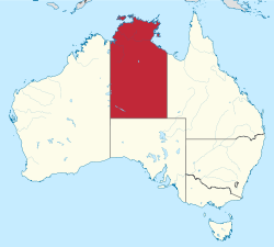
The Northern Territory is an Australian territory in the central and central northern regions of Australia. The Northern Territory shares its borders with Western Australia to the west, South Australia to the south, and Queensland to the east. To the north, the territory looks out to the Timor Sea, the Arafura Sea and the Gulf of Carpentaria, including Western New Guinea and other islands of the Indonesian archipelago.

<span class="mw-page-title-main">Gold rush</span> Gold discovery triggering an onrush of miners seeking fortune

A gold rush or gold fever is a discovery of gold—sometimes accompanied by other precious metals and rare-earth minerals—that brings an onrush of miners seeking their fortune. Major gold rushes took place in the 19th century in Australia, Greece, New Zealand, Brazil, Chile, South Africa, the United States, and Canada while smaller gold rushes took place elsewhere.

<span class="mw-page-title-main">Adelaide–Darwin railway line</span> Adelaide–Darwin railway and associated lines

The Adelaide–Darwin rail corridor consists of the 2975-kilometre (1849-mile) long 1435 mm standard-gauge main line between the South Australian capital city of Adelaide and the Northern Territory capital of Darwin, and the lines immediately connected to it. Preceded by a number of other shorter railways, a transcontinental line through to Darwin was only fully realised in 2004, when the final link from Alice Springs was opened. The line is used by interstate freight trains operated by Aurizon and by The Ghan passenger train operated by Journey Beyond.

<span class="mw-page-title-main">Tennant Creek</span> Town in the Northern Territory, Australia

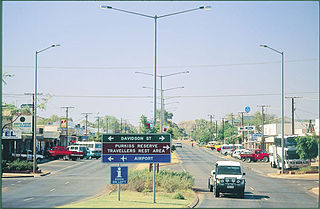
Tennant Creek is a town located in the Northern Territory of Australia. It is the seventh largest town in the Northern Territory, and is located on the Stuart Highway, just south of the intersection with the western terminus of the Barkly Highway. At the 2021 census, Tennant Creek had a population of 3,080 people, of which 55% (1,707) identified themselves as Indigenous.

<span class="mw-page-title-main">Ranger Uranium Mine</span> Uranium mine in the Northern Territory of Australia

The Ranger Uranium Mine was a uranium mine in the Northern Territory of Australia. The site is surrounded by, but separate from Kakadu National Park, 230 km east of Darwin. The orebody was discovered in late 1969, and the mine commenced operation in 1980, reaching full production of uranium oxide in 1981 and ceased stockpile processing on 8 January 2021. Mining activities had ceased in 2012. It is owned and operated by Energy Resources of Australia (ERA), a public company 86.33% owned by Rio Tinto Group, the remainder held by the public. Uranium mined at Ranger was sold for use in nuclear power stations in Japan, South Korea, China, UK, France, Germany, Spain, Sweden and the United States.

<span class="mw-page-title-main">Pine Creek, Northern Territory</span> Town in the Northern Territory, Australia

Pine Creek is a small town in the Katherine region of the Northern Territory, Australia and is situated just off the Stuart Highway; it is 90kms north of Katherine. As at the 2021 Census there were 318 residents of Pine Creek, which is the fourth largest town between Darwin and Alice Springs.

<span class="mw-page-title-main">Rum Jungle, Northern Territory</span> Town in the Northern Territory, Australia

Rum Jungle or Unrungkoolpum is a locality in the Northern Territory of Australia located about 105 kilometres south of Darwin on the East Branch of the Finniss River and it shares a boundary with Litchfield National Park. It is 10 kilometres west of Batchelor.

<span class="mw-page-title-main">Kon Vatskalis</span> Australian politician

Konstantine Vatskalis is a Greek-Australian politician and the current Lord Mayor of Darwin. Before becoming Lord Mayor in 2017 he was a Labor Party member of the Northern Territory Legislative Assembly from September 2001 to October 2014, representing the Darwin-based electorate of Casuarina. He was Minister for Business and Economic Development, Minister for Regional Development, Minister for Defence Support, Minister for Sport and Recreation, Minister for Essential Services, Minister for Health, Minister for Mines and Energy, Minister for Primary Industries and Fisheries and Minister for Children and Families.

<span class="mw-page-title-main">Mining in Australia</span> Primary sector industry

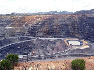
Mining in Australia has long been a significant primary sector industry and contributor to the Australian economy by providing export income, royalty payments and employment. Historically, mining booms have also encouraged population growth via immigration to Australia, particularly the gold rushes of the 1850s. Many different ores, gems and minerals have been mined in the past and a wide variety are still mined throughout the country.

Southport is an outer rural locality in Darwin. It is based on the site of the abandoned Town of Southport, a thriving river port during the Pine Creek gold rush of the 1870s. It is located at the junction of the Blackmore and Darwin Rivers.

<span class="mw-page-title-main">Mining in Afghanistan</span>

Mining in Afghanistan was controlled by the Ministry of Mines and Petroleum, prior to the August 15th takeover by the Taliban. It is headquartered in Kabul with regional offices in other parts of the country. Afghanistan has over 1,400 mineral fields, containing barite, chromite, coal, copper, gold, iron ore, lead, natural gas, petroleum, precious and semi-precious stones, salt, sulfur, lithium, talc, and zinc, among many other minerals. Gemstones include high-quality emeralds, lapis lazuli, red garnet and ruby. According to a joint study by The Pentagon and the United States Geological Survey, Afghanistan has an estimated US$1 trillion of untapped minerals.

In 2006, Cambodia's mineral resources remained, to a large extent, unexplored. Between 2003 and 2006, however, foreign investors from Australia, China, South Korea, Thailand, and the United States began to express their interest in Cambodia's potential for offshore oil and gas as well as such land-based metallic minerals as bauxite, copper, gold, and iron ore, and such industrial minerals as gemstones and limestone.

<span class="mw-page-title-main">Uranium mining in Australia</span> Mining in Australia

Radioactive ores were first extracted in South Australia at Radium Hill in 1906 and Mount Painter in 1911. 2,000 tons of ore were treated to recover radium for medical use. Several hundred kilograms of uranium were also produced for use in ceramic glazes.

Grove Hill is a ghost town in the Northern Territory of Australia. Once a centre for mining operations, today only a hotel with a few outbuildings survive. Grove Hill is located within the Victoria Daly Region and for administrative purposes is considered to be part of the locality of Burrundie. Both the defunct North Australia Railway and the modern Adelaide–Darwin railway pass through Grove Hill.

Beetaloo is the name of a pastoral lease that operates as a cattle station in the Northern Territory, known as Beetaloo Station. It is also the name of an area in the Sturt Plateau, known as the Beetaloo Sub-Basin or Beetaloo Basin, around 500 kilometres (310 mi) south-east of Darwin, between Mataranka to the north and Elliott to the south. This area is rich in natural gas, which can be exploited by fracking, which has caused controversy.

<span class="mw-page-title-main">Arltunga Historical Reserve</span> Protected area in the Northern Territory, Australia

Arltunga Historical Reserve, known also as Arnerre-ntyenge is a deserted gold rush town located in the Northern Territory of Australia in the locality of Hart about 110 kilometres (68 mi) east of Alice Springs. It is on the lands of the Eastern Arrernte people who are the Traditional Owners.

<span class="mw-page-title-main">Amadeus Gas Pipeline</span> Australian natural gas pipeline

The Amadeus Gas Pipeline is a bi-directional natural gas pipeline running north–south through the Northern Territory of Australia. Its southern extent is the Amadeus Basin gas fields west of Alice Springs. The Amadeus pipeline is owned and operated by APA Group, and regulated by the Australian Energy Regulator.

Mereenie is a locality in the Northern Territory of Australia. It is about 250 km west of Alice Springs and northeast of Uluru. It is on the "Inner Mereenie Loop" road which was completed as a sealed road in 2016 providing access for caravans and two-wheel-drive vehicles.

The COVID-19 pandemic in the Northern Territory is part of the ongoing worldwide pandemic of the coronavirus disease 2019 caused by severe acute respiratory syndrome coronavirus 2.

References

  1. 1 2 3 4 5 6 "Annual Report 2014-2015" (PDF). Darwin. December 2015. Archived from the original (PDF) on 17 August 2016. Retrieved 23 June 2016.
  2. "Aboriginal Art Online, Traditional painting methods". Aboriginalartonline.com. Retrieved 2016-06-23.
  3. 1 2 3 4 Ling, Ted (2011-01-01). "Commonwealth Government records about the Northern Territory (Research Guide)" (PDF). National Archives of Australia. Retrieved 2024-05-22.
  4. "The 'Celestials' in South Australia | State Library of South Australia". www.slsa.sa.gov.au. Retrieved 2024-05-22.
  5. "Chinese Australian families and the legacies of colonial naturalisation". The Tiger’s Mouth. 2018-07-08. Retrieved 2024-05-22.
  6. 1 2 3 Department of Mines and Energy, Energy Directorate (January 2016). "energyNT 2015" (PDF). Department of Mines and Energy. Darwin: Northern Territory Government. Retrieved 23 June 2016.
  7. Geoscience, Australia. "Australian Mines Atlas". Australian Mines Atlas. Canberra, Australia: Geoscience Australia. Retrieved 6 November 2023.
  8. Hofstra, A.; Lisitsin, V.; Corriveau, L.; Paradis, S.; Peter, J.; Lauzière, K.; Lawley, C.; Gadd, M.; Pilote, J.; Honsberger, I.; Bastrakov, E.; Champion, D.; Czarnota, K.; Doublier, M.; Huston, D.; Raymond, O; van der Wielen, S.E.; Emsbo, P.; Granitto, M.; Kreiner, D. (2021). "Deposit classification scheme for the Critical Minerals Mapping Initiative Global Geochemical Database". U.S. Geological Survey Open-File Report. Open-File Report. 2021–1049: 1-60. doi: 10.3133/ofr20211049 . Retrieved 6 November 2023.