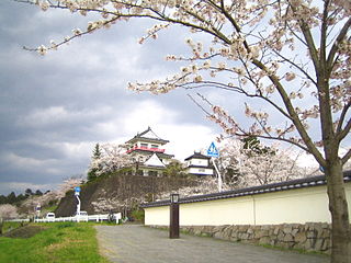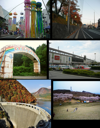
Ishinomaki is a city located in Miyagi Prefecture, Japan. As of 2 February 2022, the city has an estimated population of 138,538, and a population density of 250 persons per km2 in 61,919 households. The total area of the city is 554.55 square kilometres (214.11 sq mi).

Mogami is a town in Yamagata Prefecture, Japan. As of 29 February 2020, the town has an estimated population of 8,441 in 2,848 households, and a population density of 26 persons per km2. The total area of the town is 330.27 square kilometres (128 sq mi).

Matsushima is a town in Miyagi Prefecture, Japan. As of 1 June 2019, the town had an estimated population of 13,804 in 5663 households, and a population density of 260 persons per km². The total area of the town is 53.56 square kilometres (20.68 sq mi). It is most famous as the location of Matsushima Bay, one of the Three Views of Japan, and is also the site of the Zuigan-ji, Entsū-in and Kanrantei.

Rifu is a town located in Miyagi Prefecture, Japan. As of 1 June 2020, the town had an estimated population of 36,014, and a population density of 800 persons per km2 in 13,568 households. The total area of the town is 44.89 square kilometres (17.33 sq mi). Rifu is known for its nashi pears. Recently, wine and candy made from nashi pears have been developed in the town.

Taiwa is a town located in Miyagi Prefecture, Japan. As of 31 May 2020, the town had an estimated population of 28,436, and a population density of 130 persons per km2 in 12,016 households. The total area of the town is 225.49 square kilometres (87.06 sq mi).

Ōsato is a town located in Miyagi Prefecture, Japan. As of 31 May 2020, the town had an estimated population of 7,972, and a population density of 97 persons per km² in 2813 households. The total area of the town is 82.01 square kilometres (31.66 sq mi).

Shikama is a town located in Miyagi Prefecture, Japan. As of 31 May 2020, the town had an estimated population of 6,723, and a population density of 62 persons per km2 in 20961 households. The total area of the town is 109.28 square kilometres (42.19 sq mi).

Wakuya is a town located in Miyagi Prefecture, Japan. As of 30 April 2020, the town had an estimated population of 15,763 in 6028 households, and a population density of 190 persons per km2. The total area of the town is 82.16 square kilometres (31.72 sq mi). The area is noted for its rice production.
Kogota was a town located in Tōda District, Miyagi Prefecture, Japan.
Tōda is a district located in Miyagi Prefecture, Japan.

Tome is a city located in Miyagi Prefecture, Japan. As of 30 April 2020, the city had an estimated population of 77,897 and a population density of 150 persons per km2 in 27,298 households. The total area of the city is 536.12 square kilometres (207.00 sq mi). The area is noted for its rice production.

The Kesennuma Line is a local railway line in Japan, operated by the East Japan Railway Company. It connected Maeyachi Station in the city of Ishinomaki, Miyagi to Kesennuma Station in the city of Kesennuma, Miyagi. The route links the north-eastern coast of Miyagi Prefecture, with the Ishinomaki Line available for transfer in the south, and the Ōfunato Line in the north.

The Ishinomaki Line is a railway line in Miyagi Prefecture, Japan, operated by East Japan Railway Company. It connects Kogota Station in Misato with Onagawa Station in Onagawa, acting as a spur line from the Tōhoku Main Line to the central coast of Miyagi Prefecture. It connects with the Rikuu East Line and Tōhoku Main Line at Kogota Station, the Kesennuma Line at Maeyachi Station, and the Senseki Line at Ishinomaki Station, both in Ishinomaki, Miyagi. The line was damaged by the 2011 Tōhoku earthquake and tsunami, and the damage was so severe that service between Urashuku Station and Onagawa Station was not reinstated until 21 March 2015.

Higashi-Matsushima is a city located in Miyagi Prefecture, Japan. As of 1 June 2020, the city had an estimated population of 39,580 in 16102 households, and a population density of 390 persons per km2. The total area of the city is 101.36 square kilometres (39.14 sq mi).

Wakuya Station is a railway station in the town of Wakuya, Miyagi Prefecture, Japan, operated by East Japan Railway Company.

Kami-Wakuya Station is a railway station in the town of Wakuya, Miyagi Prefecture, Japan, operated by East Japan Railway Company.

Kogota Station is a junction railway station in the town of Misato, Miyagi, Japan, operated by East Japan Railway Company.

Kitaura Station is a railway station in the town of Misato, Miyagi Prefecture, Japan, operated by East Japan Railway Company.

Ōsaki is a city located in Miyagi Prefecture, Japan. As of 1 May 2020, the city had an estimated population of 128,763 in 51,567 households, and a population density of 160 persons per km2. The total area of the city is 796.76 square kilometres (307.63 sq mi). Ōsaki is a member of the World Health Organization’s Alliance for Healthy Cities (AFHC).


