
The Allegheny National Forest is a National Forest in northwestern Pennsylvania, about 100 miles northeast of Pittsburgh. The forest covers 513,175 acres of land. Within the forest is Kinzua Dam, which impounds the Allegheny River to form Allegheny Reservoir. The administrative headquarters for the Allegheny National Forest is in Warren. The Allegheny National Forest has two ranger stations, one in Marienville, Forest County, and the other in Bradford, McKean County.

Rothrock State Forest is a Pennsylvania state forest in Pennsylvania Bureau of Forestry District #5. The main offices are located in Huntingdon in Huntingdon County, Pennsylvania in the United States.

Moshannon State Forest is a Pennsylvania State Forest in Pennsylvania Bureau of Forestry District #9. The main offices are located in the unincorporated village of Penfield in Huston Township, Clearfield County, Pennsylvania in the United States.

Clear Creek State Forest is a Pennsylvania State Forest in Pennsylvania Bureau of Forestry District #8. The main offices are located in Clarion in Clarion County, Pennsylvania in the United States. Until August 2007, it was named Kittanning State Forest.

Tiadaghton State Forest is a Pennsylvania State Forest in the Pennsylvania Department of Conservation and Natural Resources, Bureau of Forestry. The forest is primarily in western and southern Lycoming County, with small portions in Clinton, Potter, Tioga, and Union Counties. The district's topography consists of narrow, flat to sloping plateaus cut by deep, steep-sloped valleys carved by fast moving mountain streams, including Pine Creek, Slate Run, and their tributaries. The Tiadaghton district extends south across the lowland along the west branch of the Susquehanna River to the narrow crests of Bald Eagle Mountain and North and South White Deer Ridge. The majority of forest cover is dominated by mixed oak forests, with some areas of northern hardwoods. The Tiadaghton State Forest is one of eight forest districts in the Pennsylvania Wilds region.

The Appalachian mixed mesophytic forests is an ecoregion of the temperate broadleaf and mixed forests biome, as defined by the World Wildlife Fund. It consists of mesophytic plants west of the Appalachian Mountains in the Southeastern United States.
Joseph E. Ibberson Conservation Area is a 783-acre (317 ha) Pennsylvania state park in Middle Paxton and Wayne Townships, Dauphin County, Pennsylvania in the United States.

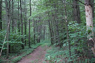
Upper Pine Bottom State Park is a 5-acre (2.0 ha) Pennsylvania state park in Lycoming County, Pennsylvania in the United States. The park is in Cummings Township on Pennsylvania Route 44 and is surrounded by the Tiadaghton State Forest. It is on Upper Pine Bottom Run, which gave the park its name and is a tributary of Pine Creek. Upper Pine Bottom State Park is in the Pine Creek Gorge, where the streams have cut through five major rock formations from the Devonian and Carboniferous periods.

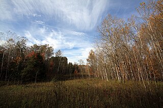
Simon B. Elliott State Park is a 318-acre (129 ha) Pennsylvania state park located in Pine Township, Clearfield County, Pennsylvania in the United States. The park is surrounded by Moshannon State Forest. The park is entirely wooded with second growth forests of mixed oak species, including northern red oak, chestnut oak, shagbark hickory, red maple, and tulip poplar, and northern hard woods, including sugar maple, black cherry, aspen, birch, hemlock, and ash. S. B. Elliott State park is 9 miles (14 km) north of Clearfield on Pennsylvania Route 153 just off exit 111 of Interstate 80.
Happy Valley Forest is a 6.48 square kilometre provincially significant ecological area, classified as an Area of Natural and Scientific Interest by the Ontario Ministry of Natural Resources. It consists of an upland forest on steeply rolling topography, various wooded swamps, and minor wetland areas. A few small kettle ponds are also present.
The Ohio Department of Natural Resources (ODNR) is the Ohio state government agency charged with ensuring "a balance between wise use and protection of our natural resources for the benefit of all." ODNR regulates the oil and gas industry, the mining industry, hunting and fishing, and dams, while maintaining natural resources such as state parks, state nature preserves, state wildlife areas, state forests, and state waterways. It was created in 1949 by the Ohio Legislature.

Native trees in Toronto are trees that are naturally growing in Toronto and were not later introduced by humans. The area that presently comprise Toronto is a part of the Carolinian forest, although agricultural and urban developments destroyed significant portions of that life zone. In addition, many of Toronto's native trees have been displaced by non-native plants and trees introduced by settlers from Europe and Asia from the 18th century to the present. Most of the native trees are found in the Toronto ravine system, parks, and along the Toronto waterway system.
Garrett State Forest is a state forest located in the state of Maryland northwest of Oakland.
Harrison State Forest is a state forest in Harrison County, Ohio, United States.

Mohican State Park is a 1,110-acre (450 ha) public recreation area located on the south shore of Pleasant Hill Lake, five miles (8.0 km) south of Loudonville in Ashland County, Ohio, United States. The state park is located along Ohio SR 3 and Ohio SR 97 and is surrounded by the 4,525-acre (1,831 ha) Mohican-Memorial State Forest. The Clear Fork of the Mohican River flows through the park carving a narrow gorge and joins the Black Fork about a half-mile east of the park to form the Mohican River. The park is open for year-round recreation including camping, hiking, boating, mountain biking, fishing, and picnicking.

The Western Allegheny Plateau is an ecoregion of the Temperate broadleaf and mixed forests Biome, located on the western Allegheny Plateau and in the Appalachia region of the Eastern United States.

Brush Mountain East Wilderness is a U.S. wilderness area in the Eastern Divide Ranger District of the George Washington and Jefferson National Forests. It was designated as wilderness area in 2009 by Omnibus Public Land Management Act of 2009.
Native trees in Ottawa are trees that are naturally growing in Ottawa, Ontario and were not later introduced by humans. Many of Ottawa's native trees have been displaced by non-native plants and trees introduced by settlers from Europe and Asia from the 18th century to the present. Most of the native trees are found in the Greenbelt, parks, and along the Rideau and Ottawa rivers.

