Mohorgon Tea Garden

Last updated

Mohurgong & Gulma Tea Estates
Village
West Bengal location map.svg
Red pog.svg
Mohurgong & Gulma Tea Estates
Location in West Bengal, India
India location map.svg
Red pog.svg
Mohurgong & Gulma Tea Estates
Mohurgong & Gulma Tea Estates (India)
Coordinates: 26°47′40″N88°23′08″E / 26.794567°N 88.38553°E / 26.794567; 88.38553
CountryFlag of India.svg  India
State West Bengal
District Darjeeling
Population
 (2023)
  Total10,000
Languages
  Official Nepali, Adivasi, English, Bengali
Time zone UTC+5:30 (IST)
PIN
734009
Telephone/STD code0353
Vehicle registration WB
Lok Sabha constituency Darjeeling
Vidhan Sabha constituency Matigara-Naxalbari
Website darjeeling.gov.in

Mohurgong & Gulma Tea Estates is a tea garden in the Matigara CD block in the Siliguri subdivision of Darjeeling district in the state of West Bengal, India.

Contents

Geography

Mohorgon Tea Garden
This is a stopgap mapping solution, while attempts are made to resolve technical difficulties with {{ OSM Location map }}
Places in the North-eastern portion of Siliguri subdivision in Darjeeling district
CT: census town, R: rural/ urban centre, MC: municipal corporation, F: facilities
Abbreviations used in names – TG for Tea Garden, Jn RS for Junction Railway Station
New Jalpaiguri Junction railway station is in Jalpaiguri district
Owing to space constraints in the small map, the actual locations in a larger map may vary slightly

Location

Mohorgon Tea Garden is located at 26°47′40″N88°23′08″E / 26.794567°N 88.385543°E / 26.794567; 88.385543 .

Area overview

The map alongside shows the Siliguri subdivision of Darjeeling district. This area is spread across the foothills of the Himalayas and is a plain land gently sloping from north to south. While the northern part is mentioned as the Terai region, the larger southern portion forms the western part of the Dooars region. While 55.11% per cent of the population resides in the rural areas, 44.89% resides in the urban areas. On the western side the Mechi River forms a long border with Nepal. On the eastern side the Mahananda River forms a short border with Bangladesh. [1] [2]

Note: The map alongside presents some of the notable locations in the subdivision. All places marked in the map are linked in the larger full screen map.

Demographics

According to the 2011 Census of India, Mohorgon Tea Garden had a total population of 3,169 of which 1,503 (47%) were males and 1,666 (53%) were females. There were 422 persons in the age range of 0 to 6 years. The total number of literate people in Mohorgon Tea Garden was 1,704 (53.77% of the population over 6 years). [3]

Mohurgong and Gulma Tea Estates

Mohurgong Tea Estate was established by the pioneer Indian planter Bipradas Palchoudhry in 1886. The place is located between Mahananda Wildlife Sanctuary and Siliguri. In 1930 Bipradas's son, Amiya Palchoudhury, purchased the adjoining Gulma Tea Estate from a British company and the two together were developed as a leading tea garden in the terai region. Presently, the fourth generation of the Palchoudhury family operates the tea estate. Large groups of people from the Eastern Himalayan and Chotanagpur regions thronged to work in the tea estate. Their descendants continue to work in the tea garden. [4]

Education

Ila Palchoudhury Memorial High School is a Hndi-medium coeducational institution established in 1981. It has facilities for teaching from class V to class XII. [5]

Transport

There is a station at Gulma, 10 km from New Jalpaiguri Junction railway station, on the New Jalpaiguri-Alipurduar-Samuktala line. [6]

Related Research Articles

Naxalbari is a village in the Naxalbari CD block in the Siliguri subdivision of the Darjeeling district in the state of West Bengal, India. Naxalbari is known for being the site of a 1967 revolt that would eventually lead to the Naxalite–Maoist insurgency.

<span class="mw-page-title-main">Malbazar</span> Town in West Bengal, India

Malbazar, also known as Mal, is a town and a municipality in Jalpaiguri district in the state of West Bengal, India. It is the headquarters of the Malbazar subdivision. It lies about 65 km from Jalpaiguri and 55 km from Siliguri. It lies on the bank of river Neora.

Dabgram is a census town in the Rajganj CD block in the Jalpaiguri Sadar subdivision of the Jalpaiguri district in the state of West Bengal, India.

Chalsa is a census town in the Matiali CD block in the Malbazar subdivision of the Jalpaiguri district in West Bengal, India.

<span class="mw-page-title-main">Tindharia</span> Village in West Bengal, India

Tindharia or Tindharay is a village in the Kurseong CD block in the Kurseong subdivision of the Darjeeling district in the state of West Bengal, India.

<span class="mw-page-title-main">Lataguri</span> Census Town in West Bengal, India

Lataguri is a census town in the Mal CD block in the Malbazar subdivision of the Jalpaiguri district in the Indian state of West Bengal.

Mongpong is a village in the Kalimpong I CD block in the Kalimpong subdivision of the Kalimpong district of West Bengal, India.

<span class="mw-page-title-main">Sevoke</span> Town near Siliguri, West Bengal, India

Sevoke is a small town near Siliguri in the Darjeeling district of West Bengal state of India near the border with Sikkim state. Situated in Dooars, Sevoke lies on the bank of River Teesta and has two bridges − namely Coronation Bridge and Sevoke Railway Bridge over it. Indian Army and Border Security Force camps are located in the area. The Mahananda Wildlife Sanctuary is situated in this area. National Highway NH10 passes through the town and connects Sevoke town to Gangtok and Siliguri. National Highway 17 originates from Sevoke near Coronation Bridge and terminates in Guwahati.

<span class="mw-page-title-main">Phansidewa</span> Community development block in West Bengal, India

Phansidewa is a community development block that forms an administrative division in the Siliguri subdivision of the Darjeeling district in the Indian state of West Bengal.

<span class="mw-page-title-main">Matigara (community development block)</span> Community development block in West Bengal, India

Matigara is a community development block that forms an administrative division in the Siliguri subdivision of the Darjeeling district in the Indian state of West Bengal.

<span class="mw-page-title-main">Kurseong (community development block)</span> Community development block in West Bengal, India

Kurseong is a community development block that forms an administrative division in the Kurseong subdivision of the Darjeeling district in the Indian state of West Bengal.

<span class="mw-page-title-main">Naxalbari (community development block)</span> Community development block in West Bengal, India

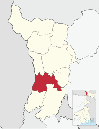
Naxalbari is a community development block that forms an administrative division in the Siliguri subdivision of the Darjeeling district in the Indian state of West Bengal.

Kharibari is a census town in the Kharibari CD block in the Siliguri subdivision of the Darjeeling district in the state of West Bengal, India.

Matigarahat is a village in the Matigara CD block in the Siliguri subdivision of the Darjeeling district in the state of West Bengal, India.

<span class="mw-page-title-main">Sukna, Darjeeling</span> Village in West Bengal, India

Sukna is a village and a gram panchayat in the Kurseong CD block in the Kurseong subdivision of the Darjeeling district in the state of West Bengal, India.

<span class="mw-page-title-main">Batasi</span> Village in West Bengal, India

Batashi is a village in Kharibari CD block in Siliguri subdivision of Darjeeling district of West Bengal, India.

Sittong (Valley) is a village in the Kurseong CD block in the Kurseong subdivision of the Darjeeling district in the state of West Bengal, India.

Kalkut is a census town in the Matigara CD block in the Siliguri subdivision of Darjeeling district in the state of West Bengal, India.

Bengdubi is a military station in the Naxalbari CD block in the Siliguri subdivision of Darjeeling district in the state of West Bengal, India.

Bhimram is a census town in the Naxalbari CD block in the Siliguri subdivision of Darjeeling district in the state of West Bengal, India.

References

  1. "District Census Handbook, Darjeeling, Series 20, Part XII A, 2011 Census of India" (PDF). Page 13: Physiography. Directorate of Census Operations, West Bengal. Retrieved 29 March 2020.
  2. "District Census Handbook, Darjeeling, Series 20, Part XII A, 2011 Census of India" (PDF). Pages 15-17: Drainage. Directorate of Census Operations, West Bengal. Retrieved 29 March 2020.
  3. "2011 Census – Primary Census Abstract Data Tables". West Bengal – District-wise. Registrar General and Census Commissioner, India. Retrieved 25 March 2020.
  4. "We make tea". Gulma Tea. Retrieved 25 March 2020.
  5. "Ila Pal Choudhury Mem HHS High School". ICBSE. Retrieved 25 March 2020.
  6. "55725 New Jalpaiguri-Alipurduar Passenger" . Retrieved 25 March 2020.