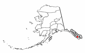
Naukati Bay is a census-designated place (CDP) in the Prince of Wales-Hyder Census Area of the Unorganized Borough of the U.S. state of Alaska. The population was 113 at the 2010 census, down from 135 in 2000.

Earlimart is a census-designated place (CDP) in Tulare County, California, United States. As of the 2010 census, the CDP population was 8,537, up from 6,583 at the 2000 census.
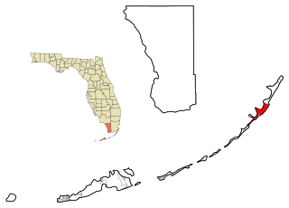
Key Largo is a census-designated place in Monroe County, Florida, United States, located on the island of Key Largo in the upper Florida Keys. The population was 10,433 at the 2010 census. The name comes from the Spanish Cayo Largo, or "long key". It is both the first island and town of the Florida Keys to be reached from the Overseas Highway to Key West. It was also the location of one of the stations of the Overseas Railroad.
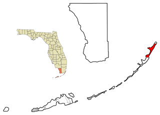
North Key Largo is a census-designated place (CDP) in Monroe County, Florida, United States. The population was 1,244 at the 2010 census. It includes two private clubs, the Ocean Reef Club and the Key Largo Anglers Club and is reached from the mainland via the Card Sound Bridge.

Swartz is a census-designated place (CDP) in Ouachita Parish in northeastern Louisiana, United States. The population was 4,536 in the 2010 census, an increase of 289 or 6.8 percent over the 2000 population. It is part of the Monroe Metropolitan Statistical Area.

Heilwood is a census-designated place (CDP) in Indiana County, Pennsylvania, United States. The population was 711 at the 2010 census.

Oakland is a census-designated place (CDP) in Sumter County, South Carolina, United States. The population was 1,272 at the 2000 census. It is included in the Sumter, South Carolina Metropolitan Statistical Area. Part of the area of the census-designated place is located within the Stateburg Historic District

Central Gardens is an unincorporated community and census-designated place (CDP) in Jefferson County, Texas, United States. The population was 4,347 at the 2010 census. It is part of the Beaumont–Port Arthur metropolitan area.

Guerra is a census-designated place (CDP) in Jim Hogg County, Texas, United States. The population was six at the 2010 census, giving it the distinction of smallest town by population in Texas.

Baring is an unincorporated community and census-designated place (CDP) in King County, Washington, United States. The population was 220 at the 2010 census. It is located on U.S. Highway 2 about 23 miles (37 km) west of Stevens Pass, along a very flat and straight three-mile section of highway that has been dubbed the "Baring Straight", since US-2 is otherwise hilly and curvy through the mountains.

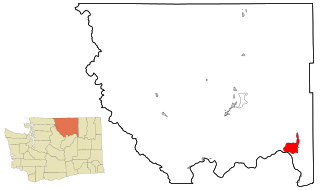
Lake Marcel-Stillwater is a census-designated place (CDP) in King County, Washington, United States. The population was 1,277 at the 2010 census.

Riverbend is an unincorporated community and census-designated place (CDP) in King County, Washington, United States. The population was 2,132 at the 2010 census.
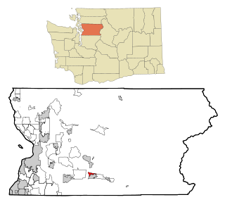
Tanner is an unincorporated community and census-designated place (CDP) in east King County, Washington, United States. As of the 2010 census, it had a population of 1,018.
Nespelem Community is a census-designated place (CDP) in Okanogan County, Washington, United States. The population was 253 at the 2010 census.

Greenwater is a census-designated place (CDP) in Pierce County, Washington, United States. The population was 67 at the 2010 census.
Lake Roesiger is a census-designated place (CDP) in Snohomish County, Washington, United States. The population was 503 at the 2010 census.

May Creek is a census-designated place (CDP) in Snohomish County, Washington, United States. The population was 818 at the 2010 census.
North Sultan is a census-designated place (CDP) in Snohomish County, Washington, United States. The population was 264 at the 2010 census.

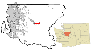
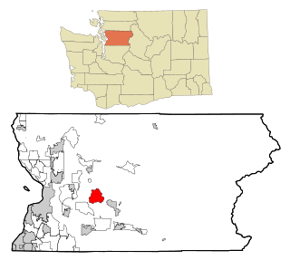
Wilderness Rim is a census-designated place (CDP) in King County, Washington, United States. It lies at an elevation of 1,043 feet (318 m). The population was 1,523 at the 2010 census.
Chain Lake is a census-designated place (CDP) in Snohomish County, Washington, United States. The population was 3,741 at the 2010 census.

