Lake Roesiger, Washington

Last updated

Lake Roesiger, Washington
CDP
Snohomish County Washington Incorporated and Unincorporated areas Lake Roesiger Highlighted.svg
Location of Lake Roesiger, Washington
Coordinates: 47°58′52″N121°55′11″W / 47.98111°N 121.91972°W / 47.98111; -121.91972
CountryUnited States
State Washington
County Snohomish
Area
  Total10.1 sq mi (26.2 km2)
  Land9.6 sq mi (24.8 km2)
  Water0.5 sq mi (1.4 km2)
Elevation
801 ft (244 m)
Population
 (2020)
  Total611
  Density60/sq mi (23/km2)
Time zone UTC-8 (Pacific (PST))
  Summer (DST) UTC-7 (PDT)
ZIP code
98290 [1]
Area code 360
FIPS code 53-37672 [2]
GNIS feature ID1852946 [3]

Lake Roesiger is a census-designated place (CDP) in Snohomish County, Washington, United States. The population was 611 at the 2020 census, [4] up from 503 at the 2010 census.

Contents

Based on per capita income, one of the more reliable measures of affluence, Lake Roesiger ranks 98th of 522 areas in the state of Washington to be ranked.

Geography

Lake Roesiger is located at 47°58′52″N121°55′11″W / 47.98111°N 121.91972°W / 47.98111; -121.91972 (47.981018, -121.919839). [5]

According to the United States Census Bureau, the CDP has a total area of 10.1 square miles (26 km2), of which, 9.6 square miles (25 km2) of it is land and 0.5 square miles (1.3 km2) of it (5.25%) is water.

Demographics

As of the census [2] of 2000, there were 652 people, 239 households, and 182 families residing in the CDP. The population density was 68.1 people per square mile (26.3 people/km2). There were 433 housing units at an average density of 45.2 units per square mile (17.5 units/km2). The racial makeup of the CDP was 95.55% White, 0.46% African American, 0.92% Native American, 0.61% Asian, 0.46% from other races, and 1.99% from two or more races. Hispanic or Latino of any race were 1.53% of the population.

There were 239 households, out of which 34.3% had children under the age of 18 living with them, 67.4% were married couples living together, 4.2% had a female householder with no husband present, and 23.8% were non-families. 15.5% of all households were made up of individuals, and 2.9% had someone living alone who was 65 years of age or older. The average household size was 2.73 and the average family size was 3.04.

In the CDP, the age distribution of the population shows 24.7% under the age of 18, 9.7% from 18 to 24, 29.6% from 25 to 44, 27.5% from 45 to 64, and 8.6% who were 65 years of age or older. The median age was 39 years. For every 100 females, there were 113.8 males. For every 100 females age 18 and over, there were 115.4 males.

The median income for a household in the CDP was $70,500, and the median income for a family was $72,375. Males had a median income of $45,313 versus $36,200 for females. The per capita income for the CDP was $24,390. None of the families and 2.4% of the population were living below the poverty line, including no under eighteens and 5.1% of those over 64.

Related Research Articles

<span class="mw-page-title-main">Oroville East, California</span> Census-designated place in California, United States

Oroville East or Kelly Ridge is a census-designated place (CDP) in Butte County, California, United States. The population was 8,280 at the 2010 census, down from 8,680 at the 2000 census. Most citizens are dependent on the commerce of Oroville, and the vast majority of high school students in Kelly Ridge attend Las Plumas High School. The community of Kelly Ridge sits at Lake Oroville and offers direct access to boating, camping, fishing and a variety of water sports.

<span class="mw-page-title-main">Lake of the Pines, California</span> Census-designated place in California, United States

Lake of the Pines is a census-designated place (CDP) and a gated residential community in Nevada County, California, United States. The population was 3,917 at the 2010 census.
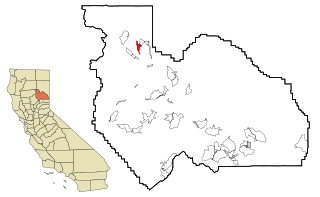
<span class="mw-page-title-main">Lake Almanor Country Club, California</span> Census-designated place in California, United States

Lake Almanor Country Club is a census-designated place (CDP) in Plumas County, California, United States. The population was 419 at the 2010 census, down from 847 at the 2000 census. The ZIP code for the CDP is 96137.

<span class="mw-page-title-main">Lake Almanor Peninsula, California</span> Census-designated place in California, United States

Lake Almanor Peninsula is a census-designated place (CDP) in Plumas County, California, United States. The population was 356 at the 2010 census, up from 336 at the 2000 census.

<span class="mw-page-title-main">ʻŌmaʻo, Hawaii</span> Census-designated place in Hawaii, United States

ʻŌmaʻo is a census-designated place (CDP) in Kauaʻi County, Hawaiʻi, United States. The population was 1,346 at the 2020 census.

<span class="mw-page-title-main">Waihee-Waiehu, Hawaii</span> Census-designated place in Hawaii, United States

Waihee-Waiehu is a census-designated place (CDP) in Maui County, Hawaii, United States. The population was 9,234 at the 2020 census.

<span class="mw-page-title-main">Montgomery Creek, California</span> Census-designated place in California, United States

Montgomery Creek is a census-designated place in Shasta County, California, United States. Its population is 176 as of the 2020 census, up from 163 from the 2010 census. The town and associated creek were named after Zachariah Montgomery.

<span class="mw-page-title-main">Acomita Lake, New Mexico</span> Census-designated place in New Mexico, United States

Acomita Lake is a census-designated place (CDP) in Cibola County, New Mexico, United States. The population was 339 at the 2020 census.

<span class="mw-page-title-main">Reid Hope King, Texas</span> Census-designated place in Texas, United States

Reid Hope King is a census-designated place (CDP) in Cameron County, Texas, United States. The population was 667 at the 2020 census. It is part of the Brownsville–Harlingen Metropolitan Statistical Area.

<span class="mw-page-title-main">Ames Lake, Washington</span> Census-designated place in Washington, United States

Ames Lake is an unincorporated community and census-designated place (CDP) in King County, Washington, United States. The population was 1,524 at the 2020 census, up from 1,486 at the 2010 census.

<span class="mw-page-title-main">Lake Marcel-Stillwater, Washington</span> Census-designated place in Washington, United States

Lake Marcel-Stillwater is a census-designated place (CDP) in King County, Washington, United States. The population was 1,334 at the 2020 census.

<span class="mw-page-title-main">Lake Morton-Berrydale, Washington</span> Census-designated place in Washington, United States

Lake Morton-Berrydale is a census-designated place (CDP) in King County, Washington, United States. The population was 10,474 at the 2020 census.

<span class="mw-page-title-main">Riverbend, Washington</span> Census-designated place in Washington, United States

Riverbend is an unincorporated community and census-designated place (CDP) in King County, Washington, United States. The population was 2,123 at the 2020 census.
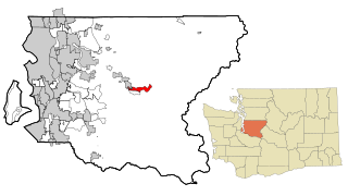
<span class="mw-page-title-main">Riverpoint, Washington</span> Census-designated place in Washington, United States

Riverpoint is an unincorporated community and census-designated place (CDP) in east King County, Washington, United States. As of the 2020 census, it had a population of 774. At the 2010 census, the area was listed as the Tanner CDP and had a population of 1,018 over a larger area.

<span class="mw-page-title-main">Easton, Washington</span> Census-designated place in Washington, United States

Easton is an unincorporated community and census-designated place (CDP) in Kittitas County, Washington, United States. The population was 478 at the 2010 census. Easton is the annual site of the start/finish line for the Cascade Crest 100-mile ultra-running race.

<span class="mw-page-title-main">Ronald, Washington</span> Census-designated place in Washington, United States

Ronald is an unincorporated community and census-designated place (CDP) in Kittitas County, Washington, United States. The population was 308 at the 2010 census.

<span class="mw-page-title-main">Canyon Creek, Washington</span> CDP in Washington, United States

Canyon Creek is a census-designated place (CDP) in Snohomish County, Washington, United States. The population was 3,445 at the 2020 census, up from 3,200 at the 2010 census. Prior to the 2010 census, the CDP was known as Jordan Road-Canyon Creek.

<span class="mw-page-title-main">Lake Bosworth, Washington</span> CDP in Washington, United States

Lake Bosworth is a census-designated place (CDP) in Snohomish County, Washington, United States. The population was 868 at the 2020 census, up from 667 at the 2010 census.
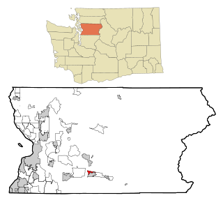
<span class="mw-page-title-main">North Sultan, Washington</span> CDP in Washington, United States

North Sultan is a census-designated place (CDP) in Snohomish County, Washington, United States. The population was 256 at the 2020 census.

<span class="mw-page-title-main">Lake Stickney, Washington</span> CDP in Washington, United States

Lake Stickney is a census-designated place (CDP) in Snohomish County, Washington, United States. The population was 15,413 at the 2020 census. The CDP was known as Paine Field-Lake Stickney prior to 2010. The new Lake Stickney CDP no longer contains the Paine Field airport.

References

  1. "Lake Roesiger WA ZIP Code". zipdatamaps.com. 2023. Retrieved June 16, 2023.
  2. 1 2 "U.S. Census website". United States Census Bureau . Retrieved January 31, 2008.
  3. "US Board on Geographic Names". United States Geological Survey. October 25, 2007. Retrieved January 31, 2008.
  4. "Census Bureau Profile: Lake Roesiger CDP, Washington". United States Census Bureau. Retrieved May 7, 2024.
  5. "US Gazetteer files: 2010, 2000, and 1990". United States Census Bureau. February 12, 2011. Retrieved April 23, 2011.