Snohomish County is a county located in the U.S. state of Washington. With a population of 827,957 as of the 2020 census, it is the third-most populous county in Washington, after nearby King and Pierce counties, and the 72nd-most populous in the United States. The county seat and largest city is Everett. The county forms part of the Seattle metropolitan area, which also includes King and Pierce counties to the south.

Pierce County is a county in the U.S. state of Washington. As of the 2020 census, the population was 921,130, up from 795,225 in 2010, making it the second-most populous county in Washington, behind King County, and the 59th-most populous in the United States. The county seat and largest city is Tacoma. Formed out of Thurston County on December 22, 1852, by the legislature of Oregon Territory, it was named for U.S. President Franklin Pierce. Pierce County is in the Seattle metropolitan area.

Woodinville is a city in King County, Washington, United States. The population was 13,069 at the 2020 census. It is a part of the Seattle metropolitan area. There is also a much larger population with Woodinville mailing addresses in adjacent unincorporated areas of King and Snohomish (Maltby) counties. Woodinville has waterfront parks on the Sammamish River, sweeping winery and brewery grounds, and densely wooded areas.
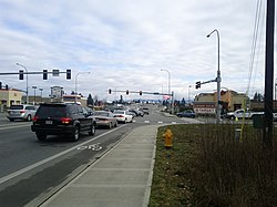
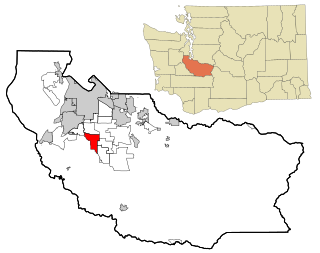
Lakewood is a city in Pierce County, Washington, United States. The population was 63,612 at the 2020 census.

Midland is a census-designated place (CDP) in Pierce County, Washington. The population was 9,962 at the time of the 2020 census.
Spanaway is a census-designated place (CDP) in Pierce County, Washington, United States. The population was 35,476 at the 2020 census, up from 27,227 in 2010. Spanaway is an unincorporated area near Tacoma, and is often identified together with the more urban, less wealthy Parkland.

Arlington is a city in northern Snohomish County, Washington, United States, part of the Seattle metropolitan area. The city lies on the Stillaguamish River in the western foothills of the Cascade Range, adjacent to the city of Marysville. It is approximately 10 miles (16 km) north of Everett, the county seat, and 40 miles (64 km) north of Seattle, the state's largest city. As of the 2020 U.S. census, Arlington had a population of 19,868; its estimated population is 20,075 as of 2021.

Edmonds is a city in Snohomish County, Washington, United States. It is located in the southwest corner of the county, facing Puget Sound and the Olympic Mountains to the west. The city is part of the Seattle metropolitan area and is located 15 miles (24 km) north of Seattle and 18 miles (29 km) southwest of Everett. With a population of 42,853 residents in the 2020 U.S. census, Edmonds is the third most populous city in the county.
Index is a town in Snohomish County, Washington, United States. The population was 155 at the 2020 census.

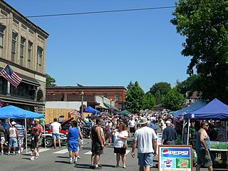
Marysville is a city in Snohomish County, Washington, United States, part of the Seattle metropolitan area. The city is located 35 miles (56 km) north of Seattle, adjacent to Everett on the north side of the Snohomish River delta. It is the second-largest city in Snohomish County after Everett, with a population of 70,714 at the time of the 2020 U.S. census. As of 2015, Marysville was also the fastest-growing city in Washington state, growing at an annual rate of 2.5 percent.

Mukilteo is a city in Snohomish County, Washington, United States. It is located on Puget Sound between Edmonds and Everett, approximately 25 miles (40 km) north of Seattle. The city had a population of 20,254 at the 2010 census and an estimated 2019 population of 21,441.

Smokey Point is a community and former census-designated place in northern Snohomish County, Washington. The area, developed as a suburban bedroom community in the late 20th century, was annexed into the nearby cities of Arlington and Marysville in the 1990s and 2000s.
Snohomish is a city in Snohomish County, Washington, United States. The population was 10,126 at the 2020 census. It is located on the Snohomish River, southeast of Everett and northwest of Monroe. Snohomish lies at the intersection of U.S. Route 2 and State Route 9. The city's airport, Harvey Airfield, is located south of downtown and used primarily for general aviation.

Stanwood is a city in Snohomish County, Washington, United States. The city is located 50 miles (80 km) north of Seattle, at the mouth of the Stillaguamish River near Camano Island. As of the 2020 census, its population is 7,705.

Sultan is a city in Snohomish County, Washington, United States. It is located approximately 23 miles (37 km) east of Everett at the confluence of the Skykomish River and the Sultan River, a minor tributary. The city had a population of 5,146 at the 2020 census.

Woodway is a city in Snohomish County, Washington, United States. The population was 1,318 at the 2020 census.

The Seattle metropolitan area is an urban conglomeration in the U.S. state of Washington that comprises Seattle, its surrounding satellites and suburbs. The United States Census Bureau defines the Seattle–Tacoma–Bellevue, WA metropolitan statistical area as the three most populous counties in the state: King, Pierce, and Snohomish. Seattle has the 15th largest metropolitan statistical area (MSA) in the United States with a population of 4,018,762 as of the 2020 census, over half of Washington's total population.
The Clover Park School District (CPSD) is the fourth largest school district in Pierce County, Washington, United States, and the 28th largest public school district in the state.
Lakewood School District, officially known as Lakewood School District 306, is a school district that serves the communities of Lake Goodwin, North Lakewood and Smokey Point in northern Snohomish County, Washington in the Pacific Northwest region of the United States. It consists of five schools, three of which are elementary schools and two are middle and high schools, respectively. The district was established in 1914 as consolidation of three earlier school districts in the region that were established as early as 1891. The majority of district facilities, including the main office, are located on a campus located south of Washington State Route 531 in North Lakewood. There are bus transportation services offered to schools part of the district in its 22.5-square-mile (58 km2) area, in addition to a family access program.