
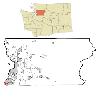
Ames Lake is an unincorporated community and census-designated place (CDP) in King County, Washington, United States. The population was 1,524 at the 2020 census, up from 1,486 at the 2010 census.

Cottage Lake is a census-designated place (CDP) in King County, Washington, United States. The population was 22,494 at the 2010 census. The lake itself falls within the 98072 ZIP code, while the developments east of the lake fall under the 98077 ZIP code.

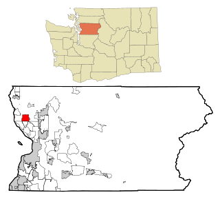
Lakeland South is a census-designated place (CDP) in King County, Washington, United States. The population was 13,169 at the 2020 census.

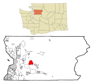
Riverbend is an unincorporated community and census-designated place (CDP) in King County, Washington, United States. The population was 2,123 at the 2020 census.

Woodinville is a city in King County, Washington, United States. The population was 13,069 at the 2020 census. It is a part of the Seattle metropolitan area. There is also a much larger population with Woodinville mailing addresses in adjacent unincorporated areas of King and Snohomish (Maltby) counties. Woodinville has waterfront parks on the Sammamish River, sweeping winery and brewery grounds, and densely wooded areas.

Cathcart is a census-designated place (CDP) in Snohomish County, Washington, United States. The population was 2,647 at the 2020 census, up from 2,458 at the 2010 census. Based on per capita income, one of the more reliable measures of affluence, Cathcart ranks 45th of 522 areas in the state of Washington to be ranked. Cathcart was named for Isaac Cathcart, a lumberman, entrepreneur, and Snohomish County pioneer.

High Bridge is a census-designated place (CDP) in Snohomish County, Washington, United States. The population was 3,140 at the 2020 census, up from 2,994 at the 2010 census. High Bridge includes the Echo Lake community and the former Echo Lake CDP, which was superseded by the larger High Bridge CDP in 2010.
Esperance is a census-designated place (CDP) in Snohomish County, Washington, United States. Esperance is an enclave of the city of Edmonds, Washington. The population was 4,007 at the 2020 census, up from 3,601 at the 2010 census.
Lake Goodwin is a former census-designated place (CDP) in Snohomish County, Washington, United States. The population was 3,354 at the 2000 census. The CDP was discontinued at the 2010 census.
Lake Roesiger is a census-designated place (CDP) in Snohomish County, Washington, United States. The population was 611 at the 2020 census, up from 503 at the 2010 census.

Machias is a census-designated place (CDP) in Snohomish County, Washington, United States. The population was 1,264 at the 2020 census.

Martha Lake is a census-designated place (CDP) in Snohomish County, Washington, United States. The population was 21,129 at the 2020 census. It lies west of Mill Creek and northeast of Lynnwood, near the lake of the same name.

North Marysville is a census-designated place (CDP) in Snohomish County, Washington, United States. The majority of the community and its 20,000 residents were annexed into the city of Marysville in 2009. The population was 108 at the 2010 census.
Northwest Snohomish is a former census-designated place (CDP) in Snohomish County, Washington, United States. The population was 2,061 at the 2000 census. The CDP ceased to exist at the 2010 census, with some parts having been annexed by Snohomish and other parts going to the new Fobes Hill CDP.

Oso is a census-designated place (CDP) in Snohomish County, Washington, United States. It is located to the west of Darrington, south of the North Fork of the Stillaguamish River and approximately 50 air miles (80 km) from Seattle. The population of Oso was 172 at the 2020 census. The area was the site of a large landslide in March 2014 that killed 43 people, the deadliest incident of its kind in U.S. history.

Priest Point is a former census-designated place (CDP) in Snohomish County, Washington, United States. The population was 779 at the 2000 census. The CDP was discontinued at the 2010 census.

Startup is a census-designated place (CDP) in Snohomish County, Washington, United States. The population was 859 according to the 2020 census.

Three Lakes is a census-designated place (CDP) in Snohomish County, Washington, United States. The population was 3,941 at the 2020 census.

Verlot is a census-designated place (CDP) in Snohomish County, Washington, United States. The population was 340 at the 2020 census.

Woods Creek is a census-designated place (CDP) in Snohomish County, Washington, United States. The population was 6,017 at the 2020 census.

