Monte Llano, Morovis, Puerto Rico

Last updated
Monte Llano
Montellano
Barrio
Barrio Monte Llano, Morovis, Puerto Rico.jpg
Houses at the foot of two mountains in Monte Llano
Monte Llano, Morovis, Puerto Rico locator map.png
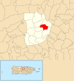
Location of Monte Llano within the municipality of Morovis shown in red
Caribbean location map.svg
Red pog.svg
Monte Llano
Location of Puerto Rico
Coordinates: 18°19′30″N66°23′23″W / 18.32502°N 66.389606°W / 18.32502; -66.389606 [1]
Commonwealth Flag of Puerto Rico.svg  Puerto Rico
Municipality Bandera de Morovis, Puerto Rico.svg Morovis
Area
[1]
  Total1.6 sq mi (4 km2)
  Land1.6 sq mi (4 km2)
  Water0 sq mi (0 km2)
Elevation
[2]
827 ft (252 m)
Population
 (2010)
  Total2,948
  Density1,842.5/sq mi (711.4/km2)
 Source: 2010 Census
Time zone UTC−4 (AST)
Zip code
00687

Monte Llano is a barrio in the municipality of Morovis, Puerto Rico. Monte Llano has about 15 sectors and its population in 2010 was 2,948. [3] [4] [5]

Contents

History

The barrio was in Spain's gazetteers [6] until Puerto Rico was ceded by Spain in the aftermath of the Spanish–American War under the terms of the Treaty of Paris of 1898 and became an unincorporated territory of the United States. In 1899, the United States Department of War conducted a census of Puerto Rico finding that the population of Monte Llano barrio was 466. [7]

Historical population
CensusPop.Note
1900 466
1910 60529.8%
1920 564−6.8%
1930 1,04785.6%
1940 1,0641.6%
1950 1,27820.1%
1960 1,3112.6%
1980 1,986
1990 2,19710.6%
2000 2,78126.6%
2010 2,9486.0%
U.S. Decennial Census
1899 (shown as 1900) [8] 1910-1930 [9]
1930-1950 [10] 1980-2000 [11] 2010 [12]

Sectors

Barrios (which are, in contemporary times, roughly comparable to minor civil divisions) [13] in turn are further subdivided into smaller local populated place areas/units called sectores (sectors in English). The types of sectores may vary, from normally sector to urbanización to reparto to barriada to residencial, among others. [14] [15] [16]

The following sectors are in Monte Llano barrio: [17]

Apartamentos Morovis Elderly, Apartamentos Parque del Retiro II, Avenida Corozal, Condominio Mariví, Residencial Padre Tomás Sorolla, Sector Avenida Patrón (Calle Patrón), Sector El Tambor, Sector La Aldea, Sector La Fábrica, Sector La Trinchera, Tramo Carretera 159, Urbanización Colinas de Montellano, Urbanización Estancias de Montellano, Urbanización Jardines de Montellano, and Urbanización Russe.

See also

Related Research Articles

<span class="mw-page-title-main">Cerro Gordo, San Lorenzo, Puerto Rico</span> Barrio of Puerto Rico

Cerro Gordo is a barrio in the municipality of San Lorenzo, Puerto Rico. Its population in 2010 was 5,284.

<span class="mw-page-title-main">Juan Martín, Yabucoa, Puerto Rico</span> Barrio of Puerto Rico

Juan Martín is a barrio in the municipality of Yabucoa, Puerto Rico. Its population in 2010 was 3,891.

<span class="mw-page-title-main">Llanos, Aibonito, Puerto Rico</span> Barrio of Puerto Rico

Llanos is a barrio in the municipality of Aibonito, Puerto Rico. Its population in 2010 was 6,840.

<span class="mw-page-title-main">Hormigueros, Hormigueros, Puerto Rico</span> Barrio of Puerto Rico

Hormigueros is a barrio in the municipality of Hormigueros, Puerto Rico. Its population in 2010 was 4,358. There is also a barrio called Hormigueros barrio-pueblo, with the administrative center and seat of this municipality.

<span class="mw-page-title-main">Caimital Alto, Aguadilla, Puerto Rico</span> Barrio of Puerto Rico

Caimital Alto is a barrio in the municipality of Aguadilla, Puerto Rico. Its population in 2010 was 3,989.

<span class="mw-page-title-main">Caimital Bajo, Aguadilla, Puerto Rico</span> Barrio of Puerto Rico

Caimital Bajo is a barrio in the municipality of Aguadilla, Puerto Rico. Its population in 2010 was 4,487. In Caimatal Bajo barrio is part of the Aguadilla urban zone.

<span class="mw-page-title-main">Camaceyes, Aguadilla, Puerto Rico</span> Barrio of Puerto Rico

Camaceyes is a barrio in the municipality of Aguadilla, Puerto Rico. Its population in 2010 was 12,547. In Camaceyes barrio is part of the Aguadilla urban zone.

<span class="mw-page-title-main">Corrales, Aguadilla, Puerto Rico</span> Barrio of Puerto Rico

Corrales is a rural barrio in the municipality of Aguadilla, Puerto Rico. Its population in 2010 was 7,659. In Corrales barrio is Cabán, a comunidad.

<span class="mw-page-title-main">Asomante, Aguada, Puerto Rico</span> Barrio of Puerto Rico

Asomante is a barrio in the municipality of Aguada, Puerto Rico. Its population in 2010 was 3,177.

<span class="mw-page-title-main">Monte Llano, Cidra, Puerto Rico</span> Barrio of Puerto Rico

Monte Llano is a barrio in the municipality of Cidra, Puerto Rico. Its population in 2010 was 984.

<span class="mw-page-title-main">Navarro, Gurabo, Puerto Rico</span> Barrio of Puerto Rico

Navarro is a barrio in the municipality of Gurabo, Puerto Rico. Its population in 2010 was 10,561.

<span class="mw-page-title-main">Santana, Arecibo, Puerto Rico</span> Barrio of Puerto Rico

Santana is a barrio in the municipality of Arecibo, Puerto Rico. Its population in 2010 was 5,253.

<span class="mw-page-title-main">Beatriz, Cidra, Puerto Rico</span> Barrio of Puerto Rico

Beatriz is a barrio in the municipality of Cidra, Puerto Rico. Its population in 2010 was 3,095.

<span class="mw-page-title-main">Morovis Norte</span> Barrio of Morovis, Puerto Rico

Morovis Norte is a barrio in the municipality of Morovis, Puerto Rico. Morovis Norte has about 15 sectors and its population in 2010 was 3,546.

<span class="mw-page-title-main">Morovis Sud</span> Barrio of Morovis, Puerto Rico

Morovis Sud also called Morovis Sur is a barrio in the municipality of Morovis, Puerto Rico. Morovis Sud has about 14 sectors and its population in 2010 was 4,208.

<span class="mw-page-title-main">Torrecillas, Morovis, Puerto Rico</span> Barrio of Puerto Rico

Torrecillas is a barrio in the municipality of Morovis, Puerto Rico. Torrecillas has eight sectors and its population in 2010 was 623. A USDA Rural Development field office is located on the Torrecillas side of Sector La Línea on PR-6622.

<span class="mw-page-title-main">Unibón</span> Barrio of Morovis, Puerto Rico

Unibón is a barrio in the municipality of Morovis, Puerto Rico. Unibón has fifteen sectors and its population in 2010 was 3,853.

<span class="mw-page-title-main">Orocovis, Orocovis, Puerto Rico</span> Barrio of Puerto Rico

Orocovis is a barrio in the municipality of Orocovis, Puerto Rico. Its population in 2010 was 3,658.

<span class="mw-page-title-main">Canóvanas, Canóvanas, Puerto Rico</span> Barrio of Puerto Rico

Canóvanas is a barrio in the municipality of Canóvanas, Puerto Rico. Its population in 2010 was 22,420.

<span class="mw-page-title-main">Bayamón, Cidra, Puerto Rico</span> Barrio of Puerto Rico

Bayamón is a barrio in the municipality of Cidra, Puerto Rico. Its population in 2010 was 5,995.

References

  1. 1 2 "US Gazetteer 2019". US Census. US Government.
  2. U.S. Geological Survey Geographic Names Information System: Monte Llano
  3. Picó, Rafael; Buitrago de Santiago, Zayda; Berrios, Hector H. Nueva geografía de Puerto Rico: física, económica, y social, por Rafael Picó. Con la colaboración de Zayda Buitrago de Santiago y Héctor H. Berrios. San Juan Editorial Universitaria, Universidad de Puerto Rico,1969.
  4. Gwillim Law (20 May 2015). Administrative Subdivisions of Countries: A Comprehensive World Reference, 1900 through 1998. McFarland. p. 300. ISBN   978-1-4766-0447-3 . Retrieved 25 December 2018.
  5. Puerto Rico: 2010 Population and Housing Unit Counts.pdf (PDF). U.S. Dept. of Commerce, Economics and Statistics Administration, U.S. Census Bureau. 2010.
  6. "Anuario del comercio, de la industria, de la magistratura y de la administración. 1881". Biblioteca Nacional de España (in Spanish). p. 1614. Retrieved 4 April 2023.
  7. Joseph Prentiss Sanger; Henry Gannett; Walter Francis Willcox (1900). Informe sobre el censo de Puerto Rico, 1899, United States. War Dept. Porto Rico Census Office (in Spanish). Imprenta del gobierno. p.  161.
  8. "Report of the Census of Porto Rico 1899". War Department Office Director Census of Porto Rico. Archived from the original on July 16, 2017. Retrieved September 21, 2017.
  9. "Table 3-Population of Municipalities: 1930 1920 and 1910" (PDF). United States Census Bureau. Archived (PDF) from the original on August 17, 2017. Retrieved September 21, 2017.
  10. "Table 4-Area and Population of Municipalities Urban and Rural: 1930 to 1950" (PDF). United States Census Bureau. Archived (PDF) from the original on August 30, 2015. Retrieved September 21, 2014.
  11. "Table 2 Population and Housing Units: 1960 to 2000" (PDF). United States Census Bureau. Archived (PDF) from the original on July 24, 2017. Retrieved September 21, 2017.
  12. Puerto Rico: 2010 Population and Housing Unit Counts.pdf (PDF). U.S. Dept. of Commerce Economics and Statistics Administration U.S. Census Bureau. 2010. Archived (PDF) from the original on 2017-02-20. Retrieved 2019-08-02.
  13. "US Census Barrio-Pueblo definition". factfinder.com. US Census. Archived from the original on 13 May 2017. Retrieved 5 January 2019.
  14. "Agencia: Oficina del Coordinador General para el Financiamiento Socioeconómico y la Autogestión (Proposed 2016 Budget)". Puerto Rico Budgets (in Spanish). Retrieved 28 June 2019.
  15. Rivera Quintero, Marcia (2014), El vuelo de la esperanza: Proyecto de las Comunidades Especiales Puerto Rico, 1997-2004 (first ed.), San Juan, Puerto Rico Fundación Sila M. Calderón, ISBN   978-0-9820806-1-0
  16. "Leyes del 2001". Lex Juris Puerto Rico (in Spanish). Retrieved 24 June 2020.
  17. "PRECINTO ELECTORAL MOROVIS 020" (PDF). Comisión Estatal de Elecciones (in Spanish). PR Government. 8 October 2019. Retrieved 24 June 2020.