Motera

Last updated

Motera
Motera, Ahmedabad
Area in Northwest Ahmedabad
View of Motera.JPG
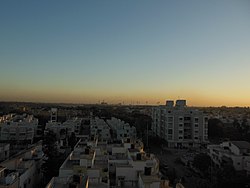
Motera at dusk, as seen southward in 2013
Ahmedabad locator map.svg
Red pog.svg
Motera
Location in Ahmedabad, Gujarat, India
India Gujarat location map.svg
Red pog.svg
Motera
Motera (Gujarat)
India location map.svg
Red pog.svg
Motera
Motera (India)
Coordinates: 23°5′39″N72°35′46″E / 23.09417°N 72.59611°E / 23.09417; 72.59611
CountryFlag of India.svg  India
State Gujarat
District Ahmedabad
Named for Motera village
Government
  TypeCivic authority
  BodyAhmedabad Municipal Corporation
Population
 (2001)
  Total21,150
Languages
  Official Gujarati, Hindi, English
Time zone UTC+5:30 (IST)
Vehicle registration GJ 01
Website gujaratindia.com

Motera is a neighbourhood in the northwestern part of the metropolis of Ahmedabad in Gujarat, India. It lies west of the Sabarmati River. It falls under the West Zone of Ahmedabad Municipal Corporation and under the Gandhinagar South constituency of Gujarat Legislative Assembly (Vidhan Sabha) and under the Gandhinagar constituency of the Lok Sabha. The chief attraction in Motera is the world's largest sports stadium, Narendra Modi Stadium. The stadium is the venue for the international cricket matches held in Ahmedabad. In 2015, old stadium was demolished and new stadium was built which got the honour of world's largest stadium.

Contents

History

It was earlier a part of the Gandhinagar district. January 2008 onwards, it is in the limits of Ahmedabad Municipal Corporation (AMC) in the Daskroi Taluka. It is included in the West Zone as per AMC, though it is the northernmost and the closest to the twin city and the capital of the Gujarat state, Gandhinagar. Motera is on the opposite bank of Sabarmati River.

Demographics

As of 2001 India census, [1] Motera had a population of 21,150. Males constitute 55% of the population and females 45%. Motera has an average literacy rate of 74%, higher than the national average of 59.5%: male literacy is 81%, and female literacy is 67%. In Motera, 13% of the population is under 6 years of age.

Public transit

By train (Indian Railways)

Apart from main Ahmedabad Railway Station (ADI) located in Kalupur area, one can use Sabarmati railway station (SBI, Northern India trains) located in Sabarmati area adjacent to Motera, and Sabarmati railway station (SBT, Central India trains) located in Ranip area, a little far from Motera, but closer than the main station.

By state bus (GSRTC)

The state-owned bus facility, Gujarat State Road Transport Corporation, connecting various cities, towns and villages of Gujarat, runs buses to Gandhinagar from Ahmedabad and vice versa. These buses have official stops at Sabarmati Tollnaka on Visat — RTO Road and Vishwakarma Govt Engg College on Visat — Gandhinagar Highway.

By city bus (AMTS)

The oldest city bus service by Ahmedabad Municipal Transport Service (AMTS), serves Motera through stops of Motera Gaam, Sahjanand Park, Indiranagar, Gandhivaas on the Motera Stadium Road and Vishwakarma Mandir, Visat, etc. on the Visat — Gandhinagar Highway.

By city bus (BRTS)

The brand new and fast city bus service is the Bus Rapid Transit System (BRTS) by Ahmedabad Janmarg Limited (AJL). It hasn't yet penetrated inside Motera, but the stations of Visat Gandhinagar Junction, Motera Cross Roads, Sabarmati Police Station, Sabarmati Municipal Swimming Pool, Rathi Apartment (ALL are on the main Visat — RTO Road i.e., separating Sabarmati and Motera) and Vishwakarma Govt Engg College station (on Visat — Gandhinagar Highway) belong to Line 8 towards Maninagar with RTO Circle and Bhavsar Hostel (only few stations ahead) as the junction for transfer to other lines.

By auto rickshaws

Private and sharing-based 'shuttle' auto rickshaws are always available, but they are less comfortable.

By MEGA metro rail (subway)

The Metro-Link Express for Gandhinagar and Ahmedabad is operational as a metro/subway system. In fact, Motera Stadium station will serve as a metro rail interchange hub. 'Motera Stadium' station will be the northern-end terminus on the north–south line of Phase-I which will consist of important stations like Sabarmati railway station, AEC, Vadaj, Income Tax, Paldi, Vasna, etc. This line intersects the west–east line of Phase-I itself consisting of stations like Thaltej, Doordarshan Kendra, Gujarat University, Navrangpura Stadium, Relief Road, Kalupur Railway Station (Ahmedabad Central), Vastral, etc. The extension of Phase-I will see connecting 'Motera Stadium' to 'SVP Airport' via 'Koteshwar' or 'Hansol' over the Sabarmati River. Also, Phase-II will see extending MEGA services to the twin city of Ahmedabad and the capital of the Gujarat state i.e. Gandhinagar.

Motera lake, Behind 4D Mall, Motera, Ahmedabad Motera Lake.jpg
Motera lake, Behind 4D Mall, Motera, Ahmedabad
Motera lake, Behind 4D Mall, Motera, Ahmedabad Motera lake 1.jpg
Motera lake, Behind 4D Mall, Motera, Ahmedabad

Related Research Articles

<span class="mw-page-title-main">Gandhinagar</span> Capital city of Gujarat, India

Gandhinagar is the capital of the state of Gujarat in India. Gandhinagar is located approximately 23 km north of Ahmedabad, on the west central point of the industrial corridor between the metropolitan cities of Delhi and Mumbai.

<span class="mw-page-title-main">Ahmedabad</span> Metropolis in Gujarat, India

Ahmedabad is the most populous city in the Indian state of Gujarat. It is the administrative headquarters of the Ahmedabad district and the seat of the Gujarat High Court. Ahmedabad's population of 5,570,585 makes it the fifth-most populous city in India, and the encompassing urban agglomeration population estimated at 6,357,693 is the seventh-most populous in India. Ahmedabad is located near the banks of the Sabarmati River, 25 km (16 mi) from the capital of Gujarat, Gandhinagar, also known as its twin city.

<span class="mw-page-title-main">Mehsana</span> City in Gujarat, India

Mehsana, also spelled Mahesana, is a city and municipality in Mehsana district, in the Indian state of Gujarat. Established in 14th century, the city was under Gaekwads of Baroda State from 18th century to the independence of India in 1947. The municipality was established in 1919–20. The town has population of about 185,000. Dairy, oil and natural gas are major industries while there are several small and medium enterprises in the city.

<span class="mw-page-title-main">Abu Road</span> Place in Rajasthan, India

Abu Road is a city and sub-district in Sirohi district of Rajasthan state in western India, lies on the bank of West Banas River. It is the tehsil and sub-district headquarters and the largest city in Sirohi District in terms of area and population. Its railway station is an important stop on the main Indian Railways line between New Delhi and Ahmedabad and registers an impressive growth in passenger traffic and revenue generation for North Western Railway zone. The popular hill station, Mount Abu is 27 km up the hill from Abu Road.

<span class="mw-page-title-main">Gandhinagar district</span> District of Gujarat in India

Gandhinagar district is an administrative division of Gujarat, India, whose headquarters are at Gandhinagar, the state capital. It was organized in 1964.

<span class="mw-page-title-main">Sarkhej–Gandhinagar Highway</span> Road in India

The Sarkhej–Gandhinagar Highway, colloquially the S.G. Road or S.G. Highway, connects the city of Ahmedabad with Gandhinagar, the capital of the state of Gujarat, India. It forms the major part of NH 8C that connects Sarkhej with Chiloda near Gandhinagar. It is a major artery road for commercial and public transport and is witnessing a major construction boom along its route towards Gandhinagar.

<span class="mw-page-title-main">Ahmedabad Junction railway station</span> Railway station in Gujarat, India

Ahmedabad Junction railway station is the main railway station of Ahmedabad, Gujarat, India. It is also the biggest railway station within Gujarat and also one of the major railway station in India. It is the highest income-generating division in Western Railways. It connects to Mumbai, Chennai, Delhi, Howrah and other major cities of India. Also it is central railway station of Gujarat which connects to Saurashtra, Kutch, Vadodara, Surat, Himmatnagar, Bhavnagar, Palanpur, etc.

<span class="mw-page-title-main">Sabarmati Riverfront</span> Development at Ahmedabad, India

Sabarmati Riverfront is a waterfront being developed along the banks of Sabarmati river in Ahmedabad, India. Proposed in the 1960s, the construction began in 2005. Since 2012, under Phase 1, the waterfront is gradually opened to public as and when facilities are constructed and various facilities are actively under construction. The major objectives of project are environment improvement, social infrastructure and sustainable development. Phase 2 was approved in 2020.

<span class="mw-page-title-main">Adalaj</span> Town in Gujarat, India

Adalaj is a census town in Gandhinagar district located in the western Indian state of Gujarat. With a population of roughly 12,000 residents within the town limits as of 2011, Adalaj is known for its semi-arid climate and its historic and religious establishments. The town sits in a generally flat area covering about 18 sq. kms.

Chandkheda is a well-developed area in northwestern Ahmedabad. It is situated on west of Sabarmati River.

Nana Chiloda, also known as Chiloda(Naroda), is a town in Ahmedabad in the state of Gujarat, India.

<span class="mw-page-title-main">Kalol, Gandhinagar</span> City in Gujarat, India

Kalol is a city in Gandhinagar district in the Indian state of Gujarat, located alongside Gujarat State Highway 41 between the cities of Mehsana and Ahmedabad.

Mahemdavad is a town with municipality in the Kheda district in the Indian state of Gujarat. Mahemdavad is situated on the Vatrak River bank. The nearest city is Kheda. It is 30 km from largest city of Gujarat, Ahmedabad.

<span class="mw-page-title-main">Ahmedabad Metro</span> Rapid transit system in Ahmedabad and Gandhinagar, Gujarat, India

Ahmedabad Metro is a rapid transit system for the cities of Ahmedabad and Gandhinagar in Gujarat state of India.

Sabarmati is an area located in Ahmedabad, India.

<span class="mw-page-title-main">Bhat, Daskroi</span> Village in Gujarat, India

Bhat is a village in Daskroi Taluka in Ahmedabad district of Gujarat State, India. Bhat is located near the bank of the Sabarmati River, 24 km towards west from District headquarters Ahmedabad, 5 km from Daskroi and 49 km from State capital Gandhinagar.

<span class="mw-page-title-main">Rupal, Gandhinagar</span> Village in Gujarat, India

Rupal is a village in Gandhinagar district of Gujarat state, India. It is located 13 km towards north from District headquarters Gandhinagar. Gujarati is the local language.

Mahemadavad Kheda Road railway station is a railway station on the Western Railway network in the state of Gujarat, India. Mahemadavad Kheda Road railway station is 18 km far away from Nadiad railway station. Passenger, MEMU and few Express/Superfast trains halt at Mahemadavad Kheda Road railway station. This railway station's nearest city is Kheda.

The Red Line of the Ahmedabad Metro is a metro route of the mass rapid transit system in Ahmedabad, India.

Ahmedabad high-speed railway station is an under construction high-speed railway station on the Mumbai–Ahmedabad high-speed rail corridor. This station is located near Ahmedabad Junction railway station in Kalupur, Ahmedabad, Gujarat, India. It is the eleventh station of the Mumbai–Ahmedabad high-speed rail corridor, after Anand-Nadiad station and before Sabarmati station.

References

  1. "Census of India 2001: Data from the 2001 Census, including cities, villages and towns (Provisional)". Census Commission of India. Archived from the original on 16 June 2004. Retrieved 1 November 2008.