Mount Craddock | |
---|---|
Highest point | |
Elevation | 4,368 m (14,331 ft) [1] |
Coordinates | 78°38′S85°12′W / 78.633°S 85.200°W |
Geography | |
Location | Antarctica |
Parent range | Sentinel Range |
Climbing | |
First ascent | January 1992 |
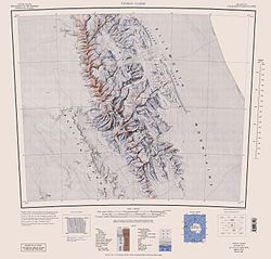
Mount Craddock is a large, bold mountain forming the south extremity of Craddock Massif in Sentinel Range, the ninth highest mountain in Antarctica. It is linked by Karnare Col to Mount Strybing in the southern Sentinel Range. The ninth-highest mountain in Antarctica was first climbed in January 1992. [1]
The name Mount Craddock was originally recommended by the Advisory Committee on Antarctic Names (US-ACAN) in 1965 for the present-day Craddock Massif but subsequent maps limited Mount Craddock to the massif's southernmost peak, a position that became established over years. To avoid confusion and to fix the position of the name, US-ACAN redefined Mount Craddock in 2006 to apply to the southernmost peak described above. [2]
The mountain was named by US-ACAN for J. Campbell Craddock (1930–2006), leader of a University of Minnesota expedition (1962–63) that made geological investigations and cartographic surveys in the Sentinel and Heritage Ranges of the Ellsworth Mountains. During 1960–61, Craddock led a Minnesota geological expedition in examining the Jones Mountains. [2]
Mount Craddock is the second-highest point of the Craddock Massif which includes Mount Rutford (highest point), Rada Peak, and Bugueño Pinnacle. Rutford was named for R. H. Rutford, Antarctic geologist and colleague of Craddock. Rada Peak and Bugueño Pinnacle were named for Camilo Rada and Manuel Bugueño, climbing partners of Damien Gildea, a leading Antarctic researcher and climber. [1]
Vinson Massif is a large mountain massif in Antarctica that is 21 km (13 mi) long and 13 km (8 mi) wide and lies within the Sentinel Range of the Ellsworth Mountains. It overlooks the Ronne Ice Shelf near the base of the Antarctic Peninsula. The massif is located about 1,200 kilometres (750 mi) from the South Pole. Vinson Massif was discovered in January 1958 by U.S. Navy aircraft. In 1961, the Vinson Massif was named by the Advisory Committee on Antarctic Names (US-ACAN), after Carl G. Vinson, United States congressman from the state of Georgia, for his support for Antarctic exploration. On November 1, 2006, US-ACAN declared Mount Vinson and Vinson Massif to be separate entities. Vinson Massif lies within the unrecognised Chilean claim under the Antarctic Treaty System.
The Sentinel Range is a major mountain range situated northward of Minnesota Glacier and forming the northern half of the Ellsworth Mountains in Antarctica. The range trends NNW-SSE for about 185 km (115 mi) and is 24 to 48 km wide. Many peaks rise over 4,000 m (13,100 ft) and Vinson Massif (4892 m) in the southern part of the range is the highest elevation on the continent.
The Nimitz Glacier is an Antarctic glacier, 40 nautical miles long and 5 nautical miles wide, draining the area about 10 nautical miles west of the Vinson Massif and flowing southeast between the Sentinel Range and Bastien Range to enter Minnesota Glacier, in the central Ellsworth Mountains.
Mount Rutford is a sharp peak that rises to 4,477 metres (14,688 ft) and marks the highest point on Craddock Massif in the Sentinel Range, Ellsworth Mountains. The peak stands just north of Bugueño Pinnacle and 2.1 mi north of Mount Craddock, with which this naming is associated. Prior to 2006 the peak had no name, but was visually identified by Camilo Rada and Damien Gildea as being higher than Mt Craddock, during their time on the summits of both Vinson (2004) and Craddock (2005). Thus they returned in 2006 and, as part of a larger GPS program, measured the height of this unnamed peak.
Craddock Massif is a mountain massif in the Sentinel Range of the Ellsworth Mountains, in the Chilean claim of West Antarctica.
Damien Gildea is an Australian mountaineer and Antarctic explorer who has climbed extensively in Antarctica, Nepal, Tibet, Pakistan, Bolivia, Alaska, New Zealand and elsewhere.
Gildea Glacier is a glacier 10 kilometres (6 mi) long and 5 kilometres (3 mi) wide flowing southwestward from Craddock Massif between Mount Slaughter and Mount Atkinson into Nimitz Glacier, in the Sentinel Range of the Ellsworth Mountains, Antarctica. The upper portion of the glacier also receives ice from Hammer Col and southern Vinson Massif.
Vinson Plateau is the summit plateau of Vinson Massif, Sentinel Range in Ellsworth Mountains, Antarctica. It extends for 9 km between Goodge Col and Hammer Col linking it to the north-central part of Sentinel Range to the north-northwest and to Craddock Massif to the south-southeast respectively, and 4.5 km wide between Branscomb Peak and Silverstein Peak to the west and Schoening Peak and Marts Peak to the east. Elevation from 4000 m to 4600 m above sea level. Rising from the plateau is the summit of Antarctica Mount Vinson, and several other peaks higher than 4700 m, albeit of modest prominence: Clinch Peak, Corbet Peak, Silverstein Peak, Schoening Peak and Hollister Peak. The lower peaks of Fukushima and Opalchenie stand at the south extremity of the plateau. Its central part is drained by Roché Glacier and a tributary glacier in Jacobsen Valley, with both of them joining Branscomb Glacier.
Patton Glacier is a broad tributary glacier in the Sentinel Range, Ellsworth Mountains. It drains the east slope of the main ridge between Mounts Ostenso and Tyree, flows east-northeastwards between Evans Peak and Versinikia Peak on the north and Mount Bearskin on the south, and enters Ellen Glacier northeast of Zalmoxis Peak and southeast of Mount Jumper.
Mount Slaughter is an ice-free peak, rising to 3,444 metres (11,299 ft) on a spur trending southwest from Opalchenie Peak on Vinson Plateau, Sentinel Range, in the Ellsworth Mountains, Antarctica. It is surmounting the head of Donnellan Glacier to the northwest and Gildea Glacier to the south. It was mapped by the United States Geological Survey (USGS) from surveys and U.S. Navy aerial photographs from 1957 to 1960. It was named by the Advisory Committee on Antarctic Names (US-ACAN) in 1982, after John B. Slaughter, the director of the National Science Foundation from 1980 to 1982.
Opalchenie Peak is the peak rising to 4,503.5 metres (14,775 ft) at the south extremity of the ice-covered Vinson Plateau, Sentinel Range in the Ellsworth Mountains, Antarctica. It is of low topographic prominence, just 63 metres (207 ft), with parent summit Fukushima Peak. The feature has a partly ice-free summit and south slopes, where two parallel ridges descend steeply southwestwards with Donnellan Glacier flowing in between and Mount Slaughter rising on the more southerly ridge. The northerly ridge was climbed up to the summit plateau by American Robert Anderson in November 1992, and subsequently used to establish a new route to Mount Vinson in 2003. Opalchenie Peak overlooks Vinson Plateau on the north, Craddock Massif on the southeast and upper Nimitz Glacier area on the southwest.
Mount Allen' is a mountain located 5.2 mi southeast of Mount Craddock in Owen Ridge, the southernmost portion of the main ridge of Sentinel Range, Ellsworth Mountains in Antarctica. The peak surmounts Saltzman Glacier to the north, Kornicker Glacier to the southeast, Bolgrad Glacier to the southwest and Brook Glacier to the west. It was mapped by the USGS from surveys and USN air photos in 1957–59. It was named by the US-ACAN for Lt. Forrest M. Allen, USNR, the co-pilot on reconnaissance flights from Byrd Station, 1957–58. Mount Allen was first successfully climbed on December 26, 2012, by Pachi Ibarra, Ralf Laier and Todd Passey.
Fukushima Peak is a high, pointed rocky peak, 4,634 metres (15,203 ft) high, near the south edge of the ice-covered Vinson Plateau in the Sentinel Range of the Ellsworth Mountains, Antarctica.
Silverstein Peak is a prominent, 4,790-metre-high (15,720 ft) peak on the west edge of the ice-covered Vinson Plateau in the Sentinel Range of Ellsworth Mountains, Antarctica. It surmounts Roché Glacier to the north and Zapol Glacier to the southwest.
Corbet Peak is a 4,822-metre-high (15,820 ft) peak, at the north edge of the ice-covered Vinson Plateau in the Sentinel Range of the Ellsworth Mountains, Antarctica. It surmounts Hinkley Glacier to the northeast and the head of Roché Glacier to the southwest.
Schoening Peak is a 4,743 metres (15,561 ft) high, steep and rocky peak, at the northeast edge of the ice-covered Vinson Plateau in the Sentinel Range of the Ellsworth Mountains, Antarctica. It surmounts Hinkley Glacier to the north and Dater Glacier to the northeast.
Clinch Peak is a 4,841 metres (15,883 ft) high, elongated peak, in the central part of the ice-covered Vinson Plateau in the Sentinel Range of the Ellsworth Mountains, Antarctica. It surmounts Roché Glacier to the west.
Marts Peak is a 4,551 metres (14,931 ft) high, small and sharp peak at the east edge of the ice-covered Vinson Plateau in the Sentinel Range of the Ellsworth Mountains, Antarctica. It surmounts Dater Glacier to the northeast and Hammer Col to the south.
Hollister Peak is a 4,729-metre-high (15,515 ft) sharp peak in the central part of the ice-covered Vinson Plateau in the Sentinel Range of the Ellsworth Mountains, Antarctica. It surmounts the head of Roché Glacier to the north.
Wahlstrom Peak is a 4,677 metres (15,344 ft) high, sharp peak at the southeast side of the ice-covered Vinson Plateau in the Sentinel Range of the Ellsworth Mountains, Antarctica. It surmounts the head of Roché Glacier to the northwest and Hammer Col to the southeast.
{{cite web}}
: CS1 maint: DOI inactive as of November 2024 (link)