
Burcott is a hamlet in the parish of Wing(where at the 2011 Census the population was included ), Buckinghamshire, England. Burcott is a common place name in the English language. The place name is Old English and refers to a fortified cottage.
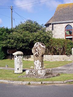
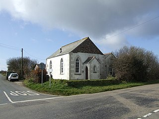
Crows-an-Wra is a hamlet in West Cornwall, England, United Kingdom. It is situated in the civil parish of St Buryan, Lamorna and Paul approximately four miles (6 km) northeast of Land's End.

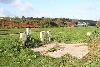
No Man's Land is a crossroads hamlet in south-east Cornwall, England, United Kingdom. It is situated approximately two miles (3 km) northeast of Looe on the B3253 road to Widegates.

Polbrock is a small hamlet in north Cornwall, England, United Kingdom. It is situated two miles southeast of Wadebridge at grid reference SX 014 695 and near Burlorne Pillow.

Carland Cross is a location in Cornwall, England, United Kingdom, about six miles north of Truro at OS grid reference OS grid ref SW846539. At Carland Cross there are a hamlet, a road junction and a large wind farm. The road junction is in the civil parish of St Erme, very close to the boundary with St Newlyn East.

Chiverton Cross is a road junction in west Cornwall, England, United Kingdom, about four miles north-east of Redruth and five miles (8 km) west of Truro at OS grid ref SW747469. Its name derives from Chyverton House which is in the extreme east of the parish of Perranzabuloe.

Menagissey is a hamlet in Cornwall, England, United Kingdom. It is half-a-mile south of Mount Hawke about three miles (5 km) north-northeast of Redruth in the civil parish of St Agnes. It is included in the Mount Hawke and Portreath division on Cornwall Council.

Polmear is a hamlet in Cornwall, England, UK. It is located on the A3082 road close to Par Sands and the village of Par. Part is in the civil parish of Fowey and part in Par and Tywardreath parish. The centre of Fowey is some 3 miles (4.8 km) distant, whilst Par railway station is less than 1 mile (1.6 km) away. Polmear used to be known as East Polmear and West Polmear is now known as Charlestown, and has been since Charles Rashleigh built the harbour there.

Buryas Bridge is a hamlet on the A30 between Land's End and Penzance in west Cornwall, England, UK.

Carminow Cross is a stone Celtic cross near a major road junction southeast of Bodmin in mid-Cornwall, England. Immediately to the north is Castle Canyke, an Iron Age fort. The cross is a Grade II* listed building.
Cockwells is a hamlet in the civil parish of Ludgvan in Cornwall, England and situated on the A30 road north-east of the village of Crowlas.

Congdon's Shop is a hamlet in the parish of North Hill, Cornwall, England. It is at the junction of the B3254 Launceston to Liskeard road and the B3257 road from Plusha to Callington.

Ellenglaze is a hamlet near the village of Cubert north of Perranporth in Cornwall, England. It lies close to the edge of Penhale Sands (dunes).

Marazanvose is a hamlet southwest of Zelah in Cornwall, England. It is on the A30 main road.
Mount Hermon is a hamlet in the parish of Grade-Ruan in Cornwall, England. It is situated to the east of the A3083 road from Helston to Lizard. There is a round barrow situated to the north east of the houses. There was formerly a chapel, marked as Ebenezer Chapel on the 1879 map, but this has been converted into accommodation, and is now called Ebenezer Cottage.
Penpillick is a hamlet in Cornwall, England, UK. It is about two miles north of St Blazey on the A390 road.

Rose-an-Grouse is a hamlet in the civil parish of St Erth in west Cornwall, England. It is on the A30 road, east of Canon's Town, and St Erth railway station is on the southern side of the hamlet.

Tregidden is a hamlet south of Manaccan in Cornwall, England, United Kingdom. A little further south is Tregidden Farm. Tregidden is located in the parish of St Martin-in-Meneage and also partly in the parishes of Manaccan and St Keverne.
Trevowhan is a hamlet in the parish of Morvah, Cornwall, England, UK, and lies 0.5 miles east of the village of Morvah.

Trewornan is a hamlet north west of Wadebridge, Cornwall, England, United Kingdom. It is on the B3314 main coast road that links Wadebridge to the tourist areas of Rock, Polzeath and Port Isaac.
