For the geographical feature, see Beech Mountain.
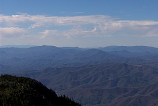
The Unaka Range is a mountain range on the border of Tennessee and North Carolina, in the southeastern United States. It is a subrange of the Appalachian Mountains and is part of the Blue Ridge Mountains physiographic province. The Unakas stretch approximately from the Nolichucky River to the south to the Watauga River to the north. The Unakas include the prominent Roan Highlands, where several summits rise above 6,000 feet. The Iron Mountains border the Unakas to the north, and the Bald Mountains border the Unakas opposite the Nolichucky to the south. The name unaka is rooted in the Cherokee term unega, meaning "white".

Pores Knob is a mountain peak located in Wilkes County, North Carolina, USA.
The Roaring River is a tributary of the Yadkin River in northwestern North Carolina in the United States. Via the Yadkin it is part of the watershed of the Pee Dee River, which flows to the Atlantic Ocean. According to the Geographic Names Information System, it has also been known historically as "Roaring Creek." The river's name comes from its headwaters in the Blue Ridge Mountains, where it flows through a series of small waterfalls.
The Reddies River is a tributary of the Yadkin River in northwestern North Carolina in the United States. Via the Yadkin it is part of the watershed of the Pee Dee River, which flows to the Atlantic Ocean. According to the Geographic Names Information System, it has also been known historically as "Reddis River."

Roan Creek is a tributary of the Watauga River that rises near the border between the U.S. states of Tennessee and North Carolina. Its source is located along the slopes of Snake Mountain near Trade in Johnson County, Tennessee. From its source, Roan Creek flows north, then turns west around the northern end of Stone Mountain. Then it flows south and west through Cherokee National Forest in the valley between Stone Mountain and Doe Mountain, until entering the Watauga River and Watauga Lake, the reservoir behind Watauga Dam. Its waters eventually flow through the Watauga River, the Holston River, the Tennessee River, the Ohio River, and the Mississippi River to the Gulf of Mexico.
Boomer is a farming community located in Wilkes County, North Carolina. Legally it is a township, a non-governmental county subdivision. The population was 2,286 at the 2010 Census. The community was named after its first postmaster, Ed "Boomer" Matheson. The community was originally called Warrior Creek, after a stream which flows through the area. Boomer was the birthplace and home of James Larkin Pearson, a poet and newspaper publisher who served as North Carolina Poet Laureate from 1953 to 1981.

Linville is an unincorporated community in Avery County, North Carolina, United States. Centered just south of US 221 and NC 105, the community is known as a summer mountain resort and host of the Grandfather Mountain Highland Games, the largest modern Highland games in North Carolina.
Scottville is an unincorporated community in both Ashe and Alleghany Counties, North Carolina, United States, on U.S. Route 221. It lies at an elevation of 2,861 feet.
Parker is an unincorporated community in Ashe County, North Carolina, on North Carolina Highway 88. It lies at an elevation of 3,136 feet.
Grayson is an unincorporated community in Ashe County, North Carolina, northeast of Creston. It lies at an elevation of 3,343 feet.
Fig is an unincorporated community in Ashe County, North Carolina, USA, southwest of Clifton. It lies at an elevation of 2,802 feet.

Crumpler is an unincorporated community on North Carolina Highway 16 in Ashe County, North Carolina, United States. It lies east of Warrensville, northeast of Jefferson, and north of Chestnut Hill, at an elevation of 2559 feet.
Clifton is an unincorporated community in Ashe County, North Carolina, east of Fig. It lies at an elevation of 2,769 feet.
Chestnut Hill is an unincorporated community in Ashe County, North Carolina, south of Crumpler. It lies at an elevation of 2,756 feet.
Warrensville is an unincorporated community at the intersection of North Carolina Highways 88 and 194 in Ashe County, North Carolina, United States, east of Comet. It lies at an elevation of 2,707 feet.

Stone Mountain is the centerpiece of Stone Mountain State Park. It is a dome of exposed granite of Devonian age, which has intruded into the gneiss of the Precambrian Alligator Back Formation. It rises sharply over 600 feet above the surrounding terrain. The mountain, which has an elevation of 2,305 feet (706 m) above sea level, is known for its barren sides and distinctive brown-gray color, and can be seen for miles. The mountain offers some of the best rock climbing in North Carolina, and the park's creeks and streams feature excellent brook trout fishing.
Whitetop is an unincorporated community in Grayson County, Virginia, United States. It is the southern terminus of the Virginia Creeper Trail. Whitetop is named for nearby Whitetop Mountain, the second-tallest independent mountain in the State of Virginia, behind Mount Rogers. The town is about four miles northeast of the North Carolina–Tennessee–Virginia Corners.
Parsonsville is an unincorporated community in Wilkes County, North Carolina, United States, close to North Wilkesboro. NASCAR legend Benny Parsons was raised in the area.
Darby is an unincorporated community in Wilkes County, North Carolina, in the United States.