Beech Mountain (North Carolina)

Last updated
Beech Mountain
Beech Mountain viewed from Grandfather Mountain, Oct 2016 (cropped).jpg
Beech Mountain seen from Grandfather Mountain
Highest point
Elevation 5,506 ft (1,678 m)
Prominence 1,520 ft (460 m)
Coordinates 36°11′02″N81°52′53″W / 36.18389°N 81.88139°W / 36.18389; -81.88139 Coordinates: 36°11′02″N81°52′53″W / 36.18389°N 81.88139°W / 36.18389; -81.88139 [1]
Geography
USA North Carolina relief location map.jpg
Red triangle with thick white border.svg
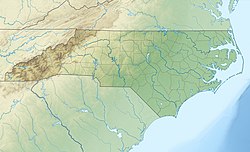
Beech Mountain
Location in North Carolina
Location Avery County, North Carolina, U.S.
Parent range Blue Ridge Mountains
Topo map USGS Elk Park

Beech Mountain is a mountain in the North Carolina High Country and wholly in the Pisgah National Forest. Its elevation reaches 5,506 feet (1,657 m) and generates feeder streams for the Elk River. Nestled on the top is the Town of Beech Mountain.

Contents

Recreation

View after getting off chairlift for a downhill mountain bike run. Beech downhill 02.jpg
View after getting off chairlift for a downhill mountain bike run.
Mountain bikers on Beech Mountain.
(short video).

Beech Mountain offers skiing, snowboarding, and tubing in the winter months. In the summer, recreation includes hiking and mountain biking. Beech Mountain Resort runs chairlifts for downhill mountain biking. [2]

One of the more interesting walking areas is the defunct Land of Oz theme park, which existed briefly in the 1970s; remnants of the park can be visited today.

See also

Related Research Articles

<span class="mw-page-title-main">Watauga County, North Carolina</span> County in North Carolina, United States

Watauga County is a county located in the U.S. state of North Carolina. As of the 2020 census, the population was 54,086. Its county seat and largest town is Boone. The county is in an exceptionally mountainous region. It is the home of Appalachian State University, which has approximately 20,023 students as of August 20, 2020. Watauga County comprises the Boone, NC Micropolitan Statistical Area.

<span class="mw-page-title-main">Avery County, North Carolina</span> County in North Carolina, United States

Avery County is a county located in the U.S. state of North Carolina. As of the 2020 census, the population was 17,806. The county seat is Newland. The county seat was initially established in Elk Park when the county was first formed, but was moved to Newland upon completion of the courthouse in 1912. Founded in 1911, it is the youngest of North Carolina's 100 counties.

<span class="mw-page-title-main">Banner Elk, North Carolina</span> Town in North Carolina, United States

Banner Elk is a town in Avery County, North Carolina, United States. The population was 1,028 at the 2010 census. Banner Elk is home to Lees–McRae College.

<span class="mw-page-title-main">Beech Mountain, North Carolina</span> Town in North Carolina, United States

Beech Mountain is a town in both Avery and Watauga counties in the U.S. state of North Carolina. As of the 2010 census, the town population was 320. The town is located atop Beech Mountain and is the highest town east of the Rocky Mountains at 5,506 ft in elevation. The nearest municipality at a higher elevation is Des Moines, New Mexico, some 1,220 miles away.

Lake Norman State Park, formerly Duke Power State Park, is a 1,942-acre (7.86 km2) North Carolina state park near Troutman, Iredell County, North Carolina in the United States. The park is on the northern shore of Lake Norman at the mouth of Hicks Creek. The park is open for year-round recreation including, boating, fishing, water skiing, swimming and camping. Lake Norman State Park is on Inland Sea Road in Troutman just off U.S. Route 70 between Interstates 40 and 77.

<span class="mw-page-title-main">William B. Umstead State Park</span> State park in North Carolina, United States

William B. Umstead State Park is a North Carolina state park in Wake County, North Carolina in the United States. It covers 5,599 acres (22.66 km2) nestled between the expanding cities of Raleigh, Cary, and Durham, North Carolina. It offers hiking, bridle, and bike trails, boat rentals, camping, picnic areas, and educational programs.

<span class="mw-page-title-main">Great Smoky Mountains</span> American mountain range along North Carolina/Tennessee border

The Great Smoky Mountains are a mountain range rising along the Tennessee–North Carolina border in the southeastern United States. They are a subrange of the Appalachian Mountains, and form part of the Blue Ridge Physiographic Province. The range is sometimes called the Smoky Mountains and the name is commonly shortened to the Smokies. The Great Smokies are best known as the home of the Great Smoky Mountains National Park, which protects most of the range. The park was established in 1934, and, with over 11 million visits per year, it is the most visited national park in the United States.

Palmetto may refer to:

<span class="mw-page-title-main">Southern Off-Road Bicycle Association</span>

The International Mountain Bicycling Association-Southern Off-Road Bicycle Association (IMBA-SORBA) is an advocacy organization for mountain biking in the Southeastern United States. IMBA-SORBA is a regional division of International Mountain Bicycling Association, managed by an Executive Director and a Board of Directors. The Board of Directors is composed of an elected Executive Board, plus one representative from each chapter. The organization has over 5000 members.

<span class="mw-page-title-main">Pisgah National Forest</span> National forest in North Carolina

Pisgah National Forest is a National Forest in the Appalachian Mountains of western North Carolina. It is administered by the United States Forest Service, part of the United States Department of Agriculture. The Pisgah National Forest is completely contained within the state of North Carolina. The forest is managed together with the other three North Carolina National Forests from common headquarters in Asheville, North Carolina. There are local ranger district offices located in Pisgah Forest, Mars Hill, and Nebo.

<span class="mw-page-title-main">Western North Carolina</span> Geographic region of the U.S. state of North Carolina

Western North Carolina is the region of North Carolina which includes the Appalachian Mountains; it is often known geographically as the state's Mountain Region. It contains the highest mountains in the Eastern United States, with 125 peaks rising to over 5,000 feet in elevation. Mount Mitchell at 6,684 feet, is the highest peak of the Appalachian Mountains and mainland eastern North America. The population of the region, as measured by the 2010 U.S. Census, is 1,473,241, which is approximately 15% of North Carolina's total population.

The Land of Oz is a theme park based on L. Frank Baum's Land of Oz books, located in the resort town of Beech Mountain, North Carolina, USA. Carolina Caribbean Corporation opened it in 1970 under the guidance of Grover Robbins, who had been successful with Tweetsie Railroad. Designed by Jack Pentes, the park was fully operational until 1980. As of September 2019, it now opens for Fridays in June for "Journey with Dorothy Tours" and in September for Autumn at Oz – the largest Wizard of Oz festival in the country.

<span class="mw-page-title-main">Prompton State Park</span> State park in Wayne County, Pennsylvania

Prompton State Park is a Pennsylvania state park on 2,000 acres (809 ha) in Clinton and Dyberry Townships, Wayne County, Pennsylvania in the United States. This park, which was established in 1962, is officially listed by the Pennsylvania Department of Conservation and Natural Resources as being undeveloped. This means that it is officially a state park but the PA-DCNR is not currently managing the park. However, the lands of the park are open to visitors. Friends of Prompton State Park, a grassroots organization is working to take over management of the park in much the same way that Salt Springs State Park in Susquehanna County is managed by The Friends of Salt Springs Park. Northeast Sports Ltd. of Honesdale sponsors several outdoor sports events that are held at the park. Prompton State Park is 4.2 miles (6.8 km) west of Honesdale on Pennsylvania Route 170.

<span class="mw-page-title-main">Croatan National Forest</span>

The Croatan National Forest is a U.S. National Forest, was established on July 29, 1936, and is located on the Atlantic coast of North Carolina. It is administered by the United States Forest Service, a part of the United States Department of Agriculture. The forest is managed together with the other three North Carolina National Forests from common headquarters in Asheville, North Carolina. However, Croatan has a local ranger district office in New Bern.

<span class="mw-page-title-main">Paris Mountain State Park</span> State park in South Carolina, United States

Paris Mountain State Park is a state park in the U.S. state of South Carolina, located five miles (8 km) north of Greenville. Activities available in the 1,540-acre (6 km2) park include hiking, biking, swimming and picnicking. The 13-acre (52,609 m2) Lake Placid offers swimming and fishing. Canoes, kayaks, and pedal boats are seasonally available for rental; private boats are not permitted. Camping is allowed and campsites range from rustic, back country sites to paved sites with water and electricity hook-ups. The park's Civilian Conservation Corps (CCC) structures, including the Camp Buckhorn lodge, are listed on the National Register of Historic Places. m.

<span class="mw-page-title-main">Dismal Swamp State Park</span>

Dismal Swamp State Park is a North Carolina state park in Camden County, North Carolina, in the United States. The park was created as a state natural area in 1974 with the help of The Nature Conservancy, and on July 28, 2007, the North Carolina General Assembly re-designated it as a state park. It opened to the public in 2008. This marked the first time that public access to Great Dismal Swamp was made possible in North Carolina. The park covers 14,432 acres (58.40 km2) of protected land on the North Carolina/Virginia border. Park offices are 3 miles (4.8 km) south of the border on U.S. Route 17 near South Mills. Features of the park include the canal which is used regularly by boaters using the Intracoastal Waterway and several miles of hiking and biking trails.

<span class="mw-page-title-main">Alum Creek State Park</span> State park in Ohio, United States

Alum Creek State Park is a 4,630-acre (1,870 ha) Ohio state park in Delaware County, Ohio, in the United States. Alum Creek Lake was constructed from 1970 to 1974 as part of the Flood Control Act of 1962. Alum Creek Dam was constructed on Alum Creek, a tributary of Big Walnut Creek, which drains into the Scioto River. Alum Creek Reservoir holds 3,387 acres (1,371 ha) of water and is open to fishing, boating, ice fishing, ice boating and swimming. The park is just north of the state capital of Columbus and contains the remnants of a settlement by freed slaves that arrived in Ohio from North Carolina.

<span class="mw-page-title-main">North Carolina Highway 184</span> State highway in North Carolina, US

North Carolina Highway 184 (NC 184) is a primary state highway in the U.S. state of North Carolina. It runs from NC 105 at Tynecastle to the town of Beech Mountain.

Rich Mountain is a mountain located in the North Carolina High Country, roughly 3 miles (4.8 km) northwest of the town of Boone. Its elevation reaches 4,748 feet (1,447 m).

References

  1. "Beech Mountain". Geographic Names Information System . United States Geological Survey, United States Department of the Interior . Retrieved 2010-03-09.
  2. https://www.beechmountainresort.com Mountain Biking.