Description
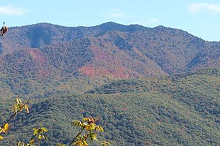
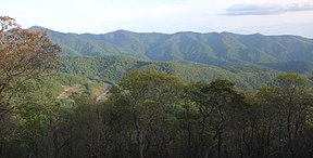
The Plott Balsams are part of the Blue Ridge Mountain Province of the southern Appalachian Mountains. The Plott Balsams stretch from Sylva in the Tuckasegee River valley to the southwest to Maggie Valley in the northeast. The Great Smoky Mountains border the Plott Balsams to the north, and the Great Balsam Mountains border the range to the south. The range comprises parts of Jackson County and Haywood County. The Nantahala National Forest protects much of the south side of the Plott Balsams. The Qualla Boundary, which is the reserve of the Eastern Band of Cherokee Indians, includes parts of the range's northwest section along Soco Creek.
Waterrock Knob, which has an elevation of 6,292 feet (1,918 m), is the highest summit in the Plott Balsams. Four other summits in the range rise above 6,000 feet, namely 6,240-foot (1,900 m) Mount Lyn Lowry, 6,240-foot (1,900 m) Browning Knob, 6,088-foot (1,856 m) Plott Balsam Mountain, and 6,032-foot (1,839 m) Yellow Face. Other notable summits include the Pinnacle, which overlooks the Sylva area to the south, 5,810-foot (1,770 m) Blackrock Mountain (near Yellow Face), and 5,875-foot (1,791 m) Campbell Lick, which overlooks Maggie Valley. A stand of Southern Appalachian spruce–fir forest cover the range's upper elevations.
The Blue Ridge Parkway traverses the slopes of the highest mountains in the Plott Balsams, connecting Soco Gap and Balsam Gap. A short road connects the parkway to an overlook and a National Park Service visitor contact station and bookstore near the summit of Waterrock Knob.
The city of Sylva maintains a municipal park along Fisher Creek in the southeast section of the range. A memorial dedicated to leukemia victim Lyn Lowry, who died in 1962, is situated atop Lowry's namesake mountain. The memorial includes a 60-foot (18 m) cross that is lit up at night, making it visible for miles from the surrounding towns.
The Plott Balsams are named for the Plott family, whose ancestor, (Johannes) George Plott (c. 1733-1815), immigrated to North Carolina in the late 18th century from Germany. The Plott Hound, a breed of hunting dog, is named after the range. [1]

The Appalachian Mountains, often called the Appalachians, are a mountain range in eastern to northeastern North America. Here, the term "Appalachian" refers to several different regions associated with the mountain range, and its surrounding terrain. The general definition used is one followed by the United States Geological Survey and the Geological Survey of Canada to describe the respective countries' physiographic regions. The US uses the term Appalachian Highlands and Canada uses the term Appalachian Uplands..

The Blue Ridge Parkway is a National Parkway and All-American Road in the United States, noted for its scenic beauty. The parkway, which is America's longest linear park, runs for 469 miles (755 km) through 29 counties in Virginia and North Carolina, linking Shenandoah National Park to Great Smoky Mountains National Park. It runs mostly along the spine of the Blue Ridge, a major mountain chain that is part of the Appalachian Mountains. Its southern terminus is at U.S. Route 441 (US 441) on the boundary between Great Smoky Mountains National Park and the Qualla Boundary of the Eastern Band of Cherokee Indians in North Carolina, from which it travels north to Shenandoah National Park in Virginia. The roadway continues through Shenandoah as Skyline Drive, a similar scenic road which is managed by a different National Park Service unit. Both Skyline Drive and the Virginia portion of the Blue Ridge Parkway are part of Virginia State Route 48 (SR 48), though this designation is not signed.

The Blue Ridge Mountains are a physiographic province of the larger Appalachian Highlands range. The mountain range is located in the Eastern United States, and extends 550 miles southwest from southern Pennsylvania through Maryland, West Virginia, Virginia, North Carolina, South Carolina, Tennessee, and Georgia. The province consists of northern and southern physiographic regions, which divide near the Roanoke River gap. To the west of the Blue Ridge, between it and the bulk of the Appalachians, lies the Great Appalachian Valley, bordered on the west by the Ridge and Valley province of the Appalachian range.

Mount Pisgah is a mountain in the Appalachian mountain range and part of the Blue Ridge Mountains of North Carolina, United States. The mountain's height is 5,721 feet above sea level, and it sits approximately 15 miles southwest of Asheville, near the crossing of the boundaries of Buncombe, Haywood, Henderson and Transylvania counties. It is located on the border of Buncombe and Haywood counties, close to the point where Henderson and Transylvania meet them, but not actually within the latter two counties. The mountain is easily accessible via a hiking trail from the Blue Ridge Parkway, near the Pisgah Inn.

The Black Mountains are a mountain range in western North Carolina, in the southeastern United States. They are part of the Blue Ridge Province of the Southern Appalachian Mountains. The Black Mountains are the highest mountains in the Eastern United States. The range takes its name from the dark appearance of the red spruce and Fraser fir trees that form a spruce-fir forest on the upper slopes which contrasts with the brown or lighter green appearance of the deciduous trees at lower elevations. The Eastern Continental Divide, which runs along the eastern Blue Ridge crest, intersects the southern tip of the Black Mountain range.

The Murphy Branch is a branch line operated by the Western North Carolina Railroad, later the Richmond and Danville, Southern Railway, the Norfolk Southern Railway (NS) and today the Blue Ridge Southern Railroad. The branch runs between Asheville, North Carolina in the east and Murphy in the west.

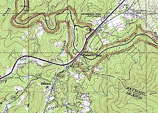
Balsam Gap is a mountain pass between the Plott Balsam Range to the northwest and the Great Balsam Mountains to the southeast on the county line dividing Haywood and Jackson counties in the U.S. state of North Carolina.

Waterrock Knob is a mountain peak in the U.S. state of North Carolina. It is the highest peak in the Plott Balsams and is the 16th-highest mountain in the Eastern United States.

Balsam is an unincorporated community in Jackson County, North Carolina, United States. Named after the Balsam Mountains, it is home of the highest standard-gauge railroad east of the Rocky Mountains, at 3,315 feet (1,010 m).

Mount Kephart is a mountain in the central Great Smoky Mountains, located in the Southeastern United States. The Appalachian Trail crosses the mountain's south slope, making it a destination for thru-hikers. The Jumpoff, a 1,000-foot (300 m) cliff on the northeast side of the mountain, has views of the central and eastern Smokies. A stand of Southern Appalachian spruce-fir forest coats the mountain's upper elevations.

Black Balsam Knob, also known as Black Balsam Bald, is in the Pisgah National Forest southwest of Asheville, North Carolina, near milepost 420 on the Blue Ridge Parkway. It is the second highest mountain in the Great Balsam Mountains. The Great Balsams are within the Blue Ridge Mountains, which are part of the Appalachian Mountains. It is the 23rd highest of the 40 mountains in North Carolina over 6000 feet.

Marks Knob is a mountain in the central Great Smoky Mountains, in the southeastern United States. It has an elevation of 6,169 feet (1,880 m), with 249 feet (76 m) of clean prominence. Its summit is a popular bushwhacking destination and one of the most difficult-to-reach summits of the Southern Sixers.
Eaglenest Mountain is a mountain located 2 miles south of Maggie Valley, North Carolina in Haywood County. It is part of the Plott Balsams, a range of the Appalachian Mountains, and less than a mile south of North Eaglenest Mountain, a higher mountain which used to be called Mount Junaluska and is the highest mountain overlooking Lake Junaluska from the southwest. The closest town that is accessible by road is Hazelwood. Hazelwood was absorbed into the larger incorporated Town of Waynesville in 1995.

North Eaglenest Mountain is a mountain located less than 2 miles (3.2 km) south of Maggie Valley, North Carolina, US, in Haywood County. It is part of the Plott Balsams, a range of the Appalachian Mountains, and less than a mile north of Eaglenest Mountain. It used to be called Mount Junaluska and is the highest mountain overlooking Lake Junaluska from the west.

Richland Balsam is a mountain in the Great Balsam Mountains in the U.S. state of North Carolina. Rising to an elevation of 6,410 feet (1,950 m), it is the highest mountain in the Great Balsam range, is among the 20 highest summits in the Appalachian range, and is the ninth highest peak in the Eastern United States. The Blue Ridge Parkway reaches an elevation of 6,053 feet (1,845 m)—the parkway's highest point—as it passes over Richland Balsam's southwestern slope. The Jackson County-Haywood County line crosses the mountain's summit.

The southern Appalachian spruce–fir forest is an ecoregion of the temperate coniferous forests biome, a type of montane coniferous forest that grows in the highest elevations in the southern Appalachian Mountains of the eastern United States. The ecoregion is the highest and coldest forest type in the Appalachian range, thriving in elevations above 5,500 feet (1,700 m) where the climate is too harsh to support the broad-leaved hardwood forest that dominates the region's lower elevations. A relict of the last Ice Age, this forest type covers just over 100 square miles (260 km2) and is considered the second-most endangered ecosystem in the United States.

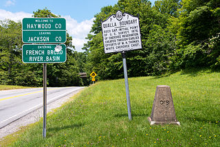
Soco Gap is a mountain pass between the Plott Balsams to the south and the Great Balsam Mountains to the north. The gap is the eastern point of the Qualla Boundary, which marks the territory held as a land trust for the federally recognized Eastern Band of Cherokee Indians. The gap separates Haywood and Jackson counties and separates the river basins to the French Broad River and the Little Tennessee River.


