List of mountains in North Carolina

Last updated

Mount Mitchell is the highest peak in the U.S. state of North Carolina Mount Mitchell viewed from Mount Mitchell State Park Restaurant, Oct 2016.jpg
Mount Mitchell is the highest peak in the U.S. state of North Carolina

This article lists notable mountains in the U.S. state of North Carolina.

Contents

Highest mountains

The following sortable table lists the 20 highest mountain peaks of North Carolina with at least 160 feet (49 m) of topographic prominence. [1] Listings found elsewhere may not necessarily agree because they do not include each of these mountains.
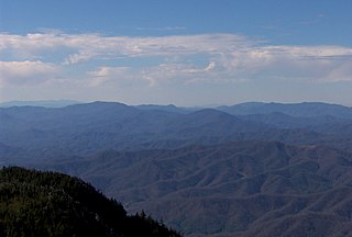
Clingman's Dome, third highest mountain in North Carolina Clingmans Dome observation tower TN1.jpg
Clingman's Dome, third highest mountain in North Carolina
From left: Old Black, Mount Kephart, Mount Guyot and Mount Chapman, 9th, 16th, 4th, and 7th highest mountains, respectively, in North Carolina Old Black, Mount Guyot and Mount Chapman viewed from Clingmans Dome, May 2017 (cropped).jpg
From left: Old Black, Mount Kephart, Mount Guyot and Mount Chapman, 9th, 16th, 4th, and 7th highest mountains, respectively, in North Carolina
Richland Balsam, 8th highest mountain in North Carolina Richland Balsam viewed from Cowee Mountain Overlook, Oct 2016.jpg
Richland Balsam, 8th highest mountain in North Carolina
Waterrock Knob, 12th highest mountain in North Carolina Waterrock Knob viewed from the Plott Balsams overlook, May 2017 1.jpg
Waterrock Knob, 12th highest mountain in North Carolina
The 20 highest summits of North Carolina with at least 160 feet of topographic prominence

Rank Summit Mountain Range Elevation Prominence Isolation Location
1 Mount Mitchell [2] [lower-alpha 1] Black Mountains 6,684 ft
2037 m
6,094 ft
1857 m
1,189 mi
1,913 km
35°45′53″N82°15′54″W / 35.764857°N 82.26506°W / 35.764857; -82.26506 (Mount Mitchell)
2 Mount Craig [3] Black Mountains 6,647 ft
2026 m
285 ft
87 m
0.89 mi
1.44 km
35°46′39″N82°15′42″W / 35.777584°N 82.261759°W / 35.777584; -82.261759 (Mount Craig (North Carolina))
3 Clingmans Dome [4] [5] [lower-alpha 2] Great Smoky Mountains 6,643 ft
2025 m
4,505 ft
1373 m
70.7 mi
113.9 km
35°33′47″N83°29′55″W / 35.562919°N 83.498601°W / 35.562919; -83.498601 (Clingmans Dome)
4 Mount Guyot [6] [lower-alpha 3] Great Smoky Mountains 6,621 ft
2018 m
1,581 ft
482 m
16.74 mi
26.9 km
35°42′19″N83°15′28″W / 35.705311°N 83.257683°W / 35.705311; -83.257683 (Mount Guyot)
5 Balsam Cone [7] Black Mountains 6,600 ft
2012 m
360 ft
110 m
0.9 mi
1.45 km
35°47′23″N82°15′21″W / 35.789705°N 82.255846°W / 35.789705; -82.255846 (Balsam Cone)
6 Mount Gibbes [8] Black Mountains 6,520 ft
1987 m
400 ft
122 m
2.1 mi
3.38 km
35°44′21″N82°17′07″W / 35.739124°N 82.285235°W / 35.739124; -82.285235 (Mount Gibbes)
7 Mount Chapman [9] [lower-alpha 4] Great Smoky Mountains 6,417 ft
1956 m
577 ft
176 m
1.49 mi
2.39 km
35°41′12″N83°16′16″W / 35.686712°N 83.271089°W / 35.686712; -83.271089 (Mount Chapman)
8 Richland Balsam [10] Great Balsam Mountains 6,410 ft
1954 m
3,010 ft
917 m
27.1 mi
43.6 km
35°22′03″N82°59′25″W / 35.367588°N 82.990335°W / 35.367588; -82.990335 (Richland Balsam)
9 Old Black [11] [lower-alpha 5] Great Smoky Mountains 6,370 ft
1942 m
170 ft
52 m
0.68 mi
1.1 km
35°42′54″N83°15′20″W / 35.715047°N 83.255426°W / 35.715047; -83.255426 (Old Black)
10 Celo Knob [12] Black Mountains 6,327 ft
1928 m
607 ft
185 m
3.52 mi
5.66 km
35°51′09″N82°14′55″W / 35.852423°N 82.248678°W / 35.852423; -82.248678 (Celo Knob)
11 Blackstock Knob [13] Black Mountains 6,320 ft
1926 m
440 ft
134 m
1.6 mi
2.57 km
35°44′17″N82°19′07″W / 35.738063°N 82.318615°W / 35.738063; -82.318615 (Blackstock Knob)
12 Waterrock Knob [14] Plott Balsams 6,292 ft
1918 m
1,947 ft
593 m
10.7 mi
17.22 km
35°27′51″N83°08′16″W / 35.464088°N 83.137812°W / 35.464088; -83.137812 (Waterrock Knob)
13 Roan High Knob [15] [16] [lower-alpha 6] Unaka Range 6,285 ft
1916 m
3,485 ft
1062 m
18.8 mi
30.3 km
36°06′16″N82°07′21″W / 36.104561°N 82.122448°W / 36.104561; -82.122448 (Roan High Knob)
14 Mount Lyn Lowry [17] Plott Balsams 6,240 ft
1902 m
360 ft
110 m
1.5 mi
2.41 km
35°27′49″N83°06′38″W / 35.46371°N 83.110627°W / 35.46371; -83.110627 (Mount Lyn Lowry)
15 Luftee Knob [18] Great Smoky Mountains 6,234 ft
1900 m
314 ft
96 m
2.5 mi
4.02 km
35°41′33″N83°12′55″W / 35.692447°N 83.215382°W / 35.692447; -83.215382 (Celo Knob)
16 Mount Kephart [19] [20] [lower-alpha 7] Great Smoky Mountains 6,217 ft
1895 m
657 ft
200 m
2.8 mi
4.51 km
35°37′52″N83°23′24″W / 35.630988°N 83.389906°W / 35.630988; -83.389906 (Mount Kephart)
17 Black Balsam Knob [21] Great Balsam Mountains 6,214 ft
1894 m
989 ft
301 m
7.1 mi
11.43 km
35°19′41″N82°52′28″W / 35.328003°N 82.874571°W / 35.328003; -82.874571 (Black Balsam Knob)
18 Winter Star Mountain [22] Black Mountains 6,203 ft
1891 m
283 ft
86 m
1.1 mi
1.77 km
35°49′04″N82°14′57″W / 35.817668°N 82.249273°W / 35.817668; -82.249273 (Winter Star Mountain)
19 Mount Collins [23] [lower-alpha 8] Great Smoky Mountains 6,188 ft
1886 m
465 ft
142 m
1.7 mi
2.74 km
35°35′11″N83°28′23″W / 35.586275°N 83.473046°W / 35.586275; -83.473046 (Mount Collins)
20 Marks Knob [24] Great Smoky Mountains 6,169 ft
1880 m
249 ft
76 m
1.4 mi
2.25 km
35°40′48″N83°14′55″W / 35.67999°N 83.248498°W / 35.67999; -83.248498 (Marks Knob)

Other mountains

Cold Mountain Cold Mountain from Haywood-Jackson Overlook, Oct 2016 2.jpg
Cold Mountain
Grandfather Mountain Grandfather Mountain peaks from Half Moon Overlook, Oct 2016.jpg
Grandfather Mountain
Pilot Mountain Big Pinnacle of Pilot Mountain high res.jpg
Pilot Mountain
Stone Mountain Stonemtnnc.jpeg
Stone Mountain
Whiteside Mountain Whiteside Mountain viewed from the top.JPG
Whiteside Mountain

See also

Notes

  1. Highest mountain in eastern North America.
  2. Partially in Tennessee; highest mountain in Tennessee.
  3. Partially in Tennessee.
  4. Partially in Tennessee.
  5. Partially in Tennessee.
  6. Partially in Tennessee.
  7. Partially in Tennessee.
  8. Partially in Tennessee.

Related Research Articles

<span class="mw-page-title-main">Clingmans Dome</span> Mountain, highest peak in Tennessee, United States

Clingmans Dome is a mountain in the Great Smoky Mountains of Tennessee and North Carolina in the southeastern United States. Its name in Cherokee is Kuwahi or Kuwohi, meaning "mulberry place." At an elevation of 6,643 feet (2,025 m), it is the highest mountain in the Great Smoky Mountains National Park, the highest point in the state of Tennessee, and the highest point along the 2,192-mile (3,528 km) Appalachian Trail. It is also the third highest point in mainland Eastern North America, after Mount Mitchell and Mount Craig.

<span class="mw-page-title-main">Unaka Range</span> Mountain range in the United States of America

The Unaka Range is a mountain range on the border of Tennessee and North Carolina, in the southeastern United States. It is a subrange of the Appalachian Mountains and is part of the Blue Ridge Mountains physiographic province. The Unakas stretch approximately from the Nolichucky River in the south to the Watauga River in the north.

<span class="mw-page-title-main">Black Mountains (North Carolina)</span> Mountain range in western North Carolina, US

The Black Mountains are a mountain range in western North Carolina, in the southeastern United States. They are part of the Blue Ridge Province of the Southern Appalachian Mountains. The Black Mountains are the highest mountains in the Eastern United States. The range takes its name from the dark appearance of the red spruce and Fraser fir trees that form a spruce-fir forest on the upper slopes which contrasts with the brown or lighter green appearance of the deciduous trees at lower elevations. The Eastern Continental Divide, which runs along the eastern Blue Ridge crest, intersects the southern tip of the Black Mountain range.

<span class="mw-page-title-main">Roan Mountain (Roan Highlands)</span>

Roan Mountain is a 6,285 ft (1,916 m) mountain straddling the North Carolina/Tennessee border in the Unaka Range of the Southern Appalachian Mountains in the Southeastern United States. The range's highpoint, Roan is clad in a dense stand of Southern Appalachian spruce-fir forest, and includes the world's largest natural rhododendron garden, and the longest stretch of grassy bald in the Appalachian range. The Roan Highlands also contain the highest quality remaining stretch of Fraser fir forest throughout the tree's entire range. The Cherokee National Forest and Pisgah National Forest converge atop the mountain, with Roan Mountain State Park located near its northern base. The Appalachian Trail traverses most of the Roan's crest. The Roan High Knob Shelter is the highest back-country shelter on the entire 2,174-mile (3,499 km) trail.

<span class="mw-page-title-main">Silers Bald</span>

Silers Bald is a mountain in the western Great Smoky Mountains, located in the Southeastern United States. Its proximity to Clingmans Dome and its location along the Appalachian Trail make it a popular hiking destination.

<span class="mw-page-title-main">Mount Kephart</span> Mountain in United States of America

Mount Kephart is a mountain in the central Great Smoky Mountains, located in the Southeastern United States. The Appalachian Trail crosses the mountain's south slope, making it a destination for thru-hikers. The Jumpoff, a 1,000-foot (300 m) cliff on the northeast side of the mountain, has views of the central and eastern Smokies. A stand of Southern Appalachian spruce-fir forest coats the mountain's upper elevations.

<span class="mw-page-title-main">Old Black (Great Smoky Mountains)</span> Mountain in United States of America

Old Black is a mountain in the Great Smoky Mountains, located in the Southeastern United States. While often overshadowed by Mount Guyot, its higher neighbor to the south, Old Black is the 5th-highest mountain in Tennessee and the 7th-highest in the Great Smoky Mountains National Park. The Appalachian Trail crosses its western slope, connecting the Cosby-area trail system with the heart of the Eastern Smokies.

<span class="mw-page-title-main">Mount Guyot (Great Smoky Mountains)</span>

Mount Guyot is a mountain in the eastern Great Smoky Mountains, located in the southeastern United States. At 6,621 feet (2,018 m) in elevation, Guyot is the fourth-highest summit in the Eastern U.S., and the second-highest in the Great Smoky Mountains National Park. While the mountain is remote, the Appalachian Trail crosses its south slope, passing to within 1,000 feet (300 m) of the summit.

<span class="mw-page-title-main">Andrews Bald</span>

Andrews Bald is a mountain in the Great Smoky Mountains, located in the Southeastern United States. It has an elevation of 5,920 feet (1,800 m) above sea level, making it the highest grassy bald in the Great Smoky Mountains National Park. The mountain is one of two grassy balds maintained in the range by the park service. The other is Gregory Bald, in the western Smokies.

<span class="mw-page-title-main">Black Balsam Knob</span>

Black Balsam Knob, also known as Black Balsam Bald, is in the Pisgah National Forest southwest of Asheville, North Carolina, near milepost 420 on the Blue Ridge Parkway. It is the second highest mountain in the Great Balsam Mountains. The Great Balsams are within the Blue Ridge Mountains, which are part of the Appalachian Mountains. It is the 23rd highest of the 40 mountains in North Carolina over 6000 feet.

<span class="mw-page-title-main">Great Balsam Mountains</span> Mountain range in North Carolina, United States

The Great Balsam Mountains, or Balsam Mountains, are in the mountain region of western North Carolina, United States. The Great Balsams are a subrange of the Blue Ridge Mountains, which in turn are a part of the Appalachian Mountains. The most famous peak in the Great Balsam range is Cold Mountain, which is the centerpiece of author Charles Frazier's bestselling novel Cold Mountain.

<span class="mw-page-title-main">Sugarland Mountain Trail</span>

The Sugarland Mountain Trail is an American hiking trail, in the Great Smoky Mountains National Park of Sevier County, Tennessee. The trail traverses Sugarland Mountain, a massive ridge running perpendicular to the main crest of the Smokies and effectively dividing the park's north-central section from its northwestern section. Sugarland Mountain is flanked by the deep upper valleys of two of the park's major watersheds— the West Fork of the Little Pigeon River and Little River. The trail passes through several forest types, including deciduous forest at lower elevations, heaths ("hells") along the mountain's backbone formations, and a stand of Southern Appalachian spruce-fir forest in the upper elevations. Occasional breaks in the foliage allow for views of Mount Le Conte and Sevier County to the east and Blanket Mountain and the ridges above Elkmont to the west.

<span class="mw-page-title-main">Mount Craig (North Carolina)</span> Mountain in North Carolina, United States

Mount Craig, 6,647 feet (2,026 m), is the second highest peak of the Appalachian Mountains and second only to 6,684 feet (2,037 m) Mount Mitchell in eastern North America. It is located in the Black Mountains in Yancey County, North Carolina. The mountain lies about a mile (2 km) north of Mount Mitchell and is within Mount Mitchell State Park and the Pisgah National Forest.

<span class="mw-page-title-main">Southern Sixers</span> Mountains in the Southern United States with elevations greater than 6,000 feet

In peak bagging terminology in the United States, the Southern Sixers refers to the group of mountains in the southern states of North Carolina and Tennessee with elevations above sea level of at least six thousand feet. The southern sixers are the tallest group of mountains in the eastern United States and the only peaks in the Appalachian Mountains besides New Hampshire's Mount Washington to exceed 6,000 feet.

<span class="mw-page-title-main">Marks Knob</span>

Marks Knob is a mountain in the Great Smoky Mountains, in the southeastern United States. It has an elevation of 6,169 feet (1,880 m), with 249 feet (76 m) of clean prominence. Its summit— located near the center of the Eastern Smokies amidst a dense stand of Southern Appalachian spruce-fir forest— is a popular bushwhacking destination and one of the most difficult-to-reach summits of the Southern Sixers.

<span class="mw-page-title-main">North Eaglenest Mountain</span>

North Eaglenest Mountain is a mountain located less than 2 miles (3.2 km) south of Maggie Valley, North Carolina, US, in Haywood County. It is part of the Plott Balsams, a range of the Appalachian Mountains, and less than a mile north of Eaglenest Mountain. It used to be called Mount Junaluska and is the highest mountain overlooking Lake Junaluska from the west.

<span class="mw-page-title-main">Southern Appalachian spruce–fir forest</span> Ecoregion of the southern Appalachian Mountains of the eastern United States

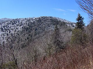
The southern Appalachian spruce–fir forest is an ecoregion of the temperate coniferous forests biome, a type of montane coniferous forest that grows in the highest elevations in the southern Appalachian Mountains of the eastern United States.

References

  1. North Carolina 5000-foot Peaks. Peakbagger.com Retrieved 20 August 2016.
  2. "Mount Mitchell". Peakbagger.com. Retrieved August 20, 2016.
  3. "Mount Craig". Peakbagger.com. Retrieved August 20, 2016.
  4. "Clingmans Dome". Peakbagger.com. Retrieved August 20, 2016.
  5. "Clingmans Dome". Peakware.com. Archived from the original on 2016-03-04. Retrieved August 20, 2016.
  6. "Mount Guyot". Peakbagger.com. Retrieved August 22, 2016.
  7. "Balsam Cone". Peakbagger.com. Retrieved February 21, 2016.
  8. "Mount Gibbes". Peakbagger.com. Retrieved February 21, 2016.
  9. "Mount Chapman". Peakbagger.com. Retrieved February 21, 2016.
  10. "Richland Balsam". Peakbagger.com. Retrieved February 21, 2016.
  11. "Old Black". Peakbagger.com. Retrieved February 21, 2016.
  12. "Celo Knob". Peakbagger.com. Retrieved February 21, 2016.
  13. "Blackstock Knob". Peakbagger.com. Retrieved February 21, 2016.
  14. "Waterrock Knob". Peakbagger.com. Retrieved February 21, 2016.
  15. "Roan High Knob". Peakbagger.com. Retrieved February 21, 2016.
  16. "Roan High Knob". Peakware.com. Archived from the original on 2016-03-04. Retrieved February 21, 2016.
  17. "Mount Lyn Lowry". Peakbagger.com. Retrieved February 21, 2016.
  18. "Luftee Knob". Peakbagger.com. Retrieved February 21, 2016.
  19. "Mount Kephart". Peakbagger.com. Retrieved February 21, 2016.
  20. "Mount Kephart". Peakware.com. Archived from the original on 2016-03-04. Retrieved February 21, 2016.
  21. "Black Balsam Knob". Peakbagger.com. Retrieved February 21, 2016.
  22. "Winter Star Mountain". Peakbagger.com. Retrieved February 21, 2016.
  23. "Mount Collins". Peakbagger.com. Retrieved February 21, 2016.
  24. "Marks Knob". Peakbagger.com. Retrieved February 21, 2016.