Mullaquana, South Australia

Last updated

Mullaquana
South Australia
Australia South Australia location map.svg
Red pog.svg
Mullaquana
Mullaquana, South Australia
Coordinates 33°03′37″S137°31′40″E / 33.060206°S 137.527901°E / -33.060206; 137.527901 [1]
Population272 (SAL 2021) [2]
Established2000 [1]
Postcode(s) 5601 [1]
Elevation9 m (30 ft)airport [3]
Time zone ACST (UTC+9:30)
 • Summer (DST) ACST (UTC+10:30)
LGA(s) City of Whyalla
unincorporated area [1] [4]
Region Eyre Western [1]
County York [1]
State electorate(s) Giles [5]
Federal division(s) Grey [6]
Mean max temp [3] Mean min temp [3] Annual rainfall [3]
23.8 °C
75 °F
11.5 °C
53 °F
263.4 mm
10.4 in
Suburbs around Mullaquana:
Middleback Range Whyalla Norrie
Whyalla Stuart
Whyalla Playford
Whyalla (suburb)
Middleback Range Mullaquana Spencer Gulf
Middleback Range Middleback Range Spencer Gulf
FootnotesAdjoining suburbs [7] [8]

Mullaquana is a suburb in the Australian state of South Australia located immediately adjoining the southern side of the city of Whyalla in the north east corner of Eyre Peninsula. The locality is bounded by Lincoln Highway to its northern side, the suburb of Whyalla to the east and by and the Spencer Gulf coastline to the south east. [8]

Its boundaries were established in June 2000 and revised again in 2011. Its name is derived from Mullaquana Road which is located within the locality and was selected instead of “Eight Mile Creek” in order to avoid confusion with a locality in the south east of South Australia. [1] [8] [9]

Mullaquana is located within the federal Division of Grey, the state electoral district of Giles and with the portion on western side of Horseshoe Road being within the boundary of local government area of the City of Whyalla and the portion on the eastern side being within the unincorporated areas of South Australia. [4] [5] [6] [8]

The land within the City of Whyalla jurisdiction contains the Whyalla Airport and areas zoned for both commercial activity and residential use. The land within the unincorporated area is one of two such parcels of land associated with the city of Whyalla which is considered by the Government of South Australia as being “strategically important to the state” due to their role in the production cycle of steel. [4] [10]

See also

Related Research Articles

<span class="mw-page-title-main">City of Whyalla</span> Local government area in South Australia

The City of Whyalla is a local government area in South Australia, located at the north-east corner of the Eyre Peninsula. It was established in 1970, replacing the town commission, which had been running the town previously. The district is mostly industrial, with many large companies having factories in the city.

<span class="mw-page-title-main">Nullarbor, South Australia</span> Town in South Australia

Nullarbor is a locality in the Australian state of South Australia located 295 kilometres (183 mi) to the west of the town of Ceduna in the western part of the state immediately adjoining the border with Western Australia.

<span class="mw-page-title-main">Port Augusta West, South Australia</span> Suburb of Port Augusta, South Australia

Port Augusta West is a suburb of Port Augusta, South Australia.

Cultana is a locality on the northeastern part of Eyre Peninsula in South Australia. It is much larger than the original locality, and includes the Australian Army's Cultana Training Area. It includes the former Baxter Detention Centre which operated from 2002 to 2007. It spans the Lincoln Highway and Iron Knob to Whyalla Road, as well as being bordered by the Eyre Highway east of Iron Knob.

Whyalla Barson is a suburb in South Australia located on the northern side of the city of Whyalla in the north east corner of Eyre Peninsula. It is named after Thomas Leonard Barson, superintendent of BHP in Whyalla from 1933 to 1938. The suburb was first established in 2011 with revisions to boundaries occurring both in 2013 and 2014.

False Bay is a locality in South Australia on the north east corner of Eyre Peninsula located north of the city of Whyalla overlooking the bay in Spencer Gulf known as False Bay.

Yellabinna is a locality in the Australian state of South Australia located to the north of the town of Ceduna in the western part of the state.

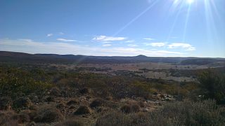
Secret Rocks is a locality in the Australian state of South Australia located on the Eyre Peninsula about 36 kilometres to the east of the town of Kimba and about 227 kilometres north west of the state capital of Adelaide.

<span class="mw-page-title-main">Gluepot, South Australia</span> Suburb of Pastoral Unincorporated Area, South Australia

Gluepot is a locality in the Australian state of South Australia located about 180 kilometres north-east of the state capital of Adelaide and about 40 kilometres to the north of the town of Waikerie.

Danggali is a locality in the Australian state of South Australia located about 70 kilometres north of the town of Renmark and about 230 kilometres north east of the state capital of Adelaide.

Calperum Station is a locality in the Australian state of South Australia located on the northern side of the Murray River about 10 kilometres to the north of the town of Renmark and about 250 kilometres east of the centre of the capital city of Adelaide.

Middleback Range is a locality in the Australian state of South Australia located in the north east corner of Eyre Peninsula to the south-west of the city of Whyalla and extending from the coastline of Spencer Gulf in the east to the west side of the southern end of the Middleback Range in the west.

<span class="mw-page-title-main">Gawler Ranges, South Australia</span> Suburb of Pastoral Unincorporated Area, Wudinna District Council, South Australia

Gawler Ranges is a locality in the Australian state of South Australia located on Eyre Peninsula about 380 kilometres north-west of the Adelaide city centre and about 48 kilometres north of the town centre of Wudinna and which is associated with the protected area known as the Gawler Ranges National Park.

Tooligie is a small town in South Australia on the Eyre Peninsula about 290 kilometres west of the Adelaide city centre and about 84 kilometres north of the city of Port Lincoln.

Blanche Harbor is a locality in South Australia located on the east coast of the Eyre Peninsula overlooking Spencer Gulf about 260 kilometres north north-west of the Adelaide city centre and about 20 kilometres south of the centre of Port Augusta.

Cowleds Landing is a locality in the Australian state of South Australia located on the east coast of the Eyre Peninsula overlooking Spencer Gulf about 225 kilometres north-west of the state capital of Adelaide and about 18 kilometres south-west of the municipal seat of Whyalla.

Murminnie Beach is a locality in the Australian state of South Australia located on the east coast of the Eyre Peninsula overlooking Spencer Gulf about 212 kilometres north-west of the state capital of Adelaide and about 36 kilometres south-west of the municipal seat of Whyalla.

<span class="mw-page-title-main">Lake Gilles, South Australia</span> Suburb of Pastoral Unincorporated Area, South Australia

Lake Gilles is a locality in the Australian state of South Australia located on the Eyre Peninsula about 278 kilometres north west of the state capital of Adelaide and about 35 kilometres to the north-east of the town of Kimba.

Pureba is a locality in the Australian state of South Australia located on the west coast of Eyre Peninsula and on land to the immediate north of the peninsula about 528 kilometres north-west of the state capital of Adelaide and about 52 kilometres north-east and 90 kilometres north respectively of the municipal seats of Ceduna and Streaky Bay.

Mount Willoughby is a locality in the Australian state of South Australia located about 837 kilometres north-west of the capital city of Adelaide and about 84 kilometres north-west of the town of Coober Pedy.

References

  1. 1 2 3 4 5 6 7 "Search results for 'Mullaquana, LOCB' with the following datasets selected - 'Suburbs and localities', 'Counties', 'Government Towns', 'Local Government Areas', 'SA Government Regions' and 'Gazetteer'". Location SA Map Viewer. South Australian Government. Retrieved 27 July 2019.
  2. Australian Bureau of Statistics (28 June 2022). "Mullaquana (suburb and locality)". Australian Census 2021 QuickStats. Retrieved 28 June 2022.  OOjs UI icon edit-ltr-progressive.svg
  3. 1 2 3 4 "Monthly climate statistics: Summary statistics Whyalla Aero (nearest weather station)". Commonwealth of Australia , Bureau of Meteorology. Retrieved 27 July 2019.
  4. 1 2 3 "Development Plan, Land Not Within a Council Area Eyre, Far North, Riverland and Whyalla Consolidated – 18 October 2012". Department of Planning Transport and Infrastructure. 2012. pp. 16 & 349. Archived from the original on 24 September 2015. Retrieved 4 September 2015.
  5. 1 2 "District of Giles Background Profile". ELECTORAL COMMISSION SA. Retrieved 20 August 2015.
  6. 1 2 "Federal electoral division of Grey, boundary gazetted 16 December 2011" (PDF). Australian Electoral Commission. Retrieved 20 August 2015.
  7. Cultana and Adjoining Locality Boundries [sic] (PDF) (Map). Department for Planning, Transport and Infrastructure, Government of South Australia. Rack Plan 1074. Archived from the original (PDF) on 24 September 2015. Retrieved 5 September 2015.
  8. 1 2 3 4 City of Whyalla - Additional Locality Boundaries (PDF) (Map). Department for Planning, Transport and Infrastructure, Government of South Australia. Rack Plan 1017. Archived from the original (PDF) on 25 March 2012. Retrieved 5 September 2015.
  9. Kentish, Peter (29 September 2011). "Notice to Discontinue the Name and Assign a Name and a Boundary to a Place and to Alter the boundary of Places" (PDF). Department for Planning, Transport and Infrastructure, Government of South Australia. DTEI.2010/12582/01. Archived from the original (PDF) on 4 March 2016. Retrieved 5 September 2015.
  10. "Development Plan, Whyalla Council, Consolidated – 19 February 2015". Department of Planning Transport and Infrastructure. 2015. pp. 207, 208 & 289. Archived from the original on 24 September 2015. Retrieved 5 September 2015.