
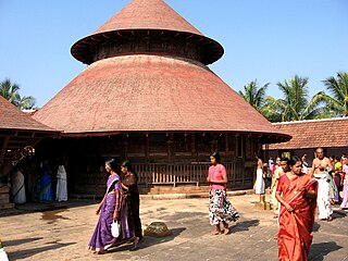
Irinjalakuda is a municipal town in Thrissur district, Kerala, India. Irinjalakuda is a revenue division and the headquarters of Mukundapuram Taluk. It is known for the Koodalmanikyam Temple and the Thachudaya Kaimals who had princely status until 1971.

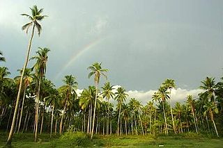
Nemmara is a town in the Palakkad district, Kerala, India. It is administrated by the Nemmara gram panchayat. Nemmara hosts the Nenmara Vallanghi Vela, a yearly festival jointly organised with Vallangi village. Nemmara is the entry point to the Nelliampathi hills, which are located at the foothills of Western Ghats.
Kizhakkancherry is a gram panchayat in the Palakkad district, state of Kerala, India. It is a local government organisation that serves the villages of Kizhakkencheri-I and Kizhakkencheri-II. It was formed in the year of 1951 and is the fourth largest grama panchayath in Kerala. It covers an area of 112.56 km2 and comprises 22 wards. The boundaries are Vadakkencherry (north), Pananjeri (south), Vandazhy (east) and Kannambra (west). The village is located 37.4 km from the city of Palakkad and 34.9 km from Thrissur.
Pavaratty is a census town in Thrissur district in the Indian state of Kerala.Pavaratty is situated in the coastal area of Chavakkad Taluk in Thrissur District. The town is about 23 km north-west of Thrissur town and 5 km south of Guruvayoor. It is the site of St. Joseph's Parish Shrine, Pavaratty and also lies near Palayur (4 km), famous for the Palayur Church. Nearby airports are Cochin International Airport (77 km) and Calicut Airport (95 km). The nearest railheads are at Guruvayoor and Thrissur. Nearest bus stations are Thrissur Bus Station and Guruvayoor Bus Station. From Thrissur, the shortest way to Pavaratty is via Amala-Parappur-Puvathur.

Chittur is a green town in Palakkad district of Kerala, South India. It is the headquarters of Chittur taluk, situated 13 km away from Palakkad towards the south-east, on the banks of Kannadipuzha, a major headstream of Bharathapuzha, the second longest river in Kerala. It was once part of the erstwhile Kingdom of Cochin.
Ashtamichira is a village in Thrissur district in the Indian state of Kerala.

Puthukkad is a town situated on the banks of Kurumali River, also known as Mupliyam River, in Kerala. The town is 15 km to the south of Thrissur, 16 km to the north of Chalakudy, and 1.2 km west of Cheruval. The National highway NH 544 passes through thi town.
Anchal is a town located in the centre of the Kollam district of Kerala, India, between National Highway 744 and Main Central Road.
Kollengode is one of the major towns of Palakkad district, Kerala, India. Kollengode is well known for the culture of Kerala. Kollengode Town is the head quarters of Kollengode Sub District, Kollengode Panchayat and Kollengode Block Panchayat. Kollengode is one of the major tourist spots of Palakkad district. Kollengode has contributed many famous personalities to the society in the fields of movies, cultural activists, social activists, musicians, writers, poets, scholars, etc.
Engandiyur is a village in the Chavakkad taluka of the Thrissur district in the state of Kerala, India. It has an area of 1411 hectares and harbours 5,760 households with total population of 23,101 as per the 2011 Census. The nearest town Chavakkad is at a distance of 8 km. Male population is 10,528 and female population is 12,573. Scheduled Caste Population is 615 and Scheduled Tribes population is 45. Census Location Code of the village is 627789.
Pazhayannur is a town and panchayath in Thrissur district, in the state of Kerala, India.

Vadanappally (Vatanappally/Vadanapally) is a panchayat and village in Thrissur district, in the state of Kerala, India.It is a suburb of thrissur city.

Varavoor, a lush green residential village in Thrissur district is in the state of Kerala, India. It is widely believed that this village was situated on the banks of Bharathapuzha during prehistoric times. Shrinking of the river over several millennia of human settlements has moved the village more distant from its banks. It is surrounded by small green hills and is 30 mins drive away from the cultural capital of Kerala. Varavoor was declared "litigation-free" village on 7 May 2000. Climatic conditions in and around Varavoor varies around the year. The well-known Palakkal Pooram is usually held in the month of February welcoming tourists from different parts of the country. During the month of February, paddy fields surrounding the Palakkal temple is usually fallow after harvest, making it ideal location for gathering for the pooram festivities and for fireworks at night.

.
Vellangallur is a grama panchayath situated in Thrissur district, Kerala, India. The nearest towns are Irinjalakuda, Kodungallur and Mala. Main highlight of the village is the junction between two main roads, which are Trissur Kodungallur State Highway 22 and Chalakudy Mathilakam Road connecting NH17 and NH47. Total Population:32,846 [Men:15,599. Women:17,247] Total Area : 26.61 Sq.km Total WARDS : 21 Literacy 88.19% [Men 93.22%, Women 83.76%] (census:2001) .Vellangallur panchayat office is situated in Konathukunnu at Pin 680123. Vallivattam,Thekkumkara,Vadakkumkara,and karumatra villages are also included in this panchayat.Many Banks have branches in this panchayat which includes Canara Bank, Indian Overseas Bank, South Indian Bank, Panjab National Bank,Federal Bank and Dhanalakshmi Bank. Several other Cooperative banks also operating.

Thalappara or Moonniyur is a place located in the Malappuram district of Kerala in India. It is on the NH 17. It is located in the highway that connects between Thrissur and Calicut.

Saifabad is a medium size village in Phillaur tehsil of Jalandhar District of Punjab State, India. It is located 10.3 km away from Goraya, 43 km from Jalandhar and 118 km from state capital Chandigarh. Saifabad has postal head office in Phillaur which is 7.4 km away from the village. The village is administrated by a sarpanch who is an elected representative of village as per Panchayati raj (India).
Bagoran also spelled as Baghoran is a village in Shaheed Bhagat Singh Nagar district of Punjab State, India. It is located 2.7 kilometres (1.7 mi) away from postal head office Mukandpur, 11.2 kilometres (7.0 mi) from Banga, 16.8 kilometres (10.4 mi) from district headquarter Shaheed Bhagat Singh Nagar and 92.5 kilometres (57.5 mi) from state capital Chandigarh. The village is administrated by Sarpanch an elected representative of the village.
Langeri is a village in Shaheed Bhagat Singh Nagar district of Punjab State, India. It is located 6.4 kilometres (4.0 mi) away from postal head office Behram, 8 kilometres (5.0 mi) from Banga, 19 kilometres (12 mi) from district headquarter Shaheed Bhagat Singh Nagar and 112 kilometres (70 mi) from state capital Chandigarh. The village is administrated by Sarpanch an elected representative of the village.
Jindowal is a village in Shaheed Bhagat Singh Nagar district of Punjab State, India. It is located 1.6 kilometres (0.99 mi) away postal head office Banga, 15 kilometres (9.3 mi) from Garhshankar, 12 kilometres (7.5 mi) from district headquarter Shaheed Bhagat Singh Nagar and 103 kilometres (64 mi) from state capital Chandigarh. The village is administrated by Sarpanch an elected representative of the village.

