
Lake Alexandrina is a freshwater lake located in the Fleurieu and Kangaroo Island and Murray Mallee regions of South Australia, adjacent to the coast of the Southern Ocean, about 100 kilometres (62 mi) south-east of Adelaide. The lake adjoins the smaller Lake Albert; together they are known as the Lower Lakes.
Lake Torrens is a large ephemeral, normally endorheic salt lake in central South Australia. After sufficiently extreme rainfall events, the lake flows out through the Pirie-Torrens corridor to the Spencer Gulf.

Murray Bridge is a city in the Australian state of South Australia, located 76 kilometres (47 mi) east-southeast of the state's capital city, Adelaide, and 77 kilometres (48 mi) north of the town of Meningie. The city had an urban population of approximately 18,779 as at June 2018 making it the fifth most populous urban area in the state after Adelaide, Mount Gambier, Victor Harbor - Goolwa and Whyalla.

Murray Mouth is the point at which the River Murray meets the Southern Ocean. The Murray Mouth's location is changeable. Historical records show that the channel out to sea moves along the sand dunes over time. At times of greater river flow and rough seas, the two bodies of water would erode the sand dunes to create a new channel leaving the old one to silt and disappear.

Port Augusta West is a suburb of Port Augusta, South Australia.

The Coongie Lakes is a freshwater wetland system located in the Far North region of South Australia. The 21,790-square-kilometre (8,410 sq mi) lakes system is located approximately 1,046 kilometres north of the Adelaide city centre. The wetlands includes lakes, channels, billabongs, shallow floodplains, deltas, and interdune swamps. It lies on the floodplain of Cooper Creek, an ephemeral river flowing through a desert landscape in the Lake Eyre Basin which rarely, after occasional large floods, empties into Lake Eyre. The wetland system has been recognised both as being of international importance by designation under the Ramsar Convention with a listing on 15 June 1987 and being nationally important within Australia with a listing in A Directory of Important Wetlands in Australia (DIWA). Its extent includes the regional town of Innamincka, the Malkumba-Coongie Lakes National Park, the Innamincka Regional Reserve, the Strzelecki Regional Reserve and the Coongie Lakes Important Bird Area.

Point Labatt is a headland located on the west coast of Eyre Peninsula in the Australian state of South Australia about 39 kilometres south by east of Streaky Bay. It is notable as one of the largest Australian mainland breeding sites for Australian sea lions. The land and the sea adjoining Point Labatt is part of three protected areas - the Point Labatt Conservation Park, the Point Labatt Aquatic Reserve and the West Coast Bays Marine Park.

Beatrice Islets are pair of islets in the Australian state of South Australia located in Nepean Bay on the north coast of Kangaroo Island about 4 kilometres east of Kingscote. The islets and adjoining intertidal areas are notable as habitat for bird life. The islet pair has enjoyed protected area status since 1909 and since at least 1972, have been part of the Beatrice Islet Conservation Park. During either the 1960s or the 1970s, the islets were extensively damaged by an exercise to remove an infestation of South African boxthorn.
Busby Islet is an islet in the Australian state of South Australia located in Nepean Bay on the north coast of Kangaroo Island about 2 kilometres north of the municipal seat of Kingscote. The islet and adjoining areas are notable as habitat for bird life. The islet has enjoyed protected area status since 1909 and since at least 1972, have been part of the Busby Islet Conservation Park.
Angove Conservation Park is a protected area located about 16 kilometres north-east of the Adelaide city centre within the local government area of the City of Tea Tree Gully. The conservation park was proclaimed under the National Parks and Wildlife Act 1972 in 1994 in order to protect a parcel of undeveloped land which contained remnant native vegetation. The conservation park is classified as an IUCN Category III protected area.

Burdett is a locality in South Australia located on the eastern side of the Murray River about 3.5 kilometres to the east of the city of Murray Bridge and about 74 kilometres east south-east of the Adelaide city centre. Its name is derived from the Hundred of Burdett.

Chowilla is a locality in the Australian state of South Australia located on the northern side of the Murray River about 250 kilometres to the north-east of the capital city of Adelaide and about 40 kilometres to the north-east of the town of Renmark, and which is bounded by the border with New South Wales in the east.
Taylorville Station is a locality in the Australian state of South Australia located about 250 kilometres north-east of the Adelaide and about 35 kilometres to the north-west of the municipal seat of Renmark.
Blanche Harbor is a locality in South Australia located on the east coast of the Eyre Peninsula overlooking Spencer Gulf about 260 kilometres north north-west of the Adelaide city centre and about 20 kilometres south of the centre of Port Augusta.
Commissariat Point is a locality in the Australian state of South Australia located on the east coast of the Eyre Peninsula overlooking Spencer Gulf about 270 kilometres north north-west of the state capital of Adelaide and about 11 kilometres south of the municipal seat in Port Augusta.
Brownlow is a locality in the Australian state of South Australia about 98 kilometres north-east of the Adelaide city centre
Goolwa North is a locality in the Australian state of South Australia located about 66 kilometres south of the state capital of Adelaide and 2.5 kilometres northeast of the centre of the municipal seat of Goolwa overlooking the following water bodies in the Murray River system - Currency Creek to the north and the channel known as Goolwa or the Lower Murray to the south-east.
Tolderol is a locality in the Australian state of South Australia located about 67 kilometres south of the Adelaide city centre, 32 kilometres north-east of the centre of Goolwa and 32 kilometres northeast of the centre of Murray Bridge on the west coastline of Lake Alexandrina.
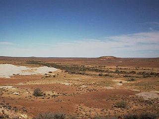
Etadunna is a locality in the Australian state of South Australia located about 684 kilometres north of the capital city of Adelaide and about 108 kilometres north-east of the town of Marree.
Mundic Creek is a locality in the Australian state of South Australia located in the Riverland in the state’s east on the southern side of the Murray River about 217 kilometres (135 mi) north-east of the state capital of Adelaide, and about 6 kilometres (3.7 mi) south-east of the municipal seat of Renmark.
