This article needs additional citations for verification .(July 2013) (Learn how and when to remove this template message) |
Mömlingen | ||
|---|---|---|
| ||
 Mömlingen  Mömlingen | ||
| Coordinates: 49°51′N9°5′E / 49.850°N 9.083°E Coordinates: 49°51′N9°5′E / 49.850°N 9.083°E | ||
| Country | Germany | |
| State | Bavaria | |
| Admin. region | Unterfranken | |
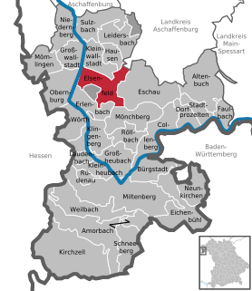
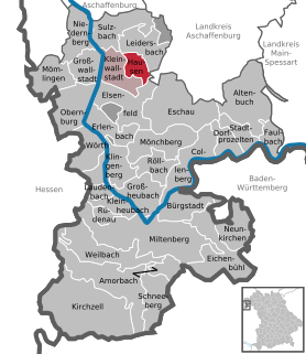
| District | Miltenberg | |
| Government | ||
| • Mayor | Siegfried Scholtka (CSU) | |
| • Governing parties | CSU | |
| Area | ||
| • Total | 18.45 km2 (7.12 sq mi) | |
| Elevation | 148 m (486 ft) | |
| Population (2017-12-31) [1] | ||
| • Total | 4,930 | |
| • Density | 270/km2 (690/sq mi) | |
| Time zone | CET/CEST (UTC+1/+2) | |
| Postal codes | 63853 | |
| Dialling codes | 06022 | |
| Vehicle registration | MIL | |
| Website | www | |

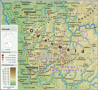
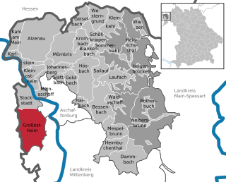
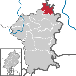
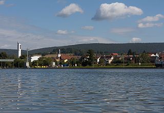
Mömlingen is a municipality in the Miltenberg district in the Regierungsbezirk of Lower Franconia (Unterfranken) in Bavaria, Germany.

Municipalities are the lowest level of official territorial division in Germany. This is most commonly the third level of territorial division, ranking after the Land (state) and Kreis (district). The Gemeinde which is one level lower in those states also includes Regierungsbezirke as an intermediate territorial division. The Gemeinde is one level higher if it is not part of a Samtgemeinde. Only 10 municipalities in Germany have fifth level administrative subdivisions and all of them are in Bavaria. The highest degree of autonomy may be found in the Gemeinden which are not part of a Kreis. These Gemeinden are referred to as Kreisfreie Städte or Stadtkreise, sometimes translated as having "city status". This can be the case even for small municipalities. However, many smaller municipalities have lost this city status in various administrative reforms in the last 40 years when they were incorporated into a Kreis. In some states they retained a higher measure of autonomy than the other municipalities of the Kreis. Municipalities titled Stadt are urban municipalities while those titled Gemeinde are classified as rural municipalities.

Miltenberg is a Landkreis (district) in Bavaria, Germany. It is bounded by the city of Aschaffenburg, the districts of Aschaffenburg and Main-Spessart, and the states of Baden-Württemberg and Hesse.

A Regierungsbezirk is a type of administrative division in Germany.
Contents
- Geography
- Location
- History
- Celts and Romans
- Frankish settlement
- First documentary mention
- Church and nobility – Mainz and Breuberg
- Lords of Mimling – Hans Memling
- Hausen hinter der Sonne
- Thirty Years’ War and its aftermath
- Mömlingen passes to Bavaria
- Politics
- Mayor
- Community council
- Town partnerships
- Coat of arms
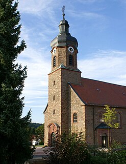
- Culture and sightseeing
- Buildings
- Personalities
- Further reading
- References
- External links