Bhutan comprises twenty districts.

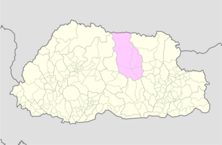
Bumthang District is one of the 20 dzongkhag (districts) comprising Bhutan. It is the most historic dzongkhag if the number of ancient temples and sacred sites is counted. Bumthang consists of the four mountain valleys of Ura, Chumey, Tang and Choekhor ("Bumthang"), although occasionally the entire district is referred to as Bumthang valley.

Trashiyangtse District is one of the twenty dzongkhags (districts) comprising Bhutan. It was created in 1992 when Trashiyangtse district was split off from Trashigang District. Trashiyangtse covers an area of 1,437.9 square kilometres (555.2 sq mi). At an elevation of 1750-1880 m, Trashi yangtse dzongkhag is rich of culture filled with sacred places blessed by Guru Rimpoche and dwelled by Yangtseps, Tshanglas, Bramis from Tawang, Khengpas from Zhemgang and Kurtoeps from Lhuentse.

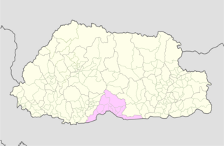
Tsirang District, is one of the 20 dzongkhags (districts) of Bhutan. The administrative center of the district is Damphu

A dzongkhag is an administrative and judicial district of Bhutan. The twenty dzongkhags of Bhutan are further divided into 205 gewogs. Some larger dzongkhags have one or more of an intermediate judicial division, known as dungkhags (sub-districts), which themselves comprise two or more gewogs. The Parliament of Bhutan passed legislation in 2002 and 2007 on the status, structure, and leadership of local governments, including dzongkhags. Its most recent legislation regarding dzongkhags is the Local Government Act of 2009. A dzongkhag is headed by a dzongdag, who is an elected official.

A gewog, in the past also spelled as geog, refers to a group of villages in Bhutan. The head of a gewog is called a gup. Gewogs form a geographic administrative unit below dzongkhag districts, and above Dzongkhag Thromde class B and Yenlag Thromde municipalities. Dzongkhag Thromde class A municipalities have their own independent local government body.

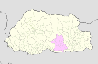
Trongsa District is one of the districts of Bhutan. It is the most central district of Bhutan and the geographic centre of Bhutan is located within it at Trongsa Dzong.
Buli is a village in the Zhemgang district in Bhutan. The village is located in the Nangkor Gewog of Zhemgang District in central Bhutan.

Ngangla Gewog is a gewog of Zhemgang District, Bhutan, bordering India. Ngangla Gewog is also a part of Panbang Dungkhag (sub-district), along with Goshing, Bjoka, and Phangkhar Gewogs.

Chiwogs of Bhutan or chios refer to the 1044 basic electoral precincts of Bhutan. Chiwogs are also former third-level administrative divisions of Bhutan below geos. Until 2009, they were the equivalent of municipalities or parishes, containing clusters of villages and hamlets. There are generally 5 or 6 chios in each geo, and in turn several geos in each dzongkha (district). To illustrate, there are 50 chios in Paro District alone. The majority of chios are small rural communities; more densely populated areas tend to be separate thromdes, or municipalities. A Chiwog Disaster Management Plan (CDMP) exists in some chios to form an effective responsive to any local disasters. Often, participants in the CDMP are also trained at a geo level for better coordination.

Ura Gewog is a gewog of Bumthang District, Bhutan. Ura Gewog consists of ten major villages- Tangsibi, Shingnyeer, Shingkhar, Pangkhar, Somthrang, Beteng, Trabi, Tarshong, Toepa and Chari with total household of 301 and population of 2288, covering an area of around 265 sq. kilometer with some 82% of forest coverage. The Gewog is located in the southeastern part of Bumthang District, 48 km distance from Dzongkhag Offices. It is bordered by Chhokhor and Chhumig gewog to the west, Tang gewog to the north, Zhemgang and Mongar District to the south and Lhuentse District to the east. The altitude of the gewog is around 3100 meters above sea level.

Umling Gewog is a gewog of Sarpang District, Bhutan.

Bardo Gewog is a gewog of Zhemgang District, Bhutan.

Bjoka Gewog is a gewog of Zhemgang District, Bhutan. Bjoka Gewog is also a part of Panbang Dungkhag (sub-district), along with Goshing, Ngangla, and Phangkhar Gewogs.

Goshing Gewog is a gewog of Zhemgang District, Bhutan. Goshing Gewog is also a part of Panbang Dungkhag (sub-district), along with Bjoka, Ngangla, and Phangkhar Gewogs.

Phangkhar Gewog is a gewog of Zhemgang District, Bhutan. Phangkhar Gewog is also a part of Panbang Dungkhag (sub-district), along with Goshing, Ngangla, and Bjoka Gewogs.

Shingkhar Gewog is a gewog of Zhemgang District, Bhutan.

Trong Gewog is a gewog of Zhemgang District, Bhutan.


