Transport in Bhutan uses about 8,000 kilometres (5,000 mi) of roads and four airports, three of which are operational and interconnected. Paro Airport is the only airport which accommodates international flights. As part of Bhutan's infrastructure modernization programs, its road system has been under development since the 1960s. There are no railways and, since Bhutan is a landlocked country without major waterways, there are no ports.

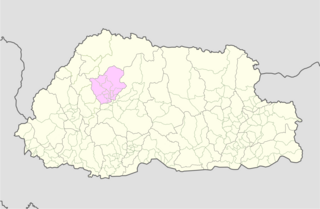
Wangdue Phodrang District is a dzongkhag (district) of central Bhutan. This is also the name of the dzong which dominates the district, and the name of the small market town outside the gates of the dzong—it is the capital of Wangdue Phodrang District). The name is said to have been given by the Shabdrung Ngawang Namgyal who was searching for the best location for a dzong to prevent incursions from the south. The word "wangdue" means unification of Country, and "Phodrang" means Palace in Dzongkha.

Trashigang District is Bhutan's easternmost dzongkhag (district).

Paro District is a district (dzongkhag), valley, river and town in Bhutan. It is one of the most historic valleys in Bhutan. Both trade goods and invading Tibetans came over the pass at the head of the valley, giving Paro the closest cultural connection with Tibet of any Bhutanese district. The dominant language in Paro is Dzongkha, the national language.

Chukha District is one of the 20 dzongkhag (districts) comprising Bhutan. The major town is Phuentsholing which is the gateway city along the sole road which connects India to western Bhutan. Chukha is the commercial and the financial capital of Bhutan. With Bhutan's oldest hydropower plant, Chukha hydel, and Tala Hydroelectricity Project, the country's largest power plant, Chukha is the dzongkhag which contributes the most to the GDP of the country. Also located in Chukha district are some of the country's oldest industrial companies like the Bhutan Carbide Chemical Limited (BCCL) and the Bhutan Boards Products Limited (BBPL).

Mongar District is one of the 20 dzongkhags (districts) comprising Bhutan. Mongar is the fastest-developing dzongkhag in eastern Bhutan. A regional hospital has been constructed and the region is bustling with many economic activities. Mongar is noted for its lemon grass, a plant that can be used to produce an essential oil. It also has a hydroelectric power-plant on the Kuri Chhu river.
Punakha District is one of the 20 dzongkhags (districts) comprising Bhutan. It is bordered by Thimphu, Gasa, and Wangdue Phodrang Districts. The dominant language in the district is Dzongkha, the national language.

Samtse District is one of the 20 dzongkhags (districts) comprising Bhutan.
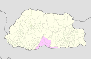
Sarpang District is one of the 20 dzongkhags (districts) comprising Bhutan.

Tsirang District (Dzongkha: རྩི་རང་རྫོང་ཁག་; Wylie: Rtsi-rang rdzong-khag; previously, is one of the 20 dzongkhags of Bhutan. The administrative center of the district is Damphu.

A gewog, in the past also spelled as geog, refers to a group of villages in Bhutan. The head of a gewog is called a gup. Gewogs form a geographic administrative unit below dzongkhag districts, and above Dzongkhag Thromde class B and Yenlag Thromde municipalities. Dzongkhag Thromde class A municipalities have their own independent local government body.
Thimphu District is a dzongkhag (district) of Bhutan. Thimphu is also the capital of Bhutan and the largest city in the whole kingdom.
Panbang is a settlement in the south of Bhutan. It is located in Zhemgang District, close to the border with India.
Bhulajhora Gewog is a former gewog of Chukha District, Bhutan. The gewog had an area of 73 square kilometres and contained 17 villages. Bhulajhora Gewog was part of Phuentsholing Dungkhag, along with Dala, Logchina, and Phuentsholing Gewogs.

Phuentsholing Gewog is a gewog of Chukha District, Bhutan. The gewog has an area of 139.8 square kilometres and contains 19 villages. Phuentsholing Gewog is part of Phuentsholing Dungkhag, along with Dala, Logchina Gewogs and Shampheling Gewog. It is one of the highest populated gewog in Chukha Dzongkhag.
Lungnyi Gewog is a gewog of Paro District, Bhutan. In 2002, the gewog had an area of 59.7 square kilometres and contained seven villages and 265 households.
Bhur Gewog is a former gewog of Sarpang District, Bhutan. Bhur Gewog, together with Serzhong, Taklai, and Gelephu Gewogs, belongs to Gelephu Dungkhag.
Gelephu Gewog is a gewog of Sarpang District, Bhutan. Gelephu Gewog, together with Serzhong, Taklai, and Bhur Gewogs, belongs to Gelephu Dungkhag.
Sherzhong Gewog is a gewog of Sarpang District, Bhutan. Serzhong Gewog, together with Bhur, Taklai, and Gelephu Gewogs, belongs to Gelephu Dungkhag.

Gelephu Airport is located in Samtenling Gewog, about three kilometres (1.9 mi) from the town of Gelephu in Sarpang District, Bhutan. The airport has been constructed on an area spanning over 500 acres (200 ha) and came into regular use in late 2017. It is one of only four airports in Bhutan.