The Government of Bhutan has been a constitutional monarchy since 18 July 2008. The King of Bhutan is the head of state. The executive power is exercised by the Lhengye Zhungtshog, or council of ministers, headed by the Prime Minister. Legislative power is vested in the bicameral Parliament, both the upper house, National Council, and the lower house, National Assembly. A royal edict issued on April 22, 2007 lifted the previous ban on political parties in anticipation of the National Assembly elections in the following year. In 2008, Bhutan adopted its first modern Constitution, codifying the institutions of government and the legal framework for a democratic multi-party system.

The Kingdom of Bhutan is divided into 20 districts. Bhutan is located between the Tibet Autonomous Region of China and India on the eastern slopes of the Himalayas in South Asia.

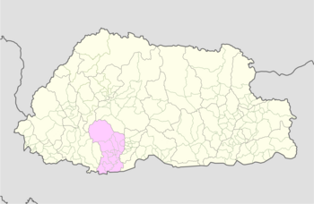
Dagana District is a district located in Bhutan. Most of the district is populated by Dzongkha speakers. However, in the southwest part near the Sarpang District, Nepali is also spoken as a native language.

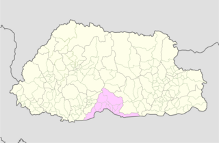
Sarpang District is one of the 20 dzongkhags (districts) comprising Bhutan. Sarpang covers a total area of 1,946 km2 (751 sq mi) and stretches from Lhamoizhingkha in West Bhutan to Manas National Park in the east. Sarpang Dzongkhag is divided into one dungkhag, Gelephu, and 12 gewogs.

A gewog, in the past also spelled as geog, is a group of villages in Bhutan. The head of a gewog is called a gup. Gewogs form a geographic administrative unit below dzongkhag districts, and above Dzongkhag Thromde class B and Yenlag Thromde municipalities. Dzongkhag Thromde class A municipalities have their own independent local government body.

A dungkhag is a sub-district of a dzongkhag (district) of Bhutan. The head of a dungkhag is a Dungpa. As of 2007, nine of the twenty dzongkhags had from one to three dungkhags, with sixteen dungkhags in total.

Thimphu District is a dzongkhag (district) of Bhutan. Thimphu is also the capital of Bhutan and the largest city in the whole kingdom.

National Council elections were held in Bhutan for the first time on 31 December 2007, having been originally scheduled for 26 December. The new National Council had 25 members, which 20 members were directly elected from 20 dzongkhags by 312,817 eligible voters, and five more were appointed by the Druk Gyalpo. Nominations had to be filed by 27 November 2007, and the campaigning for 15 of the 20 dzongkhags took place from 30 November until 31 December 2007.
Phuentsholing Gewog is a gewog of Chukha District, Bhutan. The gewog has an area of 139.8 km2 and contains 19 villages and a population of 5,183, as of 2005. Phuentsholing Gewog is part of Phuentsholing Dungkhag, along with Dala, Logchina Gewogs and Shampheling Gewog. It is one of the most populated gewogs in Chukha Dzongkhag.
Dorona Gewog is a gewog of Dagana District, Bhutan. It also comprises part of Dagapela Dungkhag, along with Goshi and Tashiding Gewogs.
Tashiding Gewog is a gewog of Dagana District, Bhutan. It also comprises part of Dagapela Dungkhag (sub-district), along with Dorona and Goshi Gewogs.

Gelephu Gewog is a gewog of Sarpang District, Bhutan. Gelephu Gewog, together with Serzhong, Taklai, and Bhur Gewogs, belongs to Gelephu Dungkhag.
Nichula Gewog is a gewog of Dagana District, Bhutan. It also comprises part of Lhamoy Zingkha Dungkhag (sub-district), along with Lhamoy Zingkha and Deorali Gewogs.

Umling Gewog is a gewog of Sarpang District, Bhutan.
The Local Government Act of Bhutan was enacted on September 11, 2009, by parliament of Bhutan in order to further implement its program of decentralization and devolution of power and authority. It is the most recent reform of the law on Bhutan's administrative divisions: Dzongkhags, Dungkhags, Gewogs, Chiwogs, and Thromdes (municipalities). The Local Government Act of Bhutan has been slightly amended in 2014.

A Thromde is a second-level administrative division in Bhutan. The legal administrative status of thromdes was most recently codified under the Local Government Act of 2009, and the role of thromdes in elections in Bhutan was defined in the Election Act of 2008.
Deorali Gewog is a former gewog of Dagana District, Bhutan. It also comprises part of Lhamoy Zingkha Dungkhag, along with Lhamoy Zingkha and Nichula Gewogs.
Norgaygang Gewog is a gewog of Samtse District, Bhutan. It is located at the extreme northwest of the Samtse District bordering on India's West Bengal (Kalimpong) and Sikkim provinces. It has the Haa District to the northeast and Samtse's Tendruk Gewog to the southeast.

Pemaling Gewog is a gewog of Samtse District, Bhutan. The gewog has an area of 49.04 square kilometres and contains 15 chewogs with 46 villages and 448 households. Pemaling Gewog comprises part of Tashicholing Dungkhag (sub-district), together with Tendu, Namgaychhoeling, Norgaygang, and Tashicholing Gewogs.


