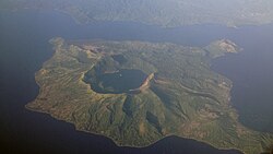
National Geological Monuments (NGM) is a declaration bestowed on landforms and features within Philippines possessing geological significance and uniqueness, as evaluated by the National Committee on Geological Sciences.
The National Committee on Geological Sciences was created via Executive order no. 625 on October 8, 1980. This committee is under the Office of the President of the Philippines, which consists of 21 government agencies headed by the Mines and Geosciences Bureau (MGB) of the Department of Environment and Natural Resources (DENR). [1]
Among the committee's programs was the establishment of National Geological Monuments, [1] [2] a declaration on landforms and geological features within the Philippines with high scientific, educational or aesthetic value worthy of protection, preservation and conservation. [3]
As of 2024, there are 7 declared National Geological Monuments in the Philippines. [4]
NGM name | Location | Date of declaration | Reference |
---|---|---|---|
Rodriguez, Rizal | September 10, 1983 | [1] [5] | |
![]() | Batangas Province | June 18, 1988 | [6] |
![]() | Laoag, Ilocos Norte | November 26, 1993 | [7] |
Carmen, Batuan and Sagbayan, Bohol Island | June 18, 1988 | [8] [9] | |
![]() | Alaminos city, Pangasinan | September 14, 2001 | [1] [10] |
![]() | Puerto Princesa, Palawan | December 11, 2003 | [11] |
Loon and Maribojoc, Bohol Island | May 14, 2015 | [12] [4] [13] |
Bohol, officially the Province of Bohol, is an island province of the Philippines located in the Central Visayas region, consisting of the island itself and 75 minor surrounding islands. It is home to Boholano people. Its capital is Tagbilaran, the largest city of the province. With a land area of 4,821 km2 (1,861 sq mi) and a coastline 261 km (162 mi) long, Bohol is the tenth largest island of the Philippines.
The Chocolate Hills are a geological formation in the Bohol province of the Philippines. There are at least 1,260 hills, but there may be as many as 1,776 hills spread over an area of more than 50 square kilometers (20 sq mi). They are covered in green grass that turns into a chocolate-like brown during the dry season, hence the name.
The International Union of Geological Sciences (IUGS) is an international non-governmental organization devoted to international cooperation in the field of geology. As of 2023, it represents more than 1 million geoscientists around the world.
Batuan, officially the Municipality of Batuan, is a municipality in the province of Bohol, Philippines. According to the 2020 census, it has a population of 13,845 people.
Bilar, officially the Municipality of Bilar, is a municipality in the province of Bohol, Philippines. According to the 2020 census, it has a population of 18,512 people.
Carmen, officially the Municipality of Carmen, is a municipality in the province of Bohol, Philippines. According to the 2020 census, it has a population of 49,191 people.
Loon, officially the Municipality of Loon, is a municipality in the province of Bohol, Philippines which was established in 1753. According to the 2020 census, it has a population of 44,224 people.
Panglao, officially the Municipality of Panglao, is a municipality in the province of Bohol, Philippines. According to the 2020 census, it has a population of 39,839 people.
Sagbayan, officially the Municipality of Sagbayan, is a municipality in the province of Bohol, Philippines. According to the 2020 census, it has a population of 24,335 people.
Alamada, officially the Municipality of Alamada, is a municipality in the province of Cotabato, Philippines. According to the 2020 census, it has a population of 68,659 people.
The European Geoparks Network (EGN) functions as the regional organization of the Global Geoparks Network (GGN) and the UNESCO International Geosciences and Geoparks Programme (UNESCO-IGGP). Its main objective is to ensure cooperation between geoparks for the protection of geological heritage and the promotion of sustainable development of their territories in Europe. In 2020 January, the EGN had 75 institutional members from 26 European countries and there are several aspiring geopark projects, applying for a UNESCO label and therefore the permanent EGN membership.
The Mines and Geosciences Bureau (MGB) is a government agency of the Philippines under the Department of Environment and Natural Resources (DENR). The MGB is responsible for the conservation, management, development, and use of the country's mineral resources, including those in reservations and public lands.
Erico Aristotle Cabagnot Aumentado, also known in Bohol as Aris, is a Filipino businessman and politician. He was a member of the House of Representatives, representing the second district of Bohol. He is the Governor of the Province of Bohol, assuming office on June 30, 2022 but was preventively suspended on May 28, 2024 due to the controversial resort construction in the middle of the Chocolate Hills. He was reinstated by the Ombudsman on July 31.
The 2013 Bohol earthquake occurred on October 15 at 8:12:31 PST in Bohol, an island province located in Central Visayas, Philippines. The magnitude of the earthquake was recorded at Mw 7.2, with epicenter 6 kilometres (3.7 mi) S 24° W of Sagbayan, and its depth of focus was 12 kilometres (7.5 mi). It affected the whole Central Visayas region, particularly Bohol and Cebu. The earthquake was felt in the whole Visayas area and as far as Masbate island in the north and Cotabato provinces in southern Mindanao.
The Padcal tailings spills of August–September 2012 were a series of mine tailings spills from Tailings Pond 3 of the Philex Mining Corporation's Padcal mine in Benguet Province, Philippines. The incident began on August 1, 2012, with a massive release on the order of 5 million tonnes or 3 million cubic meters of water and tailings from a breached drainage tunnel in the pond. The effluent flowed into the Balog River down to Agno River and San Roque Dam. At least four more major discharges were reported: on August 4, 11 and 30, and September 13. The total weight of solids discharged is given by Advocates of Science and Technology for the People, citing a Mines and Geosciences Bureau Report dated September 17, 2012, as 21 million tonnes. The Center for Science in Public Participation gives the volume discharged, for an incident that they date as August 2, but likely refers to the whole August–September series, as 13 million cubic meters. The spill was ten times larger than the 1996 Marcopper mining disaster, making it the country's biggest mining disaster by volume of toxic tailings.
Noel Kinazo Felongco is a Filipino lawyer and government official who currently serves as the Lead Convenor of the National Anti-Poverty Commission of the Philippines under the Duterte administration since October 31, 2018. He previously served as a chairperson of the Presidential Commission for the Urban Poor and as an undersecretary of the Department of Environment and Natural Resources (DENR).
A controversy arose in March 2024 when a resort built in the middle of the Chocolate Hills in Bohol, Philippines, came to wider public attention. The geological formations are a protected area.
Asik-Asik Falls, also known as Curtain Waterfalls, is a waterfall near Alamada in Cotabato, the Philippines, on the slopes of Mount Ragang. It is known for an apparent lack of a river feeding the fall, with water coming out of crevices on a 60-metre (200 ft) cliff instead. Asik means "sprinkle" in the Hiligaynon language. Much of the falls are surrounded and covered by lush vegetation, such as ferns and moss. It is theorized that the source of the falls is an underground river. The pool at the bottom flows into the Alamada River, a tributary of the Libungan River, and then into the Liguasan Marsh.
{{cite web}}
: CS1 maint: numeric names: authors list (link)