Neptune Road

Last updated
Neptune Road
Neptune Road from Lovell Street, February 2016.JPG
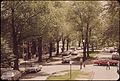
The remaining stub of Neptune Road viewed from Lowell Street in February 2016
Location East Boston, Massachusetts
Postal code02128
Coordinates 42°22′43″N71°0′24″W / 42.37861°N 71.00667°W / 42.37861; -71.00667

Neptune Road is located in the East Boston neighborhood of Boston, Massachusetts. [1] The road is fragmented, bisected by the Massachusetts Bay Transportation Authority's Blue Line which surfaces from the subway southwest of the road. Much of the portion southeast of the train tracks is encompassed within Logan International Airport.

Contents

History

Neptune Road - May 1973 NEPTUNE ROAD - NARA - 548477.jpg
Neptune Road - May 1973

Neptune Road once was a residential street that also served as the entrance to Frederick Law Olmsted's Wood Island Park, a 47-acre waterfront park designed by Olmsted in the 19th century. An elegant tree-lined road with center islands, The Boston Globe referred to the street as a “miniature Commonwealth Avenue”. [2]

The expansion of Logan Airport in the late 1960s and early 1970s displaced families along Neptune Road, which is now used for warehouses and rental car property. As the airport expanded, planes flew in low over the residential blocks and conflicts with airport officials escalated. Wood Island Park was leveled early one morning in 1967. [3] On April 23, 1969, 35 workmen with 35 chain saws toppled 35 elms along the road. The Massachusetts Port Authority, under the reign of then-director and later Governor of Massachusetts Edward J. King, seized by eminent domain some 720 feet (220 m) of the street, and evicted families with the help of US Marshalls. [2]

The airport has since implemented four "airport edge buffers," which include parks and greenery. [4] Some of Boston's last surviving elm trees are still located on Neptune Road, resisting the Dutch elm disease that have felled most of the Boston-area elms in the 20th century.

See also

Related Research Articles

<span class="mw-page-title-main">Transportation in Boston</span> Overview of transportation in Boston, Massachusetts, United States

Transportation in Boston includes roadway, subway, regional rail, air, and sea options for passenger and freight transit in Boston, Massachusetts. The Massachusetts Port Authority (Massport) operates the Port of Boston, which includes a container shipping facility in South Boston, and Logan International Airport, in East Boston. The Massachusetts Bay Transportation Authority (MBTA) operates bus, subway, short-distance rail, and water ferry passenger services throughout the city and region. Amtrak operates passenger rail service to and from major Northeastern cities, and a major bus terminal at South Station is served by varied intercity bus companies. The city is bisected by major highways I-90 and I-93, the intersection of which has undergone a major renovation, nicknamed the Big Dig.

<span class="mw-page-title-main">Chelsea, Massachusetts</span> City in Massachusetts, United States

Chelsea is a city in Suffolk County, Massachusetts, United States, directly across the Mystic River from Boston. At the 2020 census, Chelsea had a population of 40,787. With a total area of just 2.46 square miles, Chelsea is the smallest city in Massachusetts in terms of total area. It is the second most densely populated city in Massachusetts, behind Somerville, and is the city with the second-highest percentage of Latino residents in Massachusetts, behind Lawrence.

<span class="mw-page-title-main">Logan International Airport</span> Civil airport in Boston, Massachusetts, United States

General Edward Lawrence Logan International Airport, also known as Boston Logan International Airport and commonly as Boston Logan, Logan Airport or simply Logan, is an international airport that is located mostly in East Boston and partially in Winthrop, Massachusetts. It opened in 1923, covers 2,384 acres (965 ha), has six runways and four passenger terminals, and employs an estimated 16,000 people. It is the largest airport in both the Commonwealth of Massachusetts and the New England region in terms of passenger volume and cargo handling as well as the busiest airport in the Northeastern United States outside the New York metropolitan area. The airport saw 42 million passengers in 2019, the most in its history. It is named after General Edward Lawrence Logan, a 20th-century war hero native to Boston.

<span class="mw-page-title-main">East Boston</span> Neighborhood of Boston in Suffolk, Massachusetts, United States

East Boston, nicknamed Eastie, is a neighborhood of Boston, Massachusetts annexed by the city of Boston in 1637. Neighboring communities include Winthrop, Revere, and Chelsea. It is separated from the Boston neighborhood of Charlestown and downtown Boston by Boston Harbor. The footprint of the East Boston neighborhood as it is known today was created in the 1940s by connecting five of the inner harbor islands using land fill. Logan International Airport is located in East Boston, connecting Boston to domestic and international locations.

<span class="mw-page-title-main">Silver Line (MBTA)</span> Bus rapid transit system in Massachusetts, US

The Silver Line is a system of bus routes in Boston and Chelsea, Massachusetts, operated by the Massachusetts Bay Transportation Authority (MBTA). It is operated as part of the MBTA bus system, but branded as bus rapid transit (BRT) as part of the MBTA subway system. Six routes are operated as part of two disconnected corridors. As of 2019, weekday ridership on the Silver Line was 39,000.

<span class="mw-page-title-main">Airport station (MBTA)</span> Rapid transit station in Boston, Massachusetts, US

Airport station is a rapid transit station in Boston, Massachusetts. It serves the MBTA Blue Line and the SL3 branch of the Silver Line. It is located in East Boston under the interchange between Interstate 90 and Massachusetts Route 1A. The station provides one of two mass transit connections to the nearby Logan International Airport, as well as serving local residents in East Boston. Shuttle buses connect the station with the airport terminals and other facilities.

<span class="mw-page-title-main">Davis station (MBTA)</span> Rapid transit station in Somerville, Massachusetts, US

Davis station is an underground Massachusetts Bay Transportation Authority (MBTA) Red Line rapid transit station located at Davis Square in Somerville, Massachusetts. The accessible station has a single island platform for the Red Line, as well as a dedicated busway on the surface. It opened in 1984 as part of the Red Line Northwest Extension project.

<span class="mw-page-title-main">South Boston</span> Neighborhood of Boston in Suffolk, Massachusetts, United States

South Boston is a densely populated neighborhood of Boston, Massachusetts, located south and east of the Fort Point Channel and abutting Dorchester Bay. South Boston, colloquially known as Southie, has undergone several demographic transformations since being annexed to the city of Boston in 1804. The neighborhood, once primarily farmland, is popularly known by its twentieth century identity as a working class Irish Catholic community. Throughout the twenty-first century, the neighborhood has become increasingly popular with millennial professionals.

<span class="mw-page-title-main">Fenway–Kenmore</span> Neighborhood in Boston in Suffolk, Massachusetts, United States

Fenway–Kenmore is an officially recognized neighborhood of Boston, Massachusetts. While it is considered one neighborhood for administrative purposes, it is composed of numerous distinct sections that, in casual conversation, are almost always referred to as "Fenway", "the Fenway", "Kenmore Square", or "Kenmore". Furthermore, the Fenway neighborhood is divided into two sub-neighborhoods commonly referred to as East Fenway/Symphony and West Fenway.

<span class="mw-page-title-main">Chestnut Hill, Massachusetts</span> Region in Massachusetts, United States

Chestnut Hill is a wealthy New England region located six miles (10 km) west of downtown Boston, Massachusetts, United States. Like all Massachusetts villages, Chestnut Hill is not an incorporated municipal entity. It is located partially in Brookline in Norfolk County; partially in the city of Boston in Suffolk County, and partially in the city of Newton in Middlesex County. Chestnut Hill's borders are defined by the 02467 ZIP Code. The name refers to several small hills that overlook the 135-acre Chestnut Hill Reservoir rather than one particular hill. Chestnut Hill is best known as the home of Boston College and as part of the Boston Marathon route.

<span class="mw-page-title-main">Massachusetts Port Authority</span>

Massachusetts Port Authority (Massport) is an American port authority in the Commonwealth of Massachusetts. It owns and operates three airports, Logan International Airport, Hanscom Field, and Worcester Regional Airport, and public terminals in the Port of Boston.

<span class="mw-page-title-main">World's End (Hingham)</span> Peninsula in Hingham, Massachusetts, just south of Boston

World's End is a 251-acre (1 km²) park and conservation area located on a peninsula in Hingham, Massachusetts. The peninsula is bordered by the Weir River to the North and East and Hingham Harbor to the West. The land is composed of four drumlins harboring tree groves interspersed with fields attractive to butterflies and grassland-nesting birds, and offers 4.5 miles of walking paths with views of the Boston skyline.

<span class="mw-page-title-main">Port of Boston</span> Seaport district in Boston, Massachusetts

The Port of Boston is a major seaport located in Boston Harbor and adjacent to the City of Boston. It is the largest port in Massachusetts and one of the principal ports on the East Coast of the United States.

<span class="mw-page-title-main">Commonwealth Avenue (Boston)</span>

Commonwealth Avenue is a major street in the cities of Boston and Newton, Massachusetts. It begins at the western edge of the Boston Public Garden, and continues west through the neighborhoods of the Back Bay, Kenmore Square, Boston University, Allston, Brighton and Chestnut Hill. It continues as part of Route 30 through Newton until it crosses the Charles River at the border of the town of Weston.

<span class="mw-page-title-main">Wood Island station</span> Rapid transit station in Boston, Massachusetts, US

Wood Island station is a MBTA Blue Line rapid transit station located off Bennington Street in the Day Square section of East Boston, Boston, Massachusetts. The station is adjacent to and named for the former Wood Island Park, a once heavily used recreational area for East Boston residents. Most of the park was destroyed in the mid 1960s to expand Logan International Airport. It was built in 1952, replacing a pair of Boston, Revere Beach and Lynn Railroad stations that served the area.

<span class="mw-page-title-main">Bennington Street</span>

Bennington Street is one of the main thoroughfares in the neighborhood of East Boston in Boston, Massachusetts. The street runs almost the length of the residential section of the community, as distinguished from Logan International Airport, which makes up almost half of the community's landmass.

<span class="mw-page-title-main">Arborway</span>

Arborway consists of a four-lane, divided parkway and a two lane residential street in the Jamaica Plain neighborhood of Boston, Massachusetts, United States. It was designed by Frederick Law Olmsted in the 1890s as the south most carriage road in a series of parkways connecting parks from Boston Common in downtown Boston to Franklin Park in Roxbury. This park system has since become known as the Emerald Necklace of Boston.

<span class="mw-page-title-main">Blue Hills Parkway</span> United States historic place

Blue Hills Parkway is a historic parkway that runs in a straight line from a crossing of the Neponset River, at the south border of Boston to the north edge of the Blue Hills Reservation in Milton, Massachusetts. It was built in 1893 to a design by the noted landscape architect, Charles Eliot, who is perhaps best known for the esplanades along the Charles River. The parkway is a connecting road between the Blue Hills Reservation and the Neponset River Reservation, and was listed on the National Register of Historic Places in 2003.

Bremen Street Park is an 18-acre urban park, located in East Boston, Boston, Massachusetts. The park runs parallel to both Bremen Street and the Mass Pike/Route 1A and acts as a green space buffer between Logan International Airport and the residential neighborhoods of East Boston. The park is owned, operated and patrolled by the Massachusetts Port Authority (MassPort). It is also part of the East Boston Greenway, a linear park and shared use path.

<span class="mw-page-title-main">Piers Park</span> Park in Boston, Massachusetts, U.S.

Piers Park is a public park owned by Massport located on the southwest side of East Boston, overlooking Boston Harbor and downtown Boston. Designed by Pressley Associates Landscape Architects of Boston, the 6.5-acre (2.6 ha) park was conceived to reclaim a condemned industrial pier for recreational use, allowing residents and visitors direct access to the waterfront.

References

  1. "City of Boston Street Book", City of Boston
  2. 1 2 "Final chapter in the taking of Neptune Road" The Boston Globe , City Weekly section page 1, April 27, 1997.
  3. Dorothy Nelkin (1974). Jetport: The Boston Airport Controversy. ISBN   9781412826846.{{cite book}}: |work= ignored (help)
  4. "Airport Edge Buffer Project Planned for Neptune Road". MassPort. March 11, 2009. Archived from the original on 2013-07-28.