Federal Street (Boston)

Last updated
Federal Street, Boston, 2008 2008 FederalSt Boston.jpg
Federal Street, Boston, 2008

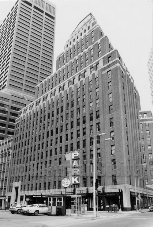
Federal Street is a street in the Financial District of Boston, Massachusetts. Prior to 1788, it was known as Long Lane. [1] The street was renamed after state leaders met there in 1788 to determine Massachusetts' ratification of the United States Constitution. [2]

Contents

History

In 1727 the Long Lane Meeting House was established; it changed its name to the Federal Street Church in 1788. Henry Knox was born on Long Lane in 1750. The Federal Street Theatre was built in 1793, designed by Charles Bulfinch; it remained until 1852.

By 1806, residents included engraver Joseph Callender; printer Nathaniel Coverly; merchant Stephen Higginson; comedian Snelling Powell; dancing master William Turner. [3] In 1823, residents included the Federal Street Coffee House; hairdresser William Lenox; Esther Newell and her "female intelligence office;" grocer Henry Sweetser; seamstress Martha Vincent. [4] Dorothy Quincy and John Mackay also lived on Federal St. in the early 19th-century. Auctioneer J.L. Cunningham worked from Corinthian Hall, 1826-1843. J. H. Bufford's Sons ran a lithography printing business in the 1870s.

In 1928 arose Boston's "first art deco skyscraper," the United Shoe Machinery Building. [5] In 1929, the "art deco jewel" at 75 Federal Street was built. [5] The Blue Cross/Blue Shield building, designed by Paul Rudolph was built 1957-1960. 150 Federal Street, designed by Hugh Stubbins Jr. was built in 1988.

Images

See also

Related Research Articles

<span class="mw-page-title-main">Charles Bulfinch</span> American architect (1763–1844)

Charles Bulfinch was an early American architect, and has been regarded by many as the first native-born American to practice architecture as a profession.

<span class="mw-page-title-main">Post Office Square, Boston</span> Square in Boston in Massachusetts

Post Office Square in Boston, Massachusetts is a square located in the financial district at the intersection of Milk, Congress, Pearl and Water Streets. It was named in 1874 after the United States Post Office and Sub-Treasury which fronted it, now replaced by the John W. McCormack Post Office and Courthouse.

<span class="mw-page-title-main">United Shoe Machinery Corporation Building</span> United States historic place

The United Shoe Machinery Corporation Building is a historic office building at 160 Federal Street in the Financial District of Boston, Massachusetts. The steel-frame skyscraper has 24 stories and a penthouse, and was built in 1929–1930 to a design by George W. Fuller and Parker, Thomas & Rice for the United Shoe Machinery Corporation. It is one of Boston's finest Art Deco buildings, including an elaborately decorated lobby. It was built for the United Shoe Machinery Corporation, which at the time controlled 98% of the nation's shoe machinery business.

<span class="mw-page-title-main">Federal Street Church (Boston)</span>

The Federal Street Church was a congregational Unitarian church in Boston, Massachusetts. Organized in 1727, the originally Presbyterian congregation changed in 1786 to "Congregationalism", then adopted the liberal theology of its fifth Senior Minister, William Ellery Channing, (1780–1842). For most of the 18th century the church was known as the Long Lane Meeting-House. In 1788, state leaders met in the relatively spacious building to determine Massachusetts' ratification of the United States Constitution. Thereafter the church renamed itself the Federal Street Church in honor of the event. In 1803, it called William Ellery Channing, (1780–1842), as its minister who defined "Unitarian Christianity" and launched the Unitarian movement, making the Federal Street Church one of the first to define itself as Unitarian.

<span class="mw-page-title-main">Chinese Museum (Boston)</span>

The Chinese Museum (1845–1847) in Boston, Massachusetts, showed to the public some 41 cases displaying approximately 800 objects related to Chinese fine arts, agriculture, costume, and other customs. It was located on Washington Street in the Marlboro Chapel.

<span class="mw-page-title-main">Court Street (Boston)</span>

Court Street is located in the Financial District of Boston, Massachusetts. Prior to 1788, it was called Prison Lane (1634–1708) and then Queen Street (1708–1788). In the 19th century it extended beyond its current length, to Bowdoin Square. In the 1960s most of Court Street was demolished to make way for the construction of Government Center. The remaining street extends a few blocks, near the Old State House on State Street.

<span class="mw-page-title-main">Hanover Street (Boston)</span>

Hanover Street is located in the North End of Boston, Massachusetts.

<span class="mw-page-title-main">Brattle Street (Boston)</span>

Brattle Street, which existed from 1694 to 1962, was a street in Boston, Massachusetts located on the current site of City Hall Plaza, at Government Center.

<span class="mw-page-title-main">Franklin Street (Boston)</span>

Franklin Street is located in the Financial District of Boston, Massachusetts. It was developed at the end of the 18th century by Charles Bulfinch, and included the now-demolished Tontine Crescent and Franklin Place.

Union Street is a street in Government Center, Boston, Massachusetts, near Faneuil Hall. Prior to 1828, it was also called Green Dragon Lane.

<span class="mw-page-title-main">Congress Street (Boston)</span>

Congress Street in Boston, Massachusetts, is located in the Financial District and South Boston. It was first named in 1800. It was extended in 1854 as far as Atlantic Avenue, and in 1874 across Fort Point Channel into South Boston. Today's Congress Street consists of several segments of streets, previously named Atkinson's Street, Dalton Street, Gray's Alley, Leverett's Lane, Quaker Lane, and Shrimpton's Lane.

<span class="mw-page-title-main">North Square (Boston, Massachusetts)</span>

North Square in the North End of Boston, Massachusetts, USA, sits at the intersection of Moon, Prince, North, Garden Court and Sun Court Streets. Paul Revere lived here, as did other notables in the 17th and 18th centuries. Prior to July 4, 1788, the area was known as Clark's Square.

<span class="mw-page-title-main">Bowdoin Square (Boston)</span>

Bowdoin Square in Boston, Massachusetts was located in the West End. In the 18th and 19th centuries it featured residential houses, leafy trees, a church, hotel, theatre and other buildings. Among the notables who have lived in the square: physician Thomas Bulfinch; merchant Kirk Boott; and mayor Theodore Lyman. The urban renewal project in the West End in the 1950s removed Green Street and Chardon Street, which formerly ran into the square, and renamed some existing streets; it is now a traffic intersection at Cambridge Street, Bowdoin Street, and New Chardon Street.

<span class="mw-page-title-main">Merchants Row (Boston)</span>

Merchants Row in Boston, Massachusetts is a short street extending from State Street to Faneuil Hall Square in the Financial District. Since the 17th century it has been a place of commercial activity. It sits close to Long Wharf and Dock Square, hubs of shipping and trade through the 19th century. Portions of the street were formerly known as Swing-Bridge Lane, Fish Lane, and Roebuck Passage.

<span class="mw-page-title-main">Pemberton Square</span>

Pemberton Square in the Government Center area of Boston, Massachusetts, was developed by P.T. Jackson in the 1830s as an architecturally uniform mixed-use enclave surrounding a small park. In the mid-19th century both private residences and businesses dwelt there. The construction in 1885 of the massive John Adams Courthouse changed the scale and character of the square, as did the Center Plaza building in the 1960s.

<span class="mw-page-title-main">Cornhill, Boston</span>

Cornhill was a street in Boston, Massachusetts, in the 18th, 19th and 20th centuries, located on the site of the current City Hall Plaza in Government Center. It was named in 1829; previously it was known as Market Street (1807–1828). In its time, it comprised a busy part of the city near Brattle Street, Court Street and Scollay Square. In the 19th century, it was the home of many bookstores and publishing companies. As of 1969, Cornhill exists as 144 feet along the edge of City Hall Plaza.

<span class="mw-page-title-main">Boston Gaol (Massachusetts)</span>

The Boston Gaol (1635–1822) was a jail in the center of Boston, Massachusetts, located off Court Street, in the block bounded by School, Washington and Tremont Streets. It was rebuilt several times on the same site, before finally moving to the West End in 1822. Prisoners included Quakers, "witches," pirates, murderers, rebels, debtors, and newspaper editors.

Grove Hinman Loomis or G.H. Loomis (1823-1898) was a photographer in Boston, Massachusetts, in the mid-19th century. He also worked as a real estate broker, teacher and government employee. He died in Newton, Massachusetts in 1898.

The RKO Boston Theatre was a movie theatre in Boston, Massachusetts, located at 616 Washington Street, near Essex Street in the Boston Theater District. It opened as the Keith-Albee Boston Theatre on October 5, 1925.

<span class="mw-page-title-main">Horticultural Hall (Boston, 1845)</span>

Horticultural Hall (1845-1860s) of Boston, Massachusetts, stood at no.40 School Street. The Massachusetts Horticultural Society erected the building and used it as headquarters until 1860. Made of granite, it measured "86 feet in length and 33 feet in width ... [with] a large hall for exhibitions, a library and business room, and convenient compartments for the sale of seeds, fruits, plants and flowers." Among the tenants: Journal of Agriculture; Azell Bowditch's seed store; and Morris Brothers, Pell & Trowbridge minstrels.

References

  1. Boston (Mass.). Street laying-out Dept. (1910), A record of the streets, alleys, places, etc. in the city of Boston (2 ed.), Boston: City of Boston Printing Dept., OL   16574538M
  2. Nathaniel Dearborn (1848), Boston notions, Boston: Printed by N. Dearborn, sold by W. D. Ticknor & Co., OL   13440177M
  3. Boston Directory. 1806.
  4. Boston Directory. 1823.
  5. 1 2 Susan Southworth; Michael Southworth (2008). AIA Guide to Boston (3 ed.). Guilford, CT: Globe Pequot. ISBN   978-0-76274-337-7.

Coordinates: 42°21′23.45″N71°3′24.1″W / 42.3565139°N 71.056694°W / 42.3565139; -71.056694