Winter Street, Boston, c. 1860s (photo by John B. Heywood) | |
| Location | Boston |
|---|---|
| West end | Tremont Street |
| East end | Washington Street |
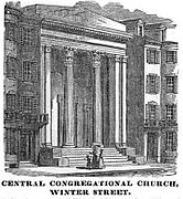
Winter Street in Boston, Massachusetts, is located between Tremont Street and Washington Street, near the Common. It is currently a pedestrian zone. [1] Prior to 1708, it was called Blott's Lane and then Bannister's Lane.. [2] [3] It was also known at times as "Winer Street". [4]