Nirjutiqavvik National Wildlife Area

Last updated

Nirjutiqavvik National Wildlife Area
Coburg Island in Jones Sound.jpg
Rissa tridactyla nesting/flying at Coburg Island in Jones Sound. One Uria lomvia on cliff top (see annotation).
Canada Nunavut location map-lambert proj3.svg
Red pog.svg
Nirjutiqavvik
Location of Nirjutiqavvik National Wildlife Area
Canada location map 2.svg
Red pog.svg
Nirjutiqavvik
Nirjutiqavvik (Canada)
Location Coburg Island, Qikiqtaaluk, Nunavut, Canada
Nearest city Grise Fiord
Coordinates 75°55′12″N79°15′00″W / 75.92000°N 79.25000°W / 75.92000; -79.25000 [1]
  1. ^ "Nirjutiqavvik National Wildlife Area". Geographical Names Data Base . Natural Resources Canada.
Area1,650 km2 (640 sq mi)
Established1995

Nirjutiqavvik National Wildlife Area is a National Wildlife Area on Coburg Island within the Qikiqtaaluk Region, Nunavut, Canada. It is located in Baffin Bay's Lady Ann Strait between Ellesmere Island, to the north, and Devon Island to the south. The NWA includes Coburg Island and its surrounding marine area.

Contents

Established in 1995, it is 1,650 km2 (640 sq mi) in area. Of this, a total of 1,283 km2 (495 sq mi) make up a marine area with marine and intertidal components. [2]

The NWA is one of the most important seabird nesting areas in the Canadian Arctic for black guillemot, black-legged kittiwake, northern fulmar, and thick-billed murre. It is also an important area for polar bears, walruses, ringed, and bearded seals. Narwhal and beluga whales migrate through the area. [3]

The Nirjutiqavvik National Wildlife Area is home to many seabird species and marine animals, providing essential nutrients to nearby Indigenous communities. The wildlife area is managed by Inuit from Grise Fiord, a nearby community, along with other governmental entities. If business as usual continues, climate change and human activity will cause severe damage to the Nirjutiqavvik National Wildlife Area. [4]

Description

The Nirjutiqavvik National Wildlife Area (NNWA) is positioned 20 km (12 mi) off the south of Ellesmere Island in the eastern Jones Sound of Nunavut. The Arctic Ocean is within a 10 km (6.2 mi) radius of the island, which contains Coburg Island and the Princess Charlotte Monument. The sanctuary is approximately 1,642 km2 (634 sq mi). Geographically, Coburg Island comprises upland Canadian Shield terrain, coastal lowlands in the northwest, and Davis Highlands. Glaciers and ice fields obscure 65 per cent of the island. The other 35 per cent consists of mountainous highlands with an elevation of 800 m (2,600 ft), which is similar to the conditions of the Princess Charlotte Monument. [4]

Management

In 1995 the Nirjutiqavvik National Wildlife Area was designed to protect and conserve seabirds and marine mammals. The Canadian Wildlife Service (CWS) of Environment and Climate Change Canada (ECCC), and Inuit from Grise Fiord, co-manage the Wildlife Area as the Nirjutiqavvik Area Co-Management Committee (ACMC). The management was established in the Nunavut Settlement Area under the Inuit Impact and Benefit Agreement (IIBA) for National Wildlife Areas and Migratory Bird Sanctuaries. The ACMC is responsible for all policy decisions, permits, research, visitor use, and protection of Nirjutiqavvik National Wildlife Area's habitat and species. [4]

The management of the Wildlife Area as per articles of the currently established IIBA with respect to the Nunavut Land Claims Agreement (NCLA) requires the ACMC to keep the consideration and interest of all Inuit parties and peoples into account for all discussion and deliberation towards the NWAs and MBSs as per Article 3.2.20 [5] (Nunavut Tunngavik Incorporated (NTI), 2016). Article 3.3.5 [6] also states that the policies proposed for NWAs and MBSs by the Canadian Government's Minister of Environment must hear the council of the ACMC relevant to the issues that those policies affect. These articles, in unison, allow Nunavut's Inuit to have a voice in the management and policies of NWAs and MBSs. The Inuit people's rights for land use pertain to Articles 5.2.1 [7] and 5.2.2. [8] They allow for Inuit to uphold the unrestricted right for all Inuit to have access to NWAs and MBSs to hunt the wildlife of the region without "any form of licence, permit, tax or fee under the CWA or the MBCA" (NTI, 2016). In conjunction to those two articles of the IIBA, any motions to restrict the Inuit of their right to harvest in any way from the CWS must "consult NTI and the relevant ACMC to find means other than regulation to resolve disputes regarding such activities" (NTI, 2016). [9]

Inuit

Nirjutiqavvik is the Inuktitut word for "the place of animals". Although no Indigenous people currently reside in the Nirjutiqavvik National Wildlife Area, the robust wildlife in the area makes it a special place for nearby Inuit communities. The Indigenous population at Grise Fiord, Canada's most northerly public community, located on southern Ellesmere island (approximately 100 km (62 mi) away), harvest much of their food from the sea, relying heavily on marine animals in the Nirjutiqavvik National Wildlife Area. [4] According to the Nunavut Agreement in Nunavut, only Nunavut Inuit can hunt wildlife. [4] This includes the collection of eggs and feathers of migratory birds for economic, social, and cultural needs. Nunavut Inuit have the free and unrestricted right of access to harvest all lands, waters, and marine areas within the Nirjutiqavvik National Wildlife Area as per article 5 of the IIBA and subject to s.5.7.18 of the Nunavut Land Claims Agreement. [4]

Species

Black-legged kittiwake nesting at Coburg Island in Jones Sound Seabirds and iceberg at Coburg Island.jpg
Black-legged kittiwake nesting at Coburg Island in Jones Sound

The Nirjutiqavvik National Wildlife Area is home to keystone species like the thick-billed murre, black-legged kittiwake, and northern fulmar. [4] The richness of the seabird population contributes to a primary reason why the protected area was created. Nirjutiqavvik National Wildlife Area contains 11 per cent of Canada's thick-billed murres breeding population and 16 per cent of the black-legged kittiwakes. [10] About 385,000 seabirds nest on the steep coastal cliffs in Nirjutiqavvik. [11]

The following species of seabird breed in Nirjutiqavvik National Wildlife Area:

Canada's Species at Risk Act (SARA) lists the ivory gull, red knot, and polar bear as species at risk. [4] The Nirjutiqavvik National Wildlife Area is protected under Canadian law, which helps these species recover in the region. [12] A number of marine animals inhabit the waters of the Nirjutiqavvik National Wildlife Area, such as polar bears, walruses, belugas, narwhals, bowhead whales, and seals. [11]

Climate change and other threats

Climate change is a concerning threat to the Nirjutiqavvik National Wildlife Area. The Earth's atmosphere has warmed by 1.5 °C (2.7 °F) since 1900 and continues to increase. [13] Nirjutiqavvik glaciers and ice sheets are vulnerable to melting and contributing to the rising sea level, compromising the habitat of the species in the area. Global sea level has increased 15–25 cm (5.9–9.8 in), or 1–2 mm (0.039–0.079 in) per year on average between 1901 and 2018 [14] and continues to accelerate. The National Snow and Ice Data Center reports that Arctic sea ice extent has declined by more than 30 per cent since 1979. [15] Precipitation patterns are shifting and have increased by about 5 to 20 per cent during the last 50 years. The ocean is a significant sink of fossil fuel emissions, and its pH levels are estimated to increase by 0.5 units in 2100. The greater the average temperatures and change in precipitation patterns invite invasive species into new ecosystems. All effects of climate change create stress upon the Nirjutiqavvik ecosystems due to the destruction of the environment. [16]

Human-induced hazards also threaten the wildlife area, such as commercial fisheries, military activity, mineral and hydrocarbon exploration, research, tourism, and marine transport. [4] Without laws and regulations that protect the land and animals, these activities could cause serious harm to the environment, Indigenous communities, and wildlife populations that inhabit the Nirjutiqavvik National Wildlife Area. [17]

Other designations

Other conservation designations include International Biological Program site, Key Migratory Bird Terrestrial Habitat site (1984), Key Marine Habitat Area (2002), and Canadian Important Bird Area. [18]

See also

Related Research Articles

<span class="mw-page-title-main">Grise Fiord</span> Hamlet in Nunavut, Canada

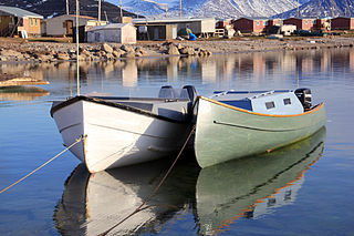
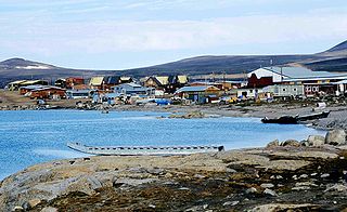
Grise Fiord is an Inuit hamlet on the southern tip of Ellesmere Island, in the Qikiqtaaluk Region, Nunavut, Canada. It is one of three populated places on the island; despite its low population, it is the largest community on Ellesmere Island. The hamlet at Grise Fiord, created by the Canadian Government in 1953 through a relocation of Inuit families from Inukjuak, Quebec, is the northernmost public community in Canada. It is also one of the coldest inhabited places in the world, with an average yearly temperature of −16.5 °C (2.3 °F).

<span class="mw-page-title-main">Eureka, Nunavut</span> Research station in Nunavut, Canada

Eureka is a small research base on Fosheim Peninsula, Ellesmere Island, Qikiqtaaluk Region, in the Canadian territory of Nunavut. It is located on the north side of Slidre Fiord, which enters Eureka Sound farther west. It is the third-northernmost permanent research community in the world. The only two farther north are Alert, which is also on Ellesmere Island, and Nord, in Greenland. Eureka has the lowest average annual temperature and the lowest amount of precipitation of any weather station in Canada.

<span class="mw-page-title-main">Sirmilik National Park</span> National park in Nunavut, Canada

Sirmilik National Park is a national park located in Qikiqtaaluk, Nunavut, Canada, established in 1999. Situated within the Arctic Cordillera, the park is composed of three areas: most of Bylot Island with the exception for a few areas that are Inuit-owned lands, Oliver Sound, and Baffin Island's Borden Peninsula. Much of the park is bordered by water.

<span class="mw-page-title-main">Qikiqtarjuaq</span> Place in Nunavut, Canada

Qikiqtarjuaq is a community located on Broughton Island in the Qikiqtaaluk Region of Nunavut, Canada. The island is known for Arctic wildlife, bird watching at the Qaqulluit National Wildlife Area. The community serves as the northern access point for Auyuittuq National Park and Pangnirtung is the southern access point.

<span class="mw-page-title-main">Prince Leopold Island</span>

Prince Leopold Island is an island in the Qikiqtaaluk Region of Nunavut, Canada. It is located in Lancaster Sound at the junction of Prince Regent Inlet and Barrow Strait. Somerset Island is situated 13 km (8.1 mi) to the southwest; Port Leopold, an abandoned trading post, is the closest landmark. The island is significant as a summer habitat and breeding ground for large populations of several arctic bird species.

<span class="mw-page-title-main">Arctic Cordillera</span> Terrestrial ecozone in northern Canada

The Arctic Cordillera is a terrestrial ecozone in northern Canada characterized by a vast, deeply dissected chain of mountain ranges extending along the northeastern flank of the Canadian Arctic Archipelago from Ellesmere Island to the northeasternmost part of the Labrador Peninsula in northern Labrador and northern Quebec, Canada. It spans most of the eastern coast of Nunavut with high glaciated peaks rising through ice fields and some of Canada's largest ice caps, including the Penny Ice Cap on Baffin Island. It is bounded to the east by Baffin Bay, Davis Strait and the Labrador Sea while its northern portion is bounded by the Arctic Ocean.

<span class="mw-page-title-main">Coburg Island</span> Island in Canada

Coburg Island is an uninhabited island in Qikiqtaaluk, Nunavut, Canada. It is one of the members of Queen Elizabeth Islands located in Baffin Bay's Lady Ann Strait. It is separated from Ellesmere Island by Glacier Strait; Devon Island is to the south.

<span class="mw-page-title-main">Qikiqtaryuaq (Queen Maud Gulf)</span> Uninhabited island in Nunavut, Canada

Qikiqtaryuaq, formerly Melbourne Island, is an island located in the Kitikmeot Region, Nunavut, Canada. It lies at the western end of Queen Maud Gulf and is dominated by lakes and marshlands. The island has a total area of 381 km2 (147 sq mi) and is uninhabited.

<span class="mw-page-title-main">Polar Bear Pass National Wildlife Area</span>

Polar Bear Pass National Wildlife Area is a National Wildlife Area on Bathurst Island within Qikiqtaaluk, Nunavut, Canada. It is on federal Crown land, and is administered by the Canadian Wildlife Service, a division of Environment Canada, with respect to the Canada Wildlife Act's National Wildlife Area Regulations. Land use is also subject to the Nunavut Land Claims Agreement. To the north and west is Qausuittuq National Park.

<span class="mw-page-title-main">Milne Inlet</span> Inlet at confluence of Eclipse Sound and Navy Board Inlet in Nunavut

Milne Inlet is a small, shallow arm of Eclipse Sound which, along with Navy Board Inlet, separates Bylot Island from Baffin Island in Nunavut's Qikiqtaaluk Region. Milne Inlet flows in a southerly direction from Navy Board Inlet at the confluence of Eclipse Sound. Milne Inlet is shallow and has high tides and strong winds. It only has 90 days where it is ice-free—from August to October. The hamlet of Mittimatalik —Pond Inlet which is 92% Inuit, is the gateway to many tourist attractions in the region, and is 80 km from Milne Inlet. The region is part of the Arctic Cordillera, with one of Canada's most inhospitable climates—with long, dark winters and temperatures averaging −35 °C (−31 °F).

<span class="mw-page-title-main">Lindstrom Peninsula</span>

The Lindstrom Peninsula is located on the southern coast of Ellesmere Island, a part of the Qikiqtaaluk Region of the Canadian territory of Nunavut. Across Baffin Bay to the south lies Devon Island. Harbour Fiord and Landslip Island are to the west, while the Grise Fiord is to the east. The highest peak on the peninsula is Mount Aqiatushuk 76°25′40″N083°15′00″W.

The Heim Peninsula is located on the southern coast of Ellesmere Island, a part of the Qikiqtaaluk Region of the Canadian territory of Nunavut. The Sydkap Fiord is to the west, and the Harbour Fiord is to the east. Landslip Island is approximately 1 km (0.62 mi) off the southeastern shore.

Cambridge Point is an uninhabited headland on Coburg Island in the Qikiqtaaluk Region of Nunavut, Canada. It is located off Marina Peninsula.

Reid Bay is an Arctic waterway in the Qikiqtaaluk Region, Nunavut, Canada. It is located in Davis Strait off Baffin Island's Cumberland Sound.

Hantzsch Island is an uninhabited island in the Qikiqtaaluk Region of Nunavut, Canada. It is located in Frobisher Bay off the southern tip of Baffin Island's Meta Incognita Peninsula and the northeastern tip of Edgell Island. The closest community is the Inuit hamlet of Sanikiluaq, 800 km (500 mi) to the west on Flaherty Island.

<span class="mw-page-title-main">North Water Polynya</span> Polynya between Greenland and Canada in Baffin Bay

The North Water Polynya (NOW), or Pikialasorsuaq to Inuit in Greenland and Sarvarjuaq to Inuit in Canada, is a polynya that lies between Greenland and Canada in northern Baffin Bay. The world's largest Arctic polynya at about 85,000 km2 (33,000 sq mi), it creates a warm microclimate that provides a refuge for narwhal, beluga, walrus, and bowhead whales to feed and rest. While thin ice forms in some areas, the polynya is kept open by wind, tides and an ice bridge on its northern edge. Named the "North Water" by 19th century whalers who relied on it for spring passage, this polynya is one of the most biologically productive marine areas in the Arctic Ocean.

<span class="mw-page-title-main">Qausuittuq National Park</span> National park in Nunavut, Canada

Qausuittuq National Park is a national park located on northwest Bathurst Island in Nunavut. It was established on September 1, 2015, becoming Canada's 45th national park.

<span class="mw-page-title-main">Tallurutiup Imanga National Marine Conservation Area</span> National marine conservation area in Nunavut, Canada

Tallurutiup Imanga National Marine Conservation Area is a proposed National Marine Conservation Area (NMCA) located in the Qikiqtaaluk Region of Nunavut, Canada. The goal of the marine conservation area is to work with local Inuit to conserve the rich biodiversity of Lancaster Sound and its adjacent waterways. Once formally established under the Canada National Marine Conservation Areas Act, it will become the largest Parks Canada-managed protected area and the second largest protected area in Canada after Tuvaijuittuq Marine Protected Area.

<span class="mw-page-title-main">Broughton Island (Nunavut)</span> Island in the Arctic Archipelago

Broughton Island is a 127.6 km2 (49.3 sq mi) island in the Arctic Archipelago.

Scott Islands Marine National Wildlife Area is a National Wildlife Area off the northwestern tip of Vancouver Island in the Canadian province of British Columbia. Covering an area of 11,570.65 km2 (4,467.45 sq mi), it is the second largest protected area in British Columbia after Offshore Pacific Seamounts and Vents Closure and is the largest national wildlife area in Canada.

References

  1. "Nirjutiqavvik National Wildlife Area". Geographical Names Data Base . Natural Resources Canada.
  2. "Nirjutiqavvik (Coburg Island) National Wildlife Area". mpaglobal.org. Archived from the original on 26 July 2011. Retrieved 11 September 2009.
  3. "Nirjutiqavvik National Wildlife Area". New Parks North. Government of Canada Environment Canada Canadian Wildlife Service. 16. March 2001.
  4. 1 2 3 4 5 6 7 8 9 10 Canada, Environment and Climate Change (7 October 2011). "Nirjutiqavvik National Wildlife Area". www.canada.ca. Retrieved 8 November 2022.
  5. Article 3.2.20
  6. Article 3.3.5
  7. Article 5.2.1
  8. Article 5.2.2
  9. "2016 TO 2023 INUIT IMPACT AND BENEFIT AGREEMENT". Nunavut Tunngavik Incorporated . Retrieved 8 November 2022.
  10. Canada, Environment and Climate Change (20 February 2015). "Nirjutiqavvik National Wildlife Area pamphlet". www.canada.ca. Retrieved 8 November 2022.
  11. 1 2 Pirie-Dominix, Lisa (2019). "Polar Continental Shelf Program Science Report" (PDF). Natural Resources Canada.
  12. "Wildlife Conservation". National Wildlife Federation. Retrieved 8 November 2022.
  13. "Chapter 1 — Global Warming of 1.5 °C" . Retrieved 8 November 2022.
  14. IPCC, 2019: Summary for Policymakers. In: IPCC Special Report on the Ocean and Cryosphere in a Changing Climate [H.-O. Pörtner, D.C. Roberts, V. Masson-Delmotte, P. Zhai, M. Tignor, E. Poloczanska, K. Mintenbeck, A. Alegría, M.  Nicolai, A. Okem, J. Petzold, B. Rama, N.M. Weyer (eds.)]. Cambridge University Press, Cambridge, UK and New York, NY, USA. https://doi.org/10.1017/9781009157964.001.
  15. "Learn". National Snow and Ice Data Center . Retrieved 8 November 2022.
  16. "National Wildlife Federation (NWF)", The Grants Register 2018, London: Palgrave Macmillan UK, pp. 553–553, 2018, doi: 10.1007/978-1-349-94186-5_859 , ISBN   978-1-349-94186-5 , retrieved 8 November 2022
  17. "Extreme Energy Injustice and Indigenous Rights Violations in Alaska - A Banking on Climate Change Case Study - The Understory". Rainforest Action Network. Retrieved 8 November 2022.
  18. "Nirjutiqavvik (Coburg Island) - National Wildlife Area". mb.ec.gc.ca. Archived from the original on 29 September 2011. Retrieved 11 September 2009.