Coburg Island

Last updated

Coburg Island
Native name:
Nirjutiqavvik
Coburg Island in Jones Sound.jpg
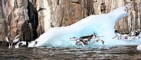
Seabirds nesting at Coburg Island
Canada Nunavut location map-lambert proj3.svg
Red pog.svg
Coburg Island
Canada location map 2.svg
Red pog.svg
Coburg Island
Geography
Location Lady Ann Strait
Coordinates 75°57′N79°18′W / 75.950°N 79.300°W / 75.950; -79.300 (Coburg Island)
Archipelago Arctic Archipelago
Area411 km2 (159 sq mi)
Length38 km (23.6 mi)
Width22–24 km (14–15 mi)
Highest elevation800 m (2600 ft)
Highest pointUnnamed
Administration
Canada
Nunavut Nunavut
Region Qikiqtaaluk
Demographics
PopulationUninhabited

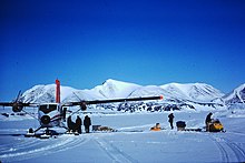
Coburg Island (Inuktitut : Nirjutiqavvik) [1] is an uninhabited island in Qikiqtaaluk, Nunavut, Canada. It is one of the members of Queen Elizabeth Islands located in Baffin Bay's Lady Ann Strait. It is separated from Ellesmere Island by Glacier Strait; Devon Island is to the south.

Contents

Elsewhere in Nunavut, there is also a tiny Saxe-Coburg Island, lying in Davis Strait, south of Leopold Island, itself east of Baffin Island's Cape Mercy (Cumberland Peninsula).

Geography

Twin Otter STOL plane brings logistic support to research station on Coburg Island, June 6, 1975 75-06-06 Coburg Island.jpg
Twin Otter STOL plane brings logistic support to research station on Coburg Island, June 6, 1975

The island is characterized by cliffs, rocky shores, and tundra.

Fauna

Bowhead whale, narwhal, polar bear, seal, walrus, and white whale frequent the area. [2]

Seabirds and iceberg at Coburg Island Seabirds and iceberg at Coburg Island.jpg
Seabirds and iceberg at Coburg Island

Conservation

Coburg Island has several designated conservation classifications including International Biological Program site and Key Migratory Bird Terrestrial Habitat site. Along with the surrounding marine area, the island is a part of the Nirjutiqavvik National Wildlife Area. [2]

Cambridge Point, off of the southeastern Marina Peninsula, is a Canadian Important Bird Area notable for black guillemot, black-legged kittiwake, glaucous gull, northern fulmar, and thick-billed murre. [2] A portion of Cambridge Point is within the NWA.

Related Research Articles

<span class="mw-page-title-main">Baffin Island</span> Largest Arctic island in Nunavut, Canada

Baffin Island, in the Canadian territory of Nunavut, is the largest island in Canada and the fifth-largest island in the world. Its area is 507,451 km2 (195,928 sq mi) with a population density of 0.03/km²; the population was 13,039 according to the 2021 Canadian census; and it is located at 68°N70°W. It also contains the city of Iqaluit, which is the capital of Nunavut.

<span class="mw-page-title-main">Devon Island</span> Uninhabited island in Nunavut, Canada

Devon Island is an island in Canada and the largest uninhabited island in the world. It is located in Baffin Bay, Qikiqtaaluk Region, Nunavut, Canada. It is one of the largest members of the Arctic Archipelago, the second-largest of the Queen Elizabeth Islands, Canada's sixth-largest island, and the 27th-largest island in the world. It has an area of 55,247 km2 (21,331 sq mi). The bedrock is Precambrian gneiss and Paleozoic siltstones and shales. The highest point is the Devon Ice Cap at 1,920 m (6,300 ft) which is part of the Arctic Cordillera. Devon Island contains several small mountain ranges, such as the Treuter Mountains, Haddington Range and the Cunningham Mountains. The notable similarity of its surface to that of Mars has attracted interest from scientists.

<span class="mw-page-title-main">Somerset Island (Nunavut)</span> Uninhabited island in Nunavut, Canada

Somerset Island is a large, uninhabited island of the Arctic Archipelago, that is part of the Canadian territory of Nunavut. The island is separated from Cornwallis Island and Devon Island to the north by the Parry Channel, from Baffin Island to the east by Prince Regent Inlet, from the Boothia Peninsula to the south by Bellot Strait, and from Prince of Wales Island to the west by Peel Sound. It has an area of 24,786 km2 (9,570 sq mi), making it the 46th largest island in the world and Canada's twelfth largest island.

<span class="mw-page-title-main">Southampton Island</span> Island in north Hudson Bay in Nunavut, Canada

Southampton Island is a large island at the entrance to Hudson Bay at Foxe Basin. One of the larger members of the Arctic Archipelago, Southampton Island is part of the Kivalliq Region in Nunavut, Canada. The area of the island is stated as 41,214 km2 (15,913 sq mi) by Statistics Canada. It is the 34th largest island in the world and Canada's ninth largest island. The only settlement on Southampton Island is Coral Harbour, called Salliq in Inuktitut.

<span class="mw-page-title-main">Bylot Island</span> Uninhabited island off Baffin Island in Nunavut Territory, Canada

Bylot Island lies off the northern end of Baffin Island in Nunavut Territory, Canada. Eclipse Sound to the southeast and Navy Board Inlet to the southwest separate it from Baffin Island. Parry Channel lies to its northwest. At 11,067 km2 (4,273 sq mi) it is ranked 71st largest island in the world and Canada's 17th largest island. The island measures 180 km (110 mi) east to west and 110 km (68 mi) north to south and is one of the largest uninhabited islands in the world. While there are no permanent settlements on this Canadian Arctic island, Inuit from Pond Inlet and elsewhere regularly travel to Bylot Island. An Inuit seasonal hunting camp is located southwest of Cape Graham Moore.

<span class="mw-page-title-main">Foxe Basin</span> Oceanic basin north of Hudson Bay, in Nunavut, Canada

Foxe Basin is a shallow oceanic basin north of Hudson Bay, in Nunavut, Canada, located between Baffin Island and the Melville Peninsula. For most of the year, it is blocked by sea ice and drift ice made up of multiple ice floes.

<span class="mw-page-title-main">Sirmilik National Park</span> National park in Nunavut, Canada

Sirmilik National Park is a national park located in Qikiqtaaluk, Nunavut, Canada, established in 1999. Situated within the Arctic Cordillera, the park is composed of three areas: most of Bylot Island with the exception for a few areas that are Inuit-owned lands, Oliver Sound, and Baffin Island's Borden Peninsula. Much of the park is bordered by water.

<span class="mw-page-title-main">Prince Leopold Island</span>

Prince Leopold Island is an island in the Qikiqtaaluk Region of Nunavut, Canada. It is located in Lancaster Sound at the junction of Prince Regent Inlet and Barrow Strait. Somerset Island is situated 13 km (8.1 mi) to the southwest; Port Leopold, an abandoned trading post, is the closest landmark. The island is significant as a summer habitat and breeding ground for large populations of several arctic bird species.

<span class="mw-page-title-main">Arctic Cordillera</span> Terrestrial ecozone in northern Canada

The Arctic Cordillera is a terrestrial ecozone in northern Canada characterized by a vast, deeply dissected chain of mountain ranges extending along the northeastern flank of the Canadian Arctic Archipelago from Ellesmere Island to the northeasternmost part of the Labrador Peninsula in northern Labrador and northern Quebec, Canada. It spans most of the eastern coast of Nunavut with high glaciated peaks rising through ice fields and some of Canada's largest ice caps, including the Penny Ice Cap on Baffin Island. It is bounded to the east by Baffin Bay, Davis Strait and the Labrador Sea while its northern portion is bounded by the Arctic Ocean.

Lady Ann Strait is a waterway in Jones Sound in the Canadian territory of Nunavut. It is 30 km (19 mi) wide at the point between Cape Fitz Roy on Devon Island to the southwest, and Coburg Island to the northeast. The strait empties into northwestern Baffin Bay.

<span class="mw-page-title-main">Milne Inlet</span> Inlet at confluence of Eclipse Sound and Navy Board Inlet in Nunavut

Milne Inlet is a small, shallow arm of Eclipse Sound which, along with Navy Board Inlet, separates Bylot Island from Baffin Island in Nunavut's Qikiqtaaluk Region. Milne Inlet flows in a southerly direction from Navy Board Inlet at the confluence of Eclipse Sound. Milne Inlet is shallow and has high tides and strong winds. It only has 90 days where it is ice-free—from August to October. The hamlet of Mittimatalik —Pond Inlet which is 92% Inuit, is the gateway to many tourist attractions in the region, and is 80 km from Milne Inlet. The region is part of the Arctic Cordillera, with one of Canada's most inhospitable climates—with long, dark winters and temperatures averaging −35 °C (−31 °F).

<span class="mw-page-title-main">Dorset Island</span> Island in the Arctic Archipelago

Dorset Island or Cape Dorset Island is one of the Canadian Arctic islands located in Hudson Strait, Nunavut, Canada. It lies off the Foxe Peninsula area of southwestern Baffin Island in the Qikiqtaaluk Region. It is serviced by an airport and a harbour.

Qaqulluit (Inuktitut syllabics: ᖃᖁᓪᓗᐃᑦ formerly Qaqaluit Island is one of eastern Baffin Island's small, offshore, uninhabited islands, located in the Arctic Archipelago in the Qikiqtaaluk Region, Nunavut. Along with Paallavvik and Aggijjat, it is situated off Cumberland Peninsula within Davis Strait's Merchants Bay.

Cambridge Point is an uninhabited headland on Coburg Island in the Qikiqtaaluk Region of Nunavut, Canada. It is located off Marina Peninsula.

<span class="mw-page-title-main">Cape Hay</span>

Cape Hay is an uninhabited headland on Bylot Island in the Qikiqtaaluk Region of Nunavut, Canada. It is located at the island's northwestern tip, protruding into Lancaster Sound. The Wollaston Islands are offshore.

Reid Bay is an Arctic waterway in the Qikiqtaaluk Region, Nunavut, Canada. It is located in Davis Strait off Baffin Island's Cumberland Sound.

Hantzsch Island is an uninhabited island in the Qikiqtaaluk Region of Nunavut, Canada. It is located in Frobisher Bay off the southern tip of Baffin Island's Meta Incognita Peninsula and the northeastern tip of Edgell Island. The closest community is the Inuit hamlet of Sanikiluaq, 800 km (500 mi) to the west on Flaherty Island.

<span class="mw-page-title-main">Nirjutiqavvik National Wildlife Area</span> National Wildlife Area site in Nunavut, Canada

Nirjutiqavvik National Wildlife Area is a National Wildlife Area on Coburg Island within the Qikiqtaaluk Region, Nunavut, Canada. It is located in Baffin Bay's Lady Ann Strait between Ellesmere Island, to the north, and Devon Island to the south. The NWA includes Coburg Island and its surrounding marine area.

<span class="mw-page-title-main">Broughton Island (Nunavut)</span> Island in the Arctic Archipelago

Broughton Island is a 127.6 km2 (49.3 sq mi) island in the Arctic Archipelago.

References

  1. "Nunavut National Wildlife Area Facts". cws-scf.ec.gc.ca. 2005-06-21. Retrieved 2009-04-24.[ dead link ]
  2. 1 2 3 "Cambridge Point". bsc-eoc.org. Archived from the original on 2011-06-12. Retrieved 2009-04-23.