Related Research Articles

Baffin Island, in the Canadian territory of Nunavut, is the largest island in Canada, the second-largest island in the Americas, and the fifth-largest island in the world. Its area is 507,451 km2 (195,928 sq mi) with a population density of 0.03/km2; the population was 13,039 according to the 2021 Canadian census; and it is located at 68°N70°W. It also contains the city of Iqaluit, which is the capital of Nunavut.

Baffin Bay, located between Baffin Island and the west coast of Greenland, is defined by the International Hydrographic Organization as a marginal sea of the Arctic Ocean. It is sometimes considered a sea of the North Atlantic Ocean. It is connected to the Atlantic via Davis Strait and the Labrador Sea. The narrower Nares Strait connects Baffin Bay with the Arctic Ocean. The bay is not navigable most of the year because of the ice cover and high density of floating ice and icebergs in the open areas. However, a polynya of about 80,000 km2 (31,000 sq mi), known as the North Water, opens in summer on the north near Smith Sound. Most of the aquatic life of the bay is concentrated near that region.

Akimiski Island is the largest island in James Bay, Canada, which is part of the Qikiqtaaluk Region of the territory of Nunavut. It has an area of 3,001 km2 (1,159 sq mi), making it the 163rd largest island in the world, and Canada's 29th largest island. Akimiski Island is 19 km (12 mi) from the province of Ontario. From the western side of the island, the Ontario coastline is visible.

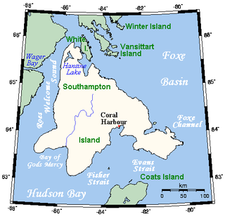
Southampton Island is a large island at the entrance to Hudson Bay at Foxe Basin. One of the larger members of the Arctic Archipelago, Southampton Island is part of the Kivalliq Region in Nunavut, Canada. The area of the island is stated as 41,214 km2 (15,913 sq mi) by Statistics Canada. It is the 34th largest island in the world and Canada's ninth largest island. The only settlement on Southampton Island is Coral Harbour, called Salliq in Inuktitut.

Foxe Basin is a shallow oceanic basin north of Hudson Bay, in Nunavut, Canada, located between Baffin Island and the Melville Peninsula. For most of the year, it is blocked by sea ice and drift ice made up of multiple ice floes.

Prince Leopold Island is an island in the Qikiqtaaluk Region of Nunavut, Canada. It is located in Lancaster Sound at the junction of Prince Regent Inlet and Barrow Strait. Somerset Island is situated 13 km (8.1 mi) to the southwest; Port Leopold, an abandoned trading post, is the closest landmark. The island is significant as a summer habitat and breeding ground for large populations of several arctic bird species.
The Ottawa Islands are a group of currently uninhabited islands situated in the eastern edge of Canada's Hudson Bay. The group comprises 24 small islands, located at approximately 60°N 80°W. The main islands include Booth Island, Bronson Island, Eddy Island, Gilmour Island, J. Gordon Island, Pattee Island, and Perley Island. The highest point is on Gilmour Island, which rises to over 1,800 ft (550 m). Located a short distance off the northwest coast of Quebec's Ungava Peninsula, they, like the other coastal islands in Hudson Bay, were historically part of the Northwest Territories, and became Crown Land upon the creation of Nunavut in 1999. Nunavik Inuit have occupied these islands since time immemorial and gained constitutionally-protected harvest and access rights under the Nunavik Inuit Land Claim Agreement signed in 2007.

Coburg Island is an uninhabited island in Qikiqtaaluk, Nunavut, Canada. It is one of the members of Queen Elizabeth Islands located in Baffin Bay's Lady Ann Strait. It is separated from Ellesmere Island by Glacier Strait; Devon Island is to the south.
The Inglefield Mountains are a mountain range in southeastern Ellesmere Island, Nunavut, Canada. The mountain range is mostly covered by ice fields, with granitic nunataks reaching a height of 1,500 m (4,921 ft) above sea level. Rocky cliffs border the coastal areas. Like most other mountain ranges in the Canadian Arctic, the Inglefield Mountains are part of the Arctic Cordillera.
The Twin Islands are similarly shaped Arctic islands in the Qikiqtaaluk Region of Nunavut, Canada. They are located in central James Bay, 56 km (35 mi) north east of Akimiski Island, and 58 km (36 mi) west of Quebec. The group includes North Twin and South Twin islands.
Lady Ann Strait is a waterway in Jones Sound in the Canadian territory of Nunavut. It is 30 km (19 mi) wide at the point between Cape Fitz Roy on Devon Island to the southwest, and Coburg Island to the northeast. The strait empties into northwestern Baffin Bay.
Scott Inlet is a body of water in the Qikiqtaaluk Region of Nunavut, Canada. It is an arm of Baffin Bay. Scott Island lies in its middle. At its south end, it splits into Clark and Gibbs Fiords. The Inuit community of Clyde River is approximately 120 km (75 mi) to the southeast.
Grey Goose Island is one of several, larger, uninhabited Canadian arctic islands in Nunavut, Canada located within the midsection of James Bay. Other comparable islands in the area include the Bear Islands, North and South Twin Islands, Spencer Island, Sunday Island, and Walter Island. La Grande River and the Cree village of Chisasibi, Quebec are 65 km (40 mi) to the southeast.
The Boas is a river on Southampton Island in Nunavut, Canada. The river rises at 64°49′58″N084°23′34″W and its mouth is located at the Bay of Gods Mercy. Proceeding inland, the river becomes braided and is about 5 kilometres (3.1 mi) wide.
Qaqulluit (Inuktitut syllabics: ᖃᖁᓪᓗᐃᑦ formerly Qaqaluit Island is one of eastern Baffin Island's small, offshore, uninhabited islands, located in the Arctic Archipelago in the Qikiqtaaluk Region, Nunavut. Along with Paallavvik and Aggijjat, it is situated off Cumberland Peninsula within Davis Strait's Merchants Bay.

Niaqunnguut (Inuktitut syllabics: ᓂᐊᖁᙴᑦ formerly Cape Graham Moore, after Vice-Admiral Sir Graham Moore, is an uninhabited headland on Bylot Island in the Qikiqtaaluk Region of Nunavut, Canada. It is located at the island's southeastern tip protruding into Lancaster Sound. The community of Pond Inlet is 70 km to the southwest.

Cape Hay is an uninhabited headland on Bylot Island in the Qikiqtaaluk Region of Nunavut, Canada. It is located at the island's northwestern tip, protruding into Lancaster Sound. The Wollaston Islands are offshore.
Reid Bay is an Arctic waterway in the Qikiqtaaluk Region, Nunavut, Canada. It is located in Davis Strait off Baffin Island's Cumberland Sound.

Nirjutiqavvik National Wildlife Area is a National Wildlife Area on Coburg Island within the Qikiqtaaluk Region, Nunavut, Canada. It is located in Baffin Bay's Lady Ann Strait between Ellesmere Island, to the north, and Devon Island to the south. The NWA includes Coburg Island and its surrounding marine area.

Cape Parry is a headland in Canada's Northwest Territories. Located at the northern tip of the Parry Peninsula, it projects into Amundsen Gulf. The nearest settlement is Paulatuk, 100 km (62 mi) to the south, and Fiji Island is located 9 km (5.6 mi) to the west. Cape Parry was formerly accessible through Cape Parry Airport that was located at the Distant Early Warning Line. The airport was listed as abandoned after the closure of the DEW line site.
References
- 1 2 "Cambridge Point". bsc-eoc.org. Archived from the original on 2011-06-12. Retrieved 2009-04-23.
- ↑ "Nunavut National Wildlife Area Facts". cws-scf.ec.gc.ca. 2005-06-21. Retrieved 2009-04-24.[ dead link ]
- Cambridge Point at the Atlas of Canada
75°47′59″N079°23′59″W / 75.79972°N 79.39972°W