The Arctic Archipelago, also known as the Canadian Arctic Archipelago, groups together all islands lying to the north of the Canadian continental mainland excluding Greenland.

Vice-Admiral Sir George Strong Nares was a Royal Navy officer and Arctic explorer. He commanded the first ship to pass through the Suez Canal, the Challenger Expedition, and the British Arctic Expedition. He was highly thought of as a leader and scientific explorer. In later life he worked for the Board of Trade and as Acting Conservator of the River Mersey.
Hans Island is a small, uninhabited barren knoll measuring 1.3 km2 (0.5 sq mi), 1,290 m (4,230 ft) long and 1,199 m (3,934 ft) wide, in the centre of the Kennedy Channel of Nares Strait—the strait that separates Ellesmere Island from northern Greenland and connects Baffin Bay with the Lincoln Sea. Hans Island is the smallest of three islands in Kennedy Channel off the Washington Land coast; the others are Franklin Island and Crozier Island. The strait at this point is 35 kilometres (22 mi) wide, placing the island within the territorial waters of both Canada and Greenland. A theoretical line in the middle of the strait goes through the island.

Baffin Bay, located between Baffin Island and the west coast of Greenland, is a marginal sea of the North Atlantic Ocean. It is connected to the Atlantic via Davis Strait and the Labrador Sea. The narrower Nares Strait connects Baffin Bay with the Arctic Ocean. The bay is not navigable most of the year because of the ice cover and high density of floating ice and icebergs in the open areas. However, a polynya of about 80,000 km2 (31,000 sq mi), known as the North Water, opens in summer on the north near Smith Sound. Most of the aquatic life of the bay is concentrated near that region.

Nares Strait is a waterway between Ellesmere Island and Greenland that connects the northern part of Baffin Bay with the Lincoln Sea. From south to north, the strait includes Smith Sound, Kane Basin, Kennedy Channel, Hall Basin and Robeson Channel. During 1962–64, a 20 km (12 mi) by 10 km (6.2 mi) ice island drifted southward from the Lincoln Sea through the Nares and Davis Straits to the Atlantic Ocean. Nares strait has a nearly permanent current from the north, powered by the Beaufort Gyre, making it harder to traverse for ships coming from the south.

The M'Clure Strait is a strait on the edge of the Canadian Northwest Territories. It forms the northwestern end of the Parry Channel which extends east all the way to Baffin Bay and is thus a possible route for the Northwest Passage. The strait was named for Robert McClure, an Irish Arctic explorer serving in the Royal Navy. He was the first man to traverse the North-West Passage.

Kennedy Channel is an Arctic sea passage between Greenland and Canada's most northerly island, Ellesmere Island.

Lincoln Sea is a body of water in the Arctic Ocean, stretching from Cape Columbia, Canada, in the west to Cape Morris Jesup, Greenland, in the east. The northern limit is defined as the great circle line between those two headlands. It is covered with sea ice throughout the year, the thickest sea ice in the Arctic Ocean, which can be up to 15 m (49 ft) thick. Water depths range from 100 m (330 ft) to 300 m (980 ft). Water and ice from Lincoln Sea empty into Robeson Channel, the northernmost part of Nares Strait, most of the time.

Hall Basin is an Arctic waterway between Hall Land in Greenland to the west and Canada's northernmost island to the east, Ellesmere Island.

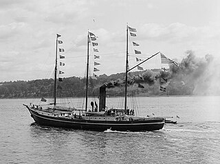
The British Arctic Expedition of 1875–76, led by Sir George Strong Nares, was sent by the British Admiralty to attempt to reach the North Pole via Smith Sound. Two ships, HMS Alert and HMS Discovery, sailed from Portsmouth on 29 May 1875. Although the expedition failed to reach the North Pole, the coasts of Greenland and Ellesmere Island were extensively explored and large amounts of scientific data were collected.
Murchison Promontory is a peninsula in northern Canada that is the northernmost point on mainland Canada and on the mainland of North America; it is also one of the Extreme points of Earth.
Lady Franklin Bay is an Arctic waterway in Qikiqtaaluk Region, Nunavut, Canada. The bay is located in Nares Strait northwest of Judge Daly Promontory and is an inlet into the northeastern shore of Ellesmere Island.
Hoppner Strait is a narrow arm of Foxe Basin east of Lyon Inlet in the Qikiqtaaluk Region of Nunavut, Canada. It is situated between Winter Island and the Melville Peninsula.
The Cook Peninsula is located on the eastern coast of Ellesmere Island, a part of the Qikiqtaaluk Region of the Canadian territory of Nunavut. North of Princess Marie Bay, it stretches eastward into Nares Strait. The peninsula is approximately 64 square kilometres (25 sq mi) in size, and has two lowland areas frequented by muskox.
HMS Alert was a 17-gun wooden screw sloop of the Cruizer class of the Royal Navy, launched in 1856 and broken up in 1894. She was the eleventh ship of the Royal Navy to bear the name, and was noted for her Arctic exploration work; in 1876 she reached a record latitude of 82° North. Alert briefly served with the US Navy, and ended her career with the Canadian Marine Service as a lighthouse tender and buoy ship.
Dobbin Bay is an Arctic waterway in Qikiqtaaluk Region, Nunavut, Canada. It is located in Nares Strait by eastern Ellesmere Island, south of the Darling Peninsula.
Herschel Bay is an Arctic waterway in Qikiqtaaluk Region, Nunavut, Canada. It is located in Nares Strait, west of Smith Sound. Ellesmere Island is to the east, while Pim Island's Cape Sabine is to the northeast.

Ikertooq Fjord is a 55 km (34 mi) long fjord in the Qeqqata municipality in western Greenland. The fjord empties into Davis Strait 21 km (13 mi) south of Sisimiut.
Sarfannguit Island is an island in the Qeqqata municipality in western Greenland.

The Canadian Arctic Rift System is a major North American geological structure extending from the Labrador Sea in the southeast through Davis Strait, Baffin Bay and the Arctic Archipelago in the northwest. It consists of a series of interconnected rifts that formed during the Paleozoic, Mesozoic and Cenozoic eras. Extensional stresses along the entire length of the rift system have resulted in a variety of tectonic features, including grabens, half-grabens, basins and faults.