Related Research Articles

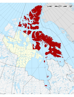
The Arctic Archipelago, also known as the Canadian Arctic Archipelago, is an archipelago lying to the north of the Canadian continental mainland, excluding Greenland.

Baffin Bay, located between Baffin Island and the west coast of Greenland, is defined by the International Hydrographic Organization as a marginal sea of the Arctic Ocean. It is sometimes considered a sea of North Atlantic Ocean. It is connected to the Atlantic via Davis Strait and the Labrador Sea. The narrower Nares Strait connects Baffin Bay with the Arctic Ocean. The bay is not navigable most of the year because of the ice cover and high density of floating ice and icebergs in the open areas. However, a polynya of about 80,000 km2 (31,000 sq mi), known as the North Water, opens in summer on the north near Smith Sound. Most of the aquatic life of the bay is concentrated near that region.

The Qikiqtaaluk Region, Qikiqtani Region or Baffin Region is the easternmost, northernmost, and southernmost administrative region of Nunavut, Canada. Qikiqtaaluk is the traditional Inuktitut name for Baffin Island. Although the Qikiqtaaluk Region is the most commonly used name in official contexts, several notable public organizations, including Statistics Canada prefer the older term Baffin Region.

Devon Island is an island in Canada and the largest uninhabited island in the world. It is located in Baffin Bay, Qikiqtaaluk Region, Nunavut, Canada. It is one of the largest members of the Arctic Archipelago, the second-largest of the Queen Elizabeth Islands, Canada's sixth-largest island, and the 27th-largest island in the world. It has an area of 55,247 km2 (21,331 sq mi). The bedrock is Precambrian gneiss and Paleozoic siltstones and shales. The highest point is the Devon Ice Cap at 1,920 m (6,300 ft) which is part of the Arctic Cordillera. Devon Island contains several small mountain ranges, such as the Treuter Mountains, Haddington Range and the Cunningham Mountains. The notable similarity of its surface to that of Mars has attracted interest from scientists.

North Kent Island is one of the uninhabited Canadian arctic islands in the Qikiqtaaluk Region of Nunavut, Canada. It is located in the Cardigan Strait between Devon Island's Colin Archer Peninsula and Ellesmere Island's Simmons Peninsula.

Jason was a Norwegian whaling vessel laid down in 1881 by Rødsverven in Sandefjord, Norway, the same shipyard which later built Ernest Shackleton's ship Endurance. The ship, financed by Christen Christensen, an entrepreneur from Sandefjord, was noted for his participation in an 1892-1893 Antarctic expedition led by Carl Anton Larsen.

Bache Peninsula is a geological formation in Canada, on Ellesmere Island in Nunavut. The peninsula is considered a cape', meaning that it is a headland that dramatically affects the ocean currents. It is primarily known for being the site of the world's northernmost permanent settlement from 1926 to 1933, a Royal Canadian Mounted Police post.
Grinnell Peninsula is a peninsula in northwestern Devon Island in Nunavut, Canada. It was discovered by the First Grinnell Expedition and named "Grinnell Land", after Henry Grinnell, the financier of Arctic explorations.

Coburg Island is an uninhabited island in Qikiqtaaluk, Nunavut, Canada. It is one of the members of Queen Elizabeth Islands located in Baffin Bay's Lady Ann Strait. It is separated from Ellesmere Island by Glacier Strait; Devon Island is to the south.

Barrow Strait is a shipping waterway in Northern Canada's territory of Nunavut. Forming part of the Parry Channel, the strait separates several large islands including Cornwallis Island and Devon Island to the north, from Prince of Wales Island, Somerset Island, and Prince Leopold Island to the south.
Cardigan Strait is a narrow waterway in the territory of Nunavut. It lies between the eastern coast of Devon Island and the western coast of Ellesmere Island. Norwegian Bay opens to the north. North Kent Island is situated within the strait.

The Borden Peninsula is a peninsula on northern Baffin Island, in Nunavut, Canada. It lies some 80 km south of Devon Island, from which it is separated by Lancaster Sound. Northeastern Borden Peninsula is home to Sirmilik National Park.

The Lindstrom Peninsula is located on the southern coast of Ellesmere Island, a part of the Qikiqtaaluk Region of the Canadian territory of Nunavut. Across Baffin Bay to the south lies Devon Island. Harbour Fiord and Landslip Island are to the west, while the Grise Fiord is to the east. The highest peak on the peninsula is Mount Aqiatushuk 76°25′40″N083°15′00″W.
This is a list of the extreme points of the Commonwealth of Nations — the points that are farther north, south, east or west, or higher or lower in elevation than any other location.

Dorset Island or Cape Dorset Island is one of the Canadian Arctic islands located in Hudson Strait, Nunavut, Canada. It lies off the Foxe Peninsula area of southwestern Baffin Island in the Qikiqtaaluk Region. It is serviced by an airport and a harbour.

Niaqunnguut (Inuktitut syllabics: ᓂᐊᖁᙴᑦ formerly Cape Graham Moore, after Vice-Admiral Sir Graham Moore, is an uninhabited headland on Bylot Island in the Qikiqtaaluk Region of Nunavut, Canada. It is located at the island's southeastern tip protruding into Lancaster Sound. The community of Pond Inlet is 70 km to the southwest.
Cape Vera is an uninhabited headland on Devon Island, in the Qikiqtaaluk Region of Nunavut, Canada. Protruding off the island's northwestern Colin Archer Peninsula, it faces Jones Sound. Often, a polynya forms in the Cardigan Strait, a waterway that separates the cape from North Kent Island.

The Judge Daly Promontory is located on the eastern coast of Ellesmere Island, a part of the Qikiqtaaluk Region of the Canadian territory of Nunavut. It stretches from the southwest northeastward into Nares Strait. Lady Franklin Bay is to the north, Archer Fiord to the west, and Cape Baird is its northernmost point.
References
- ↑ "Cape Vera, Devon Island, Nunavut". bsc-eoc.org. Archived from the original on 2011-06-12. Retrieved 2008-10-21.