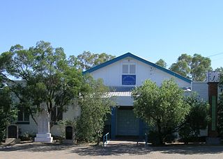
Cunnamulla is a town and a locality in the Shire of Paroo, Queensland, Australia. It is 206 kilometres (128 mi) south of Charleville, and approximately 750 kilometres (470 mi) west of the state capital, Brisbane. In the 2021 census, the locality of Cunnamulla had a population of 1,233 people.

Augathella is a rural town and locality in the Shire of Murweh, Queensland, Australia. In the 2021 census, the locality of Augathella had a population of 328 people.

Thargomindah is a rural town and locality in the Shire of Bulloo, Queensland, Australia. The town of Thargomindah is the administrative centre for the Shire of Bulloo. In the 2021 census, the locality of Thargomindah had a population of 243 people.

The Warrego River is an intermittent river that is part of the Darling catchment within the Murray–Darling basin, which is located in South West Queensland and in the Orana region of New South Wales, Australia. The Warrego River is the northernmost tributary of the Darling River.

The Shire of Paroo is a local government area in South West Queensland, Australia. The administrative centre is the town of Cunnamulla. The Paroo Shire covers an area of 47,623 square kilometres (18,387 sq mi). In the 2021 census, the Shire of Paroo had a population of 1,679 people.

Wyandra is a rural town and locality in the Shire of Paroo, Queensland, Australia. In the 2021 census, the locality of Wyandra had a population of 78 people.

Eulo is an outback town and locality in the Shire of Paroo, Queensland, Australia. It is known for its opal mining. In the 2021 census, the locality of Eulo had a population of 94 people.

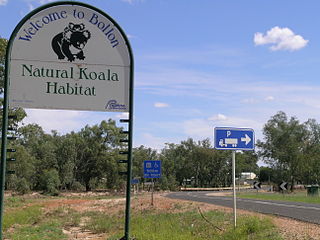
Bollon is a rural town and locality in the Shire of Balonne, Queensland, Australia. In the 2021 census, the locality of Bollon had a population of 174 people.

Yowah is an outback town and locality in the Shire of Paroo, Queensland, Australia. In the 2021 census, the locality of Yowah had a population of 126 people.
Barringun is a rural locality in the Shire of Paroo, Queensland, Australia. It is on the border of Queensland and New South Wales. In the 2021 census, Barringun had a population of 17 people.

Sommariva is a locality in the Shire of Murweh, Queensland, Australia. It is situated 37.9 kilometres (23.5 mi) east of Charleville and 57.4 kilometres (35.7 mi) west of Morven on the Warrego Highway. In the 2021 census, Sommariva had a population of 25 people.
Bakers Bend is a rural locality in the Shire of Murweh, Queensland, Australia. In the 2021 census, Bakers Bend had a population of 7 people.
Dynevor is a former locality in the Shire of Bulloo, Queensland, Australia. In the 2016 census, Dynevor had a population of 21 people.
Linden is a rural locality in the Shire of Paroo, Queensland, Australia. In the 2021 census, Linden had "no people or a very low population".

Cuttaburra is a rural locality in the Shire of Paroo, Queensland, Australia. It is on the Queensland border with New South Wales. In the 2021 census, Cuttaburra had a population of 22 people.

Tuen is an outback locality in the Shire of Paroo, Queensland, Australia. In the 2021 census, Tuen had "no people or a very low population".
Humeburn is a locality in the Shire of Paroo, Queensland, Australia. In the 2021 census, Humeburn had a population of 9 people.
Jobs Gate is a rural locality in the Shire of Paroo, Queensland, Australia. It is on the border of Queensland and New South Wales. In the 2021 census, Jobs Gate had "no people or a very low population".
Widgeegoara is a rural locality in the Shire of Paroo, Queensland, Australia. In the 2021 census, Widgeegoara had a population of 19 people.
Goondi Hill is a semi-urban locality in the Cassowary Coast Region, Queensland, Australia. In the 2021 census, Goondi Hill had a population of 437 people.


