
The M6 motorway is the longest motorway in the United Kingdom. It is located entirely within England, running for just over 230 miles (370 km) from the Midlands to the border with Scotland. It begins at Junction 19 of the M1 and the western end of the A14 at the Catthorpe Interchange, near Rugby before heading north-west. It passes Coventry, Birmingham, Wolverhampton, Stoke-on-Trent, Preston, Lancaster and Carlisle before terminating at Junction 45 near Gretna. Here, just short of the Scottish border it becomes the A74(M) which continues to Glasgow as the M74. Its busiest sections are between junctions 4 and 10a in the West Midlands, and junctions 16 to 19 in Cheshire; these sections have now been converted to smart motorways.

The M1 motorway connects London to Leeds, where it joins the A1(M) near Aberford, to connect to Newcastle. It was the first inter-urban motorway to be completed in the UK; the first motorway in the country was the Preston Bypass, which later became part of the M6.

Towcester is an affluent market town and civil parish in the West Northamptonshire unitary authority area of Northamptonshire, England. From 1974 to 2021, it was the administrative centre of the South Northamptonshire district.

The M40 motorway links London, Oxford, and Birmingham in England, a distance of approximately 89 miles (143 km).

The A14 is a major trunk road in England, running 127 miles (204 km) from Catthorpe Interchange, a major intersection at the southern end of the M6 and junction 19 of the M1 in Leicestershire to the Port of Felixstowe, Suffolk. The road forms part of the unsigned Euroroutes E24 and E30. It is the busiest shipping lane in East Anglia carrying anything from cars to large amounts of cargo between the UK and Mainland Europe.

Watford Gap is a low-lying area between two hills in the English Midlands, near Daventry and the village of Watford in Northamptonshire. Engineers from Roman times onwards have found it to be an ideal route for connecting the Midlands with South East England. The A5 road, the West Coast Main Line railway, the M1 motorway and a branch of the Grand Union Canal traverse in parallel a space about 400 metres (1,300 ft) wide. It has been written and spoken of as marking the divide between Northern England and Southern England.
Silverstone is a village and civil parish in Northamptonshire, England. It is about 4 miles (6.4 km) from Towcester on the former A43 main road, 10 miles (16 km) from the M1 motorway junction 15A and about 12 miles (19 km) from the M40 motorway junction 10, Northampton, Milton Keynes and Banbury. The population of the civil parish at the 2011 census was 2,176. The A43 now bypasses to the south-east of the village.
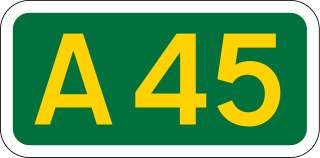
The A45 is a major road in England. It runs east from Birmingham past the National Exhibition Centre and the M42, then bypasses Coventry and Rugby, where it briefly merges with the M45 until it continues to Daventry. It then heads to Northampton and Wellingborough before running north of Rushden and Higham Ferrers and terminating at its junction with the A14 in Thrapston.

Milton Malsor is a village and civil parish in West Northamptonshire, England. The population of the civil parish at the 2011 census was 761. It is 4 miles (6.4 km) south of Northampton town centre, 45 miles (72 km) south-east of Birmingham, and 66 miles (106 km) north of central London; junction 15 of the M1 motorway is 2 miles (3.2 km) east by road. The area of the Milton Malsor civil parish is about 1,650 acres (670 ha), stretching from north of the M1 motorway between junctions 15 and 15A, south to the West Coast Main Line, east to the A508 and A45 roads, and west to the A43 road.

The A43 is a primary route in the English Midlands and northern South East England, that runs from the M40 motorway near Ardley in Oxfordshire to Stamford in Lincolnshire. Through Northamptonshire it bypasses the towns of Northampton, Kettering and Corby which are the three principal destinations on the A43 route. The A43 also links to the M1 motorway.
The A428 road is a major road in central and eastern England. It runs between the cities of Coventry and Cambridge by way of the county towns of Northampton and Bedford. Together with the A421,, the eastern section of the A428 forms the route between Cambridge and Oxford. The A428 was formerly part of the main route from Birmingham to Felixstowe before the A14 was fully opened in 1993.

Blisworth is a village and civil parish in the West Northamptonshire, England. The West Coast Main Line, from London Euston to Manchester and Scotland, runs alongside the village partly hidden and partly on an embankment. The Grand Union Canal passes through the village and the north portal of the Blisworth tunnel is near Stoke Road.
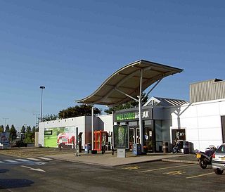
Newport Pagnell Services is a motorway service station between junctions 14 and 15 of the M1 motorway near Newport Pagnell in the City of Milton Keynes, north Buckinghamshire, England. It is owned and operated by Welcome Break.
Membury services is a motorway service station on the M4 motorway, located on the original site of RAF Membury in the civil parish of Lambourn in the English county of Berkshire, close to the boundary with Wiltshire, 4 miles (6.4 km) west of Junction 14. It is owned by Welcome Break and is situated adjacent to the Membury Radio Mast.

Roade is a village in Northamptonshire, England. Currently in West Northamptonshire, before local government changes in 2021 it was represented by South Northamptonshire District Council, falling within the two-member Blisworth and Roade ward.

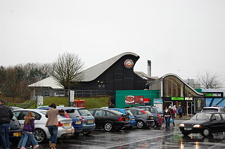
Motorway service areas (MSA) in the United Kingdom and Ireland, also known as services or service stations, are rest areas where drivers can leave a motorway to refuel/recharge, rest, eat and drink, shop or stay in an on-site overnight hotel. The vast majority of motorway services in the UK are owned by one of three companies: Moto, Welcome Break and Roadchef. Smaller operators include Extra, Westmorland and EG Group.

In Ireland, the highest category of road is a motorway, indicated by the prefix M followed by a one- or two-digit number. The motorway network consists entirely of motorway-grade dual carriageways and is largely focused upon Dublin. There are also several three-lane motorways, while Ireland's busiest road, the M50, incorporates four-lane, five-lane, and six-lane stretches.

Easton Neston is situated in south Northamptonshire, England. Though the village of Easton Neston which was inhabited until around 1500 is now gone, the parish retains the name. At the 2011 Census the population of the civil parish remained less than 100 and was included in the town of Towcester.

Houlton is a large housing development to the east of Rugby, Warwickshire, England. It is located between the Rugby suburb of Hillmorton, Warwickshire and Crick, Northamptonshire, west of the A5 road and M1 motorway.

Skelton Lake services is a motorway service area operated by Extra, on the M1 motorway near Leeds, West Yorkshire, England. It is located on junction 45 of the motorway which also links into the A63. It lies on the south side of the motorway; however, the junction affords access to, and from, all directions.


