Hopwood Park services

Last updated

Hopwood Park Services
Hopwood Services M42 J2 - geograph.org.uk - 14891.jpg
The modern buildings
Worcestershire UK location map.svg
Red pog.svg
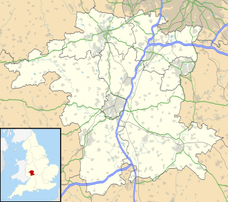
Hopwood Park Services
Location within Worcestershire
Information
County Worcestershire
Road M42, A441
Coordinates: 52°22′20″N1°56′52″W / 52.3721°N 1.9477°W / 52.3721; -1.9477
Operator Welcome Break
Date opened1999
Website welcomebreak.co.uk/locations/hopwood-park/

Hopwood Park services is a motorway service station in Bromsgrove, Worcestershire, England situated off Junction 2 of the M42 motorway on the A441 road to Redditch south of Birmingham. It opened in August 1999. Services include a Shell Petrol Station, Waitrose, Starbucks Coffee, WHSmith, and KFC. Electric Vehicle charging is provided by Gridserve (2 chargers) and Tesla (16 chargers).

Contents

This motorway service area is operated by Welcome Break.

History

Planning permission for the site was granted by Bromsgrove District Council in October 1998, [1] work started two months later in December 1998, costing £40 million. [2] When it was opened, it became the first service area in the country to include its own wildlife reserve. [1]

Reviews and criticisms

View to the rear of the main building Hopwood Park services, woods to rear.jpg
View to the rear of the main building

The independent Motorway Services Online has Hopwood Park down as the most popular service station, with visitors giving it an average rating of five stars (as of 2007).[ citation needed ]

The Holiday Which? magazine praised Hopwood Park for having a good variety of food, a smart cafe and staff who are helpful. [3]

Sustainable Drainage System (SuDS)

Hopwood Park was the site of one of the first fully integrated Sustainable Drainage Schemes (Sustainable Urban Drainage Systems) in the United Kingdom. Designed by Robert Bray Associates in conjunction with Baxter Glayster Consulting Ltd., the SuDS system comprises a chain of basins, swales, filter strips, and ponds. The system collects surface water from roofs and parking areas and is released at a controlled rate into the local watercourse where it is naturally treated and filtered via the vegetation through the various catchment ponds. [4]

Related Research Articles

<span class="mw-page-title-main">M40 motorway</span> British motorway connecting London and Birmingham

The M40 motorway links London, Oxford, and Birmingham in England, a distance of approximately 89 miles (143 km).

<span class="mw-page-title-main">A38 road</span> Trunk road in England

The A38, parts of which are known as Devon Expressway, Bristol Road and Gloucester Road, is a major A-class trunk road in England.

<span class="mw-page-title-main">M5 motorway</span> Motorway in England

The M5 is a motorway in England linking the Midlands with the South West. It runs from junction 8 of the M6 at West Bromwich near Birmingham to Exeter in Devon. Heading south-west, the M5 runs east of West Bromwich and west of Birmingham through Sandwell Valley. It continues past Bromsgrove, Droitwich Spa, Worcester, Tewkesbury, Cheltenham, Gloucester, Bristol, Portishead, Clevedon, Weston-super-Mare, Bridgwater, Taunton, Tiverton, Cullompton terminating at junction 31 for Exeter.

<span class="mw-page-title-main">M42 motorway</span> Motorway in England

The M42 motorway runs north east from Bromsgrove in Worcestershire to just south west of Ashby-de-la-Zouch in Leicestershire, passing Redditch, Solihull, the National Exhibition Centre (NEC) and Tamworth on the way, serving the east of the Birmingham metropolitan area. The section between the M40 and junction 4 of the M6 forms – though unsigned as such – a part of Euroroute E05. Northwards beyond junction 11, the route is continued as the A42; the junctions on this section, 12–14, are numbered like a continuation of the motorway, but the road has non-motorway status from here.

<span class="mw-page-title-main">Bromsgrove</span> Human settlement in England

Bromsgrove is a town in Worcestershire, England, about 16 miles (26 km) north-east of Worcester and 13 miles (21 km) south-west of Birmingham city centre. It had a population of 34,755 in at the 2021 census. It gives its name to the wider Bromsgrove District, of which it is the largest town and administrative centre. In the Middle Ages, it was a small market town, primarily producing cloth through the early modern period. In the eighteenth and nineteenth centuries, it became a major centre for nail making.

<span class="mw-page-title-main">Redditch</span> Town and Borough in England

Redditch is a town and borough in Worcestershire, England. It is located south of Birmingham, east of Bromsgrove, northwest of Alcester and northeast of Worcester. The borough had a population of 87,037 in 2021. In the 19th century, it became a centre for the needle and fishing tackle industry.

<span class="mw-page-title-main">Permeable paving</span> Roads built with water-pervious materials

Permeable paving surfaces are made of either a porous material that enables stormwater to flow through it or nonporous blocks spaced so that water can flow between the gaps. Permeable paving can also include a variety of surfacing techniques for roads, parking lots, and pedestrian walkways. Permeable pavement surfaces may be composed of; pervious concrete, porous asphalt, paving stones, or interlocking pavers. Unlike traditional impervious paving materials such as concrete and asphalt, permeable paving systems allow stormwater to percolate and infiltrate through the pavement and into the aggregate layers and/or soil below. In addition to reducing surface runoff, permeable paving systems can trap suspended solids, thereby filtering pollutants from stormwater.

<span class="mw-page-title-main">Barnt Green</span> Village and civil parish in Worcestershire, England

Barnt Green is a village and civil parish in the Bromsgrove District of Worcestershire, England, situated 10 miles (16 km) south of Birmingham city centre, with a population at the 2011 census of 1,794.

<span class="mw-page-title-main">Bromsgrove District</span> Non-metropolitan district in England

Bromsgrove is a local government district in north-east Worcestershire, England. It is named after its only town, Bromsgrove, where its council is based, but also includes several villages and surrounding rural areas. It borders the built-up area of Birmingham to the north. Other places in the district include Alvechurch, Aston Fields, Belbroughton, Catshill, Clent, Hagley, Rubery, Stoke Prior and Wythall. The population at the 2021 census was 99,475.

<span class="mw-page-title-main">Alvechurch</span> Village and civil parish in Worcestershire, England

Alvechurch is a large village and civil parish in the Bromsgrove district in northeast Worcestershire, England, in the valley of the River Arrow. The Lickey Hills Country Park is 2.5 miles (4 km) to the northwest. It is 11 miles south of Birmingham, 5 mi (8 km) north of Redditch and 6 mi (10 km) east of Bromsgrove. At the 2001 census, the population was 5,316.

Welcome Break Limited is a British motorway service station operator that operates 35 motorway service stations in England, Scotland and Wales. It is the second-largest motorway service area operator behind Moto. It also operates hotels and motels. It is a subsidiary of Applegreen.

<span class="mw-page-title-main">Leicester Forest East MSA</span> Services on the M1 motorway, UK

Leicester Forest East services is a motorway service station situated between junctions 21 and 21A of the M1 motorway, near Leicester, England.

<span class="mw-page-title-main">Magor, Monmouthshire</span> Human settlement in Wales

Magor is a large village in Monmouthshire, south east Wales, about 9 miles (14 km) west of Chepstow and about 9 miles (14 km) east of Newport. It lies on the Caldicot Levels beside the Severn Estuary, and is in the community of Magor with Undy. Magor lies close to the M4 motorway.

<span class="mw-page-title-main">Essington</span> Human settlement in England

Essington is a village and civil parish in South Staffordshire, England, located near the city of Wolverhampton and towns of Walsall, Bloxwich, Cannock and Brewood. The villages of Cheslyn Hay, Great Wyrley, Coven, Penkridge and Featherstone are also nearby. The village forms part of the Staffordshire/West Midlands border.

<span class="mw-page-title-main">Oxford MSA</span>

Oxford services is a motorway service station next to junction 8A of the M40 motorway at Waterstock near Wheatley in Oxfordshire, several miles to the east of the city of Oxford. It is named after the nearby city of Oxford. The services are owned by Welcome Break and opened in the summer of 1998. It was the third of four service stations to open on the M40.

<span class="mw-page-title-main">Sustainable drainage system</span> Designed to reduce the potential impact of development

Sustainable drainage systems are a collection of water management practices that aim to align modern drainage systems with natural water processes and are part of a larger green infrastructure strategy. SuDS efforts make urban drainage systems more compatible with components of the natural water cycle such as storm surge overflows, soil percolation, and bio-filtration. These efforts hope to mitigate the effect human development has had or may have on the natural water cycle, particularly surface runoff and water pollution trends.

<span class="mw-page-title-main">Strensham services</span> Motorway service station in Worcestershire, England

Strensham services is a motorway service station on the M5 in Worcestershire, England. It is operated by Roadchef. In August 2011, it was rated as 4 stars (southbound) and 3 stars (northbound) by quality assessors at Visit England.

<span class="mw-page-title-main">Cobham MSA</span> M25 motorway services in Surrey, UK

Cobham services is a motorway service area on the M25 motorway in Surrey between junctions 9 and 10. It is operated by Extra MSA and was opened for business on 13 September 2012. Its planned opening date was scheduled to be early 2010, but was changed to early 2012 following various planning issues. The services were constructed as there was concern with the large 65 mile (104 km) gap without any service areas. At either end of that stretch of motorway was South Mimms services and Clacket Lane services, and the Secretary of State explained there was a clear and compelling need for a further service area. The other service area serving the motorway is Thurrock.

<span class="mw-page-title-main">Low-impact development (U.S. and Canada)</span>

Low-impact development (LID) is a term used in Canada and the United States to describe a land planning and engineering design approach to manage stormwater runoff as part of green infrastructure. LID emphasizes conservation and use of on-site natural features to protect water quality. This approach implements engineered small-scale hydrologic controls to replicate the pre-development hydrologic regime of watersheds through infiltrating, filtering, storing, evaporating, and detaining runoff close to its source. Green infrastructure investments are one approach that often yields multiple benefits and builds city resilience.

References

  1. 1 2 "Wildlife welcome at M-way stop". Birmingham Evening Mail. 22 October 1998. Archived from the original on 25 October 2012. Retrieved 19 June 2009.
  2. "Work on service station starts". Birmingham Evening Mail. 29 December 1998. Archived from the original on 25 October 2012. Retrieved 19 June 2009.
  3. Motorway service stations rated, BBC News, 7 March 2006. Retrieved 16 December 2009.
  4. SuDS case studies, Hopwood Motorway Service Area, CIRIA, Retrieved 20 July 2012.