Hato Nuevo is a barrio in the municipality of Guaynabo, Puerto Rico. Its population in 2010 was 4,114.

Río is a barrio in the municipality of Guaynabo, Puerto Rico. Its population in 2010 was 2,791.

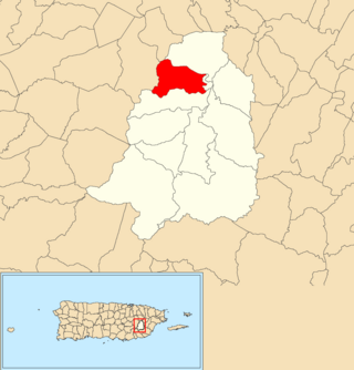
Naranjito barrio-pueblo is a barrio and the administrative center (seat) of Naranjito, a municipality of Puerto Rico. Its population in 2010 was 1,157.

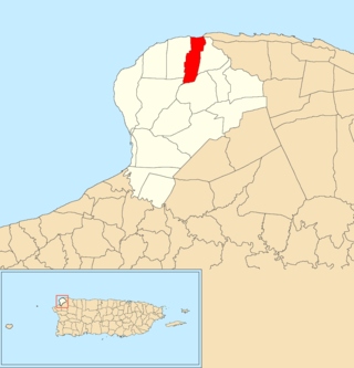
Achiote is a barrio in the municipality of Naranjito, Puerto Rico. Its population in 2010 was 3,919.

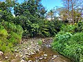
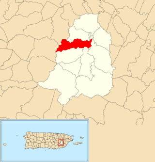
Anones is a barrio in the municipality of Naranjito, Puerto Rico. Its population in 2010 was 4,976. Anones is located to the South of the urban center of the municipality. There are schools and shops here and it is the most mountainous area of the municipality.

Cedro Abajo is a barrio in the municipality of Naranjito, Puerto Rico. Its population in 2010 was 4,627.

Guadiana is a barrio in the municipality of Naranjito, Puerto Rico. Its population in 2010 was 3,978.

Cibao is a barrio in the municipality of San Sebastián, Puerto Rico. Its population in 2010 was 1,224.

Camino Nuevo is a barrio in the municipality of Yabucoa, Puerto Rico. Its population in 2010 was 3,391.

Sabana Seca is a barrio in the municipality of Toa Baja, Puerto Rico. Its population in 2010 was 53,192.
Hato is a barrio in the municipality of San Lorenzo, Puerto Rico. Its population in 2010 was 6,945.
Quemados is a barrio in the municipality of San Lorenzo, Puerto Rico. Its population in 2010 was 4,712.
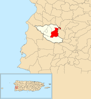
Lavadero is a barrio in the municipality of Hormigueros, Puerto Rico. Its population in 2010 was 4,305.

Palmar is a rural barrio in the municipality of Aguadilla, Puerto Rico. Its population in 2010 was 1,743.
Aguacate is a barrio in the municipality of Aguadilla, Puerto Rico. Its population in 2010 was 1,525.

Beatriz is a barrio in the municipality of Cidra, Puerto Rico. Its population in 2010 was 3,095.

Ceiba is a barrio in the municipality of Cidra, Puerto Rico. Its population in 2010 was 3,850.

Duque is a barrio in the municipality of Naguabo, Puerto Rico. Its population in 2010 was 2,425.

Guzmán Abajo is a barrio in the municipality of Río Grande, Puerto Rico. Its population in 2010 was 7,367.
Bayamón is a barrio in the municipality of Cidra, Puerto Rico. Its population in 2010 was 5,995.