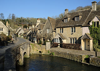
The Cotswolds is a region of central South West England, along a range of rolling hills that rise from the meadows of the upper River Thames to an escarpment above the Severn Valley and the Vale of Evesham. The area is defined by the bedrock of Jurassic limestone that creates a type of grassland habitat that is quarried for the golden-coloured Cotswold stone. It lies across the boundaries of several English counties; mainly Gloucestershire and Oxfordshire, and parts of Wiltshire, Somerset, Worcestershire, and Warwickshire. The highest point is Cleeve Hill at 1,083 ft (330 m), just east of Cheltenham. The predominantly rural landscape contains stone-built villages, towns, stately homes and gardens featuring the local stone.

Government Communications Headquarters (GCHQ) is an intelligence and security organisation responsible for providing signals intelligence (SIGINT) and information assurance (IA) to the government and armed forces of the United Kingdom. Primarily based at "The Doughnut" in the suburbs of Cheltenham, GCHQ is the responsibility of the country's Secretary of State for Foreign and Commonwealth Affairs, but it is not a part of the Foreign Office and its director ranks as a Permanent Secretary.
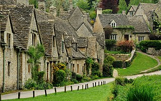
Gloucestershire is a ceremonial county in South West England. It is bordered by Herefordshire to the north-west, Worcestershire to the north, Warwickshire to the north-east, Oxfordshire to the east, Wiltshire to the south, Bristol and Somerset to the south-west, and the Welsh county of Monmouthshire to the west. The city of Gloucester is the largest settlement and the county town.

Swindon is a large town in Wiltshire, England. At the time of the 2021 Census the population of the built-up area was 183,638, making it the largest settlement in the county. Located in South West England, Swindon lies on the M4 corridor, 71 miles (114km) to the west of London and 36 miles to the east of Bristol. The Cotswolds lie just to the town's north and the North Wessex Downs to its south.
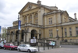
Cheltenham is a spa town and borough on the edge of the Cotswolds in Gloucestershire, England. Cheltenham became known as a health and holiday spa town resort following the discovery of mineral springs in 1716, and claims to be the most complete Regency town in Britain. It is directly northeast of Gloucester.

Tewkesbury is a market town and civil parish in the north of Gloucestershire, England. The town grew following the construction of Tewkesbury Abbey in the twelfth century and played a significant role in the Wars of the Roses. It stands at the confluence of the River Severn and the River Avon, and thus became an important trading point, which continued as railways and, later, the M5 and M50 motorway connections were established. The town gives its name to the Borough of Tewkesbury, a local government district of Gloucestershire. The town lies on the border with Worcestershire, marked largely by the Carrant Brook.

Winchcombe is a market town and civil parish in the Borough of Tewkesbury in the county of Gloucestershire, England, it is 6 miles (10 km) north-east of Cheltenham. The population was recorded as 4,538 in the 2011 census and estimated at 5,347 in 2019. The town is located in the Cotswolds and has many features and buildings dating back to medieval times. In 2021 it was the primary strike site of the eponymous Winchcombe meteorite.

The University of Gloucestershire is a public university based in Gloucestershire, England. It is located over three campuses, two in Cheltenham and one in Gloucester. In March 2021, the university purchased the former Debenhams store in Gloucester City Centre, with a new campus due to open there in 2023.

Churchdown is a large village in Gloucestershire, England, situated between Gloucester and Cheltenham in the south of the Tewkesbury Borough.

Cheltenham West is an area in the western part of Cheltenham, Gloucestershire, England. It is the generic name for an area which includes the council wards of Hesters Way, Springbank, Arle, Rowanfield, Alstone, Fiddlers Green, St Mark's and some of St Peter's and the Moors.

Prestbury is a village and civil parish in the borough of Cheltenham in Gloucestershire, England. Located on the outskirts of Cheltenham and part of the Tewkesbury parliamentary constituency.
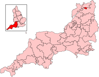
Cheltenham is a constituency in Gloucestershire represented in the House of Commons of the UK Parliament since 1832. As with all constituencies, it elects one Member of Parliament (MP) by the first past the post system of election at least every five years. Since 2024, its MP has been Max Wilkinson of the Liberal Democrats.

Oakley is a village in the borough of Basingstoke and Deane in Hampshire, England, located around 4.5 miles (7 km) west of Basingstoke. In the 2001 Census it had a population of 5,322. Together with the smaller village of Deane, it forms the Oakley and Deane civil parish renamed as Oakley at the 2011 Census.

GCHQ Bude, also known as GCHQ Composite Signals Organisation Station Morwenstow, abbreviated to GCHQ CSO Morwenstow, is a UK Government satellite ground station and eavesdropping centre located on the north Cornwall coast at Cleave Camp, between the small villages of Morwenstow and Coombe. It is operated by the British signals intelligence service, officially known as the Government Communications Headquarters, commonly abbreviated GCHQ. It is located on part of the site of the former World War II airfield, RAF Cleave.

Leckhampton is a village and a district in south Cheltenham, Gloucestershire, England. The area is in the civil parish of Leckhampton with Warden Hill and is part of the district of Cheltenham. The population of the civil parish taken at the 2011 census was 4,409.

Marlwood School is a state-funded co-educational secondary school currently part of the CSET multi-academy trust. Located at Alveston, South Gloucestershire, it is situated on the B3561 on the outskirts of the south-west of the village.
Up Hatherley is a civil parish and a suburb of the spa town of Cheltenham, Gloucestershire, England. Formerly a hamlet in the parish of Shurdington, it became a parish in 1887 and became a part of Cheltenham in 1991.
Kohler Mira Ltd is a plumbing company based in Cheltenham, Gloucestershire known for its brand of Mira showers.

The Doughnut is the nickname given to the headquarters of the Government Communications Headquarters (GCHQ), a British cryptography and intelligence agency. It is located on a 71 hectares site in Benhall, in the suburbs of Cheltenham, Gloucestershire, in South West England. The Doughnut accommodates 5,500 employees; GCHQ is the largest single employer in Gloucestershire. Built to modernise and consolidate GCHQ's multiple buildings in Cheltenham, the Doughnut was completed in 2003, with GCHQ staff moving in the same year, and fully moved into the building in 2004. It is the largest building constructed for secret intelligence operations outside the United States.
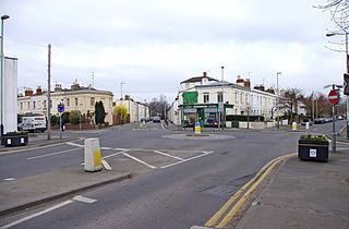
153–159 Fairview Road is a terrace of four houses in Cheltenham, Gloucestershire, on the south side of Fairview Road beside the roundabout at its junction with Hewlett Road. The terrace became a Grade II listed building in 1972. The street artist Banksy produced an artwork, Spy Booth, on either side of a public telephone booth adjacent to the gable end of number 159 in April 2014. The work was destroyed in August 2016.


